After a cool first night at Hart Mountain Antelope Refuge, we slapped at mosquitoes the following morning as we prepared to go hiking. On the skyline of Adams Butte, I could make out the silhouette of a pronghorn antelope sprinting up the butte's slope. Now, there's something you don't see on the west side of the Cascade Mountains!
 |
| Flat is as flat does |
The hike along Poker Jim Ridge is a cross country walk through the sagebrush and the going was not particularly speedy as the rocky ground made for tedious walking. Since there were no trees, navigation was simple: keep the ridge rim within sight on the left side and don't step off, the next stop would be 3,000 feet below!
 |
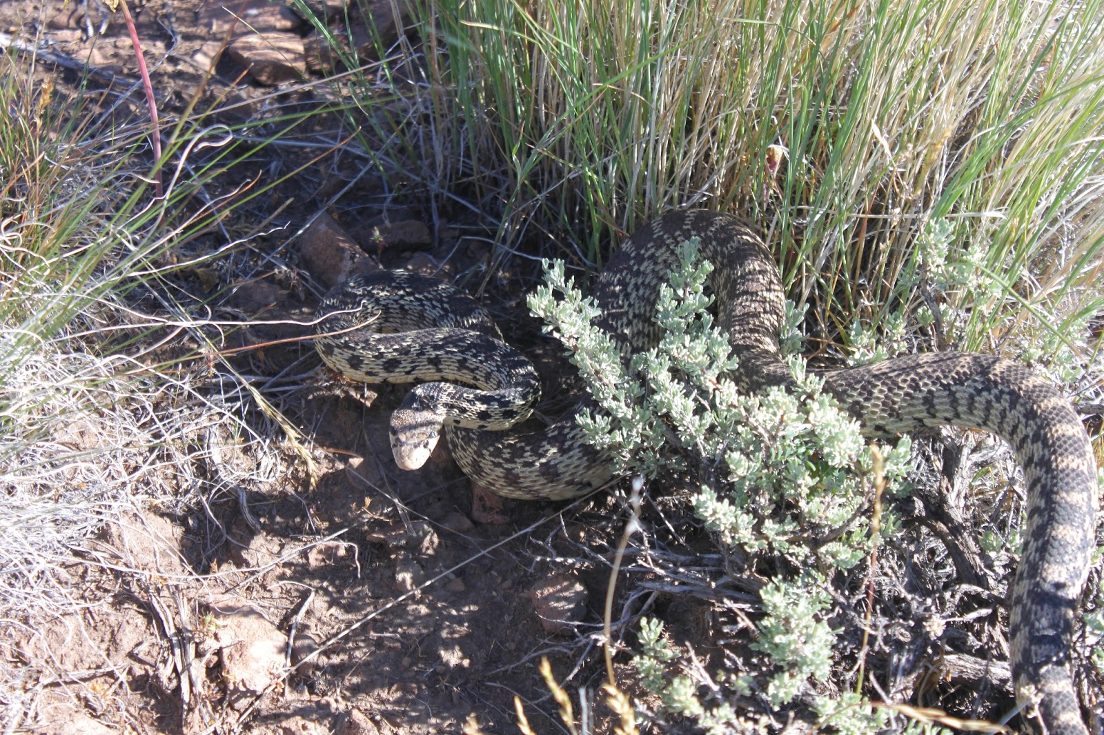
| A snake with anger management issues |
At the start of the hike, John found a large gopher snake that was not too happy to see us. Coiled up in a defensive posture, the snake hissed and vibrated his tail, it wanted us to think it was a rattler. After taking a few pictures of the snake, I moved the toe of my boot into its personal space and my boot was subsequently attacked. Despite knowing the snake was harmless, I still jumped.
 |
| No Dollie, I would never drive your car on that road |
From Poker Jim Ridge, the views were tremendous. Directly below was Campbell Lake and its other Warner Valley lake friends: Lakes Flagstaff, Upper Campbell, Stone Corral, and Turpin. Bluejoint Lake, the northernmost lake, was all dried up but we could see where it had been. Further south were Hart Lake and the small itty-bitty town of Plush, both flanked by the rock wall that is Hart Mountain. Beyond the Warner Valley were the desert mountains, most of them brownish in color. Truly a vista for the ages.
 |
| Petroglyph Lake in the distance |
We worked our way up to a small high point on the ridge and enjoyed lunch in shade provided by a copse of juniper trees. We could see for miles and miles and two small lakes glistened in the vast expanse of the refuge, one of which would be our next destination.
 |
| John sets sail to the lake |
We dropped off our knoll and headed overland to Petroglyph Lake which disappeared from view like a mirage as we lost elevation. Not to worry, though, we kept going in the same direction and eventually happened upon the lake, hidden in a natural bowl in all the sagebrush.
 |
| Colorful Petroglyph Lake and don't drink the water |
Surprisingly, there was a lot of color at Petroglyph Lake, seeing how it was ringed by tansy-leaved evening primrose which was blooming bright yellow in broad daylight, despite its name. Green grass ringed the lake and reeds hugged the shoreline in the milky waters of the lake. Petroglyph Lake, as is the case with so many of the lakes in this area, has no outlet so the waters tend towards the muddy and alkaline.
 |
| Petroglyph |
At one end of the lake, there was a rocky cliff and we explored the cliff, taking in the petroglyphs that give the lake its name. I tried to be respectful but one of the glyphs sure looked a lot like Sponge Bob. We wondered if the glyphs were art, storytelling, advertisements, or graffiti. I supposed it might have been the equivalent of what you see in our public restrooms: "For a good time, send smoke signal to Running Turtle" or "Here I sit all broken-hearted, tried to poop but only rock-arted".
 |
| Merle and Richard try to keep pace with John |
At any rate, we left the lake and headed across the flat sagebrush plain to our car. Apparently there was a pronghorn baby hidden in the sagebrush that took off running in panic at our arrival. Pronghorn can run at speeds up 60 mph and it was impressive to see the little guy speed across the same rocky plain we were struggling to walk through. We also got to see a mother with two pups(?) in tow, eventually joined by enough other pronghorns to formally constitute a herd.
 |
| Fading light on Hart Mountain |
So back to camp we went for a post-hike soak in the hot springs. We did learn to avoid "The Naked Guy" after this particular evening soak. After the rustic Jacuzzi, we were treated to a superb sunset and the end to a productive day.
 |
| Spectacular sunset |
For more pictures of this hike,
stop by and visit the Flickr album.