Showing posts with label Illinois River. Show all posts

Saturday, June 8, 2019

Illinois River Trail (to Indigo Creek)


A quick limerick about this hike:

Men are from Mars and women are from Venus
This is a tale of a hike in extemis
If I may be so bold,
This story to be told
Of a tick, a man, and his penis!

Quintessential sunny day in the Siskiyous
Yup, and here I thought it was only deer I had to worry about! You know, it had been an enjoyable run of several years where the ticks completely left me alone while simultaneously pestering and tormenting my hiking buddies. Being the totally empathetic individual that I am, all kinds of jokes, quips, taunts, and verbal slings and arrows of outrageous fortune were directed at hikers less fortunate than my tick-immune self. Clearly it was time for karma to champion the cause of my picked-upon comrades by making me repent for every tick-magnet joke that ever found its way out of my mouth or onto my blog page.

Unsullied by the Biscuit Fire
After our challenging hike on the Oregon Coast Trail the day prior, it was made known to me that today's venture needed to be a "mountain hike". Well, fortunately for your eminent hike director, the Siskiyous were just a short drive from the coast so we headed up the Rogue River to Oak Flat, a primitive campground next to the Illinois River just upstream from where it joins up with the Rogue. This area had been burned in Oregon's largest wildfire ever, the massive Biscuit Fire of 2002. Burning just a few acres short of a half-million, the fire nearly burned all the way to Oak Flat. So, it was no real big surprise when after a short walk on the Illinois River Trail in a forest untouched by fire, and as green and shady as a forest should be, we walked out into the Biscuit burn area. 

World, meet Bridges' triteleia
The Siskiyous, unlike most other mountain ranges in Oregon, were not created by processes volcanic in origin. Nope, the rugged Siskiyous were seismically extruded from deep within the earth and are comprised of serpentinitic soils and heavy metals. Accordingly, the soils here are nutrient poor, which would explain the slow recovery from the Biscuit Fire, ably demonstrated by our hiking in terrain still denuded by the fire, even though the fire occurred eighteen years ago. Plant life must adapt to the peculiar blend of minerals in the Siskiyous and that would explain why we saw so many plant specimens common in the Siskiyous but not so much anywhere else. I was able ro recognize some of the usual suspects like California ground cone, luina, yerba santa, and elegant brodiaea. Growing all over the first part of the trail was another brodiaea type of flower, one that I had never seen before, that I was able to identify after copious research on the Internet: Bridges' triteleia (Triteleia bridgesii ). I learn something new every hike!

The bridge at Ethel Creek might, just
might, be in need of some repair
Even though we were just twenty-five or thirty miles from the coast, it can get quite hot in the comparitively arid and dry mountain range and we quickly shed jackets and sweaters as we toiled uphill in the rapidly heating-up sun. In spite of the relative aridity of the terrain, numerous creeks flowed across the path, seemingly at odds with the overall dry clime. The bridge at Ethel Creek had taken a hit from a falling tree and the fence railings were irretrievably shattered beyond repair. We were still able to walk safely across, despite the lack of safeguards.

Epic view from Mother-in-Law's Buzzard's Roost
Walking uphill should always provide a reward and this one did, the climb culminating in a superbly scenic overlook at Mother-in-Law's Buzzard's Roost. The pointed tip of the Roost would be a worthy destination in and of itself, but when the roost is poised over the deep Illinois River canyon, well it just goes to a whole other level of landscape view. The tip of the rocky spire was only about ten feet higher than the overlook and the rough terrain dropped away at our feet into a river canyon that was about one thousand feet deep. At the bottom of the canyon, the remote and inaccessible Illinois River snaked in between the surrounding mountains like the watery turquoise serpent it is. Much higher above and still mostly denuded from the fire, rose the rugged peaks of Horse Sign Butte, Lawson Butte, and Game Lake Peak. Amazingly, a trail allegedly leads from Oak Flat Campground (a low-water wade across the Illinois is required) to Game Lake, which would be like a four-thousand foot climb over eight miles or so. You'd really have to hate yourself to pull that one off and besides which, I'm not even sure if the trail exists anywhere else besides on maps.

Horse Sign Butte, in the rugged Siskiyou Mountains
At any rate, we had a much easier time of it after we crested at Mother-in-Law's Buzzard's Roost, beginning a long descent down to Indigo Creek. Here on the south-facing slopes, there was no real wildfire recovery in process. Most of the snags from the Biscuit Fire had toppled over long ago to be replaced by nothing. Well, that's not entirely accurate for the once and former forest had been supplanted by a regrettably robust growth of poison oak and buck brush. The poison oak as we all know, is more than willing and able to make hikers rue a hike through the accursed oily-leaved devil-spawned spreader of itchy torment. However, ticks thrive in malevolent abundance in the buck brush, patiently waiting for months and months to leap on the first warm blooded animal that walks by and on this day, that would be us. We quickly discerned that we were prime candidates to become tick dinner, so we stopped frequently to perform tick checks and we all plucked the odious arachnids (ticks are not insects, by the way) from our respective selves. For the remainder of the hike, this would be the hiking mode du jour because the ticks were so pervasive.

Silver Peak rules over the Illinois River and Indigo Creek
We had been hiking steadily downhill and the complete and utter lack of forest provided a great and awesomely unimpeded panorama of the surrounding landscape. Way below the trail, the Illinois had forsaken its snaky to-and-fro journey for a route that was straight as an arrow in a slot canyon for about a mile or two. At right angles to the river and between us and the Illinois was the equally impressive canyon of Indigo Creek running into the larger canyon of the Illinois. A grassy pasture at Frantz Ranch lay below the massive pyramid of Silver Peak, which someday I will hike to the top of. On our side of Indigo Creek was Fishhook Mountain, looming like a lesser version of Silver Peak. The view was magnificently epic and this is the reason we hike through tick-infested brush.

Indigo Creek, on its way to the Illinois River
The trail bottomed out at Indigo Creek, where a stout footbridge spanned the wild stream tumbling in a narrow and rocky defile. Downstream of the bridge were a series of beautiful swimming holes, if you could actually find a way down there, that is. The canyon was rough and rugged and I'm not sure you could safely get down there without mountaineering equipment and know-how. The canyon and creek scenery deserved an extended session of contemplation so we sat down in the shade of a sheer cliff and ate lunch while admiring the view.

Be glad there are no photographs of the "tick incident"
After the climb out of the Indigo Creek canyon under a hot sun and through tick-laden brush, we rounded Mother in-Law's Buzzard's Roost, and began the relatively gentle descent down to Oak Flat. It was definitely shadier and cooler on this side of the ridge we had just hiked over and around. However, an uncomfortable burning sensation "down there" was calling my attention with ever insistent urgency. During the hot slog away from Indigo Creek, I had drank enough water to feel it sloshing in my belly with each step taken. Because enough water had been drunk to stimulate the call of nature, I went behind a nearby tree with the dual purpose of relieving myself and performing a primitive backwoods medical examination. 

California ground cone was a welcome diversion from ticks
I remember being totally aghast and gasping "Noooo..." Right where a tick should never be, right next to The Anaconda's lone eye, there it was, completely embedded with disgusting little spider legs flailing in annoyance at being discovered. If I thought the pain had been uncomfortable before, that paled in comparison to the removal of the evil eight-legged invader of southern nether regions and as that little backwoods surgery took place, I could almost hear Glenn, Lane, Dollie, John, Dale, Rheo, and all the other hordes of tick victims I had ever made fun of over the years laughing in triumph as they all high-fived each other in it's-about-time celebration. We should all be thankful that in the horror of the moment, photography was completely forgotten, which was OK because I didn't bring the wide-angle camera lens anyway.

I can just sense the ticks waiting for to hike through

Because of my impromptu tickectomy procedure, I arrived at the trailhead well behind my compatriots who were blissfully unaware of my mentally scarring episode with the tick. Some of them were just putting on their shirts, sheepishly explaining they were doing tick checks in case I presumed they were having wild sex while waiting for me to arrive.  "Heh-heh", I laughed "I have a funny story about that!"

Victims of the Biscuit Fire
I've got to hand it to my people. If it would have been me listening to a hiking buddy recalling a penile encounter with a tick, I'd be rolling on the ground with laughter at my buddy's discomfiture. But not my peeps! After listening to my tale, a look of mutual horror crossed each one's face and with all the dignity that each could muster, they each dispersed behind their respective trees for a subsequent and more detailed tick check. I guess it's universal, no male likes to hear about tick bites on certain body parts, except for maybe me, I still would have laughed.

A tiger beetle is a much nicer alternative to ticks
For more pictures of this hike, please visit the Flickr album.


Sunday, June 22, 2014

Polar Bear Gap

Leaving the small eccentric hamlet of Takilma, I drove up a rough and rickety road to a rocky ridge above the East Fork Illinois River. Silently grateful Dollie was home and blissfully unaware of what her jeep was doing, I drove around Crazy Peak before arriving at the trailhead. If the last half of the previous sentence doesn't sum up my recent run of  hiking weekends, nothing else will.

Evening, from my tent
The drive to the Black Butte Trailhead is about 3 1/2 hours from Roseburg so I threw in some camping gear and headed out late Saturday afternoon, timing it so I'd arrive in the early evening.  My tent was hurriedly set up on a flat rocky patch of earth about a quarter mile up the trail. Black Butte loomed over me as the sun set and it was nice to camp without having to lug a heavy backpack full of gear. 

Sunrise
I woke up at day break with the eastern skyline glowing red through the trees. Fortified with a quick breakfast, I set out on the trail, snapping a picture of Black Butte at the outset. Later at home, I would notice the time stamp on the photograph, it turned out this hike began at the improbable hour of 5:55 AM. Yet, somehow it is exceedingly difficult to get to work by 9:00 AM. I wonder why that is. 
This, before coffee

If the Siskiyou Widerness was located anywhere near a major population hub, the wilderness would be world famous. However, this California wilderness area is accessible mostly through Oregon and the remoteness means one is likely to have the place to one's self. Hiking in the Siskiyou Wilderness is challenging, to say the least. The mountains are incredibly rugged and the trails equally so. As a measure of how challenging the hiking is, I offer without shame or embarrassment that I hiked at a 55 minute per mile pace. The Black Butte Trail basically stayed high on the east side of the East Fork Illinois River canyon but even so, the trail went up and down and was rarely level. The rocky path was sketchy at times and potentially treacherous to inattentive ankles.

Mountains and deep valleys
Ah, but the views are amazing! Tall pointy peaks abound everywhere up and down the East Fork's canyon. Prominent to the west were craggy Sanger Peak and nearer Young's Peak. On my side of the canyon was Polar Bear Mountain and its offspring Bear Cub. Looming above and forever keeping the two polar bears in order were the jagged peaks of The Lieutenants. Due south and down the Clear Creek valley was a partial cone looking like a molar whose filling fell out; that would be Bear Mountain whose crater is the repository of Devil's Punchbowl which is on "the list". Black Butte, whose slopes I was walking on, is also prominent but I was too close to see it, if that makes any sense.

The trail was sketchy, at times


Polar Bear Gap is a fairly short hike, so at a trail junction I continued on the Black Butte Trail for some extra exploratory mileage. I had some vain notion of hiking the 5 miles to Young's Valley but this was some really tough hiking. From the junction, the trail dropped rapidly down into the East Fork canyon, sometimes not even pretending to switchback. The path was faint and overgrown and at times, was pretty hard to follow. The tread was uneven and full of rocks and I spent a lot of time scrambling over fallen trees. 

A small creek crosses the trail


The Black Butte Trail crossed over a couple of small forks of the East Fork and there were backpacking campsites at each of the streams. The thought of lugging a backpack down and up this rugged terrain nearly made me want to cry with empathy for the abject human misery that particular labor had to have entailed. After crossing the second of the two East Fork forks crossed on this hike, the trail followed an extremely rough roadbed and I made the decision to then backtrack to Polar Bear Gap. 

Ugh!
The impetus for the decision was that I could see the path charging down towards the East Fork itself, still several hundred feet below. Above me, the headwall of the canyon loomed several hundred feet above and I was painfully aware the trail would then have to climb up and over that to get to Young's Valley. Trail designers will not go to heaven! 

California lady's-slipper
So the steep knee-straining descent now became a thigh-burning ascent. But frequent rest stops allow one to stop and smell the figurative roses. Feathery plumes of beargrass were abloom and insects were grateful. Other spring flowers spotted along the trail were columbine, starflower, windflower, paintbrush, and thimbleberry. However, this is the Siskiyous and there were plenty of Siskiyou-only plant specimens such as luina, Sadler oak, and California pitcher plants (also known as darlingtonias). Next to the darlingtonia bog was a patch of California lady's-slipper, an attractive orchid of note.

The drab and nondescript snow plant
There were so many different kind of flowers a second paragraph is merited. So, also seen were bog wintergreen, azaleas, stonecrop, lupines, and an odd yellow-colored coralroot orchid thingy. I also spotted a couple of snow plants, colored bright red among all the greenery. Lots of pictures were taken which may have, in combination with the rough trail and steep climb, had something to do with 55 minute miles.

Broomrape
Once back at the trail junction, I continued uphill, switchbacking through a shaded forest with a couple of boggy springs where fairybells bloomed. Oh, and I found some yellow-colored broomrapes of some sort. So many odd little flowers that they have spilled into a third paragraph. Anyway, back to the hiking: eventually the trail left the shade and spit me out onto a dry grassy slope where I got a neck strain peering up at very close and craggy Polar Bear Mountain.

Lookout Mountain at Polar Bear Gap
When the trail leveled out shortly thereafter, the flatness of the grade was my cue that I had arrived at Polar Bear Gap, situated right between Polar Bear Mountain and Lookout Mountain. While Polar Bear Mountain dominated the near scenery, a nice view was had to the southeast where a ghostly Mount Shasta was faintly visible in the wildfire smoke from mostly likely the Bryant Fire, near Bonanza. Oddly enough, I saw no polar bears.

Black Butte at the trailhead
After a fly-swatting lunch 'n laze in the warm sun, it was time to head back, carefully leg-braking on the way down. I got to enjoy the views all over again with the big difference being the hiking in warm sun versus the cool shade at the early morning start. This hike just barely scratched the Siskiyou Wilderness and I promised myself a return visit to sample further the rugged delights in this little corner of the Siskiyou Mountains sandbox. As I reached the end of the hike, Crazy Peak loomed right in front and I was hiking straight towards it. Somehow, that seemed fitting.

Polar Bear Mountain
For more pictures of this rugged and unique gem of a wilderness, please visit the Flickr album.

Lurker in the beargrass


Sunday, May 20, 2012

Kerby Peak

Proof we were there
Several weekends ago, Ray and I opted to do Kerby Peak as an impromptu Plan B hike when Plan A was snowed over. Plan B did not pan out that day either because of a road closure but we were very impressed with the massive rock wall that is Kerby Peak. Our legs trembled with both fear and anticipation at hiking up to the Kerby summit, a paltry 2,600 feet above us. So, when the aforementioned road opened, we found ourselves craning our necks once again to peer at the summit all those thousands of feet above us.

Hiking is fun, right?
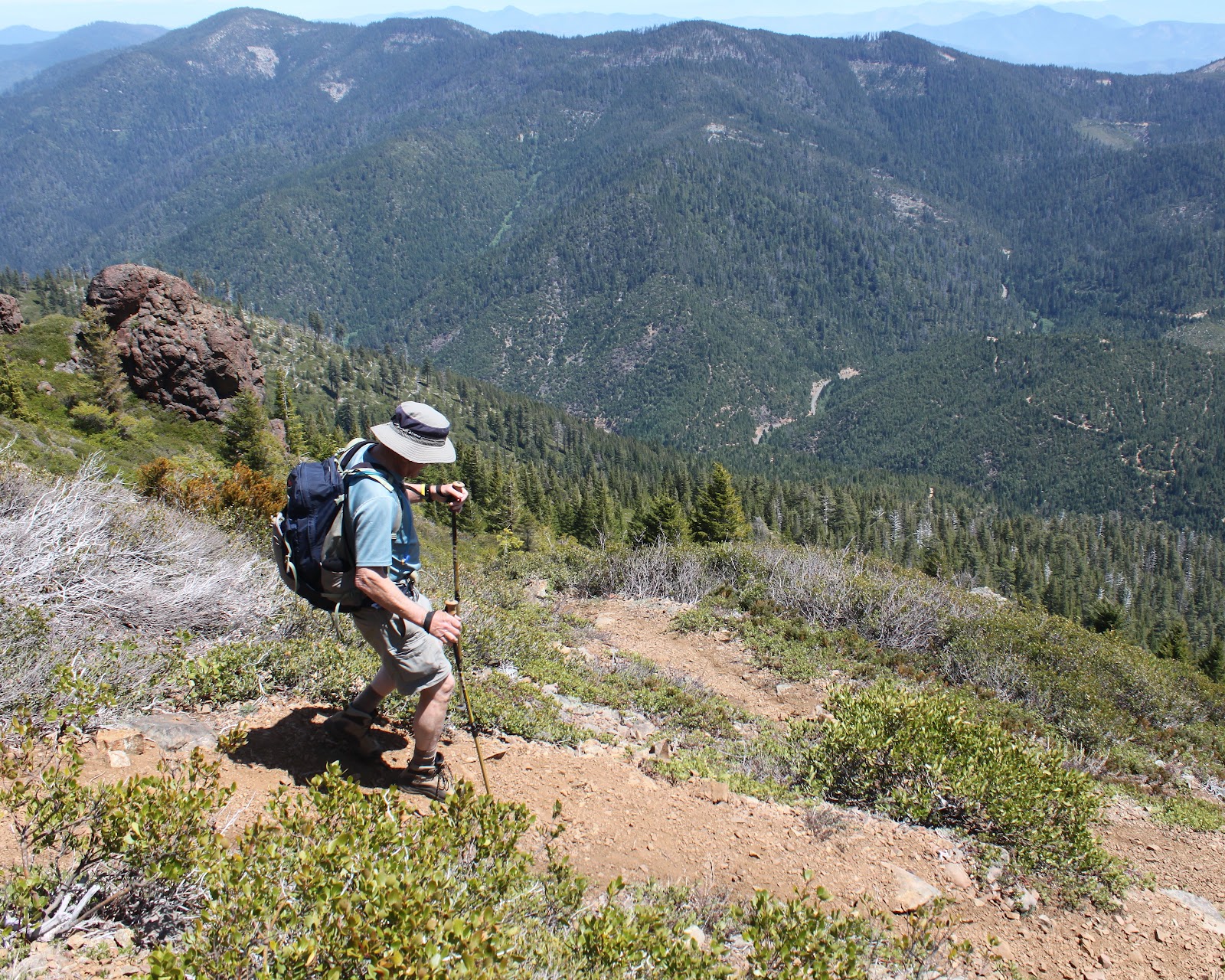
The trail wasted no time heading uphill and we stopped at every other switchback panting with the exertion. Thank goodness there were switchbacks, it could have easily been a lot worse as the old trail simply charged straight up the forested slope that was nearly a vertical wall. Periodically, a break in the forest would show us that Kerby Peak was so far above and so far away. Better to head back into the forest and focus on getting to the next switchback.

I'm NOT TIRED, I tell you!
At least spring was happening on the forest floor and I stopped to take pictures of all the flowers because I like to take pictures and I was NOT TIRED.  Suffice to say, lots of pictures were taken on the climb up.


Siskiyou lewisia
At the halfway point, the trail spit us out onto a rocky cliff totally devoid of trees. Little rock gardens consisting of pink mats of phlox, stonecrop (not yet blooming), and cliff maids (also known as Siskiyou lewisia) colored the rocks nicely.  

And we are only halfway up!
But really, this was all about the view. The Illinois Valley lay spread out below us with green pastured farmland straddling the Deer Creek valley. Rising beyond the small town of Selma were the orange-brown mountains of the Kalmiopsis Wilderness, all stripped clean of trees by the 2002 Biscuit Fire. And, unfortunately, Kerby was still high above and far away. Sigh.

Time to break out the sunscreen
We had been switchbacking back and forth on the north face of Kerby and eventually the trail surmounted a ridge and put us on the sunnier south slope. The vegetation changed, there were more ponderosa pines and cedars and a whole lot more sunshine. And blessedly, the trail switched from steep to merely uphill.


Brewer's weeping spruce, taken by a weeping hiker
Brewer's weeping spruce made an appearance also, the branches drooping sadly like our heads. The trees then thinned out together and the trail began switchbacking through an open slope of low-growing manzanita, just the right height for scratching hiker's shins. I made the comment to Ray that this must be the final push but a couple of miles later we were still hiking upwards. Just like child labor, it was a long and painful push.

One of many false summits

Summit cairn


Rocky towers loomed above the trail, contrasting nicely with the blue sky and we were ever hopeful that one of these towers would be the actual summit. But Kerby was a cruel and capricious taskmaster and was merely throwing false summits at us. It was almost anticlimactic when I strolled onto a flat spot with a summit cairn on it.
Magnificent view from the top

Climber's ritual of adding to the summit cairn


A magnificent panorama awaited us at the top and we soaked in the views while waiting for the feeling to return to our quavering legs dangling over the edge as we lunched. We could see the towns of Selma, O'Brien, Murphy, and Cave Junction as they sprawled in the valley dotted with farms. The rugged Kalmiopsis Wilderness dominated the northern view and we could see the snow cone of Mt. McLaughlin, and the gray mounds of Grayback Mountain and Mount Elijah. To the southwest were the snowy peaks of Preston Peak, El Capitan, The Lieutenants, and Bear Mountain, all located in California's Siskiyou Wilderness.

Going down is also "fun"
All good things must end, and we headed downhill towards the trailhead.  Going down was harder than going up with all the leg braking, but it was quicker: it took three hours to reach the summit but only an hour and a half to get down. Ray summed it up best when he said "That was the hardest 7 miles I have ever hiked!" Short, succinct, and entirely accurate.


Tuesday, February 21, 2012

Lower Rogue River Trail

February 21, 2012

This was the getaway hike on the getaway day, last President's Day weekend.  Having enjoyed a superlatively sunny day and a horribly wet day on the days prior, this day split the difference as it was overcast; fortunately not a single drop of rain touched this incredibly handsome hiker.
The trail was a road walk at the start of the hike
Beginning at Agness, whose welcoming sign said "Population:  small", the first portion of the hike was on gravel roads weaving through the various Agness homesteads.  A brisk climb designed for autos and not quavering hiker legs brought me to the "real" trail but not the end of the climbing.
I should paint the bathroom this color
Topping out on a small crest wooded with oaks, the trail descended towards the very wide Rogue River, before heading back uphill.   Then it went down.  Then up.  Down.  See a trend?
Getting past this fallen tree was a challenge
As the trail approached the river, a large tree had fallen across the trail as it cut across a steep slope.  It was so not-fun to beat my way through the branches and get over the trunk via some adroit contortioning.  Whew!
 
Shortly after, the path approached a grassy pasture above the river, the large prints indicating cattle had been here not too long ago.  I'm not sure who Eddy is but a rapid in the river is named Big Eddy, the name bearing more significance to the rafting crowd.  As I walked through the pasture, the trail petered out altogether and I went back up the trail and found where I had unwittingly left the main trail for a cattle trail.


Thank you, cows!
Contouring the woods above the grassy bench, the path arrived at the first of several notable creeks:  Blue Jay Creek.  In what was false advertising, there were no blue jays that I could see or hear.  But there was a nice creek tumbling through the green and mossy forest.  A small gate took me uphill as the trail bypassed some private property alongside the river. 

Bridge at Morris Rodgers Creek
As the trail climbed, the vegetation became more Siskiyou-ish what with manzanita, evergreen coastal huckleberry, madrone, and laurel making an appearance.  After cresting at a dry and rocky slope, the trail dropped down into the Morris Rogers Creek drainage, crossing the creek on a stout bridge.  For a backwoods bridge, this trestled bridge truly was a work of art and probably is solid enough to last a millenia or two. 

After Morris Rodgers Creek, the trail began to climb in earnest and the vegetation and clime became drier as I gained elevation.  Huffing and puffing, I crested a jagged ridge and oh-my-goodness, there was a view for the ages waiting for me up there.  Even though I was all alone, I let out some jubilant war whoops at the splendor of it all.
The Rogue River, at Copper Canyon
Unbeknownst to me, while I was feeling sorry for myself climbing through viewless woods, I was at magnificent Copper Canyon.  The canyon is a narrow and rocky gorge with the turquoise and placid waters of the Rogue River pooled in between the bordering cliffs.  I was approximately 650 feet above and one step away from the river's waters.
 
A small landslide on the trail
Eeeh!


After a lengthy view-soak, I continued on the very cliffy trail.  At one point a landslide had covered the trail and I picked my way carefully across while the ground shifted under my feet with rocks rolling all the way down to the river.  Eeeh!  However, I'm glad to report no hikers were harmed in the resumption of the hike.


A brisk descent through rocky slopes and then shaded woods...well, they would have been shaded if there had been any sun; at any rate, I wound up at idyllic little Painted Rock Creek.  Since I had a long drive back to Roseburg, this was a logical turnaround point, I commenced a leisurely return hike, snapping pictures of just about everything. 
Painted Rock Creek

This was an absolutely gorgeous hike.  I'd never been on this trail before but I'll be back, preferably with a backpack on.