Wednesday, November 17, 2021

Cooper Creek Reservoir


The day before this little outing at Cooper Creek Reservoir, I had hiked on the Bolt Mountain Trail under mostly sunny skies and relatively warm sunlight. The one exception to the summery vibe occurred when I rounded the north side of the mountain, where the temperature dropped precipitously in a hint of things to come this winter. Fortunately, that frigid little interlude was relatively short-lived as I emerged back into the bright sun after a mile of hiking in the cold. Contrast that with this day's hike along Cooper Creek Reservoir where the gray day was as unflinchingly cold as a predator's calculating gaze. Seemed like, at least on this day, the entire world was on a cosmic north-facing slope.

A very calm and quiet lake and morning

This was a hike among friends and the five of us began hiking in easy companionship across the lake's dam, the cold air slapping our rosy cheeks (of our faces, to be clear) like an outraged diva. Winter cometh and noses runneth, and I hadn't brought gloves or a knit cap so right away my fingers went numb and my head went dumb, thanks to the frosty temperature. Because fingers are not overrated, my hands took alternate turns at some quality pocket time, and cold digits were grateful until their time in the warm pocket was up. The runny nose problem was taken care of with perfunctory swipes from the back of my non-pocket hand and I wonder why nobody will shake hands or fist-bump with me.

The lake needs to kick its smoking habit

All members of our party were Cooper Creek regulars since the lake is so close to Roseburg and we get out there fairly often. Accordingly, it was readily apparent to all concerned that despite the recent runs of rain, the lake level was pretty low. Exposed shores or not, the lake was as preternaturally calm and serene as a monk in deep meditation. The scenery was in grayscale though, seeing as how the sky was overcast, and the dark waters of the lake could only reflect back the same overall grayness. Vapor emanated from the black water of the lake as we hiked by, ourselves uncharacteristically matching the tranquility out of respect for the peaceful scene. We also matched the whole vapor-emanating thing too, as our breaths hung in the still air like so many miniscule cumulonimbus clouds.

Salal contributes some local color

The forest surrounding the lake was damp and sodden thanks to the aforementioned recent rains. There were still some vestigial remnants of autumn in the form of colorful blackberry, salal, and wild rose leaves; along with occasional yellow maple leaves still clinging to life and mother tree alike. Where there were maple trees, the path was carpeted with dead leaves underneath and our boots churned the leafy detritus into the muddy trail. The overall dampness on the trail tread created a few unexpected mud-ski and skating "opportunities" for hikers every now and then.

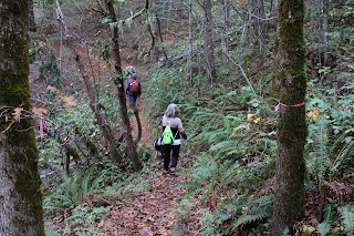
Trail through a damp forest
next to an even damper lake
The morning had warmed up a degree or two as we hiked along the quiet lake but the exertion of hiking was the primary reason for warming erstwhile cold bodies. The trail around Cooper Creek Reservoir is not particularly rugged but does serve up a regular dose of up and down hiking. So, winter cometh but hiking warmeth uth. Tho thorry.

A meadow forms where there once was a lake

Cooper Creek Reservoir is long and narrow, almost fjord-like, and the trail rounded the Cooper Creek inlet end after a couple of miles. As mentioned, the lake was low and the retreating shoreline had been supplanted in turn by a rather vigorous meadow of tall grass, mostly dry and desiccate this time of year. Now heading back in the general direction of where we had started from, we stopped for a lunch and laze at a convenient picnic table near the boat ramp.

The forested part of our hike

At this point we discussed options for the remainder of the hiking route. We could turn around and go back the way we came or we could continue on and circumnavigate the body of water. The circumnavigation could be completed by either a road walk or by bushwhacking along the shore. John, Patty, and I (namby-pambies!) opted for the road walk, which I'd never done before, while honorary he-men Jennifer and Gayle (and canine friend Sammy) opted to bushwhack around. All routes were soon perfunctorily hiked and we all met up at the trailhead in short order.

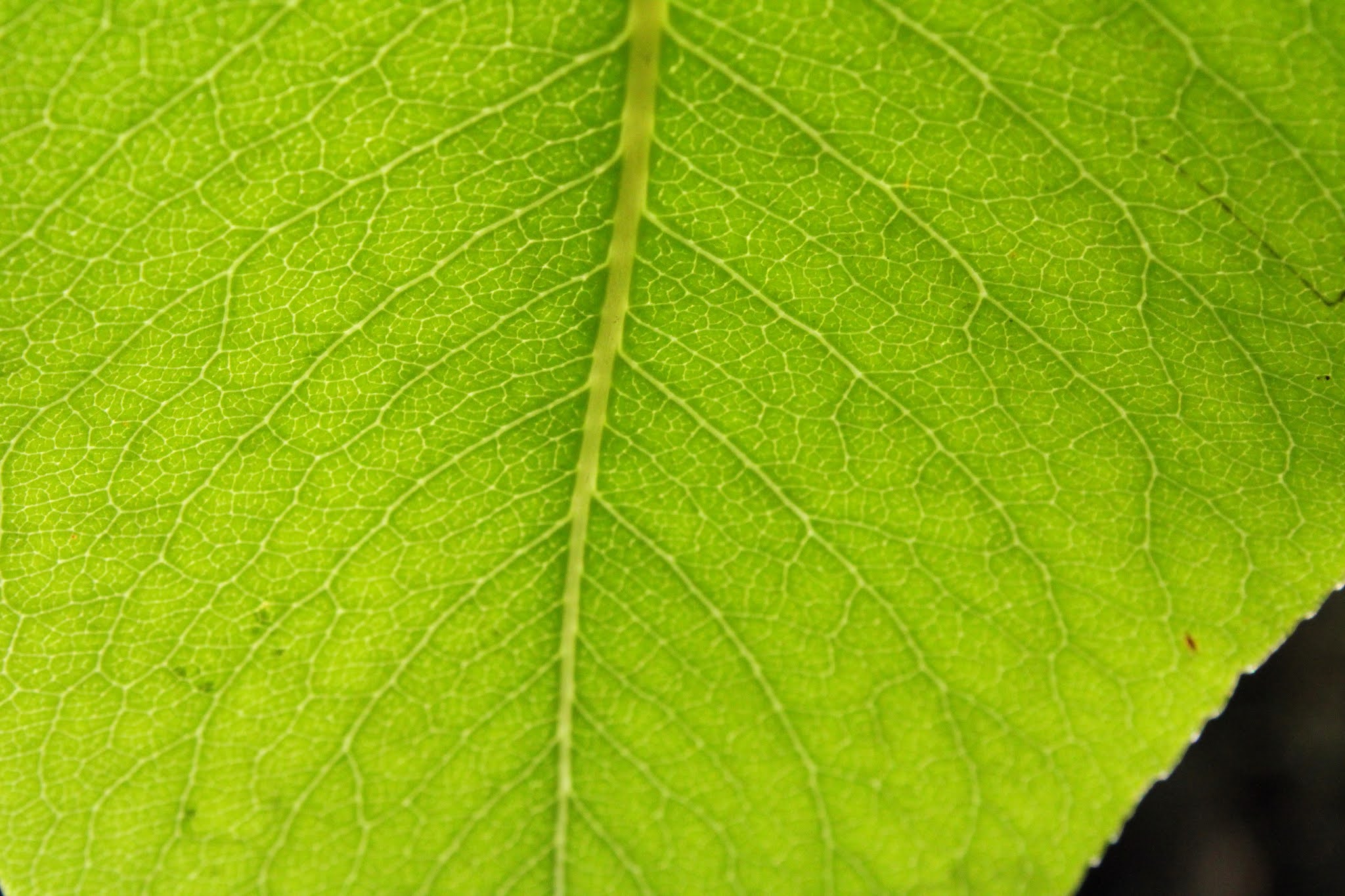
Blackberry does not have black leaves

The cold conditions on this hike were not necessarily dire but they did serve as warning for what is to come. Accordingly, my day pack has since been restocked with winter essentials such as crampons, mittens, ski cap, balaclava, and a flask of scotch which will almost guarantee that none of those items will ever be needed (excluding the scotch, that's always useful) during a winter hike. That's just how it works. 

Almost too quiet!

For more photos of this hike, please visit the Flickr album.

Tuesday, November 16, 2021

Bolt Mountain

The hiking club was going on a hike to the summit of Bolt Mountain but instead of bolting out of bed (see what I did there?) to join them, I slapped the alarm into submission and returned to a blissful embrace in the arms of Morpheus (meaning I went back to sleep). Afterward, the rest of the day was spent wading in a sad little koi pond of regret, for I had missed an opportunity to get onto a trail on which I'd never been. But while I couldn't undo not hiking with my friends, I could do something about not ever hiking to the Bolt Mountain summit.

A piece of Bolt Mountain looms at the trailhead
A couple of days later on a chilly but sunlit morn at the Fish Hatchery Park trailhead it was only me and the mountain, just a nut and Bolt on a fine day for hiking. Whereas my friends had spent their day hiking in fog, I walked under a clear blue sky and enjoyed great views of the surrounding countryside all hike long. Serendipity! See, I must have known what I was doing when I decided to sleep in!

A forest reflects in a slow moving creek
The trail initially descended on an old road bed through some pleasant woods with trees mostly stark and bare. Oak leaves still sported some of their autumn finery as I scuffed along on a path covered in maple leaves long since dropped from the trees. At a rock-hop crossing of a barely trickling creek, the trail then angled uphill and there'd be no more downhill hiking until the return from the summit.

Still some autumn going on, thanks to the oaks
The trail was well-manicured and groomed for the most part, although the rocky tread did impart an element of roughness to the path. It would be about 1,200 feet of elevation gain and while the trail was uphill the whole way, the grade was mild and not particularly daunting. Occasional open spots in the forest provided ever expansive views of pastoral farmlands surrounding the nearby Applegate River.

The trail angles up through a thin stand of Jeffery Pine
Per the BLM's Bolt Mountain brochure, the soils here are comprised of serpentine, a nutrient-poor mineral that is endemic to the Siskiyous. Accordingly, the woods were comprised of hardier species such as madrone, oak, cedar, and Jefferey pine. On the sunny side of the mountain in particular, the stands of Jeffrey pine were sparse and the slopes covered with only dry grass underneath.

Madrone berries collect some morning dew
Smooth, orange-trunked madrone trees were found all over, happy to thrive in the drier conditions found on the mountain. While madrones are evergreen and as a result, non-participants in the autumn festival of color, this time of year they are heavily laden with grape-like bunches of red fruits as if they were already celebrating the upcoming Christmas season.

Please O sun gods, send sunlight to warm my cockles!
For the first half of the uphill hike, the trail had inscribed a back-and-forth route up the south-facing slope of Bolt Mountain. Eventually the trail rounded the north-facing side and commenced a spiral route to the summit. The north side was shady and the temperature dropped noticeably, sending me into a frantic rummage through my pack in search of a jacket. A nearby madrone giant sent up two large trunks that resembled arms raised to the heavens, as if desperately beseeching the sun gods to send some warm sunlight its way. I too may have done some similar beseeching of my own at that point.

Who says there's no view from the summit?
The trail returned to the wonderful world of sunlight with one last push to the summit. The mountaintop itself was not much to look at, just a bare spot ringed by thorny ceanothus bushes and stunted cedar trees. However, the hike up Bolt Mountain is all about the view anyway and the unassuming summit delivered on that end. Bolt Mountain is surrounded by much taller mountains rising above the river valleys and farmlands, and all are eminently visible from the peak. Grants Pass lay in its valley floor below with the mountains and canyons of the Rogue River extending beyond the city. Clouds clung to nearby high ridges while the sky was mostly blue around Bolt Mountain itself. It was a huge payoff for relatively little work.

Ants have hairy butts
All good things come to an end and sometimes those ends are followed by some more good things. The easy descent down to the trailhead afforded me the opportunity to play around with my macro lens which is something one can do when not having to keep up with friends. Accordingly, much up-close lichen, fungi, and ant photos were taken and thanks to the awesome power of the macro lens, I now know ants have hairy butts. By now, the morning had morphed into early afternoon and winter shadows lengthened underneath the trees which in turn led to the macro lens coming off and going back on with some frequency.

Christmas tree, Bolt Mountain style
Alas, all the hiking fun came to a close upon arrival at the trailhead, and I was quite pleased with my first Bolt Mountain experience. In perusing a trail map post-hike I noticed there is (allegedly) another trail accessing Bolt Mountain beginning from Stringer Gap. Funny, I didn't really notice another trail intersecting today's route to Bolt Mountain but hey, I think I just found another reason to come back. Unlike my friends, I'll just make sure not to do it on a foggy day. 

Sunlight illuminates a madrone leaf
For more photos of this hike, please visit the Flickr album.

Saturday, October 30, 2021

North Umpqua Trail (Hot Springs Segment)


Last year, the Friends of the Umpqua's outing on the North Umpqua Trail's Hot Springs Segment had been all about the autumn colors. It was Halloween weekend and the weather had been gloriously sunny, the sky inspiringly blue, and the forest brilliant with fall colors. I happily hiked as one with the elements, because I too am bright and flamboyantly colorful. However, this year's hike was the exact opposite. Three weeks of rain had knocked most of the leaves out of the trees, the temperature was on bordering on cold, and the overcast sky rudely dumped water on our heads. What a difference a year makes!

Colorless grubs and crawly things

Beginning from the trailhead at Toketee Lake, ten hikers warmed up with a pleasant up and down ramble through a dimly lit forest above the mostly unseen river. This section was all green with ferns, moss, Oregon grape, and a whole forest comprised primarily of Douglas fir. The dark forest seemed to be darker than usual though, thanks to a gloomy gray sky overhead and a general scarcity of sunlight. Underneath the trees, we scuttled in the low light like so many colorless grubs and crawly things slithering away from underneath a freshly overturned garden stone.

The Golden Path

After a bit, the trail dropped down to the North Umpqua River and commenced one of my favorite sections of trail. Here the path follows the river and in autumn, is blanketed with a thick layer of fallen leaves. Just follow the Golden Path, Richard, and you will be rich beyond your wildest dreams, the richness in this case pertaining to the glorious autumn vibe. When not ambling beneath maples and their fading leaves (mostly on the ground), the trail wound its way through a cathedral of tall firs flanking either side of the trail and I gaped in reverential awe like some humble pilgrim finally reaching his sanctified destination.

Trees (and maybe a hiker or two)
get buried by the leaves

As mentioned, the forest floor (and trail) were shag-carpeted with a thick layer of leaves. Already, the processes of decomposition and soil regeneration were well underway. Individual fronds of Oregon grape and ferns had snagged some of the fallen maple leaves which were now decomposing on the evergreen plants and shrubs. The contours of fallen trees of seasons past were barely visible underneath mountains of accumulated leaf litter. Mushrooms and fungi of various ilk and specie were taking advantage of the decaying biomass and just generally thrived all over.

The North Umpqua Trail gently
climbs up to Deer Creek

At just under the two-mile mark, the North Umpqua Trail egressed onto a forest road and the path then resumed on the other side of the river. The only uphill hiking commenced here, but fortunately it wasn't daunting at all, just a steady climb through a lush and tangled forest. Here, the North Umpqua Trail diverged from the North Umpqua River but Deer Creek happily took the river's trailside place and burbled merrily somewhere down there in the forest below. As I hiked through the bucolic scenery, the peace and quiet of the forest was suddenly interrupted by John hiking in my direction with an obvious limp. Uh-oh.

Final score: This little creek 1, Knees 0

Up ahead there is an unnamed creek that was just a trickle last year. This year, it was running vigorously and enterprising hikers had fashioned a primitive creek crossing made up of branches and rocks. One of these rocks broke in two when John stepped on it, causing him to have an unwanted sit-down in the creek. Also unwanted, was a knee bending the wrong way and John had to take his sprained joint back to the trailhead, one gimpy step at a time.

Deer Creek flows under the hiker's bridge

After making sure John was in reasonable enough shape to hike back without assistance, I continued on to Deer Creek, my turnaround point. Everybody else had continued on to Columnar Falls but because I had lagged behind, this hike had turned out to be more photo shoot than hike so Deer Creek was as far as I would get. At the stout metal and wood bridge spanning the stream, I took a moment or two just to simply appreciate the beauty of the creek approaching from upstream, well on its way to joining forces with the North Umpqua River. 

Natural leaf arrangement on a log

Shortly after turning around and heading back, the ominous gray clouds delivered on their threat to rain on us. The day darkened considerably and the pitter-patter of raindrops and the surround-sound hiss of millions of raindrops striking millions of fallen leaves were a soothing counterpoint to the rhythmic noise of my boots swishing through the leaf litter cloaking the path. Since I was now ahead of everybody else, I took my appreciative and thankful time as I walked, while valiantly trying my best to keep the camera dry.

New arrival

It was a short wait at the trailhead before everybody else began straggling in, all wet and bedraggled like my dogs get when I've forgotten to let them back in the house on a rainy day. The day was now dark and gloomy with that hint of cold that says winter is on its way, and all hikers, including me, were rain-soaked and sodden. Despite the discomfiture caused by the inclement weather, nonetheless I had happily hiked as one with the elements, for I too am gloomy, gray, and chill.

A family of mushrooms make
a happy home on a rotting log

For more photos of this hike, please visit the Flickr album.

Friday, October 15, 2021

McKenzie River Trail (from Belknap Springs)

No matter how meticulous or painstaking the planning, sometimes things just do not go as intended. Improvisation is often the saving grace of a given hike and the unpredictability makes hiking fun, as long as it's good unpredictability. An unexpected trail closure that forces you onto a trail you'd never been on can be an enjoyable adventure, as long as you don't do something stupid like twist your ankle on the new trail. Gratefully, no body parts were injured on this hike, but because my intended route on the McKenzie River Trail was closed due to wildfire damage, I was forced mid-hike to come up with a new plan on the spur of the moment.

The cold and forbidding waters of the McKenzie

Uncharacteristically (for me), the hiking festivities started early morning, the sun had not yet risen high enough to shine down into the river canyon. Winter is coming and dang, it was cold. I could barely feel my fingers and the cold air made me rue my newly shaved head. If my ears could talk they'd be clamoring for me to immediately don a ski cap before they freeze and fall off my hairless head.

Autumn decorates a bridge railing

Initially, fallen trees covered the trail so I improvised (theme of this blog!) by walking down to Belknap Hot Springs Resort and then through the nearby campground full of still snoring campers. A short cross-country walk from an empty campsite then put me on the McKenzie River Trail proper, where the campground "scenery" was exchanged for a forest lush and light green, the understory being comprised of dense vine maple growth just starting to turn yellow.

The river takes a moment to
reflect on the meaning of life

The McKenzie River was nearby, which only makes sense, given that I was hiking on the McKenzie River Trail. The river surged dark and foreboding in the deep shade, the waters exuding an icy aura that did not even come close to inviting a refreshing swim. In the quiet parts, the surface of the river was like polished onyx and the autumn colors and what little sunlight there was reflected on the river and artfully colored it up. 

Bridge crossing at Boulder Creek

In quick succession, a pair of rustic footbridges crossed over an unnamed creek and Boulder Creek. The unnamed creek's bridge was one-railed, causing me to place an inordinate amount of trust and faith in my left hand and arm. Boulder Creek's bridge has the proper amount of rails (two!) but the creek had very little water pooling between the many boulders in the creek bed. I could see where Boulder Creek joined with the McKenzie but the unnamed creek just disappeared into the rampant greenery encroaching the creek bed. And thus ends this random tale of two creeks which much like this hike, rambled aimlessly.

A moment of Zen

I knew the Knoll Fire had trashed the McKenzie River Trail at Deer Creek, causing the Forest Service to close that section of trail. What I did not realize was that the line of demarcation for the closure was not at Deer Creek itself, but at Deer Creek Road instead. That closure site meant that my intended 8 mile hike was now going to be a 4 mile hike. The barrier itself was just a wooden sawhorse with no explanation attached and I could hear my hiking buddies saying "If you can walk around it, it's not closed!' (We had discussed trail closures on our last hike). But I believe in playing nice with the USFS, so it was back the way I had come, pondering how best to come up with some additional mileage.

Sunlight filters through the leafy woods

Duh, the McKenzie River Trail runs in either direction from Belknap Springs Trailhead. So once I reached the trailhead, it was a simple matter of crossing the road and continuing west on the trail. Now, my preconceived notion was that this trail section basically hugged busy McKenzie Highway and was generally uninteresting. Boy, was I wrong, wrong enough that I am even putting it in writing right here in my blog.

The trail wound its way through an
entrancing and captivating forest

The forest on this part was beautiful and eminently sublime. Ample greenery abounded, although the greenery was not entirely green-leafed, thanks to vine maples turning yellow or red, depending on the sunlight. Lush growth flanked the trail, the usual suspects being Oregon grape, salal, and all the ferns you could ever hope to see on a day hike. Not to mention, tall maple and conifer trees kept the hike shady and whatever sunlight made it down to the forest floor was of the dappled variety. 

Arrival at Lost Creek

The trail rapidly descended down a forested ridge crest that peeled away from the now unseen river. My reward for all that downhill hiking, besides having to hike back up, was a scenic bridge crossing at Lost Creek. The creek didn't look all that lost, as it joined the McKenzie within eyeshot of the bridge. The stream coursed in the bottom of a pronounced canyon and was nearly wide enough to be considered a river. The bridge seemed a good place as any to turn around at, and back up the trail I went, happy with the discovery of another totally awesome hike, thanks to an unexpected closure and some improvisation.

This portion of the McKenzie River
Trail invites further exploration

For more photos of this hike, please visit the Flickr album.

Saturday, October 9, 2021

Upper Rogue River Trail (Big Bend Trailhead, north)


A couple of summers ago, I attempted a hike on the Upper Rogue River Trail (URRT), beginning from Foster Creek Trailhead. There, a well-defined trail led from the trailhead down to the fast moving creek. And from there...? After a wet ford of the creek and some mortal combat against head-high thickets of willow, I could not find the resumption of the trail on the other side of Foster Creek. One's chances are better for finding a Sasquatch nest than locating the trail in that mess of vegetation. At any rate, this time out I figured I'd try to reach Foster Creek from Big Bend Trailhead, simply because I had never been on that section of trail.

This way to glory
This hike began where the URRT crosses gravel Hershberger Mountain Road. You really have to watch for the trail to find it and the same level of alertness was required to watch for trail markers once on the trail, for there were several dirt roads and confusing trail intersections to contend with. Fortunately, markers with tiny words but large arrows kept me headed in the right direction before the "real" trail made a short drop down to the river and commenced the "real" hike.

The first step in plant-to-pants water transfer
It was a cold and nipply morning and all the encroaching vegetation was damp with morning dew that soaked pant legs as I brushed by. I can honestly say I wet my pants, something I hope to never have to say again as I enter my elder years. Not all the vegetation was wet and dewy, for clusters of bright red wild rose hips were lightly frosted in a subtle reminder that winter cometh.

How alder does autumn
The Rogue Gorge, site of my last hike, was only 6.5 miles downstream but it was worlds apart when it came to fall colors. Here, there was a noticeable dearth of vine maples, so it was incumbent upon the alders to hold up the autumn flag. They tried, but alders just don't glow as bright or as multicolored as their vine maple brethren. So, the autumn colors tended towards light yellow and paled (color pun intended) in comparison to the vine maple carnival found further downstream.

The Rogue River, all hike long
Generally, the Rogue River was always nearby but in these parts, the river coursed slowly at the bottom of its forested canyon in a series of graceful curves and bends. There was none of that wild gorge stuff that is so prevalent downstream. The sun was out, the sky was blue, and sun, sky, and forest all reflected on the ponderous river seemingly in no hurry to reach the Rogue Gorge. The water was crystalline and clear, and boulders and small rocks were eminently visible on the river bottom from various trail overlooks.
Tall cliffs, courtesy of Mount Mazama
Something like 7,000 years ago, Mount Mazama erupted and buried the surrounding countryside in volcanic ash. Nowadays, the scars from that cataclysmic eruption are still visible across the river, mostly in the form of tall cliffs clearly comprised of volcanic ash. On the trail side of the Rogue, you could not see the cliffs because you were actually standing on top of them, and the rim thereof provided some nice scenic overlooks of the tranquil river flowing below.
 
Where there are ferns, there is almost no trail
Periodically, the trail would peel away from the river and duck into a forest sublime and beautiful. The map said there were footbridges on this part of the trail but I only found one, the others having been washed out long ago. Fortunately, the creeks that did the washing out were dry during my visit. Lush vegetation carpeted the forest floor, and thigh-high bracken fern were doing a mighty fine job of fading the trail into oblivion beneath their yellowing fronds. 

The meadows along the river were incredibly scenic
After traversing a dark and shady forest with faint sunbeams illuminating lucky seedlings, the trail entered an extensive meadow that flanked both sides of the Rogue. The lazy river curved around a bend and disappeared under a ginormous log jam; apparently, this is where logs come to die. Equally slow moving creeks drained marshes pooling in the tall grasses and reeds but the one footbridge I encountered allowed for boots to remain dry, unlike my pants. However, the tall grasses made the trail faint and a little hard to follow.

The trail went sketchy in the vegetation
Once past the stunning scenery at the meadows, the path ducked into the forest and then just basically melted away underneath the trees, the path becoming indistinguishable from the forest floor. I sort of could see where it might go but trying to follow would dramatically increase the probability of getting Search and Rescue involved at some point, so I called it good and returned the way I had come.

A dogwood leaf adds to the fall fun
The turnaround point was only about two miles south of elusive Foster Creek and I'd like to come back and finish off this section. Safety first, though, and I'll bring some friend or friends with me, provided I can find any willing to risk getting lost with me. Also useful would be a roll of orange flagging tape (pink, if Lane comes), so we can backtrack without getting lost. While the unexpected turnaround was slightly disappointing, I don't think I'm quite done with the URRT yet.

The forested bits of trail were just gorgeous
For more photos of this hike, please visit the Flickr album.