Saturday, January 26, 2019

North Umpqua Trail (Tioga Segment) 1/2019

In the summer of 2017, the North Umpqua Complex Fire(s) swept over the Tioga Segment of the North Umpqua Trail, leaving behind acres and acres of blackened forest. Fast forward to January of 2019. when  the Friends of the Umpqua Hiking Club swept through the Tioga Segment of the North Umpqua Trail and likewise left behind acres and acres of blackened forest. Of course, the dead forest was not the club's fault, we'll assign blame to the nasty wildfire for that.

The creeks were full today
The Tioga Segment used to be the longest segment of the venerable North Umpqua Trail, being 16 miles or so long. In 2012, the BLM constructed the stout and picturesque Tioga Bridge across the North Umpqua River, neatly splitting the Tioga Segment into the Swiftwater Segment and the current incarnation of the Tioga Segment. Prior to the bridge's construction, I had never hiked the middle of the Tioga and I could still say the same after the bridge was put into place. All that would change though, with this hike.

The dividing line between shiver and bask
At the start, the weather really acted like it wanted to rain but before long the sun broke out and warmed hearts and souls, if not bodies. It's kind of a truism that no matter what side of the North Umpqua River the trail is on. the warm sun will be on the other side of the river. Backpackers hiking the full 78 miles of the North Umpqua Trail have been known to begin as tanned individuals and finish the hike with complexions like those of pallid grubs that live under rocks. I exaggerate of course, but suffice to say our hike was spent entirely in deep shade and chilly temps.

We did this often
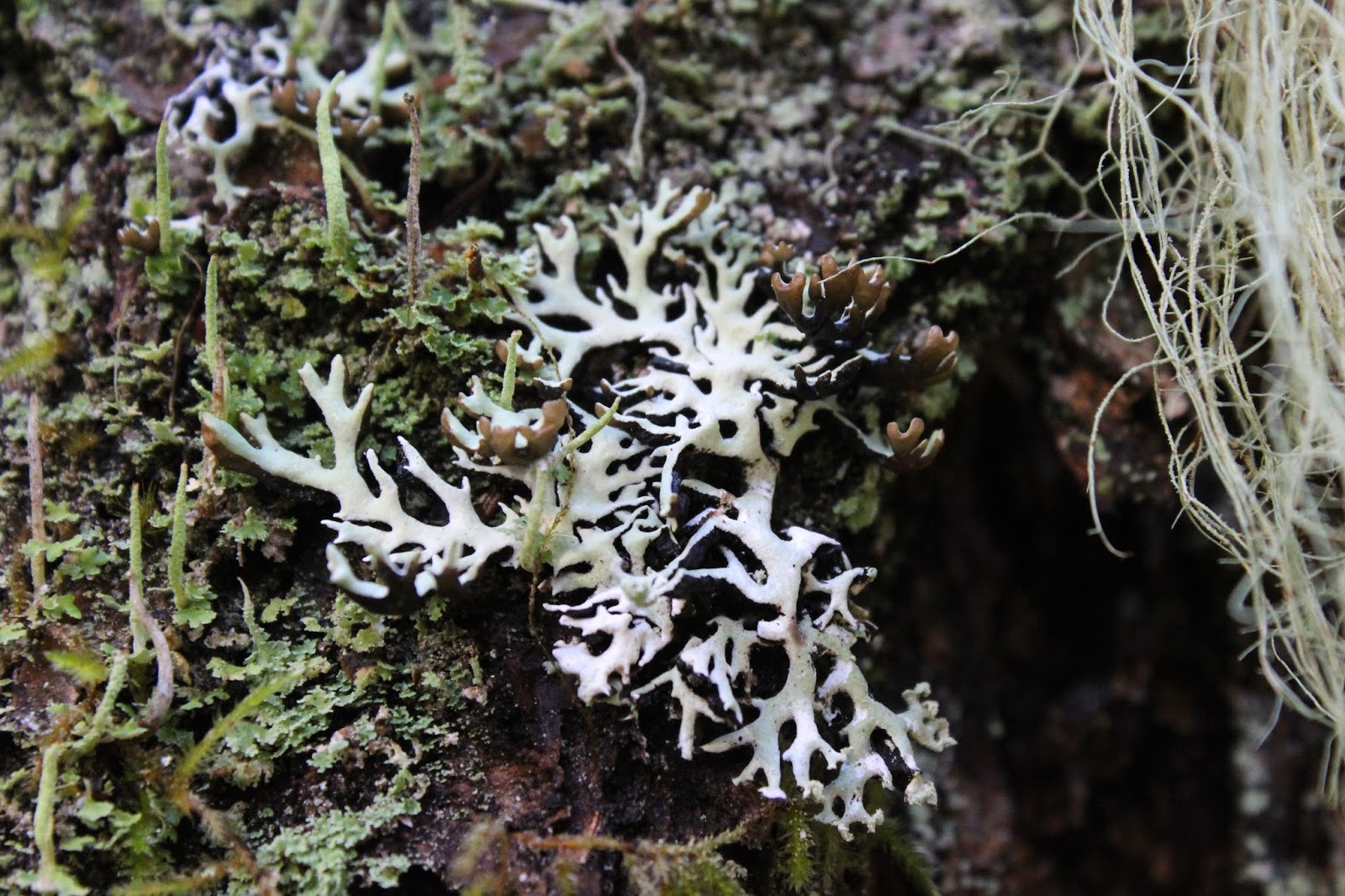
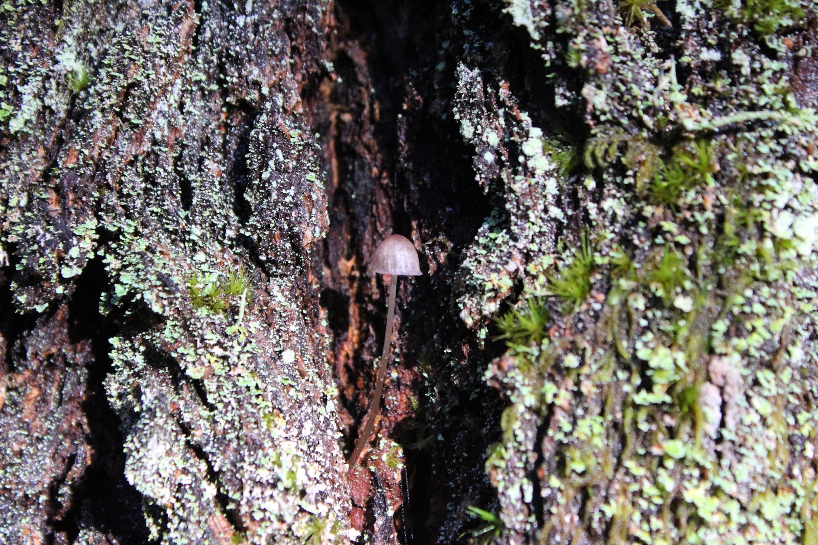
Naturally, as the trail charged uphill immediately from the trailhead, we became quite warm from the exertion thereof. The trees were mostly dead with trunks blackened by the fire and we had to step and clamber over several that had fallen, which is a common occurrence post-conflagration. Turkey tails were spotted on many of the fallen trees and to clarify, I will point out that I am referring to a fungus and not alluding to the fact that Lane was hiking in front of me. In spite of all the arboreal death and destruction next to the trail, a healthy green undergrowth was already sprouting, well under way in the business of restoring things as they were before the summer of 2017.

Charred rock garden
Another byproduct of wildfires is landslides. Forest is nature's way of engineering land stabilization on sloping terrain. Kill the plants and trees and you kill the the ability of the forest to sop up rain and snow. Without the vegetation to absorb moisture, the moisture goes into the ground, softening it to the point where a landslide occurs. After 2002's Apple Fire, the Forest Service had their hands full keeping the North Umpqua Trail's Calf open because landslides were such a recurring theme after the fire. Let's hope that the same thing does not happen on the Tioga Segment, but back to the hike.

Yikes!
All this talk about landslides is because a big one had taken out a piece of the trail. We could see the path end at the scar and resume on the other side. The trick was to cross the slide itself and so we did, picking our way across the slide scar, soft soil shifting and moving underneath our boots. I'm glad to report, though, no hikers took a quick and wild trip down to the river but yikes.

Thunder Creek waterfalls down to the North Umpqua


Amazingly, the bridge at Thunder Creek survived the fire even though the surrounding woods did not. The creek, as is wont this time of year, was flowing rather robustly, tumbling down to the North Umpqua in a series of pools surrounded by green mossy boulders. The creek drainage upstream of the footbridge was clogged with charred fire debris and this was typical of all the drainages in this area, be the creek large or small.

The North Umpqua is just one step away
We stopped briefly at Elevation Rock, a rocky promontory overlooking the North Umpqua River in its water-carved canyon. Our taking in the view was somewhat on the wistful side for plain to see was the ample sunlight on the other side of the river while we shivered in the cold shade. Virtually one step away was the the green-blue river itself and we made sure to stay away from the edge.

Sooty basalt formations
The fire had done the most damage in the area between Elevation Rock and Fox Creek and the undergrowth had not yet come back in the charred woods. This was a graveyard with the blackened bodies of the trees not yet interred. The woodpeckers, fungi, and other assorted dead-tree eating life forms will no doubt be happy in the years to come. However, the fire did improve the views by clearing out that annoying vision-blocking forest and I never realized there were rocky cliffs above the trail. However, these cliffs were no longer mossy green but blackened with soot.

"It's just a flesh wound!"
Fox Creek marked the rough halfway point of the Tioga, accent on the rough. There used to be an awesome backpack campsite next to the creek but now a large tree lay across the campsite. The bridge had taken a hit too, to judge by the broken railings, but it was just a flesh wound and the bridge still soldiers on, faithfully performing its designated mandate of helping hikers cross from one side of the creek to the other. Also providing double-duty was the fallen tree itself, functioning both as campsite smasher and lunchtime seating.

A small waterfall next to the trail
As we resumed hiking away from Fox Creek, we left the burn zone and entered a forest as it should be. Green was the dominant color and all the trees had those leaf-things that had been in such short supply up unto this point.  Small creeks small-waterfalled onto and across the trail and life was good until the trail rudely headed uphill at a prodigious rate. So cruel.

The river was always nearby
The trail went up and over a wooded ridge in a series of short but sweet switchbacks that had hikers considering getting a new hobby, or maybe it was just me. After the ridge was crested, a whole new set of other leg muscles were set aflame on the descent, as we leg-braked down the slope.


Susan Creek at the end of the hike

Once down to river level, I'm glad to report the trail was flat for the next several miles to the Susan Creek  trailhead. The forest was lush and green and the river was always nearby and mostly visible. Legs began to forgive their hikers at this point and life was good. Despite the fire damaged scenery, hiking on the North Umpqua Trail is always a beautiful experience, steep trails notwithstanding.

An unnamed creek slides down a rock face
For more photos of this hike, please visit the Flickr album.


Saturday, January 12, 2019

Bandon Beach 1/2019

I really should know better. It's not like this hasn't happened before. Oh wait...that was yesterday's blog about being attacked by waves near Floras Lake. On this day, the same old high surf warning was still in effect, so heeding the experience from the day prior, I led a small group scrambling over the slippery rocks at the foot of Grave Point because the incoming tide and high surf had taken our beach away. Like I said, I really should know better...but I don't.

Table Rock sets the table for this hike
The day was briskly cool as our group set out on the beach just south of the Coquille River jetty. Sun, mist, and clouds competed photogenically for sky supremacy with the sun mostly prevailing, but not always. Despite the sunlight, the day was still chill and most of us hiked with some jacket or coat on for warmth. The tide was out, but because of the high surf activity, low tide was not all that low. However, we did have plenty of beach to safely walk on while the sea seethed from a safe distance away. What a difference a day and a whole different beach can make!

Some of that amazing Bandon scenery
The high surf first affected us at Coquille Point. Normally, one can just walk around the point on the beach during low tide but on this morn, the ocean was still lapping around the point. However, a well-used short scramble route over the point delivered us to the arcing bay of Bandon Beach. The jumble of rocks and islands always delight and those of us with cameras soon found ourselves straggling behind the speed-walkers who don't care about photography at all.

A furtive peek at Cat and Kittens
Elephant Island has a tunnel boring completely through it and the ocean was busy applying vigorous colonic hydrotherapy to the island, whether the island wanted it or not. Further up the beach was Cat and Kittens, a collection of small islands beyond the waves and an unnamed rock that I euphemistically refer to as "Seal Rock" because it does resemble a seal. At any rate, an entire Noah's Ark of rocks resembling animals were strewn about the beach and surf with Princess Elwauna (mostly known as Face Rock) being the head zookeeper of it all.


Why we hike
Scenery like this is why Bandon is world-famous and why hotels, houses, and condos crowd the clifftops above the beach. It also explains the relative crowds of beach-goers like ourselves out enjoying the sand  and winter sun on a chill morning. Despite the seeming overpopulation, especially when compared to our usual hiking destinations, the scenery commands attention and it is quite easy to ignore the thundering hordes and their abodes. Needless to say, much photography ensued.

Doing the Crooked Creek dance
"Graceful" creek crossing
The recent rains had Crooked Creek full of water as it snaked in serpentine fashion across the sandy beach. Time for boots to get wet although many tried all sorts of leaps and high-steps, some more graceful than others, in a vain attempt to remain dry-footed. Me, I've just learned over the years to simply wade stoically across; it's only water, boys and girls. Still, the interpretive dancelike contortions employed to get across were amusing and much photography ensued, much to the regret of all participants.

High tide moved us up the beach
We turned around at Devils Kitchen, which is where most of the shore and offshore rockery begins to peter out. By the time we had hiked to the Kitchen and lazily consumed lunch, the low tide had become a rising tide. Accordingly, we had less beach for walking on the way back and on more than one occasion, we had to jog away from an incoming wave. On the positive side, the sneaker waves here could not even come close to matching the ferocity of the waves of the day before and thankfully, no hikers were smote on this day. The dryness of our feet were under constant threat, though.

The world's biggest candle
On the return, our group of about 10 hikers or so became strung out and per the natural order of things, I found myself hanging out near the tail end of the pack when a couple of funny things happened. We had hiked, in several instances, on the seaward side of the rocks and sea stacks on the beach when the tide was low. But now, the sea was in the process of overtaking the rocks. That didn't stop Lane from trying to walk around the front anyway and who knew the water was waist deep? Lane didn't but now he did! He had wet trousers and Lane-wet-his-pants jokes as a temporary souvenir of his excursion around the sea side of the rock.

We all should know better
The second point of amusement occurred at Grave Point where the ocean had likewise lapped up against the sheer cliffs of the point. The front (and prudent, too) portion of our hiking group left the beach on a staircase and walked on city streets to bypass the point. But, that's not how I roll! I gauged the situation and decided I could just scramble over the rockpile at the base, warily keeping an eye on the incoming waves wanting to eat me. Several hikers followed me over in blind and trusting faith. Given the situation of the day prior, where I was assaulted by a sneaker wave, you'd think I would know better, but I don't. On the plus side, all hikers got past the point safely and we didn't have to go up a steep flight of stairs either.

The ocean was riled up, to say the least
Once past Coquille Point, it was a sandy beach hike where there was less sand for us to hike on, due to the rising tide. On the seaward side of the rocky Coquille River jetty, the ocean had churned itself into a white frothy bowl of watery anger issues. Large waves rolled up the river, entertaining hikers who had scrambled up to the top of the river jetty at the end of the hike. Occasionally, a wave larger than the rest saw fit to splash us, even though we were on top. Like I said, I really should know better.

Jay tempts the wave gods
For more pictures of this hike, please visit the Flickr album.


Friday, January 11, 2019

Oregon Coast (Near Floras Lake)

I really should know better. It's not like this hasn't happened before. But the lesson here, dear readers, is that one should ALWAYS respect the ocean even though the respect isn't necessarily mutual. The sea is ever ready, willing, and able to merrily smite complacent or inattentive hikers, Exhibit A being this hike on a half-sunny half-stormy day.

The dividing line
Several  years ago, Dale, Lane, and I backpacked the longest continuous beach stretch of the Oregon Coast Trail and our first night was spent at a very crude and primitive campsite next to the New River. So, I figured I'd revisit the campsite by way of Floras Lake on an out-and-back beach hike. What a great idea and what could possibly go wrong?

A great start to this hike
The day was crisp and clear and the sky shone a bright blue with all the sparkling clarity winter air engenders. With a skip and a whistle, I set out on the trail and my mellow was immediately harshed by a warning sign. Literally, it was a rumpled note tacked onto the trailhead bulletin board. Sounding ominous and dire, the notice advised that the beach conditions were way too dangerous due to high surf. However, my inner paralegal noted the sign was dated yesterday and did not mention, cite, or allude to this current day, leaving me a legal loophole large enough to hike through. Based on a) nothing bad ever happens on a clear day and b) if there was a surf warning for today, the note would have said so, and c) those warnings don't ever pertain to me anyway; I decided to ignore what in hindsight, was very prescient advice.

Say bye-bye to the nice trail!
Accompanied by my own sense of delusional infallibility, I stepped around the sign and started hiking. The trail to the beach was underwater from a rain-swollen Floras Lake and I merrily splashed through the extended puddles before peeling to the north on a path I'd never been on. Halfway through a grassy expanse behind the beach foredunes, said path disappeared under several feet of standing water. Sheesh, but the grass made bushwhacking (grasswhacking?) easy and in short order, I found another path leading to the beach.

Belligerent wavery


The ocean was angry. There is no other way to describe it. The waves were booming and frankly, were somewhat on the large side. However, due to the recent storm action, the beach sloped steeply into the ocean which meant that while the waves were large, they didn't run up the beach at all, being effectively deterred by simple slope geometry and gravity (vector cross products and coefficients of static friction too, for the mathematically inclined). 

Shoreline turbulence
The fact the waves did not run far up the beach meant that I could get really close to them and take some awesome pictures of the thundering surf wanting to eat me. Laboring under the misapprehension that I was safe and secure, progress along the beach was slow while the photography was fast and furious. It was time for Master Poseidon to teach Richard a lesson.

Booming waves, as far as the eye can see
The camera was pointed northward along the coast, with my eyes and concentration totally affixed to the scene in the camera viewfinder, when a movement in my peripheral vision caught my attention. It was whitewater in the air, coming in about waist high, and moving faster than a cheetah on a rocket. My mind analyzed the situation and quickly deduced that the airborne water brigade was the leading front of a speeding wave. Obviously, my mind works slower than a speeding wave because before I could take evasive action, I was in it.

Incoming!
The violence of the onrushing water was unexpectedly shocking, for that wave enthusiastically clouted my backside like my abuelita did after catching me in a fib. My hiking pole was rudely snatched out of my right hand and I staggered like a punch-drunk boxer (or even a drunk boxer, for that matter!) in a desperate attempt to remain upright. The outcome of remaining upright was very much in question at that point. I'm proud to say that in a nanosecond, I took firm and decisive action which consisted of raising the camera skyward with my left arm while crying out to the heavens "No, not the camera!" Priorities.

The breach into the New River
The surf quickly retreated, thanks to the steep slope of the beach and I retrieved my hiking pole from where it had been deposited. From that point on, I hiked on the crest of the beach foredunes, soft sand be damned. Truth be told, the beach foredunes were not very tall, and there was a reason for that, which became evident when the New River curved close to the beach. 

The New River on a winter morn
The foredunes are formed by European beachgrass growing next to the beach. As windblown sand collects around the grasses, the dunes grow in height, eventually getting to be 15'ish feet tall. However, on the small strip of sand separating the New River from the beach, there was no grass growing at all. Why? Because the rampaging ocean had clearly breached the dune, running into the New River itself. And here I was, hiking on the precarious sandy perch between two bodies of water that could hurt me if they put their minds to it.

The Coast Range rises on the other side of the New
On the plus side, there was no impromptu hydrologic engineering while I was there and the scenery was fantastic. The wide river glinted in the morning sun and the coastal range rose up in the distance, seemingly coming close to touching the sky. On the ocean side, the noisy waves were a bright white in the early sunlight. Maybe nearly getting drowned was worth all this, but not really.

Clouds start scudding in
I didn't get very far north, not even getting remotely close to the primitive campsite. The walking was tedious, consisting of fighting for footing in soft sand and wading through hummocks of beachgrass. But no way was I going to hike down on the beach! The tide was definitely incoming and it was a logical presumption that hiking conditions would become increasingly challenging. I called it good after several miles and turned back to the south, in the direction of Floras Lake and Blacklock Point.

Not a question of if, but when the rain would start
A storm was undoubtedly blowing in from the southwest and skies quickly became dark with ominous clouds. It was time to quickly hoof it back to Floras Lake but instead, I hiked even slower, taking photo after photo of increasingly belligerent surf and cloud cover. I'm glad to report that there was no more hiker-smiting by the ocean although it did start to rain just as I reached Floras Lake.

Stormy view to Blacklock Point
So the lesson here, dear readers, is always make sure your camera is waterproof! Heed the warning signs, too.

Floras Lake as the day went gloomy
For more photos of this hike, please visit the Flickr album.


Tuesday, January 1, 2019

Mildred Kanipe Park

Yeah I know, I haven't blogged in a long, long, long time. So to answer all the questions I've received from concerned friends (all two of them): yes, my health is fine; and yes, I still hike. Fine and dandy, but what's up with not blogging? Well, for starters I've branched out and no longer single-mindedly devote all my spare time to the wonderful avocation that is hiking. Added to the mix is live music, photography of live music, and time and energy bartering with bands for free CDs, backstage passes, and quality band time in the green room in exchange for photography. Oh yeah, and that work thing, too.

Nothing but blue skies overhead
Additionally, my attention got sucked into tracing my family history and frankly, that journey has been amazing. Now, my family tree goes back 32 generations and includes, saints (probably some sinners, too), kings and queens, presidents, authors, opera composers, and many other luminaries. With all my illustrious ancestors contributing to my own little shallow end of the gene pool, it's perhaps disappointing I turned out the way I did, but oh well. However, the time spent painstakingly perusing and translating ancient hand-written Spanish baptismal certificates was one more deterrent to sitting down and laying some awesome prose about my trail time.

Sun lights up a blackberry leaf
But really, truth be told, those are just excuses. The reality is that I simply just sort of got out of the habit of writing. After all, if I didn't catch my blog up, the sun still rose and the world did not end. Knowing the blog was getting ridiculously behind I set an arbitrary deadline of one year, as in if I got over one year behind, then I'd just give up the blog altogether. However, a couple of months ago, I had a little trail talk with myself and decided I would catch the blog up. But sheesh, a whole year's worth of hikes? So with profound apologies to my one blog follower, here goes my first hike of 2019.

Tinder fungus works on a decaying stump
This was New Year's Day of 2019 and New Year's Eve had been spent woo-hooing the new year in to the ska beats of Ludicrous Speed at Sam Bond's Garage in Eugene. Needless to say, it was nearly 4:00 am by the time I crawled into bed, effectively ruling out any early morning start to a hike. So, with body and soul dragging from a raucous night of Ludicrous Speed, I began this hike at the ludicrously late hour of 12:30 pm. I probably hiked at a ludicrous speed, too.   

Lichen drapery on an oak tree

Despite the late hour, the peacock welcoming committee at the park was happy to see us, and canine companion Luna was happy to see the peacocks. She was less overjoyed about the leash restraining and constraining her desire to joyously chase the feathered ones. In keeping with the optimism of a new year, the sun was out and the temperature was mild and just perfect for hiking.

Berry nice hawthorn tree

Same old park but a brand new trail for me on this day. We grabbed an unnamed trail that followed a fence line and were immediately surrounded by menacing hawthorns. Sharp thorns do put the "thorn" in "hawthorn" but fortunately, the  trail was well maintained, keeping the painful trees and shrubs at bay. Contrasting nicely against a blue sky, the branches were heavily laden with pithy but bright red hawthorn berries.

Just a beautiful day for a hike!
Life was good for about 3/4 mile or so, at which time the trail hung a sharp left turn at the park's boundary and the uphill hiking began. On the plus side, the path angled across the steep slope instead of charging straight up like the Oak Savannah Trail (my normal route) does. On the other side of the park fence, a horny bull (horny, as in it had horns, not as in...never mind) warily eyed Luna as we walked by. Oak trees were everywhere, their leafless branches gaily festooned with lichen drapery. Much photography ensued.

The wildlife was not all that wild
On a broad grassy ridge dotted with bare oaks, we rejoined the Oak Savannah Trail for a brief bit before departing on the Fern Woods Trail at a junction. The comfortable wide track became a narrow muddy trail that aimlessly meandered up and down through the woods. The two-legged portion of our hiking party left 10-foot skid marks on the treacherously muddy path but never actually fell. The four-legged portion of our hiking party had no problem at all with the slippery mud. Luna wondered how humans got to be the master species on this planet when they can't even walk right and besides which, they walk so slow.

Lichen sprouts on a tree trunk
Fern Woods is a special place and I always enjoy the peaceful forest when I hike here. Today was no exception and frequent stops were made, much to the consternation of an overly energetic dog, to photograph ferns, mushrooms, moss, and lichen. Because of our late start and because the days are short in winter, shadows lengthened in the forest as the sun slipped behind the trees.

Whee!
Leaving the tranquil forest behind, we entered Bachelor Creek's wet valley bottom. There were several inches of standing water covering the trail and while I trod through the ankle deep water, Luna was beyond joy. Letting out yips of unrestrained exuberance, the dog ran back and forth across the large puddles. The world would truly be a much better place if everybody hiked like Luna.

I got way too close to cow poop for this photo
At a prominent trail junction next to Bachelor Creek, a temporarily unleashed Luna enjoyed a quick splash and swim in the cloudy water. From there, this short 4 mile loop hike was closed off by returning to the trails through the oak savannas, where we enjoyed the sunshine and open pasture all over again. Our walk was briefly interrupted when I spotted odd little orange fungi sprouting all over a cow patty. I may have even let out my own little unrestrained yips of joy as I photographed the orange poop-loving fungi from a way-too-close distance, .

Mushroom on (in?) crack
Flash forward a year from this hike to find grandchildren and I standing in the checkout line at Fred Meyer, buying foodstuffs for the current day's hike. The woman in front of us said "Hello" and then asked "Are you that guy that writes for the News-Review about hiking?" I had to explain that it had been a couple of years since I last did that so she asked "Well, do you have a blog or anything like that?" Then I had to shamefacedly explain that I am one lazy Hiking Dude. But that conversation was one more impetus to resume blogging!

The Puddle of Serenity in the oaken woods
For more pictures of this hike, please visit the Flickr album.