Saturday, June 25, 2022

Hemlock Creek


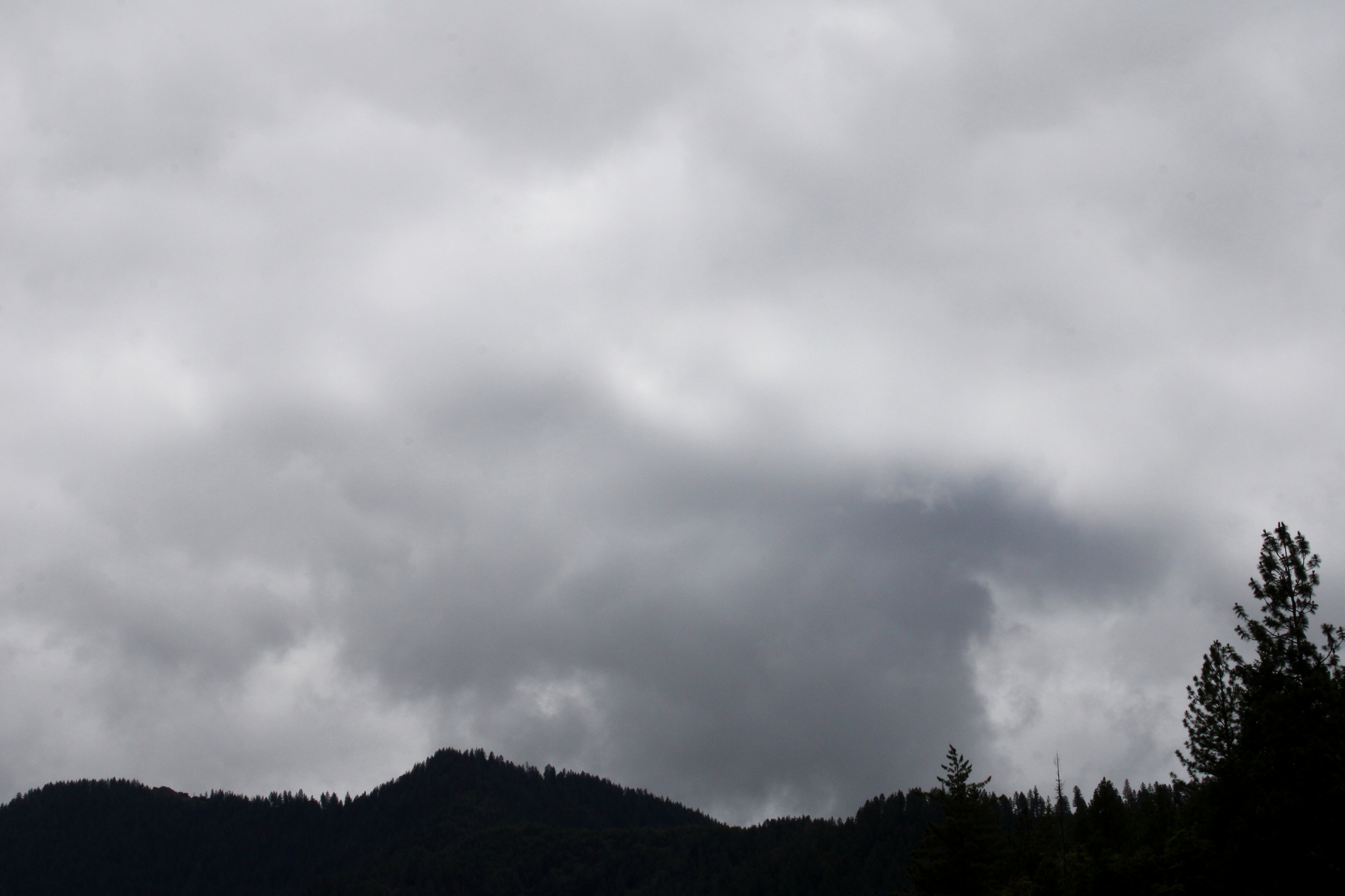
Sometimes, the forest is the hike and the hike is the forest. What I mean by that when you hike, there's usually a destination in mind, a place to go to, a particular something to see, as the reason for your being out on the trail in the first place. But then again, sometimes there is no raison d'etre for the day's venture, it's just about the being of it. Hemlock Creek was such a hike, because once I entered a forest sublime, it became all about the journey and not the destination.

Pink rhododendron flowered next to Lake in the Woods

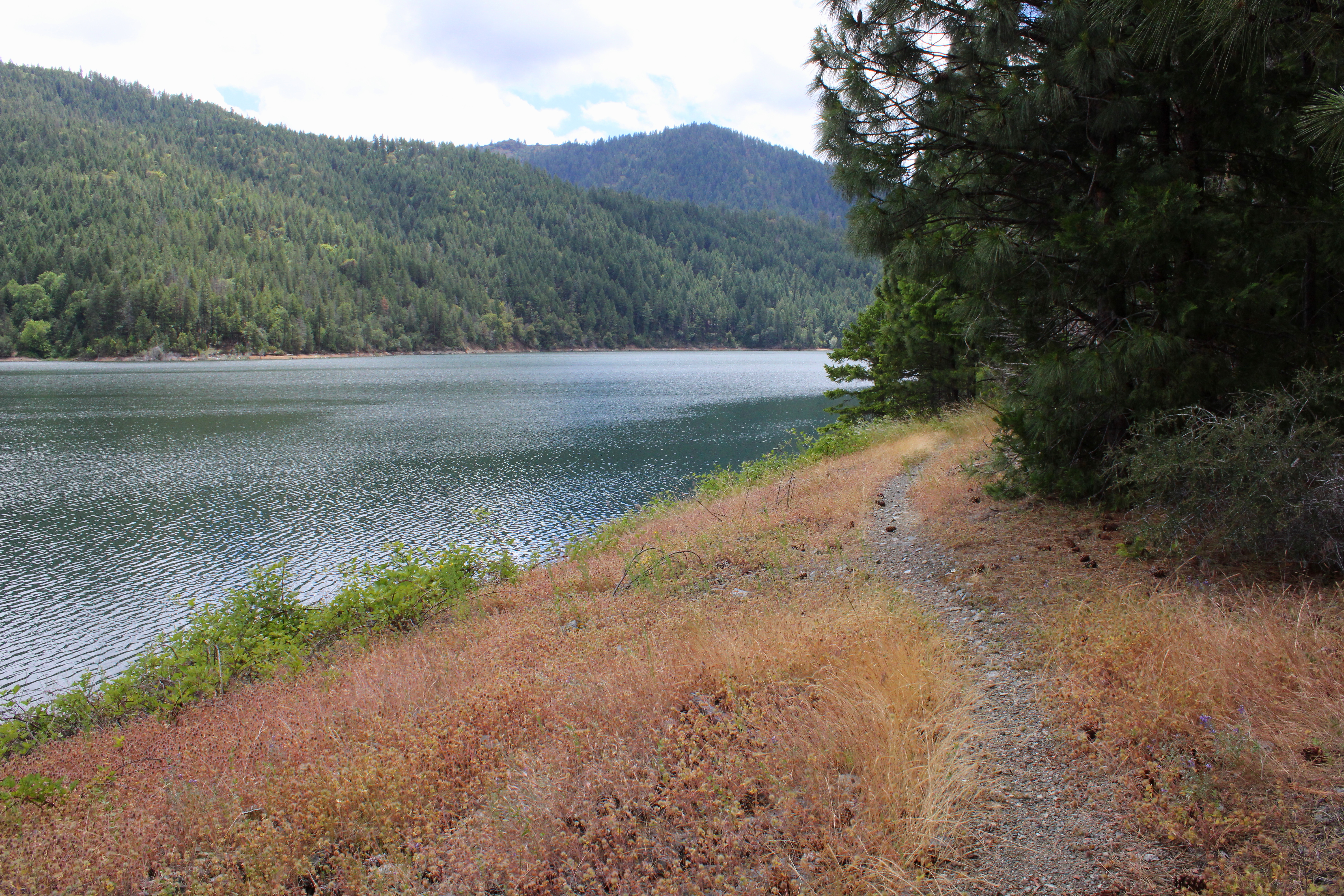
This tree-centric hike began at smallish Lake in the Woods, ringed not only by campers trying to escape the heat cooking the Umpqua Valley, but also by flowering rhododendron bushes gracing both lake and woods. Not wanting to disturb sleeping campers, I grabbed a use trail that skirted around the camping spots along the semi-stagnant lake. This led to some momentary confusion when I egressed onto a gravel road and had to spend a few minutes searching for the resumption of the trail.  

A log spans Hemlock Creek and tempts the adventurous

From the aforementioned gravel road, the trail entered a thick forest and headed uphill at a moderate grade. But who cares about uphill hiking when the forest was so out-of-this-world beautiful? The shade was as refreshing and as cool as a waterfall's mist. Sunlight filtered through trees, limbs, branches, and leaves, winding up on the trail as dappled light and shade. Life was good here and I considered staying in this place for the remainder of my days, it was so pleasant. 

Elegant cat's ear with that fuzzy feeling

A diverse collection of wildflowers mostly shared the forest in a harmonious rainbow coalition of specie and color. However, Columbia windflower and elegant cat's ear each practiced a form of floral apartheid, staking their claim on a particular patch of ground, making sure that not one pistil or stamen belonging to the lower castes of flower rabble dared cross over their territory. They couldn't stop me from taking photographs, though.

Lower Hemlock Falls wasn't easy to get to

Hemlock Creek was seldom seen from its namesake trail but did provide a couple of notable waterfalls to gawk at. The first cascade was Lower Hemlock Falls, which was kind of hard to see, you have to bushwhack a bit to get a decent photo thereof. The second waterfall, encountered on a side creek, is Clover Falls and is a lot harder to see, seeing how it's effectively screened from view by trees and tree parts. In fact, I didn't even notice the cascade when I hiked past but caught it when I returned in the opposite direction. Such are my keen powers of observation.

Trail into the forest darkness

After the two waterfalls, the route temporarily departed from Hemlock Creek and inscribed what seemed like an endless amount of switchbacks but were probably only four. My GPS said I was about to cross another forest road but the back and forth through the dense vegetation made the road crossing seem a lot farther away. 

Stout bridges crossed and re-crossed Hemlock Creek

After crossing the forest road, the trail did provide some quality Hemlock Creek time and miles. The path crossed and re-crossed the pristine and clear-flowing creek passing underneath the stout footbridges. Initially, the bridges were sturdy and sound except for one span showing its age by sagging in the middle, just like some hikers do. The final creek crossing had no bridge at all and required an easy ankle-deep wade.

The forest was a pleasure to hike through

Once Hemlock Creek was forded, the route commenced a more rigorous climb through the forest in yet another series of switchbacks that seemingly went on forever but probably only numbered four. Orange and salmon-colored clumps of coral fungus pushed their way into existence along the trail, emerging from the dark depths of the earth below. Flowers bloomed in the forest undergrowth and always, there was that delightfully mottled light keeping things cooler than they would otherwise have been. 

The meadows at the Yellowjacket Loop junction

After a mile of slogging ever on upward, the trail grade eased up and the forest thinned out, providing views of intermittent meadows with willow thickets in the middle, where Hemlock Creek flowed somewhere within the small trees, hidden away from the prying eyes of passing hikers. And just like that, the forest ended and the trail spit me out into some large meadows near Hemlock Lake. 

A wasp enjoyed the shade, just like me

These meadows are part of the Yellowjacket Loop, a great hike in its own right if you like meadows (and who doesn't?), wildflowers, and yellowjackets. I briefly entertained a notion of hiking the full Yellowjacket Loop and turning this moderate eight mile hike into an exhausting fourteener. But it was a hot afternoon by now, giving me the perfect excuse to turn around and head back to Lake of the Woods. But you know I would have done the longer loop except for the heat, and quit your sniggering! 

Fern frozen in mid-furl

It was all downhill back to the opaque green waters of Lake of the Woods, through the same beautifully shaded forest I had so enjoyed when hiking up. But, the easy downhill walking allowed me to better appreciate the shade, rampant greenery, and tall trees just that much more. When the hike ended at the trailhead kiosk, I turned around and said out loud "Thanks, forest!" but not too loudly. No need to get the nearby campers wondering about the lone sweaty dude talking to trees.

Peace like a forest

For more photos of this hike, please visit the Flickr album.

Saturday, June 18, 2022

Da-Ku-Be-Te-De Trail


Da-Ku-Be-Te-De just nicely rolls off the tongue, doesn't it? Well, maybe not. I was watching a YouTube video by some dude who hiked on the Da-Ku-Be-Te-De Trail and boy, did he ever struggle to pronounce the trail's name. He eventually gave up after he sprained his tongue and suffered severe mouth contusions. Speaking from personal experience though, it's pretty simple to say when your other native language is Spanish. Fortunately for the linguistically challenged, pronunciation and elocution are not a prerequisite for enjoyment of the hike. Just let your boots do the talking, the trail will always understand.

"Once upon a morn so dark and dreary,
while I hiked, weak and weary..."

It had been raining the week prior to this hike along the shore of Applegate Lake. When I began walking, the sky was overcast, dark, and dreary, matching my mood perfectly. Stepson Carl had been badly injured in a work accident and the worry about his well-being definitely harshed my mellow. Hopefully the sun would just stay hidden behind the moody clouds, no need to unduly mellow my harsh. However, as I hiked along the trail, the day would eventually bifurcate into equal parts sunny and cloudy, improving my mood and overall outlook, despite my best intentions to do otherwise.

Not your basic wilderness hike

The Da-Ku-Be-Te-De Trail is part of a trail network that circumnavigates Applegate Lake and this hike began at Hart-tish Park which boasts a campground, picnic area, boat ramp, small general store, and hundreds of squealing children recreating in the lake's cold waters. The civilized start to the hike continued as I walked past the campground, especially since the trail was paved at that point.

Mirrory

After several years of minimal precipitation and maximal wildfires, it was nice to receive a lot of rain last winter, leaving Applegate Lake full to the brim with water, as every lake should be. The air was quiet and still, and the lake reflected the gray clouds in the sky on its mirrory surface and I don't think "mirrory" is really a word, but I'm still going with it. In general, the body of water sported an alpinesque vibe, seeing how the narrow fiord-like lake is surrounded by tall craggy peaks still flecked with snow.

Mule Mountain rises beyond the lake's dam

Even though the trail closely followed the shore, dense woods surrounded the track and at times, it was like there was no lake at all. But periodic openings in the tree cover allowed me to observe some of the surrounding lakeside topography, like Little Grayback Mountain, whose tip-top generally hid somewhere within the low cloud cover. Across the lake was Elliot Creek Ridge with Stein Butte being the most prominent high point on the forested ridge. Not all the scenery was mountain-centric though, as the pronounced bay of Squaw Creek's arm reposed on the opposite shore below Elliot Creek Ridge.

Golden yarrow brightened up the trail

Wildflowers were a thing on this hike, too. Much of my time was spent bent over or lying prone on the trail, photographing small plants with colorful blooms representing all colors of the rainbow. Many of the plant species were regular Siskiyou denizens, seemingly exotic to this particular denizen of the Oregon Cascades country. Elegant brodeaia, ookow, checkermallow, golden yarrow, and paintbrush all did their part in colorizing the hike and much photography ensued.

The ticks await my presence on the trail

Intermittently, the woods gave way to small meadows and open grassy fields. Somewhat paranoid about the small biting creatures that lurk in the grass, I performed frequent tick checks, particularly right after a round of photo-grazing at grass level. I'm glad to report only one eight-legged vermin was found crawling on my pants leg, and luckily that was before it found its way to the delicious O'Neill blood flowing underneath my preciously soft and tender skin.

The Da-Ku-Be-Te-De Trail follows
the shore of Applegate Lake

As the miles slowly accrued, the lake's dam, eminently visible at the beginning of the hike, soon receded from view and it was easy to pretend Applegate Lake was then a natural body of water. On a clear day, the high peaks of the Red Buttes Wilderness, most notably those of the Red Buttes themselves, are an impressive sight from the shore. Unfortunately though, all that sumptuous snow-capped mountain scenery was hidden from sight by the brooding cloud cover on this latest visit.

Trail intersection near Watkins Campground

After about four miles of pleasant and mostly level hiking, a wooden footbridge and trail intersection marked my arrival at Watkins Campground. To continue hiking further around the lake required a fairly lengthy road walk, which made the campground my logical turnaround point. If I wanted to hike on pavement, I would have just walked back and forth a bunch of times on the campground path at Hart-tish Park.

I can see most of the Red Buttes

On the way back, the whole semi-stormy vibe completely changed as the clouds began to break up and dissipate. More and more, blue sky began to hold sway above the lake, but the clouds resisted mightily while I hiked below, fully entertained by the meteorological contest of wills. At the end of the hike, the Red Buttes, looming large on the Siskiyou crest, did finally make a brief appearance.

Blue sky began to rule the day, come afternoon

This hike had been another exercise in mental health, allowing me to assimilate myself back into civilization and generally mimic socially acceptable behavior. Totally enjoyable it was and I'll probably return to this trail in the future, for the backpack trip around Applegate Lake is on my to-do list. Because the trail around the lake is relatively level, it would be a pleasant backpack trip and probably is as easy as pronouncing Da-Ku-Be-Te-De.

Easy for you to say!

For more photos of this hike, please visit the Flickr album.