Wednesday, February 26, 2020

Diamond Lake


I've often said hiking is my mental health therapy and never have I needed hiking and therapy more than the present time. My world ended with an early morning phone call that began with "Aislinn died last night". With those four words life as I knew it was shattered and my youngest daughter was gone, leaving behind wonderful memories and broken hearts that will probably never heal in this lifetime. I could certainly write so much more about Aislinn, her life, her passing, and my feelings on the subject and while I recognize this is a hiking blog and not a blog about grief, a sadness this profound will inevitably bleed into all that I do for a bit. Just four days removed from that awful morning, I was feeling pretty raw but the idea of spending another despondent day at home just did not feel very healthy, it was time for some trailside therapy in the nurturing company of John, Jennifer, and Diane, who are some really awesome friends.

The lake was calling and we must go
The original plan was to snowshoe to Boundary Springs but since I'm unable to concentrate much these days, I naturally forgot to bring my snowshoes. So, Plan B was to swing by Diamond Lake Resort and rent some snowshoes and then continue on. However, one look at the frozen beauty of Diamond Lake changed our collective minds and we, by unanimous consent, opted to hike on the lake instead.

Diamond in the rough
The day was sunny, the sky was a deep blue color, and groups of ice fishermen dotted the lake's frozen surface like flakes of pepper on a pile of mashed potatoes. Despite the seemingly warm weather (even though it was sunny, it was still pretty chilly), the ice felt solid enough under our shoes as we left the cabins, restaurant, store, and other civilization accouterments behind at Diamond Lake Resort.

View south towards Crater Lake National Park
Basically, we just followed the lake's eastern shore, eschewing the campground road running through the forest along the lake. It wasn't too long before the sharp needle of Mount Thielsen made an appearance over the eastern shore, its pointed white spire seemingly intent on poking a hole in the sky. Straight ahead were some low hills located in Crater Lake National Park, one of which I recognized as the disturbingly named Bald Crater. It was Mount Bailey on the western shore, however, that dominated the mountain scenery surrounding the lake.

Mount Bailey, ever and always
The mountain was cloaked in white and no matter where we went, there was Mount Bailey, reposing in all its snow-covered awesomeness. We had all hiked to the top of Bailey at one time or another, so we periodically stopped to admire the view and call out some of the landmarks seen on the rugged trail to the summit.


Fissures in the ice cap
As we walked, we stepped over some cracks and fissures in the ice cap covering the lake. None of us were well versed in ice and lakes or the dangers thereof, so naturally we were somewhat concerned for our safety as we hiked. All of us, at differing times, poked our hiking poles into the fissures only to find hard unyielding ice below, apparently the crack had since frozen back shut. But visually, it still was disconcerting.

We took the campground road to the pizza restaurant
After a couple miles of lake-top walking, we edged toward the large campground on the lake's east side. Grabbing the campground road and after veering to and fro for a bit, we hit the well-used road which in winter time, does double duty as the Pizza Connection Trail, so named because it connects the South Shore Pizza Parlor to Diamond Lake Resort. In winter, or at least the times I have snowshoed there, the pizza parlor is open despite there not being any clear driveable road to the restaurant, serving warm pizza to snowmobilers, Nordic skiers, and lowly snowshoers such as ourselves. From prior experience, the smell of hot pizza wafting through the snow-covered trees is its own heavenly experience.

A great place for lunch
Alas, on this day the pizza parlor was closed (it was mid-week after all, so maybe it's only open on weekends) so no sublime pizza experience for us. Bummer, but we resorted to lunch consisting (in my case) of oranges, beef jerky, and nut bars while bittersweetly contemplating the silent lake and mountain majestically reposing before us under a cobalt blue sky.

It was stark and windswept on the lake
We decided that snowshoeing across the lake was way more interesting than following the campground road, fissures be damned. By this time it had warmed up enough that most of us figured on shedding jackets and just walking in our base layers. However, upon immediately striding out onto the lake, an arctic wind blowing in our faces quickly and emphatically dissuaded us of that notion. It was cold! As we walked across the barren surface of Diamond Lake, John remarked he felt as if he was walking across a Russian steppe in the middle of winter and I pretty much agreed with him.

Mount Thielsen on the east side
There wasn't a lot of variety on the way back, just us making our way across a frozen lake with Mount Bailey on one side and Mount Thielsen on the other. The only thing that was different was that since we were facing north on the return leg, we could see the snow-covered massif of distant Diamond Peak. On the walk back, I took the occasion to bend each of my companions' ears in turn, talking about the horrible event of four days prior. They should have packed a couch so I could lie down and unburden my troubles while they take notes. However, I'm eminently grateful for having such good, kind, and understanding friends; I'd be lost without them.

Where sun and contrail intersect
I did do some thinking about where I go from here and where this new journey may take me and I did come to some resolution, which is as follows. My daughter had taken critically ill for no reason at all three years ago but managed to survive that, although it was very close to the other outcome. It was not very realistic to expect her to emerge unscathed from such a close call and the price she had to pay was that her legs were amputated. Just imagine being 28 years old and losing your legs. I know I would have had a lifelong pity party for myself but not my girl. In the three years after that catastrophic life change, not once, not ever, did I hear her complain about her lot in life or feel sorry for herself. She was amazing, incredibly strong, and utterly resilient: she unflinching stared Fate right in the eye until Fate blinked first.

Fishing party straight ahead

In a way, Aislinn embraced the whole living-without-legs experience, doing things like rowing on a competitive dragon boat team, exercising with yoga, and putting on a short dress whenever she'd go out in public. We had even talked about hiking at some point in the future! So, there's her legacy for me: look your problems (like overwhelming grief) in the eye and fully embrace the challenge and experience.

Peaceful aspen grove
There'll be ups and downs in the near future, such a huge and tragic loss cannot be so easily disposed of. But trail therapy definitely helps and rest assured I will be OK in the end: this is a journey, after all, and it will be amazing. Thank you all for listening.

We head straight to Diamond Lake Resort
For more photos of this hike, please visit the Flickr album.


Sunday, February 16, 2020

Lower Table Rock

"Wow. Just wow." That rather succinct and terse statement from Jay was entirely accurate, though. The Rogue Valley spread out at our feet like a gigantic picnic blanket thrown out from the top of Lower Table Rock, and the clouds were creating all sorts of sun-and-sky drama as a storm dissipated, making for a stunning diorama that mere words could never convey. Just wow, indeed.

A zen moment in a vernal pool on top of Lower Table Rock
Eons ago, the Rogue River used to flow atop a volcanic plateau about 800 feet higher than the river's current elevation. Seismic events cracked the hardened lava flow and the river subsequently wormed its way through the cracks into flow's soft underbelly, thus beginning the process of eroding the plateau and creating the Rogue Valley, which nowadays contains the city of Medford and surrounding towns and communities. Remnants of the ancient river banks still exist today, chiefly being the prominent flat-topped U-shaped mesas of Upper and Lower Table Rocks. Currently, the rocks are jointly administered by the BLM and Nature Conservancy, and a trail to the summit of each of the locally renown landmarks are heavily hiked by Medfordians, and with good reason.

Jay...come back!
When we arrived at the Lower Table Rock Trailhead, the parking lot was uncharacteristically empty. The morning rain may have had something to do with that but the rain had stopped when Jay and I set out upon the trail. Immediately upon setting out, a sign warned us to stay on trail to avoid rattlesnakes. I had to explain to Jay (who is from rattlesnake-free India) what a rattlesnake was and then had to persuade him to continue hiking instead of hopping back into the car with the windows rolled up and the doors locked for protection.

Dreary trees against a dreary sky


Actually, I exaggerate of course, he only expressed mild concern about the snakes, and we commenced hiking with no girly screams of terror from either one of us. During the course of the hike, I pointed out poison oak and explained all about ticks and he began to wonder why he had come. Mistletoe hung in the oak trees and I told him since we were standing under the mistletoe he now had to kiss me, I do believe I may have heard a girly scream of terror about then.

Tree speaks with forked branch
The hike to the top of either rock is not very long so for a little additional mileage, we added to our itinerary a short nature trail that looped through an oak savanna. There was movement underneath the trees as a flock of turkeys frantically fled our arrival. The oaks were all leafless and stark against the gray sky while lichen hanging from the branches swayed with each movement of air. Water drops hung off the end of every twig and lichen beard, explaining the copious amounts of moss growing on tree trunks and limbs.

We could see our destination above the wet path


Once the loop hike was completed, it was all uphill on the trail to the summit, the path still covered in places by puddles from the rain. As we gained elevation, bits and pieces of the surrounding farm valleys appeared here and there, depending on the whims and caprices of the cloud cover. However, in a hopeful sign for our hiking future, small but temporary holes of blue sky appeared in the cloud cover as we labored up the trail.

Sam's Valley gets some intermittent sunlight
Clearly, the morning rainstorm was dissipating. When had we first started hiking, neighboring Upper Table Rock was hidden in the clouds but now we could see the massive plateau in all its entirety. The neighboring community known as Sam's Valley was eminently visible and was off-and-on bathed in sunlight. Visible on the slopes well above us, were the massive cliffs of the actual rim of Lower Table Rock, giving us a good way to gauge our progress, or lack thereof. We stopped frequently to simultaneously admire the ever increasing view and catch our breath, not necessarily stated in order of importance.

Peek-a-boo!
The hike had begun in oak savanna and manzanita chaparral but as we gained elevation, the trail took us into several dense stands of spindly madrone trees. This was a young forest, to judge by the relative lack of size in the trees, and we did stop to eat lunch among them. After exiting the madrones, one last push up a steep stretch of trail spit us out onto the flat top of Lower Table Rock and the wowiness began.

Wet trail atop Lower Table Rock


Table Rock used to be a lava flow and the rock here is still solid and impermeable. Accordingly, no trees grow on top and rainwater does not soak into the ground but instead collects in a series of vernal pools. The terrain on Lower Table Rock is as flat as...well, as flat as a table, and a trail runs from one end to the other. The trail was originally constructed as an airstrip in the 1940s and in keeping with the austere tabletop geometry, is as straight as the table is flat.

Clouds added their own element of drama to the scene
In addition to the alien-looking landscape, dark clouds hovering above the volcanic plateau were particularly dramatic and foreboding as we hiked the mile-long trail on top. Despite the seeming black and gray menace, the clouds really were in the process of breaking up and apart from an occasional weak sprinkle, we really had no weather concerns.

One of several vernal pools atop
the plateau of Lower Table Rock
The vernal pools support a population of rare and endangered meadowfoam (a small flowering plant) and equally rare and endangered fairy shrimp. Accordingly, hikers are admonished to look but don't touch when it comes to the idyllic pools. The clouds and small patches of blue sky reflected nicely in the still ponds, although the clouds prevented the photogenic reflections of Mount McLaughlin and other Cascades Range mountain friends.

Amazing view from the rim
The view of the valley below was what was stunning, though, triggering Jay's not so eloquent but entirely accurate wow statement. The Rogue River snaked to and fro like a large aqueous anaconda through the farmland fields and pastures below the two Table Rocks. Man-made wetlands flanked either side of the river and the collective marshes and ponds support a healthy population of waterfowl, many of whose honks, quacks, and cackles floated up to hikers perched on the rocky rim of the plateau.

An unerringly straight trail
We actually stayed there quite a bit, soaking up the amazing and stunning vista while the clouds burned off in the late afternoon.  The day turned from gray to mostly sunny while cloud shadows moved ever so slowly across the landscape. But we couldn't stay there forever, as much as we would have liked to, so we headed back across the plateau, greeting parties of hikers arriving in time to catch the sunset show. I know that back in the day I used to make the ladies swoon but since I've gotten older, I just get them to slip in the mud apparently. Two ladies did that very thing upon my greeting them, and I'm not sure if I should or should not be honored to have that awesome power.

Jay is impressed
Wow, just wow, indeed. For more photos of this hike, please visit the Flickr album.


Wednesday, February 12, 2020

Rogue River Trail 2/2020

The Rogue River Trail is like an old friend that I visit several times a year to reminisce and share stories with, but without the all the drinking of whiskey and spitting of tobacco from the front porch. I've long ago lost count of how many times I've hiked this trail but each and every time out, the same old scenery is different in some way, shape, or form, never failing to provide a day's worth of enjoyment. That's why I hike this trail over and over again so it should come as no surprise that on a chill February day, four old hikers (some older than others) set out on the Rogue River Trail to visit our perennial friend for alt least the 3,072nd time, but who's counting?

Crystal clear pool on a seasonal creek
Despite the comfortable familiarity of the route, the hike is different every time out (I know, I'm repeating myself, aren't I?). Today's exercise in differentness was the sun and shade. The planet and earth had aligned just so, leaving the river canyon in deep and dark shade despite it being a sunny day in general. Every time the high ridges and mountains prevented the sun from reaching the river flowing in its deep canyon, the temperature dropped, chilling noses, ears, fingers, and any other unprotected body parts. 

From light unto dark


The river zigs and zags on its quest to become one with the ocean and every time the trail rounded a bend, the sun emerged from its blocked-by-mountains purgatory to bathe us in unseasonably warm sunlight. Eventually, I gave up trying to put on or remove layers to get warmer, colder, or just righter, settling instead on hiking in short sleeves and just putting up with shivering in the shade until the sun came out from behind the high ridges.

Saxifrage graced moist cliffs
The Rogue River Trail puts on a vibrant wildflower show each spring and we were ahead of the floral fireworks. However, there were some early blossomers commencing the blooming festivities, notably those being saxifrage, Hall's desert parsley, snow queen, with occasional specimens of Oregon sunshine and oaks toothwort. (Grammatical question: shouldn't the plural of toothwort be teethwort?) I can't quite say much photography ensued because there weren't that many wildflowers to take photos of...yet.

The leaves of laurel are more fragrant than the flowers
One of my favorite things about the Rogue River Trail is the forest comprised of laurel, tan oak, and madrone treees. The laurels were sporting umbels of yet unopened flower buds and as always, the fragrance of the leaves entranced passing hikers. The madrones reached up to the blue sky overhead, their wiggly smooth orange-colored trunks providing a pleasing visual contrast to all the blue and green above and around the trail. A cousin to madrone, manzanita shrubs contributed their blue-gray leaves and smooth burgundy-colored limbs and trunks to the shrubbery rainbow flanking the trail. And as always, the mottled light filtering through the trees created a pleasant ambiance to hike in.

A small spring runoff trickles across the trail
If you've ever hiked the Rogue River Trail in the summer, then you are well aware that it can get blazing hot, arid, and dry, with the rocky cliffs well populated by buzzing rattlesnakes, ex-wives, and other scaly reptiles. However, in spring and early summer, small creeks run across the trail, the tinkling waters providing a musical backdrop to the all the usual sounds of the forest mixed in with some huffing and puffing from old out-of-shape hikers (present company included). Today was no different and I was only too happy to get boots wet as I splashed across the burbling creeks.

Snow queen, blooming on the forest floor
Our party of four had gotten spread out as John and Jennifer had left me in their dust as is their usual wont, and I had left Dianne in my dust as is my usual wont. Mostly, I just hiked by myself, accompanied by my own idle thoughts on a gorgeous day. We had talked about lunching at Whiskey Creek Cabin, a backwoods museum and historical site but when I arrived, I had the whole place to myself. Obviously, John and Jennifer had continued on further up the trail. Nonetheless, I enjoyed lazing on the grass, eating lunch amid the rusting mining relics strewn about in front of the rustic cabin. 

Sun and shade on the trail
I did run into John and Jennifer lunching on a sun-exposed beach where Whiskey Creek met the Rogue River and we called out greetings to each other as I continued hiking back to the trailhead at Graves Creek. Wanting to prove my mettle somewhat, I pushed my pace in what I presumed would be a vain attempt to keep from being overtaken by my speedy comrades. Actually, I managed to pull off the feat, arriving at the trailhead mere minutes in front of the two uber-hikers.

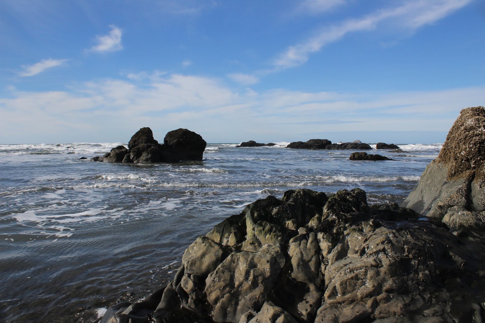
Thanks old friend, I needed that!
As always, it was nice to fraternize with our old friend the Rogue River Trail, and I certainly look forward to my next visit there. For more photos of this hike, please visit the Flickr album.


Monday, February 10, 2020

North Bank Deer Habitat - Soggy Bottom/Blacktail Basin Loop

Normally, when I hike in cold weather, I usually start out somewhat underdressed. The reason is that once hiking commences, the exertion soon gets the old body warmed up. So, if I am nice and warm at the outset, then I'm roasting and sweltering underneath all the layers of outerwear within a few minutes. It's more convenient to start out slightly cold and then warm up to a comfortable stasis and avoid all that having to stop and shed clothing while your comrades leave you behind. But then again, there are days like this hike at the North Bank Habitat, where I had to stop in less than a quarter-mile of hiking and hurriedly put on layers because it was freezing cold and starting out with minimal protection was not one of my better moves.

Squish, squish go the boots
Once I was properly clad with ski cap, mittens, muffler, and a down jacket, the hike continued on in earnest to a broad grassy swale known as Soggy Bottom, which was not named to memorialize that time that I ate too many dried apricots. Soggy Bottom is appropriately named however, because a creek runs through it while every other square inch of soil in the swale seeps ample moisture into the creek. They've been doing some habitat restoration lately and the jeep road that serves as the trail had been all chewed up by ATVs. All that seepage had turned the dirt road into a muddy quagmire of boot-sucking doom and that turned out to be one of the main themes of this hike. Much or most of the nearly eight miles of hiking were spent slogging and sliding through the goo. Periodically, the thick mud would accrue on the underside of my footwear, and I lumbered clumsily forward on boots with six-inch soles of thick clay like some incredibly handsome Frankenstein.

Smile for the camera!
A new livestock gate had been installed over the trail at Soggy Bottom and a sign above an electronic gizmo attached to the gatepost advertised the whole setup was part of a wildlife survey. I assumed the gizmo was a trail camera and one must respect the fine work the wildlife biologists do, so naturally I made funny faces and did my one-footed "running man" pose in front of the presumed camera. As I walked, I pondered the form or format of the survey, imagining a clipboard-toting someone polling wildlife about their political preferences. Preliminary results say hooved creatures are all in for Deernald Trump, bears will throw their weight behind Joe Bear-den, and the mountain lions think all candidates taste equally good.

Mud was a recurring theme on this hike


All trails in the Habitat go uphill, it's just a question of gradient. Because hiking in the mud was pretty tedious, I opted for the route of least resistance. Soggy Bottom Road still goes uphill but not as quickly as some of the other pain-filled trails around here. It's kind of like whether you prefer chiltepin chiles over habaneros. Either way, there is same-day and day-after burning pain involved but it's mostly a question of degree and flavor.

Grand vistas are to be had in the North Bank

As the trail climbed up and away from Soggy Bottom, the higher ridges were hidden in the cloud cover. Great, my hike was going to wind up being both cold and foggy. However, as I gained elevation, so did the clouds and by the time I crested at the intersection with Powerline Road, the cloud cover had lifted off the ridges. That was a good thing because one of the main reasons for laboring up the Habitat's steep trails are the views that reward determined hikers. 

View down Soggy Bottom
Accordingly, the drainages of both Jackson Creek and Soggy Bottom lay well below the trail in all their awesome view glory. Grassy hills, forested ridges, and deep creek valleys rolling all the way to the farmlands surrounding the North Umpqua River. It was enough to make me forget I was cold and tired and I daresay I even felt spritually, if not physically, energized and replenished by the superb vistas from the top. More replenishment took place at Grumpy's Pond where a quick meal was consumed. For some reason, the name Grumpy's Pond reminds me of my ex-wife, not sure exactly why that is.

Grumpy's Pond and no frogs
One little oddity I noticed was that when I was coming up Soggy Bottom Road, the frogs were croaking en masse like some amphibian tabernacle choir in the creek canyons running down the grassy slopes. However, at Grumpy's Pond, where there exists an ample and stable water supply, there was nary a croak to be heard. The water was colored an unappealing gray so that might explain it, or maybe the frogs eschewed the acerbically humored pond for waters that were in a better mood.

A thick stand of oak trees
At a trail junction atop North Boundary Ridge, there are several options for a return loop and I grabbed the most gentle way back, that being the descent through Blacktail Basin. The basin is dotted with oak trees, still leafless this time of year, and poison oak growing underneath effectively discouraged any off-trail exploration. Blue jays squawked in noisy abundance and alder trees, leafless like the oaks, sported thousands of dangling flower tassels in a harbinger of spring.

I got "ticketed"
Once the trail descended into basin, it was several miles of mostly level walking next to Jackson Creek running through an oak savanna. After closing the last gate (and making more funny faces at a wildlife survey camera), I entered the parking lot and noticed a white piece of paper fluttering underneath my windshield wiper. A ticket? Here? Really? What on earth for? There's no fee for parking at the Habitat! Turned out it was a note from friends John and Bill who apparently were also hiking in the North Bank Habitat. "Hey Dude, got mud?" it said. I promptly walked back to the trail gate and held it up in front of the wildlife survey camera. I'm so easily amused sometimes.


How to tell it was a good hike
For more photos of this hike, please visit the Flickr album.

Tuesday, February 4, 2020

Otter Point


Way back when Oregon was being created, the Grand Terraformer put the finishing touches on the coast, looked upon her handiwork and decided something was missing. But what? "Oh, I know!" she said, brightly snapping her fingers for emphasis "There otter be a point!" And that is my theory as to how Otter Point got its name. Of course, the point could have also gotten its name because otters live there but that would be too easy.

One small piece of the beach treasure chest
Weak puns aside, it was a glorious day at the Oregon coast. The sun was out, the sky was blue, and boy howdy, was it ever cold! The sun was about as useful as a bubble gum machine in a tetanus ward, and five seconds after I removed my jacket, I hurriedly put it back on to stave off immediate hypothermia. A brisk breeze was moving all that cold air around, cutting right through the fabric of all my layers of clothing, rendering them as useful as a sprinkler system in a Fizzie factory. Ok, I'll quit.

The Queen
While I started this hike with chattering teeth, my companion had no issues at all with the chill air as she mindlessly sprinted to and fro on the beach. Luna, my canine hiking buddy of the day, has only one speed and that is a full sprint. Sadly, she's been showing her age lately and I've decided I need to start curtailing her hiking (she gets pretty gimpy the following day). When I informed her she had to stay home today, she just looked at me with those sad eyes which turned out to be way more effective than rubber lips on a woodpecker, and that's how she got invited to come along.

The jetty ends here


The hike began on the north jetty flanking the mouth of the mighty Rogue River where it empties its rather large flow into the Pacific Ocean. A short walk on the jetty delivered us to a beach comprised of rounded pebbles, the surf making a gravelly sound with each pebble-filled wave. This beach (hereafter referred to by its proper name: Bailey Beach) is a beachcomber's paradise but we had a hike to perform, so we didn't stop too much to browse for beach treasure.

Lots of islands dotted the surf
We left the luxury homes overlooking the beach behind when we rounded a small point after nearly a mile of hiking. In front of us stretched the wild Oregon coast all the way to distant Humbug Mountain. Halfway in between, a low brown bluff was Otter Point (today's hiking destination) still waiting for us from several miles away. In the surf, dozens of small rock islands, seemingly flung into the ocean during a divine temper tantrum, provided some photographic stops every now and then. The beach was remarkably free of seagulls, thanks to my four-legged bird enforcement officer.

One creek splits into thousands of braided creeklets
There were a number of small nameless creeks fanning out across the beach, their shallow rivulets as intricately braided as a reggae hairdo. None of them were running deep so only boot soles and the bottoms of paws got wet. The wet sand and trickling creeks sparkled in the noonday sun like a thousand points of light reflecting from a mirror ball in a concert hall. Much photography ensued.

The Oregon Coast Trail heads up to Otter Point
After about three miles of pleasant beach walking as the tide waned noticeably, the cliffs of Otter Point blocked further progress northward. Time to grab the Oregon Coast Trail off the beach, the short climb to the top of the point having legs burning in short order.

Hubbard Mound got its name
because...because...ah, I got nothing
We didn't tarry too long atop Otter Point, for the wind was cuffing us around pretty good. However, we did stay long enough to appreciate the view to Hubbard Mound, the next point to the north. Try as I might, I haven't yet been able to come up with a dumb story as to how Hubbard Mound got its name, but I'm still working on that.

Bailey Beach in the afternoon light
Below and to the south of Otter Point, lay glistening Bailey Beach with nary a soul to be seen on the silver sands. After a quick snack break for Luna and I on a strategically sited bench at a forested overlook, we made the short descent down to the beach and headed back in the direction of the Rogue River.


Luna is off and running


It was low tide and the beach was as wide as two time zones. All the little rock islands were just rocks now, stranded high and dry by the retreating ocean. And as the sun lowered in the sky, the sea glimmered like so many twinkling diamonds. Luna finally gave up on beach running and began walking at my speed, a rarity for her. At any rate, the hike finally came to a close at Doyle Point, which is a good thing because without the point, the end of this hike would be pointless, like the end of this blog.

Abstract art painted by sand and tide
For more pictures of this hike, please visit the Flickr album.