They say what goes down must go up and vise versa. I'm not sure who "they" are or why we put so much stock in what they say but I bet they haven't ever hiked with the Friends of the Umpqua to Kentucky Falls, because we've always happily hiked eight downhill miles to the North Fork Smith River Trail terminus. Unfortunately though, the bottom half of that route currently lies under a bunch of trees knocked down by a severe storm, so on this day, we'd be hiking down to Kentucky Falls and right back up again, I guess "they" might have really known what they were talking about...this time.
 |
| Random snippet of a saturated forest |
At least it was raining when we started walking. You'd think we were hiking in Oregon or something. It never really rained hard during our visit to Kentucky Creek but hours of hiking in a continual downpour soon rendered us as sodden and soaked as the forest we were hiking though. Puddles lay on the trail and encroaching ferns were only too happy to transfer water from frond to clothing. Suffice to say, our raingear was put to the test today.
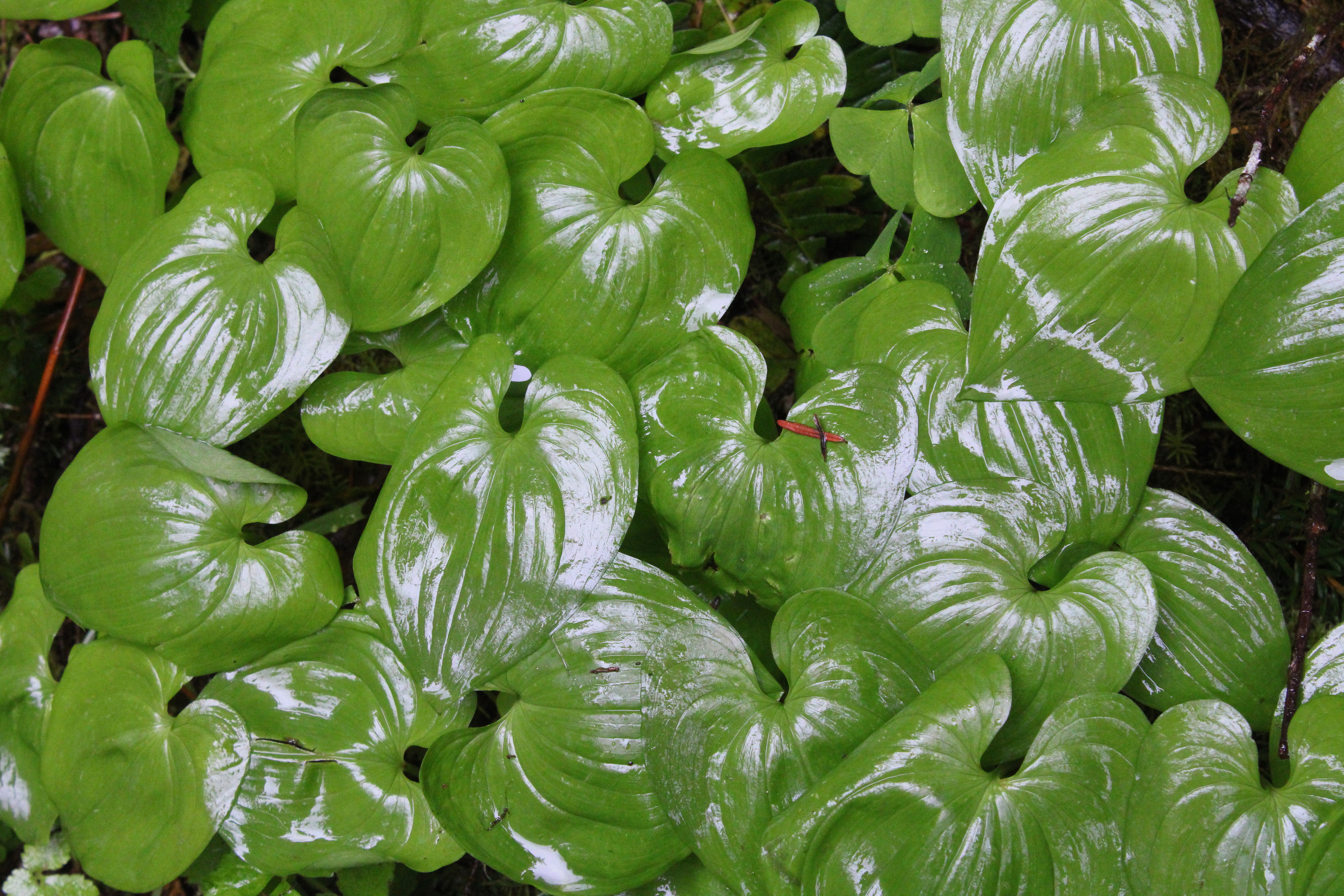 |
| A veritable carpet of false lily-of-the-valley |
The noisy rat-a-tat-tat on hat brims from the steady rainfall would be a constant throughout the hike. However, no complaining allowed because rain makes the forest green and we do enjoy hiking below tall trees with a healthy understory of ferns, salal, and other assorted vegetation growing underneath. Moss claimed all that did not move and cliffs, boulders, and fallen trees alike were covered by a soft mossy blanket. Green was the watchword here as we hiked in a verdant forest beneath a brooding sky.
 |
| Kentucky Creek was always heard and/or seen |
Once raindrops roll off trees, branches, leaves, and hikers, they eventually find their way into Kentucky Creek. Rain makes creeks flow and a very wet spring had Kentucky Creek coursing along in rather vigorous fashion. The stream tumbled through its creek bed of mossy rocks, the whitewater seemingly luminous amongst the dark trees under the dark clouds on a dark day. Several small unnamed waterfalls dropped over several equally unnamed ledges in what was a prelude to the Kentucky Falls main event.
 |
| Translucence in a trillium flower |
Rain renders trilliums soggy, too. Like some people, trillium flowers tend to show their age by changing color from pale white to dark maroon as they get older. The current rainstorm pelted tired pink trillium flowers with an incessant deluge and the semi-transparent petals became quite saturated with water, folding over on themselves like wet crepe paper lying in a spilled drink on the dance floor.
 |
| My favorite fungus-bearing footbridge |
About halfway down to the upper falls, the trail crossed Kentucky Creek on a rustic footbridge that seemed to be more moss than wood. On the bridge, bird's nest fungus grew in prolific bunches on the rails and posts of the span. Normally, I find this particular fungus on the ground and am always grateful to see them flourishing on this bridge, for I don't have to lie down on the ground like normal to get a photograph, especially on a wet day when the ground is muddy,
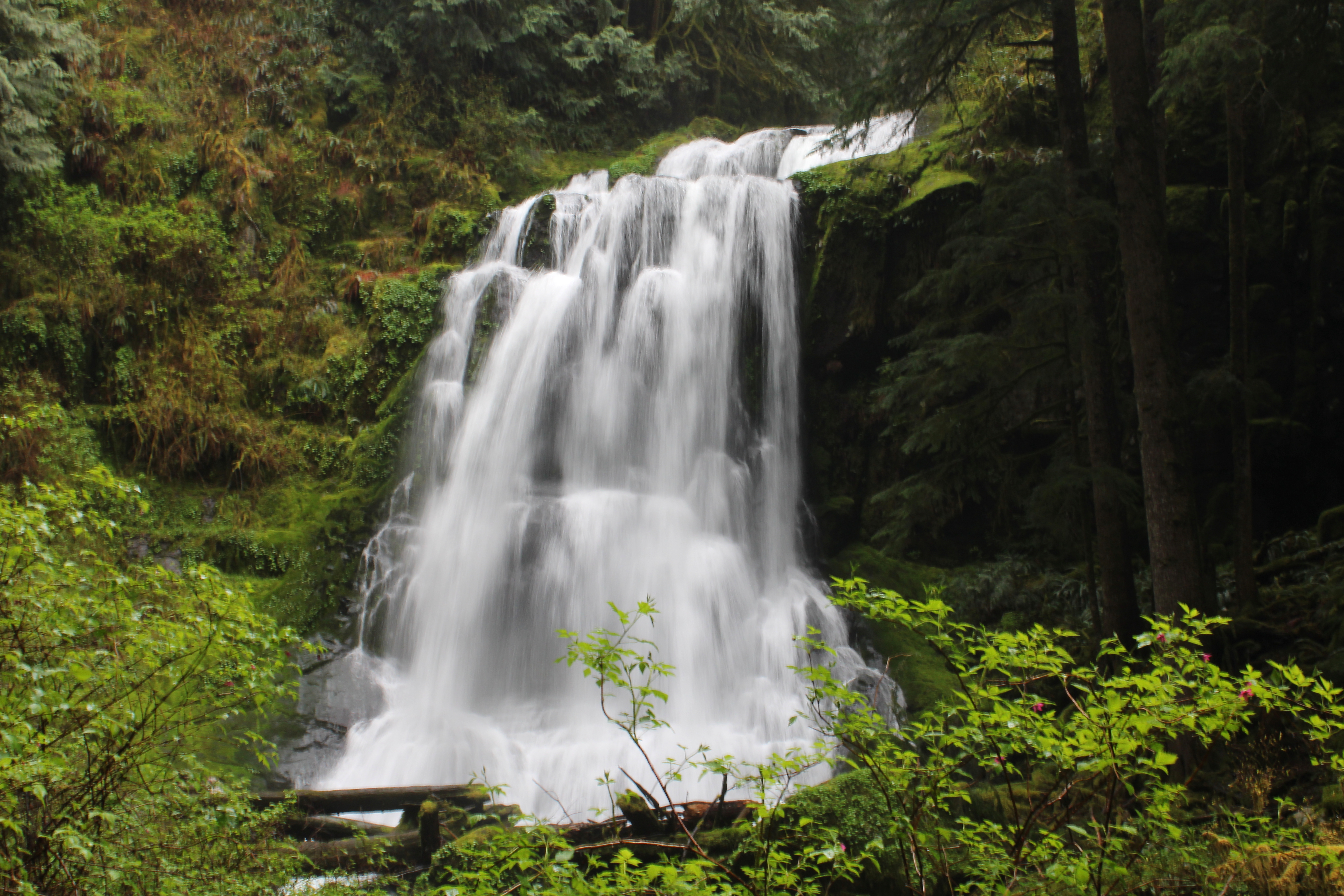 |
| Upper Kentucky Falls |
A roar sounding like the world's largest fire hose advertised the presence of Upper Kentucky Falls. The trail made several switchbacks from above the falls down to the cascade's splash basin, each switchback providing an opportune vista point from which to admire the photogenic cascade. Just like me, the falls were impressive and noisy, and that only stood to figure because the creek was so full of water. The mist emanating from the waterfall blew into our faces but from our standpoint, it was just more water in the air and no different from our hiking experience up to this point.
 |
| North Fork Smith River Falls (left) and Lower Kentucky Falls (right) |
Another mile or so of hiking down the forested creek canyon delivered us to Lower Kentucky Falls where it was more of the same but twice the fun. Here, Kentucky Creek plunges over a ledge to create Lower Kentucky Falls. Approximately 25 yards to the left, the North Fork Smith River does the same so you have two large waterfalls thundering next to each other for all of perpetuity. It's not often you get to see two waternal-twin waterfalls tumbling side-by-side in such close proximity to each other.
 |
| A fern asks for a peanut |
We tarried at the lower falls for a bit to admire the view but mostly to postpone the hike up and out of the canyon for as long as possible. It had been all downhill to this point and we'd regrettably "enjoy" the uphill yang to the downhill yin on the return leg. Good thing I brought the uphill legs! I actually felt walky and pretty much power-hiked my way up the canyon in the rain.
 |
| Bird's nest fungi on a footbridge post |
I was trying out a new raincoat and it was waterproof for most of the hike. However, by the time I reached the trailhead, the coat had given up the fight and I was soaked thanks to the fabric's acquiescence to the elements. The temperature was pretty chill too, and I gratefully partook of the car heater while I waited for my comrades to straggle back to the trailhead. Good things come to those that wait, they say, and there I go again, giving credence to what "they" say.
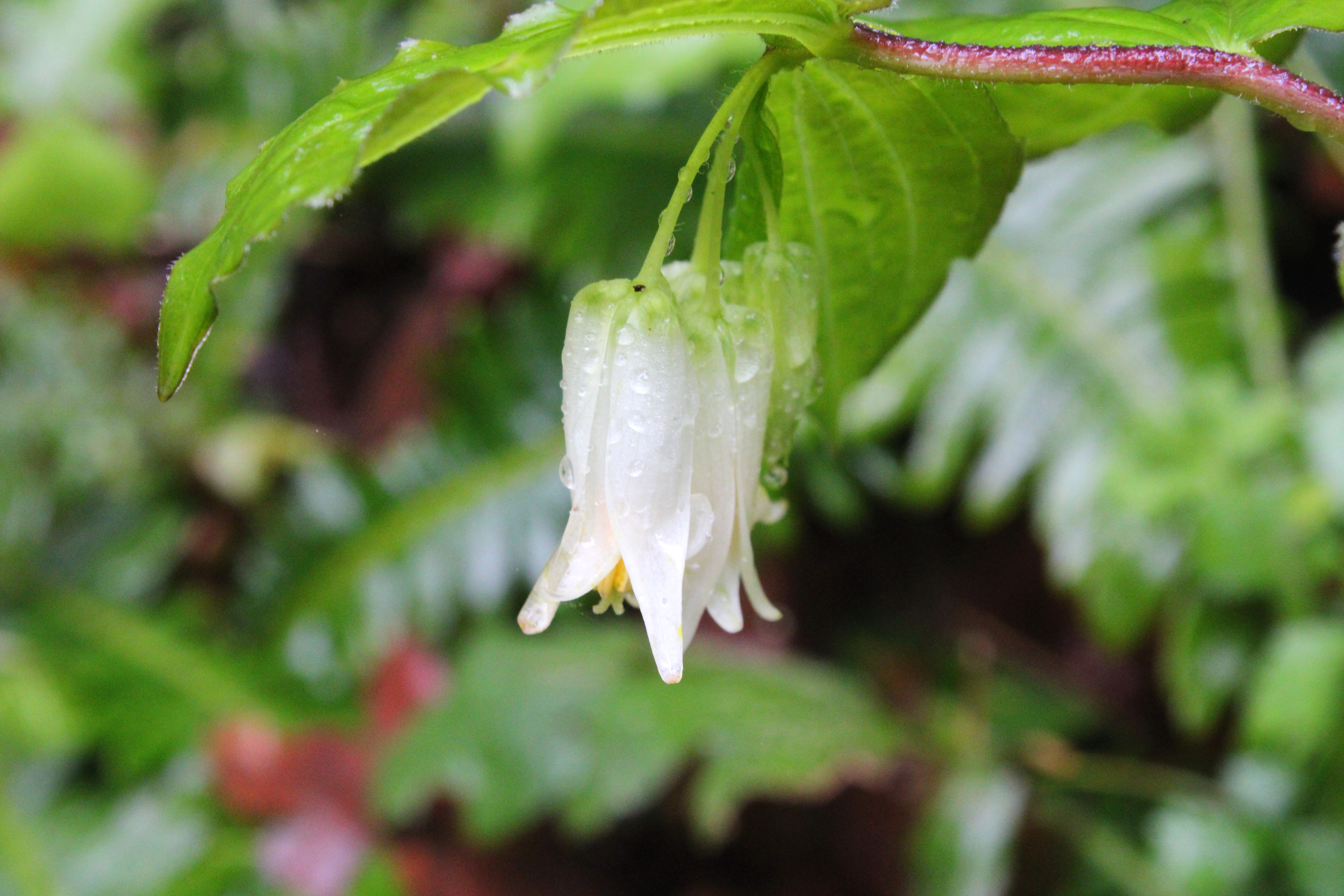 |
| Smith's fairybells were seen on occasion |
For more photos of this hike, please visit the Flickr album.