Saturday, November 30, 2019

Cape Arago


It's Oregon Coast Time, in terms of our hiking itinerary. Gone are those hikes high up in our beloved Cascade Mountains, because rainy weather down in the Umpqua Valley translates to snow in the higher elevations. Therefore, we tend to find ourselves a bit more often on the coast where the weather is generally more conducive to the wonderful avocation of hiking, even though there is an increased probability of getting soaked by rain, buffeted by wind, or crapped on by a seagull. And out of all the destinations on the coast, Cape Arago is definitely one of our favorites because of its relative proximity to Roseburg and the always reliably spectacular scenery.

The ocean was quiet...too quiet

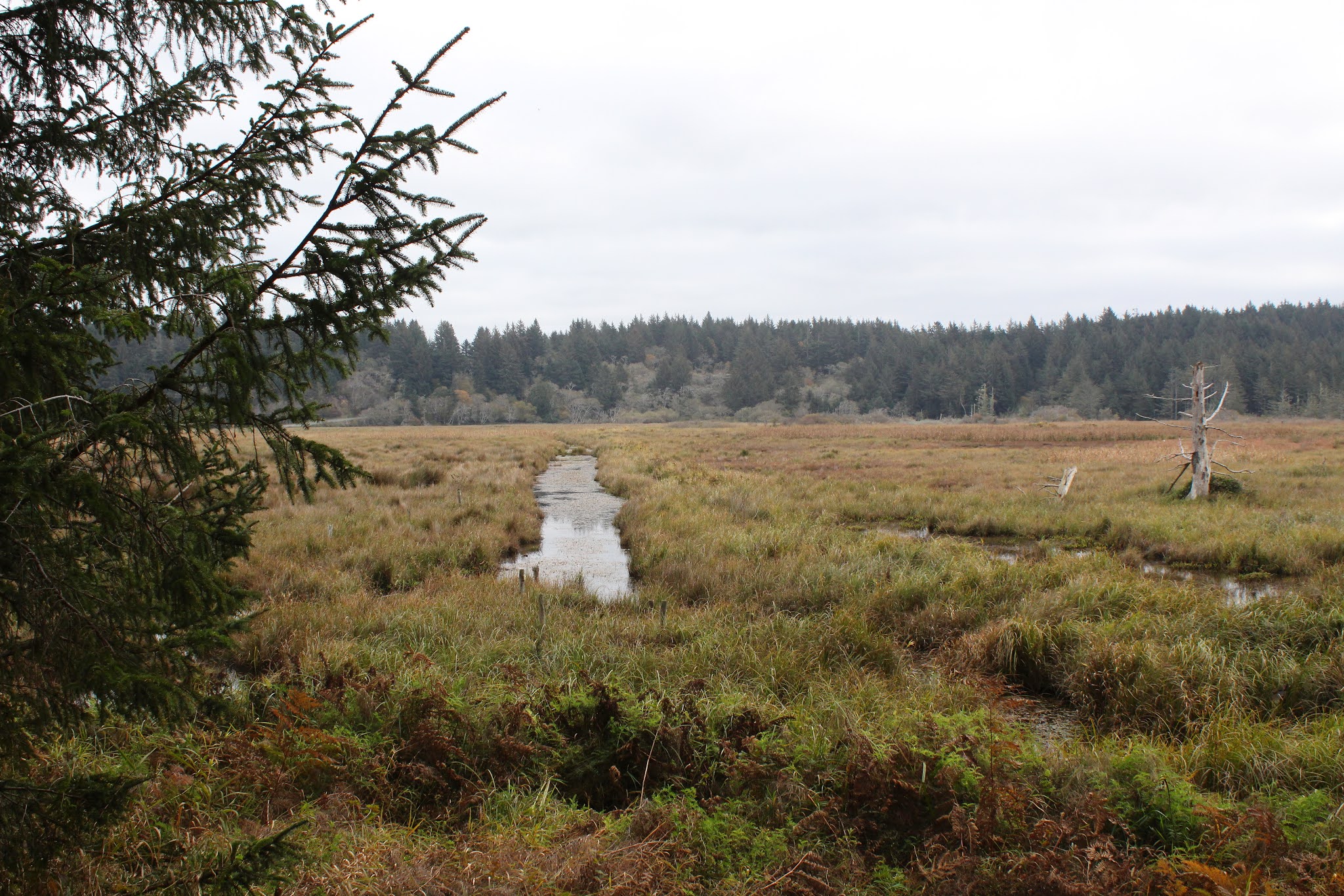
Eons ago, the incredibly rocky and scenic shoreline at Cape Arago was formed when seismic events tilted the sea floor upward around 45 degrees. Nowadays, the resultant inclined sedimentary layers make for some incredible waves when the ocean kamikazes itself upon the rocks at high tide. Much photography ensues when this happens, and not just by me either, the area is quite popular with shutterbugs and hikers alike. Given the awesome ocean wavery in the area, we eagerly dashed up to the top of the forested bluffs overlooking Sunset Bay, fully prepared to be awed by the raging surf. Oops, we were ever so disappointed in the narcoleptically calm ocean, as still as a cat napping on a window sill, even though it was high tide. Heck, we might as well fold up our hiking poles and go home.

The beauty of the Cape Arago coast

The normally restless surf was serene and peaceful but despite that sad failing, the coast nonetheless was quite beautiful. The jagged shore was sticking its many rocky fingers up the ocean's nostrils, figuratively speaking, and the trail followed the serrated shoreline, meaning we went in, out, and around a series of coves and gulches. When the route veered inland and away from the coast, we found ourselves ambling through a green coastal forest full of sprouting fungi and mushrooms.

What do you call a chair with feet?
A toed stool!

Rachel was photographing a mushroom when Dave said "Wow, he looks like a fun guy!". Fun guy? Fungi? Get it? Rachel apparently did because she groaned audibly. I asked her to pick up a couple of fungi specimens, telling her if she did so, she'd be a "woman with loose morels!" Dave and I high-fived each other in congratulatory exultation while Rachel quickly scurried off, refusing to walk any further in our company. Wow, Rachel must have thought she was being pun-ished, but she was correct in her assumption.

Trees, personally invested in the outcome of rising sea levels

One aspect of climate change is rising sea levels and at Shore Acres, there are disturbing signs of the change mankind has wrought. Several times over the years, the trail has had to have been rerouted further inland because the old paths have tumbled into the sea as Oregon crumbles under the relentless maritime onslaught. In some places, they put fences on the old trails to keep hikers out but those fences have likewise tumbled into the sea as the coastline continues to erode. Also, the path sideswipes the old Shore Acres tennis court and now the erosion has eaten away at a corner of the old court. I can remember when not too long ago, it was safely out of reach, dozens of yards away from the ocean and eroding waves.

Tafoni formations at Shore Acres

Over the ages, the waves have exposed a rocky bench sited below the tennis court, uncovering all sorts of phantasmagorical rock formations and an ossified log or two. The formations here have always reminded me of the cemetary scene in a horror movie where zombies emerge from their graves. But today the rock formations did not want to eat my brains (and good luck finding any!) so I scrambled down there to observe and photograph the concretions and tafoni (rock formations that look like Swiss cheese) on the rocky bench.

The woods were full of mushrooms

The observation point at Shore Acres was amazingly still and quiet, both in terms of lack of people and crashing waves. But that's OK, there's nothing wrong with some peace and quiet and we enjoyed both of those things as we ducked into the woods and headed down to Simpson Beach. The woods were full of fungi and maybe a fun guy or two; much of my hiking time was spent lying on my belly on a muddy trail, taking photographs of the fungal splendors on the ground. 

What do you call an amphibian's hammer?
A toad's tool!

As we hiked in turn to the Simpson Reef viewpoint and to Cape Arago itself, the clouds became darker and the wind picked up a little bit. Clearly a storm was coming in so cameras were mostly put away and we hied it quickly down the trail so as to arrive at the trailhead before the sky broke loose. But, I had one more for Rachel. "Hey Rachel, what do you call a place to eat oatmeal!" I just get a blank look and a pair of shrugged shoulders. "A mushroom!" Mush room? Mushroom, get it?" Sheesh, tough crowd, I tell you!

Bad weather is coming

For more photos of this hike, please visit the Flickr album.

Saturday, November 16, 2019

Oregon Dunes


On the face of it, one can presume mid-November to be a wet, cold, and blustery affair at the Oregon coast. More often than not, you'd be correct in your presumption. But then again, there are semi-sunny days like this one where I tempted fate by hiking at the Oregon Dunes in shorts, but thankfully was not taken to task for my karmic impertinence. 

A crisp and clear morning on the beach

The weather was a little on the chill side and most of the Friends of the Umpqua group began the hike with jackets and full pant legs on, present deranged company excepted. I've found from past experience that if you start your hike dressed for warmth, you'll become overly heated within a few minutes or so of exertion. Me, I just start out like a first date: cold at first but plenty warm before too long. And sure enough, after the first mile or so of hiking to the beach, a large contingent of perspiring and overheated hikers stopped to remove some of their nine layers of clothing. After a few more miles of hiking it'd be pretty much a given that by then all hikers would be desperately sawing off pant legs. 

It was a pleasant two mile beach walk to Tahkenitch Creek

After our perfunctory walk to the beach and clothes-removal stop (jackets and coats only, you perverts!), we turned to the south and headed toward unseen Tahkenitch Creek, yet several miles ahead of us. The sky was sort of unusual in that it was gray on top but gloriously blue to the rear, just like me. Obviously we were hiking under a cloud border of sorts but we had nothing to declare as we passed through customs. 

Lane horks up a jellyfish

The beach was littered with debris, deposited onto the beach strand courtesy of some recent storms. Logs and driftwood were strewn about and in one case, a fully branched tree in its entirety. Clam shells, sand dollars, and jellyfish were all found and examined by beachcombing hikers, the jellyfish resembling the largest and slimiest boogers ever. 

Moody clouds hovered over Tahkenitch Creek

We ate lunch at Tahkenitch Creek to the accompaniment of keening sea gulls doing the same thing. I think we had the better food though, but we were entertained watching the birds forage at the water's edge. Tahkenitch Creek looked to be more river than creek, being quite wide as it reached the end of its journey and the same thing can be said about most of us too, now that I think about it. As we lollygagged, ominous looking clouds scudded overhead and we wondered if we were going to get rained on or not. We didn't and the blue sky to the north remained although it became less and less a commodity as the increasingly cloudy day waned.

The world within Tahkenitch Creek

After a couple of more miles of beach walking, we left the beach via Exit 114, the bright neon yellow sign totally at odds with the foreboding gray sky above. The plan here was to make a loop hike through the Oregon Dunes, but first we had some forest walking to get through. A side trail in the woods led to a viewpoint of Tahkenitch Creek, its overly calm surface reflecting the weak sun fighting its way past the cloud cover. A resumption of the forest walk led us to another awesome overlook of Tahkenitch Creek.

Tahkenitch Creek takes the long way home

Here, the creek snakes to and fro in a series of exaggerated oxbow bends below the sandy dunes, resembling a large watery snake lazing or slithering in the sun. It's a spectacular sight and we stopped for a few minutes to admire the sinuous serpentine curves of the creek before resuming our journey across the sandy dunes.

Hi ho, hi ho, across the dunes we go

In the dunes, there is no formal path per se, but marker posts keep hikers on track and in theory prevent the map and compass-challenged set from getting lost. It was several miles of sandy dunes, beachgrass, small lakes, and ponds before the trailhead area appeared, inconveniently sited on top of a large hill made entirely out of sand. Just to do something different, Lane and I opted to hike up the sandy slope instead of grabbing the customary trail through the coastal woods.

Why we walk uphill in soft sand

Oof! That turned out to be quite the Sisyphean struggle because for every two steps up in the soft and shifting sands, we slid down one. Although at times, it felt like we backslid three steps for every two. But the fun part of this impromptu route came not from the awesome view of the dunes and distant ocean, even though that was pretty cool too, but by virtue of the fact that our people were expecting us to appear on the trail, and not from the rear. "Watch this!" said Lane, he of the evil grin. He pressed the panic button on his key chain and his vehicle, which everybody was leaning up against, exploded into honking and flashing chaotic cacophony. You know how it is when you touch a cat that is all coiled up, ready to pounce and the startled feline reflexively launches skyward, arms outspread in an involuntary four-limbed crucifix pose? Yeah, it was kind of like that, making a great hike even more enjoyable!

The day darkens as the hike ends

For more photos of this hike, please visit the Flickr album.


Saturday, November 9, 2019

Cape Blanco (via Sullivan Gulch)


Cape Blanco State Park is one of my favorite places to hike at. To nit-pick a bit though, there's a sameness to the trail network in that all possible routes essentially follow the coast from the Sixes River to the Elk River or vice versa. Yes, you can hike either atop the forested coastal bluffs or on the beach but either way, you are pretty much hiking from the Sixes River to the Elk River or vice versa. But as I recently found out, there is an inland approach that begins at Sullivan Gulch. Yay, somewhere I'd never hiked before, and naturally, the alluring "new trail" siren song called out to me. Powerless to resist its haunting melody, I soon found myself lacing boots at the cattle gate that serves as the Sullivan Gulch trailhead.

For some reason, we did not take this trail, not really sure why that was

Accompanied by my trusty sidekick Lane, I opened the cattle gate and our hiking festivities commenced with a walk up a grassy ranch road flanking the west side of Sullivan Gulch. Per the Oxford English Dictionary, "gulch" is defined as a "narrow and steep-sided ravine marking the course of a fast stream". Well, Sullivan Gulch is not narrow, nor is it what I would call a ravine, and good luck finding a fast stream in the marshy wetlands. The wide swale with plenty of standing water in it does have steep sides though, but the trail here sort of cheats past by finding a gap in the steep sides on its way to the beach.


Waterway in the Sullivan Gulch wetlands

The first part of the route followed the wide grassy marsh containing ponds, drainage ditches, and various other forms of standing water in and among the marsh grasses. Ducks make a home in the ponds and regrettably, our arrival caused them to flee their watery abode in quacking panic. A more intimate exploration of the gulch was effectively discouraged by wire fencing and standing water, so we just looked and did not touch.

Mother and child, toxic mushroom style

It didn't take long for both of us to decide we really like this trail. The path gradually left the edge of the marsh and we hiked in woods sublime. White-trunked alder trees were already leafless, proffering their bony limbs to the sky in supplication for the return of leaves purloined by winter's arrival. Closer to ground level, the greenery was still thriving, unwilling to surrender their leaves like weak-willed alders. Ferns draped over the trail and mushrooms were everywhere. This was too much to expect two dudes with cameras to walk through without engaging in much photography. Consequently, it was slow going through the woods to an overlook of the beach from atop a tall dune.

Bushwhacking is fun!

Before we hit the beach though, we followed an obvious path leading into the forest, curious to see where it went. 
As it turned out, it pretty much went nowhere. The well-defined path quickly degenerated into a loose network of deer paths, game trails, and thick forest clawing at us as we fought our way up a ridge. Eventually, we wound up at the edge of Sullivan Gulch, wrestling head-high grasses while mud sucked at our boots. While fun, the bushwhack venture yielded little reward, so we bushwhacked back to the sandy saddle above the beach.

The mighty Elk River

The tide was out and the exposed wet sand was hard-packed (just like my abs, hah!) and perfect for hiking on. We beach-walked south for about a mile before the swiftly moving Elk River barred further progress south. Surprisingly, the fairly remote river was in use by a moderate population of salmon fishermen. After an obligatory lunch and laze next to the river, Lane and I returned to the overlook atop the dunes.

A sea of silver mercury

Feeling adventuresome and walky, always a potent situation, we grabbed a footpath that headed straight up through some woods. The whole vibe of this section of trail felt like wilderness because we did not see a single soul as we trudged upward. The trail served up some expansive views of Sullivan Gulch and the beach south of Cape Blanco as our route zigged and zagged from the ridge crest to the east side and then back again. After a mile or so of this, the path crested at what presumably is the tallest point in the park.

Flocks of geese head north

Oh, the things we could see from the top! The beach lay immediately below our clifftop perch, albeit several hundred feet below. Fishermen and beachgoers looked like ants on a kitchen counter and their vehicles like little Matchbox toys waiting to be picked up by a giant hand. Offshore loomed the ocean, glinting silver in sunlight diffused by an indistinct cloud layer. Ah, now this is why we hike!

Lane and Richard go for a hike

After admiring the view from our clifftop aerie, it almost seemed anticlimactic to cut across the horse camp and take the trail back to Sullivan Gulch. However, the forest was lush and green and the trail challenged our legs as it dropped straight down into the gulch. I do mean straight down, for the trail plunged as fast as a wingless duck, putting our quad and glute muscles to the test as we bravely resisted the pull of gravity on the way down. Once back down to gulch-level, the hike was finished off with a short walk on a grassy path covered with crawling newts. I think this is my new favorite hike at Cape Blanco State Park.

They say the spirit of Sullivan still haunts the park

For more photos of this hike,
please visit the Flickr album.


Saturday, November 2, 2019

North Umpqua Trail (Jessie Wright Segment)


Well, things were certainly a bit chilly on this early November morn! Jackets, ski caps, and mittens were items de rigeur down at the bottom of the North Umpqua River canyon, unless you're partial to frostbite. Things weren't always this cold, though. In the summer of 2017, part of the Umpqua Complex Fire(s) raged on the Jessie Wright Segment of the North Umpqua Trail (NUT) and the fire scars were visible throughout the hike. While we could have certainly done without the destructive wildfire, to be honest I wouldn't have minded rubbing hands together over a still-smoldering ember or two.

Lots of jackets, gloves, and ski caps on this crew

Fifteen humans and one dog commenced this hike with a short walk along the North Umpqua Highway. Since the trailhead parking is at the Marsters Segment trailhead, we had to cross the river on the roadway to get to the Jessie Wright trailhead. Upon setting feet on a real trail, the scars from the fire were immediately apparent. The fire here had been somewhat beneficial for although it killed the saplings, the older trees survived, proudly sporting scorch marks upon their trunks as a battle scar. In essence, the fire just cleared out the undergrowth, an aspect of wildfire that is actually good for forest health, although the slain saplings might object to that characterization.

A cold river of cold water on a cold morn

We all hiked pretty quick, for the the season was in that cold little space between fall and winter, but the exercise warmed bodies, minds, and souls. The sun was out and the sky was clear but unfortunately for us, the sunlight did not reach the bottom of the cold river canyon. The grasses and leaves close to the ground were dusted with a light coating of frost and the air was cold and nippy. But while the weather was wintry in some aspects, autumn still had a thing or two to say about that.

We hiked through fireweed patches that were dying off

The fall season was well represented by red and yellow leaves still hanging on the maple and dogwood trees. The first frosts of year had signalled to the bracken ferns on the ground that they too had to turn yellow and they so obliged. Dense patches of fireweed, already gone to seed, were beginning the winter shutdown process by browning out and dying off. Below the trail coursed the North Umpqua River, the waters looking black and cold as an ice queen's heart and definitely not tempting hikers in for a quick dip.

Mushrooms huddle together to keep warm

Mushrooms and fungi thrive in a post-burn zone because the dead trees provide ample food for fungi family members; it's like a decade-long all-you-can-eat feeding frenzy. Normally, the fungi organism is just a threadlike root existing underground until it's time to further the species by the process of reproduction. The mushroom or fungus that we observe above ground or on a tree is the reproductive organ, so to speak. In our area, it seems the peak breeding season for fungi is in November and accordingly, we observed all manner of fungi figuratively going at it on logs, fallen trees, standing snags, and on the mossy ground.

Trees both live and dead, post-fire

The trail climbed up to a point high above the river and stayed there as morning headed into afternoon. By the time we reached our turnaround point at Boulder Creek, the sun was rising over the tall ridges flanking the river and our hearts were gladdened while our bodies were warmed by the glorious light. It was nearly an anti-winter political statement when we defiantly shed outer layers and basked in the noonday sunlight. Begone, o tyranny of wintry chill, don't frost on me!

A dogwood basks in the warm sunlight

Jay and I soon lagged behind, our progress happily slow as we photographically enjoyed the autumn day now that sunlight reached our side of the river. The forest was by now bathed in afternoon light with lengthening shadows slanting through the trees. Sunbeams were hijacked and appropriated by vine maples sticking branches and leaves into the light, like somebody warming their hands over a smoldering ember. 

The North Umpqua River on a chill autumn day

In the morning leg of this hike, the river had a cold and forbidding appearance, running black in the absence of sunlight. But in the afternoon sunlight, the river was now colored dark green with white-watered rapids running bright and white. The sun also lit up what leaves remained with the big-leaf maples trending to yellow, the dogwoods to red, and the vine maples every available color from the warm end of the spectrum. The trail and forest were eminently beautiful, particularly coming as it did, after a wintry morning.

C'mon sun, you can do it if you try!

Poor Jay. He hails from Gujurat, India where the winter temperature might get down as low as 70 degrees. And here we were, hiking in the mid-40's, one of us clad in shorts and a T-shirt, the other clad in a parka, ear muffs, muffler, scarf, mittens, and battery-powered warming socks. Just about when he was beginning to question his moving to Oregon and becoming friends with me, we reached the trailhead and the car heater restored his happy good nature. It would be another three months before I could persuade him to go hiking with me again.

Dogwood colorizes the forest

For more photos of this hike, please visit the Flickr album.