Showing posts with label coast. Show all posts

Saturday, April 2, 2022

Tahkenitch Dunes


John stated he wanted to partake of "King Neptune's Pedicure". I speak John, so I'll translate: He wanted to hike barefoot in the surf. Since he was the designated leader for the Friends of the Umpqua this particular weekend, we were totally at his mercy as to the destination of the hike. Given his proclaimed desire for wet feet, the destination was Tahkenitch Dunes, the loop rendition of this hike serving up a mile or so of beach walking or in John's case, surf hiking.

The clouds would eventually burn off

After the long drive through foggy conditions that had 15 or so hikers wondering if they would ever see the sun on this day, we laced up our boots at the trailhead and set out on the trail, which immediately inclined up through the forest. The constant coastal fog keeps things well watered and accordingly, the forest here is healthy and lush with a vibrant understory of coastal huckleberry, ferns, and rhododendron thriving underneath the spruce trees and Douglas fir. Moss covered all that did not move and fungus, ever nature's recycler, was busy decomposing the ample decaying biomass on the forest floor.

The club emerges from the deep dark woods

The short and wooded trail soon spit us out onto the bright and sandy dunes like so many cave salamanders, our eyes blinking myopically in the comparatively bright light. It wasn't full-on sunny though, as heavy gray clouds still blocked the sun, but blue sky in between hinted at the clouds' eventual dissipation and demise. 

All the soft sand you could ever want to walk on

The trail leading away from Tahkenitch Campground heads straight to the beach but before we could get John his saltwater pedi, a left turn was made onto the dunes trail. Here, it was all sand and beachgrass and too bad John didn't want to partake of Queen Sandy's pedicure instead. At any rate, we hiked among the hummocks of beachgrass while calves complained about hiking in soft sand and despite my usual and customary whining, I actually felt walky and enjoyed both the exertion of the hike and scenery.

Epic view of Threemile Lake

At the intersection with the Threemile Lake Trail, we made another left turn and headed uphill in the shifting sand, beelining toward an overlook of Threemile Lake. The viewpoint serves up an epic vista of the lake, which normally dries itself into two separate bodies of water. On this day though, it was its three-mile-long single self, sited and sighted in a long and slender bowl sunk in a forested basin. Clouds artistically reflected on the mirrorlike surface and we slid down a long sandy hill like so many Jacks and Jills to eat lunch on the lakeshore.

The beach portion of this hike commences

After a lakeside lunch and laze, we hiked over to the beach where the clouds finally melted away and all beach hikes should take place under a blue sky and springtime sun. John took off his shoes and proffered his crusty feet to poor King Neptune. I'm surprised that gagging King Neptune didn't hurl tidal waves in our direction in response to John's effrontery. But he didn't, and everybody happily hiked along, with or without hiking boots and smelly socks.


We went as far north as Tahkenitch Creek, which was mostly roped off to protect the endangered snowy plover. The water flowed across the pristine sand at its delta and we could clearly see the tide forcing itself upstream like a watery proctologist's probe, not that I really know what that is like. Disgusting and gross simile aside, the incoming tide and wide creek was our cue to lace up our boots (in John's case) and grab the sandy trail heading inland.

"Back in the day..."

Tahkenitch Dunes used to be one of my favorite weekend backpack camping places. Here, one could pitch a tent at the edge of the creek and observe creek, beach, and sunset from the campsite. But now, the migrating creek has gobbled up the camping spots and forest service rangers have roped off the creek's banks. Sigh, all I have left are memories. On the plus side, there were some nice views of the creek as we hiked while I bored younger hikers with "Back in the day..."


The loop was closed off by hiking through the same emerald forest we had started on. But now, sunlight filtered through, or tried to filter through, the thick forest cover, infusing the very air with a soft green glow. Palmate leaves of tall rhododendrons spread their leafy fingers out like so many green monkey hands begging for handouts, while salal bushes filled up the spaces underneath, their leaves totally devoid of any anthropomorphic metaphor. This green section of trail was a good way to close off the hike.

It's so hard to be humble!

I was feeling pretty proud of myself at the end, for I had felt energetic and walky throughout. Maybe I was finally able to kick Covid to the curbside, although I don't want to get too cocky about this, I don't really need a viral comeuppance for my conceit. Stay humble, Richard, even though it's so hard, you can do it because you're the best and everybody basks in the glow of your bestness. I think I just failed at being humble. 

They say imitation is the sincerest form of
flattery but in this case, they'd be wrong!

For more photos of this hike,
please visit the Flickr album.

Saturday, February 5, 2022

Cape Arago


The signal light turned green and I stepped on the gas. In response, my Jeep gave a small shudder and feebly inched forward as fast as a beetle with two legs. After hearing the prognosis from the vehicle's physician, we made the hard decision to authorize a death warrant for our long-term faithful servant. Naturally, I was devastated, so much so that Dollie and I happily purchased a brand new vehicle the very same day. And as I parked my new ride at the trailhead on what will be the first of many such drives, I cheerily sung to myself "I'm a Soul man!" mostly because I'm now the proud owner of a brand new Soul.

Heigh ho, it's hundreds of hikers we go

Hiking and the driving-to thereof, are good for both my soul and Soul, and we parked with a bright cherry red splash at Sunset Bay State Park. This hike to Cape Arago and back was a South Coast Friends of the Umpqua Striders venture, which is what you call a cooperative effort between Friends of the Umpqua and sister hiking club South Coast Striders. The superb weather and scenery ensured a large turnout and all hikers present at the trailhead had plenty of old and new hiking friends with whom to bond with.

A secret beach at low tide

I've hiked in the Cape Arago area when the weather's been nasty and belligerent but on this day, it was downright balmy as the day dawned as sunny and bright as a granddaughter's smile. Lest we get too comfortable though, a chill breeze made sure to ruffle both windbreakers and the ocean's surface and at the start, I didn't see anybody hiking without jackets or extra clothing layers.

Norton Gulch lured some hikers down for a visit

With so many hikers (around 30!) what could possibly go wrong? Plenty really, but the worst of it came when the hikers in front, who did not know the route like us grizzled vets, made a right turn at the first junction and began to head down into Norton Gulch and I figured everybody just wanted to visit the gulch where it meets the sea. They made it about halfway down before stopping and asking me which way we should go. So amusing to see approximately 30 hikers turn around and backtrack on a narrow trail.

Low tide

High tide

It was low tide at the Cape Arago environs, the retreating ocean exposing reefs and rocky shoals to the airy elements. The booming waves at nearby Shore Acres are famed the world over but on this morning, they were barely making a ripple. The wind-driven whitecaps out to sea were larger than the waves lapping against the shore like a thirsty cat at a water dish. However, the ocean patiently bides its time and will once again rampage against the coastal ramparts come high tide.

Panorama of Simpson Reef 

From the gardens and viewpoints at Shore Acres, the coastal trail dipped in and out of the forest, sideswiping iconic landmarks such as Simpson Beach, before winding up at Simpson Reef Overlook. At the viewpoint, tourists and hikers alike can observe the sea lion bacchanalia and debauchery taking place on Shell Island. Replete with fishy smell, all that barking, belching, and farting was kind of like a gathering of through-hikers, but without the backpacks or hiking poles.

The forested path heading up to the Pack Trail

I'm not bragging (oh, but I am!) but I've lost weight lately and where I really notice the difference is when I'm hiking uphill. There is no direct trail from Simpson Reef Overlook to Cape Arago and one can either walk along the road to the cape, or cross the road and take the forested path leading to the Pack Trail. That particular path is a steep one but my lighter new and improved self just charged uphill, nearly as quick as a brand new Soul when the light turns green. Whew, did that ever feel good!

Lunchtime view

The coastal woods, fed by the perpetual fog at the cape, were predictably lush and verdant. The earthen track wound through the trees while numerous clumps of green ferns flanked the footpath. After reaching the Pack Trail, which is actually a gravel road, it was a short drop to Cape Arago herself, where we ate lunch while admiring the view of the sparkling sea and the rugged Oregon coast running to the south.

The sea was a bit more agitated on the way back

On the hike back to the trailhead, high tide was beginning to roll in and the waves were now a lot more entertaining than they had been earlier. We (John, Merle, and I) would see a huge wave break in spectacular explosive fashion, so cameras would be readied and then we'd wait...and wait...and wait for the next large wave. It apparently is a Cape Arago truism that waves are only spectacular when you aren't pointing a camera at them.

Pictorial definition of whitewater

The cool part about going home after the hike is I got to drive my new car all over again. Unfortunately, John and Merle took the occasion to pepper me with technical questions that I did not know the answers to, other than "Yeah, I'm pretty sure it has a motor". My ignorance of all things automotive was further exposed at my first fuel purchase when the attendant asked me to pop the gas tank lid open. Crap, how do I do that? Shaking his head in condescension and with a smirk on his face, the dude showed me where the lever was down on the floor by the seat. Hiking is so much easier!

A wall of solid rock, exposed by the low tide

For more photos of this hike,
please visit the Flickr album.

Wednesday, December 1, 2021

Blacklock Point


Of the six hikers in our little group, only I knew the secret route to a hidden epic viewpoint overlooking the Oregon coast north of Blacklock Point. Naturally, it was incumbent upon me to lead us all on a scrubby and cliff-hugging journey to Mother Nature's observation deck. As we worked our way through cruel growths of scratchy brush, somebody asked "Are you sure you know where you are going?" and my cruel heart was immediately gladdened. Nice to know I still have the touch, even on a hike that I was not formally in charge of.

The Oregon coast calls, and I must go

I've been to Blacklock Point like a million times or so and have had plenty of miles in which to experience Blacklock's many moods, ranging from icy windstorms to stifling heatwaves. Today's offering was sunny and mild, with just a hint of windy bluster (just like me!). Given the cool and wet conditions so prevalent on the coast on most any given day, we gratefully accepted the bright and breezy bounty from the weather gods.

The difference between evergreen and perennial, illustrated

Things got off to a little bit of an awkward start when I tried to find the path running behind the runways of nearby Cape Blanco.  A faint track overgrown by thorny gorse discouraged most of us from taking the loop route to Floras Lake and after a brief discussion (mutiny, really) it was decided by majority vote that 1) the hike would be an out-and-back and 2) nobody should follow me down any further overgrown paths that might otherwise arise during the hiking of this hike.

There were whole entire worlds inside the puddles

The trail from the airport to the Oregon Coast is an old road and as is an old road's wont, potholes had formed on the dirt road. And as are potholes' wont, over time they had grown larger and then had filled up with water during recent rainy weather, testing hikers' mettle and determination both. And as are hikers' wont, an unofficial system of footpaths were illegally braided through the brush for the express purpose of walking dry-footed around the bodies of water. While I'm not particularly averse to hiking with wet feet, some of those puddles were large enough to host a yachting regatta, so we used the detours like everybody else.

Light beams slice through the forest

The Oregon Coast Trail basically contours along and atop the coastal cliffs keeping the ocean from overrunning the rest of Oregon. Apart from occasional bushwhacked-to overlooks, most of the hiking was through dense coastal forest, the trees twisted into phantasmagorical shapes by the near-constant sea breeze. It was both dark and light in those woods, with sunbeams slicing through the deep shade like giant light-swords wielded by angry samurais. The air was slightly misted which provided some heft to the sunbeams and I soon lagged behind, completely engrossed with the light show.

The footing was treacherous on this bridge

After a walk of several miles, made slightly longer by side trips to several coastal overlooks, the trail dropped down to a small creek. There usually is a small wooden footbridge spanning the creek but given the proclivity of winter rains, the span is often transported downstream in one piece or sometimes in many pieces. On this day, the rustic bridge was found intact but downstream. A test step revealed that the small span was somewhat slippery so I opted to just get across the creek with one long-legged stride.

Hiking on a beautiful day

We ate lunch on the beach, sitting on driftwood logs while debating whether to continue walking on the beach all the way to Floras Lake. The tide was receding but the sea was still an angry seething cauldron of turbulent water and there was not a lot of beach between watery maw and unyielding cliffs. Several years ago, a hiker and his young child had tragically lost their lives there so our consideration was indeed somber and serious. It was eventually decided to turn around and catch Blacklock Point on the return leg.

Life on the edge

So, it was back the way we had come, through the same old dark forest accentuated by the same old bright sunbeams. Halfway back to Blacklock Point, I led my gullible and trusting comrades on the previously mentioned bushwhack venture to the epic viewpoint. From atop an ochre colored bluff, cliffy ramparts marched in stately procession for many miles north before fading into the misty distance. Waves continually broke at the edge of the vast blue ocean and nearby rocky Battleship Bow imposed its bulk and will upon the beach below. As a bonus, a small waterfall trickled over the cliff's edge and splashed onto the beach below. The awesome scenery was well worth the many aspersions cast in my direction to go along with the scratches.

See Blacklock Point?
Me, neither!

At Blacklock Point, we only had a few minutes to enjoy the view of the craggy point and its chain of rocky islands. While we were there, a fog bank rolled in from the ocean and within minutes, Blacklock Point was just a ghostly outline in the mist. I'll have to add thick fog to the catalog of weather conditions I've experienced at Blacklock Point. From the point, it was a perfunctory hike back to the trailhead, bypassing the familiar potholes and puddles. Hearts were gladdened by today's endeavor and also by a stop in Bandon for some restorative ice cream.

The day completes the transition from blue to gray

For more photos of this hike, please visit the Flickr album.

Wednesday, November 17, 2021

Cooper Creek Reservoir


The day before this little outing at Cooper Creek Reservoir, I had hiked on the Bolt Mountain Trail under mostly sunny skies and relatively warm sunlight. The one exception to the summery vibe occurred when I rounded the north side of the mountain, where the temperature dropped precipitously in a hint of things to come this winter. Fortunately, that frigid little interlude was relatively short-lived as I emerged back into the bright sun after a mile of hiking in the cold. Contrast that with this day's hike along Cooper Creek Reservoir where the gray day was as unflinchingly cold as a predator's calculating gaze. Seemed like, at least on this day, the entire world was on a cosmic north-facing slope.

A very calm and quiet lake and morning

This was a hike among friends and the five of us began hiking in easy companionship across the lake's dam, the cold air slapping our rosy cheeks (of our faces, to be clear) like an outraged diva. Winter cometh and noses runneth, and I hadn't brought gloves or a knit cap so right away my fingers went numb and my head went dumb, thanks to the frosty temperature. Because fingers are not overrated, my hands took alternate turns at some quality pocket time, and cold digits were grateful until their time in the warm pocket was up. The runny nose problem was taken care of with perfunctory swipes from the back of my non-pocket hand and I wonder why nobody will shake hands or fist-bump with me.

The lake needs to kick its smoking habit

All members of our party were Cooper Creek regulars since the lake is so close to Roseburg and we get out there fairly often. Accordingly, it was readily apparent to all concerned that despite the recent runs of rain, the lake level was pretty low. Exposed shores or not, the lake was as preternaturally calm and serene as a monk in deep meditation. The scenery was in grayscale though, seeing as how the sky was overcast, and the dark waters of the lake could only reflect back the same overall grayness. Vapor emanated from the black water of the lake as we hiked by, ourselves uncharacteristically matching the tranquility out of respect for the peaceful scene. We also matched the whole vapor-emanating thing too, as our breaths hung in the still air like so many miniscule cumulonimbus clouds.

Salal contributes some local color

The forest surrounding the lake was damp and sodden thanks to the aforementioned recent rains. There were still some vestigial remnants of autumn in the form of colorful blackberry, salal, and wild rose leaves; along with occasional yellow maple leaves still clinging to life and mother tree alike. Where there were maple trees, the path was carpeted with dead leaves underneath and our boots churned the leafy detritus into the muddy trail. The overall dampness on the trail tread created a few unexpected mud-ski and skating "opportunities" for hikers every now and then.

Trail through a damp forest
next to an even damper lake
The morning had warmed up a degree or two as we hiked along the quiet lake but the exertion of hiking was the primary reason for warming erstwhile cold bodies. The trail around Cooper Creek Reservoir is not particularly rugged but does serve up a regular dose of up and down hiking. So, winter cometh but hiking warmeth uth. Tho thorry.

A meadow forms where there once was a lake

Cooper Creek Reservoir is long and narrow, almost fjord-like, and the trail rounded the Cooper Creek inlet end after a couple of miles. As mentioned, the lake was low and the retreating shoreline had been supplanted in turn by a rather vigorous meadow of tall grass, mostly dry and desiccate this time of year. Now heading back in the general direction of where we had started from, we stopped for a lunch and laze at a convenient picnic table near the boat ramp.

The forested part of our hike

At this point we discussed options for the remainder of the hiking route. We could turn around and go back the way we came or we could continue on and circumnavigate the body of water. The circumnavigation could be completed by either a road walk or by bushwhacking along the shore. John, Patty, and I (namby-pambies!) opted for the road walk, which I'd never done before, while honorary he-men Jennifer and Gayle (and canine friend Sammy) opted to bushwhack around. All routes were soon perfunctorily hiked and we all met up at the trailhead in short order.

Blackberry does not have black leaves

The cold conditions on this hike were not necessarily dire but they did serve as warning for what is to come. Accordingly, my day pack has since been restocked with winter essentials such as crampons, mittens, ski cap, balaclava, and a flask of scotch which will almost guarantee that none of those items will ever be needed (excluding the scotch, that's always useful) during a winter hike. That's just how it works. 

Almost too quiet!

For more photos of this hike, please visit the Flickr album.
Wednesday, October 21, 2020

Oregon Coast Trail (Old Highway 101 to Humbug Mountain State Park)


The genesis for this hike came about when I was cobbling together a plan for last month's Humbug Mountain hike. The hike on Humbug Mountain is a short five'ish miles long, so I was looking for some way to come up with a longer route. In particular, my search entailed finding a way down to the beach at the base of the mountain itself. However, a shiny object distracted me long enough to make me forget about the beach and the object in question was a section of the Oregon Coast Trail that starts about two miles south of the small town of Port Orford and ends at the picnic area on the south side of Humbug Mountain. Now, I've driven this stretch of coastal highway many a time but had never noticed a trailhead where the map said there was a trailhead and my curiosity now piqued, I headed to Port Orford like a landlocked Captain Ahab in search of the Great White Trail.

This way to hiking paradise

Found it! The trailhead was on an unsigned road that looked like it might be someone's driveway (but I drove up it anyway!). However, there were several cars parked next to a gated road and lo and behold, an Oregon Coast Trail marker was affixed to a post right next to the gate. Adding my vehicle to the car collection at the gate, I laced up my boots, eagerly anticipating a full day of hiking on a rugged coastal track, even though the trail suspiciously resembled a road.

Hard to believe this used to be a two lane highway

Ah, there's nothing like the hard feel of unyielding pavement underneath the boots and I began to wax nostalgically about hiking on a freeway, something I've never done before but I'm being sarcastic here. The trail was actually the once and former Highway 101 and while encroaching vegetation had narrowed the repurposed highway considerably, a faint yellow line was still clearly visible in the middle of the road, along with maybe an equally faint skid mark or two.

Redfish Rocks, from the first of several viewpoints

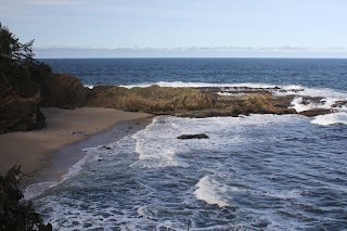
Normally, I don't get too excited about walking on a roadway, abandoned or not, but I've been known to become rather ebullient over signs labeled "Viewpoint" with real dirt paths behind them. One such matching set of trail and sign appeared after about a half mile of hiking and I heeded the siren song of a real trail. The short path led to a grassy overlook with a strategically-sited bench on it, and I thoroughly enjoyed the view of nearby Point Orford, Humbug Mountain, and some rocky islands known as Redfish Rocks bobbing in the ocean. As I gawked at the coastal scenery, several water spouts advertised the otherwise hidden presence of whales in the vast blue sea.

Island Rock, off in the distance

After a short stop 'n gawk, it was back on the old road-cum-trail which then crested at a high point with a superb overlook of the Pacific Ocean rolling onto an inviting beach at the base of Humbug Mountain. In the ocean offshore of Humbug Mountain was the unimaginatively named Island Rock. If Island Rock is the only name the island namers could come up with, why not just call it Rock Rock? Or, maybe Island Island? Especially since a small pointed rock nearby makes the two islands collectively appear as a whale and tail. Whale Island, anyone? Anyway, after some oohing and aahing at the overlook, it was back to the trail inclining downward to the campground located in Humbug Mountain State Park.

Now we are talking about gorgeous trails!

Maple trees arched over the still-paved trail, with most trees just starting to turn yellow with autumn's looming advent. After crossing Dry Run Creek (which was not dry nor was I running) on a well constructed bridge, the forest morphed from maple to myrtlewood with tall trees of each specie hovering over a deeply shaded road coated with a light layer of fallen maple leaves.The old highway did come to an end in the campground but never fear, the Oregon Coast Trail resumed on a dirt path that provided a butt-kicking grade as it went up and over a deeply wooded ridge.

The myrtlewood forest was absolutely sublime

Burning quads, glutes, and other assorted aching body parts aside, this was my favorite part of the hike. The forest was mostly comprised of myrtlewood trees, and the deeply shaded trail was perfumed with the sweet aromatic incense of their leaves. Once the trail crested, it then bottomed out next to Brush Creek coursing below the trail, the creek barely visible in the surrounding brush. Given the bucolic splendor of the peaceful woods, it was almost disappointing to enter the manicured lawns and civilized picnic tables of the Humbug Mountain day use area. 

A spider patiently waits for a hiker to blunder into its web

After lunch and a perfunctory visit to the forlorn ruins of long-abandoned Brush Creek Fishery, it was back the way I had come while the afternoon light slanted poetically through the branches of tall maple trees. Because the old highway is paved, it stood to reason I'd eventually encounter a cyclist or two. One such cyclist was looking for a misplaced husband, stating she would wait for him at the park entrance. Sure enough, I ran into him looking for his misplaced wife who had sped by him, oblivious to his impromptu stop to heed the call of nature. Feeling like a trailside marriage counselor, I gave him her location and hopefully the happy couple is still reconciled because it's always nice to come back from a hike with valuable karma points in hand.

Silvery sea on the return stage of the hike

For more photos of this hike,
please visit the Flickr album.