Saturday, May 26, 2012

Windy Valley

Memorial Day weekend offered a chance to get out for a spring 3-day hiking extravaganza and I took the chance. The weather in weeks prior had been superb and the visions of hiking under sunny blue skies had been dancing in my head, causing my own little version of Restless Leg Syndrome.  
The drive to Windy Valley was "interesting"

Peak 3349
Idyllic Windy Valley was the chosen destination, to be followed by a day hike from the valley to the top of Snow Camp Mountain. I'd been to the valley several years ago and it remains one of the most beautiful places in the Siskiyous despite a visit from the catastrophic Biscuit Fire of 2002. But, I'd forgotten how remote the valley is and it seemingly took all day to get to the trailhead and the hike started late afternoon under threatening skies.


Fortunately, after a desultory rain shower, the cloud cover broke up as I sallied forth onto the trail. Windy Valley sits on the western edge of the fire-ravaged Kalmiopsis Wilderness and immediately this hike became all about the Biscuit. There weren't a lot of trees here, just a forest of ghostly white snags.

A tree, my kingdom for a tree!

Cedar Creek
The trail had that Kalmiopsis vibe as the rocks were comprised of serpentine and peridotite, all colored orange due to oxidation. The spring flowers were putting on a show what with lavender mats of phlox stuffed into the cracks in the rocks, and waist high azalea bushes sporting clusters of the distinctively ornamental bloom. Cedar Creek trickled through the moonscape, the sight of clear running water clashing with the general aridity of the area.


A flower, to show my love for thee

In another sign of hiking in the Kalmiopsis, there were two darlingtonia bogs growing right on trail. Also known as California pitcher plant or cobra lily, these unique specimens trap insects in their distinctive pitchers and digest them to supplement the nutrient-poor soils of the Kalmiopsis. And they have got to have the strangest flowers ever and they were in their full odd blooming season. It almost seemed sacrilegious to step on them as I crossed the darlingtonia bog on the overgrown trail.


Windy Valley
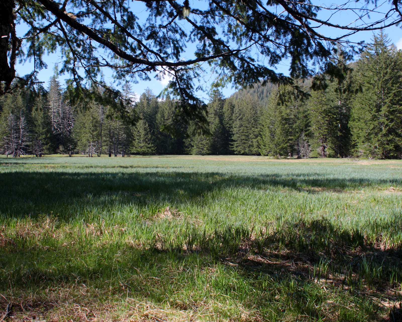
A short two mile descent dropped me down into Windy Valley where I set up camp.  The trees surrounding the valley were merely singed by the Biscuit and the valley was spared the scorched earth treatment shown the surrounding mountains. The valley floor is a long meadow with Windy Creek running alongside it and I can't think of a more peaceful and tranquil place.


Let's walk around the meadow some more!
Unfortunately, there wasn't a lot to do there after camp was set up so I walked around the meadow. Then I ate dinner and walked around the meadow. Then I walked around the meadow some more. I had some vain notion of taking pictures of the sunset but then some clouds rolled in and just like that, sunset was cancelled. So, I walked around the meadow again.

The next morning dawned wet, foggy, and pretty darn cold. Snow Camp Mountain was hidden and unseen up there in the foggy netherworld. I began to harbor grave doubts about the wisdom of hiking to the top of  a mountain where all views would be occluded by the mist. The deal was cinched when I explored the ford where the trail crossed Windy Creek, as the creek was close to thigh deep.

Are we having fun yet?

Striking camp, I climbed out of the valley in ever thickening fog. This turned out to be a long drive for a short hike, making this Memorial Day somewhat forgettable.  It still was beautiful, though.


Azalea

Sunday, May 20, 2012

Kerby Peak

Proof we were there
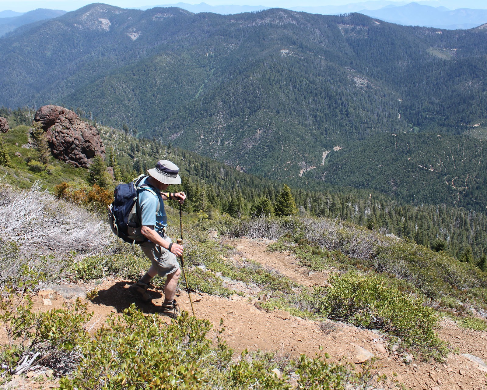
Several weekends ago, Ray and I opted to do Kerby Peak as an impromptu Plan B hike when Plan A was snowed over. Plan B did not pan out that day either because of a road closure but we were very impressed with the massive rock wall that is Kerby Peak. Our legs trembled with both fear and anticipation at hiking up to the Kerby summit, a paltry 2,600 feet above us. So, when the aforementioned road opened, we found ourselves craning our necks once again to peer at the summit all those thousands of feet above us.

Hiking is fun, right?
The trail wasted no time heading uphill and we stopped at every other switchback panting with the exertion. Thank goodness there were switchbacks, it could have easily been a lot worse as the old trail simply charged straight up the forested slope that was nearly a vertical wall. Periodically, a break in the forest would show us that Kerby Peak was so far above and so far away. Better to head back into the forest and focus on getting to the next switchback.

I'm NOT TIRED, I tell you!
At least spring was happening on the forest floor and I stopped to take pictures of all the flowers because I like to take pictures and I was NOT TIRED.  Suffice to say, lots of pictures were taken on the climb up.


Siskiyou lewisia
At the halfway point, the trail spit us out onto a rocky cliff totally devoid of trees. Little rock gardens consisting of pink mats of phlox, stonecrop (not yet blooming), and cliff maids (also known as Siskiyou lewisia) colored the rocks nicely.  

And we are only halfway up!
But really, this was all about the view. The Illinois Valley lay spread out below us with green pastured farmland straddling the Deer Creek valley. Rising beyond the small town of Selma were the orange-brown mountains of the Kalmiopsis Wilderness, all stripped clean of trees by the 2002 Biscuit Fire. And, unfortunately, Kerby was still high above and far away. Sigh.

Time to break out the sunscreen
We had been switchbacking back and forth on the north face of Kerby and eventually the trail surmounted a ridge and put us on the sunnier south slope. The vegetation changed, there were more ponderosa pines and cedars and a whole lot more sunshine. And blessedly, the trail switched from steep to merely uphill.


Brewer's weeping spruce, taken by a weeping hiker
Brewer's weeping spruce made an appearance also, the branches drooping sadly like our heads. The trees then thinned out together and the trail began switchbacking through an open slope of low-growing manzanita, just the right height for scratching hiker's shins. I made the comment to Ray that this must be the final push but a couple of miles later we were still hiking upwards. Just like child labor, it was a long and painful push.

One of many false summits

Summit cairn


Rocky towers loomed above the trail, contrasting nicely with the blue sky and we were ever hopeful that one of these towers would be the actual summit. But Kerby was a cruel and capricious taskmaster and was merely throwing false summits at us. It was almost anticlimactic when I strolled onto a flat spot with a summit cairn on it.
Magnificent view from the top

Climber's ritual of adding to the summit cairn


A magnificent panorama awaited us at the top and we soaked in the views while waiting for the feeling to return to our quavering legs dangling over the edge as we lunched. We could see the towns of Selma, O'Brien, Murphy, and Cave Junction as they sprawled in the valley dotted with farms. The rugged Kalmiopsis Wilderness dominated the northern view and we could see the snow cone of Mt. McLaughlin, and the gray mounds of Grayback Mountain and Mount Elijah. To the southwest were the snowy peaks of Preston Peak, El Capitan, The Lieutenants, and Bear Mountain, all located in California's Siskiyou Wilderness.

Going down is also "fun"
All good things must end, and we headed downhill towards the trailhead.  Going down was harder than going up with all the leg braking, but it was quicker: it took three hours to reach the summit but only an hour and a half to get down. Ray summed it up best when he said "That was the hardest 7 miles I have ever hiked!" Short, succinct, and entirely accurate.


Sunday, May 13, 2012

Sacchi Beach

So my alarm rings early Saturday morning but instead of bounding up out of bed with unbridled enthusiasm, I dispiritedly slap at the alarm clock and go back to sleep. And when I woke up several hours later, I had missed a hike with the Friends of the Umpqua Hiking Club. D'oh! It's too bad, because they were hiking from the Seven Devils Wayside, north of Bandon, and I had never been hiking there. After a day of rest and chore-avoidance, I (and Maggie, our happy-to-be-out-hiking dog) drove out to Seven Devils Wayside and performed a solo reenactment of the hike.

Twomile Creek on Merchants Beach

Maggie sprints to Fivemile Point
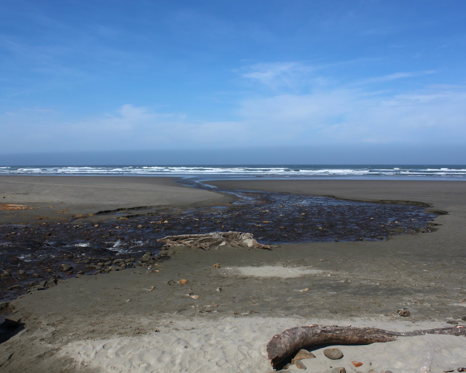
It was a gorgeous spring day and Twomile Creek burbled merrily onto the beach. We too, burbled happily onto the beach and crossed Twomile Creek and headed south to Fivemile Point. Seven Devils, Twomile, Fivemile: lots of numbers in these parts! Maggie, with unbridled and simple canine enthusiasm, ran ahead and then ran back to make sure I was coming, she got the double mileage award as a result.


Fivemile Point

Fivemile Point is a fairly innocuous looking point that juts out into the sea. Rounding the point at any other time besides at low tide would be anything but innocuous, however. Fortunately, the tide was retreating and we had no issues. Well, Maggie did have an issue as she was getting used to wading through the ankle deep puddles in between all the rocks. Not paying attention, she blundered into a tidepool that was about 5 feet deep and she paddled frantically back to relatively dry land, much to my amusement.


Whiskey Run Beach stretched ahead of us when we rounded the point and there was a noticeable dearth of rocks. It was just miles and miles of sandy beach fading away into the misty yonder. We walked as far as Whiskey Run, a creek that flows through and from its namesake wayside and picnic area. Since it was another 7 miles or so further to Bandon and Bullards Beach and since there really weren't any major sights to see, we turned around and re-rounded Fivemile Point.

Whisky Run, full of water...boo!

Agate Beach rocks!


Heading north, we left the tidepools at Fivemile Point behind and continued north past the Seven Devils Wayside. Rounding a small point, we ambled onto Agate Beach. The beach is covered with rocks of every shape and color, most rounded to smoothness by centuries of wave-on-sand action.  I spent a lot of time prone on the ground, squinting through the camera viewfinder while Maggie plopped down on the sand, bored with the whole photography process. My grandchildren would have a field day on this beach, we'd never get them to leave! Plus, I'd have to carry the bucket of rocks back.


At the north end of Agate Beach was an unnamed point that also would be impassable at high tide, just like Fivemile Point. Rocks and tidepools abounded with starfish clinging to rocks covered with mussels and barnacles. Waiting for us as we rounded the point was the long and secluded cove of Sacchi Beach.

This hike was not pointless

Oceanic mayhem at the end of Sacchi Beach


Arago Peak, above Cape Arago, had been off in the distance when we began this hike but now it was kind of close in an indicator of just how far we had walked. There were some pretty fancy homes, castles really, perched on top of the massive cliffs above the sandy beach. These homes probably have a limited shelf life, judging by the amount of debris at the base of the inexorably crumbling cliffs. At any rate, we walked to the end of the beach which is bordered by a cliff at the north end and observed the waves crashing on the jagged rocks and pinnacles beyond the beach.

One small treasure
It seemed like the tide was beginning to rise so I put the camera away and walked really fast to the unnamed point, having no desire to get stranded at Sacchi Beach. They make horror movies about people who get stranded in remote areas. I need not have worried, for we had plenty of dry land at the point and the camera came out again.


Before we end this blog, a brief word about pelicans. We obviously were walking under a pelican flyway as squadrons of them flew silently and mysteriously above us. This was like an interstate freeway for the odd--looking birds as formation after formation flew north.  Needless to say, my picture collection now has lots of pelicans in it.

Strafe the hiker!


Saturday, April 28, 2012

Blacklock Point

"My traveling companion is nine years old..."
Paul Simon, from the song "Graceland"


That line kept playing in my head as I took eight year old grandson Aiden on his first backpack trip. I was reminded of the fact I was hiking with an eight year old when, a mere half-mile into the hike, he plopped down on the trail and said "I'm tired, I can't go on!" This was going to be a long trip, and I'm not just talking about the mileage.
Are we there yet?
Mud puddles and boys go together


We had started with the Friends of the Umpqua Hiking Club on a recent hike to Blacklock Point and we had left the car at Floras Lake, where we would be putting out. The trail initially tunnelled through tall rhododendrons not yet in bloom on an old roadbed that was full of deep standing water that were more like ponds and less like puddles. It wasn't long before all our hiking friends left us behind as we were walking at boy-speed.


On the cliffs at Blacklock Point


As stated previously, approximately a half-mile into the hike Aiden plopped down and said he was tired and couldn't go any further. What the...?  After I explained that our car was 7 miles away and it was either continue walking or go missing in the woods, he reluctantly continued on the trail. A short bit through a ferny forest brought us out onto the cliffs overlooking Blacklock Point and some epic views.

Blacklock Point


It was a gorgeous spring day with nary a cloud in the sky and the view south consisted of the rocky bay arcing to Cape Blanco. To north, stretched the Oregon coastline towards an unseen Bandon. And due west, virtually at our feet, was craggy Blackock Point with a small chain of islands, seemingly tossed out there by Blacklock. Views like this require a sit down and we found out the boy's miracle food was nut-bar snacks. 


Drink this for a diarrhea song inspiration
Totally rejuvenated we set off on the Oregon Coast Trail.  To while away the time we played, for lack of a better word, the "diarrhea game". Not as gross as one might initially surmise, the game consisted of making a rhyme about diarrhea, as in "no pain, no strain, just sit and let it drain!" The obvious rhymes consisted of "poop" and "goop, or "creamy" and "steamy" but I was particularly proud of my rhyme using "fish emulsion" and "jet propulsion". Now, some readers, or even most readers, would question the value of this little game but the game's true value was that it kept Aiden walking without complaining.

The Oregon Coast Trail followed the cliffs above the beach and periodically we would bushwhack and sally forth onto a russet colored bluff top to explore and eat more nut bars. The views were all magnificent as the cliffs stretched several miles north, looking like a massive Egyptian temple a la Abu Simbel. Truly magnificent under a clear blue sky.

Ooh!  Aah!
We set up camp at the 4 mile mark alongside a small creek and went to explore the beach a short walk away. Our creek snaked back and forth through the coarse sand before joining up with the Pacific Ocean. Aiden crossed and recrossed the creek, scrambled up some rocks, and played tag with the ocean. In short, he was being a boy. The beach is quite steep so the waves made up for lack of inland distance with power. One particular wave tagged Aiden and said in wave-speak "you're it!" Aiden somersaulted several times in the white water and rolled up stating "I'm ready to go back to camp now" as salty water dripped off of his face
Welcome to the sand canyon

Sunset, sort of
So he got to wear some of my shirts which were comically big but seriously dry and we hung up his clothes on some bushes to air out over the night. After dinner, we returned to the beach and were quite surprised to see a storm system had come in. Rain was definitely in the offing and Aiden played in the sand (Grandpa wouldn't let him get near water) while I took pictures.


While we were telling scary stories in the tent, the wind began to whip up and eventually the rain came and kept it up all night. It was a "howlah" like they say in Australia. This was the first occasion I had to field-test my tent and I'm glad to say we stayed dry. 

Camp Waterlog
The Hunchback of Notre Blacklock


The rain let up by morning and we struck camp in a muddy campsite and returned to our beach. As we did so, the cloud cover broke up and we were treated to another magnificent day on the coast. Our going was slow because Aiden is a rockhound and the beach was covered with rocks. My pockets became heavy as they  were slowly stuffed with Aiden's treasures.


After a mile, the imposing cliffs petered out and a small creek was our ticket off the beach where we followed an overgrown trail to Floras Lake. Aiden waded in the shallows while I stayed on the trail. Eventually, we arrived at the car and our reward was a lunch of Chinese food in Bandon. We both got a lot out of this hike as it was a nice bonding experience in a Graceland of our own.
A great time was had by all

Saturday, April 21, 2012

Mule Creek


Many years ago, I volunteered to lead a Friends of the Umpqua Hiking Club hike up Mule Mountain. In the annals of club lore, that hike will live in infamy. The trail was basically 4 miles of uphill with no shade under the hot sun. That was the first time I heard the phrase "Richard-Hike" bandied about, and not in a complimentary way, either.


You ain't nuthin' but a hound's tongue


Despite the relentless climb, I enjoyed the hike. There are magnificent views of the Siskiyou Mountains and given the right time of year, the slopes are festooned with wildflowers of every color. Because I've enjoyed this hike, I have returned to visit the Mule Mountain area many times since. And many times since, I have questioned why I hate myself as sweat mixed with sun lotion runs into my eyes, ticks burrow into my skin, poison oak makes me itch for the next three weeks, and of course all the trails run straight uphill.


Shooting stars carpeted the forest floor
A couple of days ago, we caught our first taste of summer heat as the temperature reached the 90's. Tree-lined Mule Creek (below infamous Mule Mountain) looked like it was shady and that was the only reason this trail was chosen. The Mule Creek Trail is accessed 3/4 of a mile up the Mule Mountain Trail which meant I got to relive the Mule Mountain leg-burn experience by climbing steeply through a shaded forest carpeted with bright fuschia colored shooting stars.


View to Little Grayback Peak above Mule Creek
Once on a Mule Mountain spur ridge, the Mule Creek Trail heads steadily down through grassy and brushy slopes into Mule Creek's canyon. On the way down, I enjoyed nice views of the Applegate River valley and of Little Grayback Peak looming at the head of the canyon. Of course, I had to be careful to dodge poison oak encroaching the path but the tick-checks yielded none of the little vampires, thankfully.


Build me up, buttercup
From glacier lilies to red bells, the spring flowers were putting on their usual show.  A member of the onion family with one of my favorite names (ookow) was also prevalent.  Ookow is also known as blue dick, which prudish Webshots censures, thereby denying Webshots users some crude hilarity.  The hound's tongue were blooming in profuse clusters of blue flowers; the term "hound's tongue" refers to the shape of the leaf and has nothing to do with my ex-wife.


Once at the bottom of the canyon, the trail follows an old road bed alongside the creek.  The creek was overgrown with brush and was mostly heard and seldom scene.  At the point where the roadbend ended, the path crossed the creek and became a bonafide trail.  The mid-afternoon heat was rolling down the slopes and collecting at the bottom of the ravine and I paused to stick my head in the remarkably clear waters of the stream.  Yikes!  The water was not far removed from snowmelt and gave me what felt like a brain freeze, only the freeze was in the whole brain and not confined to just the upper sinuses. 

C'mon in, the water's freezing!

Steep trails make me hate hiking
After a second crossing of the creek, the trail charged up a dry hill covered in madrone. The trail had been heading uphill all along, but this was steeper than the price of gas nowadays. It was hard to gauge my progress because of all the trees but it did seem like I was heading up the creek's headwaters below the disturbingly named Baldy Peak. Several miles later, I was still wondering where the @#$% end of the trail was and I was hot, tired, and as sweaty as a Zuma class in a sauna.

I turned around at my self-imposed 4:30 PM deadline and headed back down the trail, totally defeated. I didn't feel so bad on the way down because it was readily apparent why I was tired:  this was a long and steep trail. Of course, there was the steep climb out of the creek canyon to the Mule Mountain Trail to look forward to. 

Typical hike in this area:  I came back with lots of nice pictures and yet again, I'm wondering why I hate myself so.