Showing posts with label Agate Beach. Show all posts

Friday, March 26, 2021

Port Orford Heads and Tseriadun Recreation Site

The views from Port Orford Heads were stunning

Day 2 of my hernia surgery recovery plan (not specifically endorsed by my surgeon) called for another short hike on Port Orford Heads, the idea being to hit places where I would not normally hike because of the meager distance of the trails. Located between the town of Port Orford and the Pacific Ocean, the headlands on the ocean side are surrounded by nasty rocky islands and even nastier rocks lying in wait just below the surface of the ocean. Back in the day, boats ran into the submerged rocks with enough frequency that a lifeboat crew was stationed atop the heads to rescue sailors and passengers alike. Nowadays, the Heads and historical lifeboat station are a state park and a short trail leads to several outstanding viewpoints atop the headlands.

Wild iris graced the trail

Beginning at the aforementioned lifeboat station, the path quickly dropped into a lush forest where ferns rested upon the stout arms of spruce branches like so many polypodiophytic (fancy word for ferny) turkeys roosting for the night. Wild iris, woodland violet, and oaks toothwort were beginning the spring show on the forest floor while small birds twittered and flittered in the flourishing shrubbery.

The ruins of the once and former boathouse

At an overlook of a narrow cove dwarfed by the tall cliffs of the headlands, the ruins of the old boathouse (long since lost to a fire) could be seen. To effect a rescue, the lifeboat crews stationed here had to hike down from the station to the boathouse, manually row the boats out onto the stormy sea, rescue those in need of such, row back to the boathouse, and then hike back up the incredibly steep stair-stepped path back to the station atop the Heads. Wow, they were capable of much greater things than anything this herniated hiker could ever accomplish.

A keyhole-shaped cove at Port Orford Heads

The trail soon left the forest and transitioned to an up and down route along the edge of the headlands. The track abruptly came to an end, primarily because Oregon likewise came to an abrupt end. The drop-off was sheer and precipitous, and the view from the head of the Heads was stunning. Below, windblown waves with spindrifts curling off them crashed onto rocky islands and shores, or surged into keyhole coves with equal vigor. Offshore, a number of boat-eating islands extended out to several miles from the shore. One pyramid-shaped island had a large cave in it which reminded me of my Sisters Rock hike from the day before.

You could see forever except for Cape Blanco being in the way

To the north, stretched a beach all the way north to Cape Blanco with the town of Port Orford and local landmark Garrison Lake eminently visible. The sea was colored aquamarine, the surf glowed a radiant white, and the sky was painted a bright blue, all colors contrasting nicely with the dark brown beach and the black and brown terrain of Port Orford Heads. Definitely a colorful view for the ages!

Red currant prettied up the Tseriadun trailhead

While fun, the hike on Port Orford Heads was not very long and my legs still felt peppy, as they should, so I drove down to Tseriadun State Recreation Site, because I had never been there and the name sounded exotic if only because it began with a "ts". The locals and maps refer to Tseriadun as Agate Beach which is not as exciting a name, but if I could return home with a small haul of agates, then that would be excitement enough.

A low dune of soft sand is all that protects
Garrison Lake from the ravages of the ocean

Beaches are always fun but this particular beach is made unique by the proximity of Garrison Lake, for only a tenuous spit of sand separates lake from ocean. From a hiking standpoint, it's kind of cool to walk on the dune with the calm and placid lake on one side while on the other side, the restless ocean fumes "Mine, soon you will be mine!" Given a recent history of the ocean breaching the sandy spit during raging storms, it's not an idle threat.

Offended by my intrusive presence, the ocean gnashes its teeth

The beach sprawled under a clear blue sky but a cold and strong wind made my eyes water which might be why I didn't spot any agates. The waves were large and boisterous with the stiff breeze peeling spray off of the onrushing surf. At the south end of the beach, loomed an imposing rocky pyramid with the much larger cliffs of Port Orford Heads rising beyond. The waves were pretty awesome as they thundered against the rock so I hiked in that direction to get a better look-see.

Heed the warning, Richard

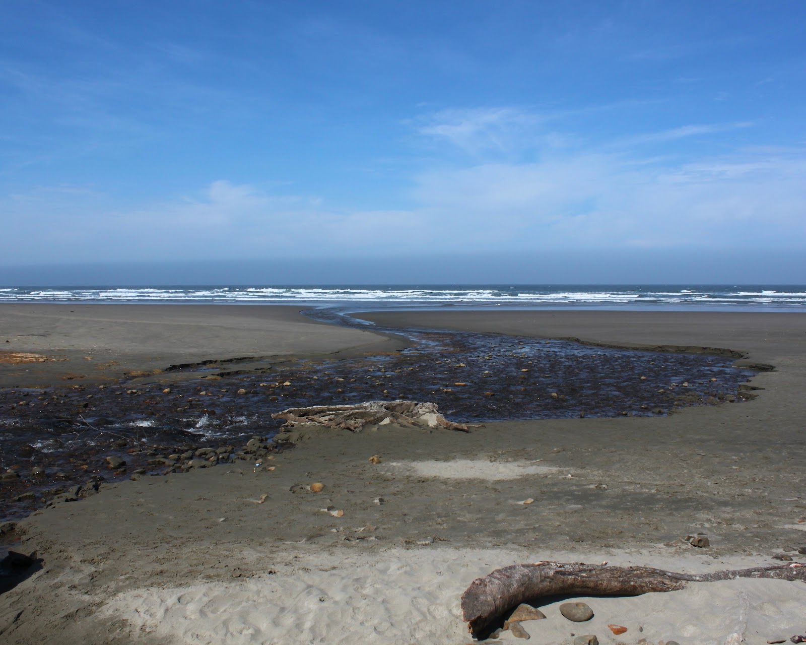
On the other side of the jagged rock was a fairly substantial creek snaking back and forth through a sand and rock combo before reaching the sea. The waves were breaking big, the spray of the surf rolling off the rocks and into the creek and I spent a few minutes doing some photography. However, several large waves rolled up the creek bed, nearly cutting me off from a safe retreat. That was my cue, and when the incoming tide temporarily receded between waves, I backtracked to safety on the beach.

The waves were spectacular

I had intended to hike a nearby nature trail before heading back to Winston but could not find the trailhead (I did see it as I was leaving, though). But the day almost felt complete anyway, with awesome scenery accessed via some restorative walking. While I could have used a few more miles of hiking, my surgeon will no doubt have a frowny face when she hears what I've been up to, so we'll just make this outing our little secret. 

The rugged Oregon coast at Port Orford Heads

For more photos of this pair of hikes, please visit the Flickr albums:

Port Orford Heads

Tseriadun State Recreation Site


Saturday, October 7, 2017

Merchants Beach

Seems like the Friends of the Umpqua hiking schedule was about as solid and permanent as a sand castle at high tide. The wildfires this summer had us all scrambling and rearranging destinations due to closures, smoke, and outright fire on or around our favorite trails. The upcoming hike was scheduled for Rattlesnake Mountain but the Rattlesnake Fire kind of got in the way of that. What an amazing coincidence to have Rattlesnake Fire burning on Rattlesnake Mountain, what were the odds of that happening? Naturally, there wasn't going to be any Rattlesnake hiking but the Forest Service made it official when they closed not only the Rattlesnake Trail, but the entire Rogue-Umpqua Divide Wilderness.

One misty moisty morning...
Hike leader Diana was incommunicado while enjoying a fire-free vacation in Spain, so yours truly made an executive decision and changed the destination to Sacchi Beach. I'd been there a few weeks earlier but the club hadn't hiked there that I knew of, Sacchi Beach would be a new destination for most hikers. Plus, the odds of a Sacchi Fire taking hold on the beach were pretty slim. In hindsight, I should have checked the tide tables first, but what's a Richard Hike without a little chaos involved?

Morning constitutionals
Fifteen hikers, one dog, and one drone showed up on a misty morning for a nice beach walk. Turned out, high tide was due to crest in about 90 minutes but there was plenty of sandy beach as we started. There are three beaches involved when hiking from the Seven Devils State Recreation Area: Merchants Beach lies north of Fivemile Point with Twomile Creek roughly marking where Agate Beach begins. Agate Beach ends at an unnamed point, with Sacchi Beach laying on other side of the point. Got it? There's going to be a pop quiz in the morning, kids, so be ready.

The hike north ends here
At any rate, we traversed Agate Beach, reaching the unnamed point in short order. The waves were already lapping at the base and a quick climb up some rocks revealed the bad news: there would be no hiking on Sacchi Beach today. At best the water was near knee deep and of course, it was much deeper when the waves rolled in. 

C'mon sun, you can do it!
So back south we went, as the mist lifted and returned, seemingly ebbing and waning with the waves. However, the trend was generally heading towards a sunny day. The hike back to Seven Devils was pretty short so most hikers continued on south towards Fivemile Point. A flock of vultures watched us from a stand of dead trees, licking their beaky lips as they watched their lunch walk by. It always makes me nervous when the vultures do that, what do they know about my life expectancy that I don't?

The hike south ends here
When Issiah and I hiked to Fivemile Point earlier this year, we scrambled over Fivemile Point by clamboring over the rocky point. While hands were required, the scramble up and over wasn't too difficult, although Issiah seemed to have less difficulty climbing over than I did.  But with the incoming tide clasping the point in a watery embrace, we couldn't even reach the point where the climb over began. What we were left with were damp and sheer cliffs, and the realization we weren't going to get past Fivemile Point either.

Who says an old dog can't teach new tricks?
A long and leisurely lunch break was enjoyed at the point, the seaside scenery entertaining us as the sky morphed from gray to blue. Oddly enough, a rusting engine block lay in the sand at the base of the point, leading to much speculation as to how that block got here in the first place. My theory is that it was dropped there by the world's strongest osprey.

Beach treasure, in the form of petrified wood
All good things come to an end and reluctantly, we strolled back to the car, having to be satisfied with an easy 6 mile hike. Maybe next time I'll check the tide table before deciding on a beach hike. But it could have been worse, we could have been hiking in the middle of a wildfire on Rattlesnake Mountain.

Sure beats walking in a forest fire
For more pictures of this hike, please visit the Flickr album.


Friday, September 1, 2017

Sacchi Beach

I've never felt the need to smoke. In my view, there's just no appeal in burning a stinky weed in your mouth. The whole allure of smoking simply baffles me, I just don't get it. I try not to get too judgmental about those who do smoke because I have friends and family members who smoke and apart from that one fault, are generally pretty nice people. But I do think second-hand smoke is pretty rude because somebody else's smoking habit is being imposed on me against my will. So, imagine my discomfiture when in the month of August and early September, I had to unwillingly inhale unfiltered smoke all day and every day. I'll probably wind up with some lung disorder later on in life, directly attributable to the fire smoke that filled up the valleys of western Oregon in summer of 2017.

Mid-morning in Winston
Near Roseburg, we had the North Umpqua Forest Complex fires vaporizing thousands of acres of trees along the North Umpqua River. The complex included the Happy Dog Fire happily burning up the forest in the Boulder Creek Wilderness area. Bad doggie! Poor little Boulder Creek is like Lightning Central when the summer storms commence and can't even get a baby forest started due to the frequent fires in the area. Yet, despite the lack of live trees, the fires somehow still find plenty of fuel to burn.

Cough!
However, the North Umpqua Forest Complex was not alone and had plenty of flaming company: The Falcon Complex and High Cascade Complex fires managed to shut down the Rogue-Umpqua Divide Wilderness and the north and west sides of Crater Lake National Park. Further south was the Miller Complex, gloriously denuding the slopes of Red Buttes Wilderness and Grayback Mountain. Nearer to home, the Horse Prairie Fire chewed up the oft-burned Lower Cow Creek area near Riddle. But the star of the smoke show was the Chetco Bar Fire which at the time of this writing (September 19th) was rapidly approaching 200,000 acres of ashy terrain as its legacy. 

Our view, for six straight weeks
During late August and early September, the weather had been hot and dry, with little or no wind movement. So, the fires churned and burned and the resulting smoke filled up all the low-lying valleys. The smoke had no other place to go, yet the fires continued to pump more smoke into the already smoke-filled low areas to the point where the sun was not visible at all in the dirty brown sky. The vibe and atmosphere was apocalyptic and I'm going to start smoking whether I like it or not.

Twomile Creek, on a fine day a the coast
However, the weekend forecast did call for some relief at the coast with winds predicted to sweep the Chetco Bar Fire smoke and ash in a northeastern direction. The city of Bend was the lucky recipient of our smoke, but I was OK with that, even though Bend wasn't, as I headed out to the coast to see if blue sky was what I remembered it to be. On the drive over the Coast Range, the air near Coquille was nearly solid with fresh particulate matter that left parked cars coated with ash.

Agate Beach beckons
At Seven Devils State Recreation Site on the Oregon coast, there was some blue sky, although there was still plenty of smoke graying up the sky to the south with a noticeable layer of smoke hanging high over the ocean. Given the recent six-week long nastiness of the air quality (or lack, thereof), I'll take it. As I set out on Merchants Beach, a chill wind blew into my face, it was so good to feel air movement, too.

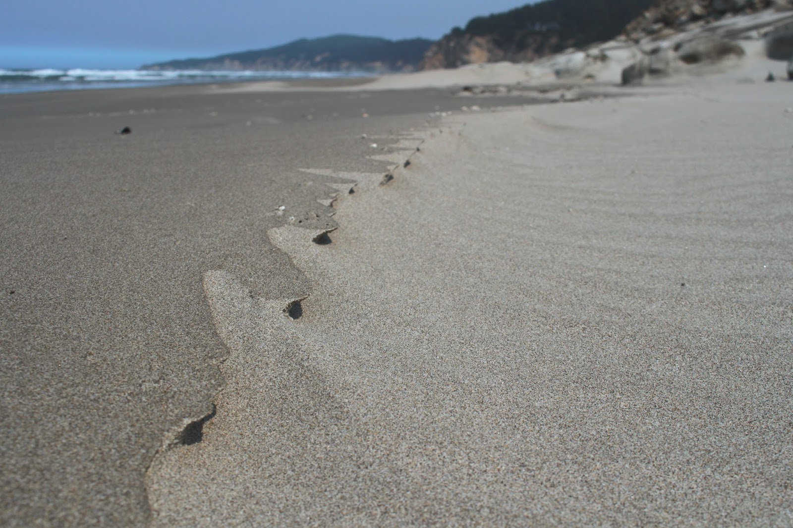
Sand art
This hike would be a tale of three beaches: Merchants, Agate, and Sacchi. Merchants and Agate Beach are basically the same strip of sand with Agate Beach kind of hanging around Threemile Creek and Merchants Beach hanging around Twomile Creek. An unnamed rocky point keeps Sacchi Beach pent up in its own little beachy corner of the Oregon coast.

Miniature wind hoodoos
Heading north to Agate Beach, it was several miles of a lonely strand of sand arcing towards a distant Cape Arago, with only gulls and sand crabs to keep me company. The wind had created miniature formations out of the numerous pebbles on the beach, from an ant's-eye view, they probably resembled hoodoos and balancing rocks. Occasional rocky cliffs sported interesting rock formations and one rock in particular resembled the fossilized skull of the Aztec god Mictlantecuhtli.

Eroded rock at Sacchi Beach
The tide was receding at the unnamed point, so there were no interesting wet-footed tales to tell: just a simple dry-footed stroll around barnacle encrusted rocks to secluded Sacchi Beach. After a mile of walking along the sand, the beach abruptly ended at a formidable cliff that delineated where Sacchi Beach ended and Cape Arago sort of started. The tide was way out, exposing some phantasmagorical rock formations. More dear to my heart, a sandy maze of a route through the rocks provided a way to explore further north along the shore, leading me to a secret cove.

The secret cove was a wild place
This is not the place to be in high tide and even though it was low tide, a wave rolled in and left me stranded atop a rock, waiting for the water to recede so I could safely leave the secret cove. While waiting, I availed myself of the opportunity to take pictures of the rocks, islands, and a notable amphitheater carved into a massive cliff by the waves. This little piece of Sacchi Beach was my favorite part of the hike.

Creepy ball of sand crab babies
On the way back, the tide had receded farther than a middle-aged man's hairline, exposing acres of beach glistening under the afternoon sun. The scenery was pretty and all, but this portion of the hike soon became all about the sand crabs. As waves ebbed, dozens of sand crabs emerged from the sand and scurried after the retreating water line before hurriedly burrowing back into the sand. Large balls of baby sand crabs rolled in the shallow water, creepily scattering hither and yon at my arrival.

Rock warts


At about the 5.6 mile mark, I had made it back to Twomile Creek and the picnic area at the Seven Devils Recreation Site, but I wasn't done yet. For more mileage, I walked to Fivemile Point and back. The sun was getting low and the restless sea glinted silver in the afternoon sunlight. Fivemile Point was totally exposed by the low tide and I was able to take photographs of concretions and eroded honeycomb formations on the rock.

My route 
From Fivemile Point, it was a lean-into-the-wind hike back to Seven Devils picnic area, as a flock of rather nonchalant and blase seagulls blithely watched me walk by. There was a critter track that ended abruptly in the wet sand, so I started digging to see what made the track. When some wiggling wormy creature from the depths started flipping around in my hand unexpectedly, I may have screamed a little.

Behold the fossilized skull of Mictlantecuhtli!
It was nice to spend at least one day this summer under semi-blue sky and I was a happy hiker on the drive home. Well, I was happy, until I reached Coquille and the smoky air. The Horse Prairie Fire was still burning and more smoke was being pumped into the Coquille River valley. Looks like I picked the wrong day to quit smoking!

Sacchi Beach rocks!
For more pictures of this hike, please visit the Flickr album.


Saturday, February 22, 2014

Newport beach hike


So, a month ago on Baker Beach I found myself involuntarily in a sinkhole of chest deep cold water. Unfortunately, my camera was stowed safely away in my waist pack, which was underwater along with my ample waist during my sinkhole visit. Sorrow then came to my house after the hike, because the little adjustment wheel on the camera that adjusts everything no longer adjusted anything. While I've been taking pictures, it has been a tedious process as I have to make all the camera adjustments through the menu screens and not all the adjustments have menus. It was like having a Nikon!

Watch out for sinkholes
This ostensibly sad and tragic little tale does have a happy ending, though. Last Thursday, the UPS truck stopped by and dropped off a nondescript cardboard box containing a shiny brand new camera. It's not waterproof, though, so I'll have to still work at avoiding those nasty sinkholes in the marshes.


The air was filled with the sound
of clicking camera shutters
The camera came with Dollie and I on a recent visit to Newport on a sunny and more importantly, a sinkhole-free day. From the edge of Old Town, we grabbed the Yaquina Beach Trail, a rocky path that followed the north bank of the Yaquina River. Overhead,  the spidery web of the Yaquina Bay Bridge hummed with the whoosh and clank of highway traffic. Below the bridge, the air hummed with the smooth and beautiful click of new camera shutters (Dollie also had a new camera: thank you, Santa Claus!) getting used for the first time.

A large bridge unsuccessfully hides behind a dune
After taking pictures of the bridge using every camera setting known to man and maybe a few that were not previously known, we continued onward along the wide river. As the trail petered out, we walked on jetty rocks to the beach at Yaquina Bay State Park. From this point on, it would be a beach hike as we headed north.

My view for 7.7 miles
The tide was out and we had acres and acres of sand to walk on. As an added bonus this was hardpack sand, just like my abs (in my dreams!) and would remain easy to walk on all day long. The sun was out but the temperature was cool with a mild breeze. It was just perfect for hiking and there were plenty of beachgoers out enjoying the Oregon coast.

Faster hikers than Dollie and I
While we enjoyed a nice beach hike, there weren't a lot of things to see other than sand and sea. Newport was on the cliffs above the beach in the form of hotels and we could see the hotel we stayed at when we cycled the Oregon coast several years ago. A row of nondescript knee high rocks covered with barnacles attracted a crowd as tourists are so easily amused. Kites flew overhead, rustling as they swooped over passing hikers. One big kite was dragging its unwilling human across the sands.

Yaquina Head
Directly north of us was Yaquina Head but no matter how far we walked it seemed like it was always a long way away. We had started with a notion of hiking all the way to the head but at 4 miles, we still had not reached the end of the beach. So we ate a windblown lunch on a log and then headed back to Newport.


Yaquina Bay Lighthouse


On the way back, we paid a visit to the Yaquina Bay Lighthouse. Situated on a small knoll above the beach and river, the historic lighthouse provided a magnificent view of the Yaquina River reaching the sea, shepherded by the rock jetties on either side of the river. From there it was a walk back under the Yaquina Bay Bridge to our car and not stepping into a sinkhole made this a successful hike.

Sun and sea
For more pictures of this hike, see the Flickr album.


Sunday, May 13, 2012

Sacchi Beach

So my alarm rings early Saturday morning but instead of bounding up out of bed with unbridled enthusiasm, I dispiritedly slap at the alarm clock and go back to sleep. And when I woke up several hours later, I had missed a hike with the Friends of the Umpqua Hiking Club. D'oh! It's too bad, because they were hiking from the Seven Devils Wayside, north of Bandon, and I had never been hiking there. After a day of rest and chore-avoidance, I (and Maggie, our happy-to-be-out-hiking dog) drove out to Seven Devils Wayside and performed a solo reenactment of the hike.

Twomile Creek on Merchants Beach

Maggie sprints to Fivemile Point
It was a gorgeous spring day and Twomile Creek burbled merrily onto the beach. We too, burbled happily onto the beach and crossed Twomile Creek and headed south to Fivemile Point. Seven Devils, Twomile, Fivemile: lots of numbers in these parts! Maggie, with unbridled and simple canine enthusiasm, ran ahead and then ran back to make sure I was coming, she got the double mileage award as a result.


Fivemile Point

Fivemile Point is a fairly innocuous looking point that juts out into the sea. Rounding the point at any other time besides at low tide would be anything but innocuous, however. Fortunately, the tide was retreating and we had no issues. Well, Maggie did have an issue as she was getting used to wading through the ankle deep puddles in between all the rocks. Not paying attention, she blundered into a tidepool that was about 5 feet deep and she paddled frantically back to relatively dry land, much to my amusement.


Whiskey Run Beach stretched ahead of us when we rounded the point and there was a noticeable dearth of rocks. It was just miles and miles of sandy beach fading away into the misty yonder. We walked as far as Whiskey Run, a creek that flows through and from its namesake wayside and picnic area. Since it was another 7 miles or so further to Bandon and Bullards Beach and since there really weren't any major sights to see, we turned around and re-rounded Fivemile Point.

Whisky Run, full of water...boo!

Agate Beach rocks!


Heading north, we left the tidepools at Fivemile Point behind and continued north past the Seven Devils Wayside. Rounding a small point, we ambled onto Agate Beach. The beach is covered with rocks of every shape and color, most rounded to smoothness by centuries of wave-on-sand action.  I spent a lot of time prone on the ground, squinting through the camera viewfinder while Maggie plopped down on the sand, bored with the whole photography process. My grandchildren would have a field day on this beach, we'd never get them to leave! Plus, I'd have to carry the bucket of rocks back.


At the north end of Agate Beach was an unnamed point that also would be impassable at high tide, just like Fivemile Point. Rocks and tidepools abounded with starfish clinging to rocks covered with mussels and barnacles. Waiting for us as we rounded the point was the long and secluded cove of Sacchi Beach.

This hike was not pointless

Oceanic mayhem at the end of Sacchi Beach


Arago Peak, above Cape Arago, had been off in the distance when we began this hike but now it was kind of close in an indicator of just how far we had walked. There were some pretty fancy homes, castles really, perched on top of the massive cliffs above the sandy beach. These homes probably have a limited shelf life, judging by the amount of debris at the base of the inexorably crumbling cliffs. At any rate, we walked to the end of the beach which is bordered by a cliff at the north end and observed the waves crashing on the jagged rocks and pinnacles beyond the beach.

One small treasure
It seemed like the tide was beginning to rise so I put the camera away and walked really fast to the unnamed point, having no desire to get stranded at Sacchi Beach. They make horror movies about people who get stranded in remote areas. I need not have worried, for we had plenty of dry land at the point and the camera came out again.


Before we end this blog, a brief word about pelicans. We obviously were walking under a pelican flyway as squadrons of them flew silently and mysteriously above us. This was like an interstate freeway for the odd--looking birds as formation after formation flew north.  Needless to say, my picture collection now has lots of pelicans in it.

Strafe the hiker!