About halfway through my hike on a small piece of the Oregon Coast Trail, the path spit me out onto a parking area just off of Highway 101. Next to a trail marker there, a small plaque honored Samuel Dicken, founder of the
Oregon Coast Trail. In addition to honoring his contribution to the establishment of the trail, he was further honored by having this particular section named after him. Since I had reached this commemorative site after several miles of seemingly needless ups and downs, I agreed: This trail was indeed the Dicken's.
 |
| Incoming! |
I'm not sure how Samuel Boardman became involved but there is a nice
state park named after him. Basically the park is the 27 mile long strip of land between the ocean and the highway with the Oregon Coast Trail (hereafter referred to as the OCT) running the length of the park. Arguably, the park sports the most scenic stretch of coastline in Oregon. Last weekend, I partook of the ample coastal delights by hiking on Samuel's trail in Samuel's park.
 |
| Up, up, up.... |
Beginning at a pullout on the coast highway, the OCT entered the park by descending rapidly for about 50 yards after which the trail immediately ascended in equally rapid fashion. Up and down all day long would be the theme. Yes, I'm whining but in part that's my self-deprecating humor at work. But mostly, it's whining because they could have made the trail level in a lot of places but they didn't and a big phooey on trail engineers.
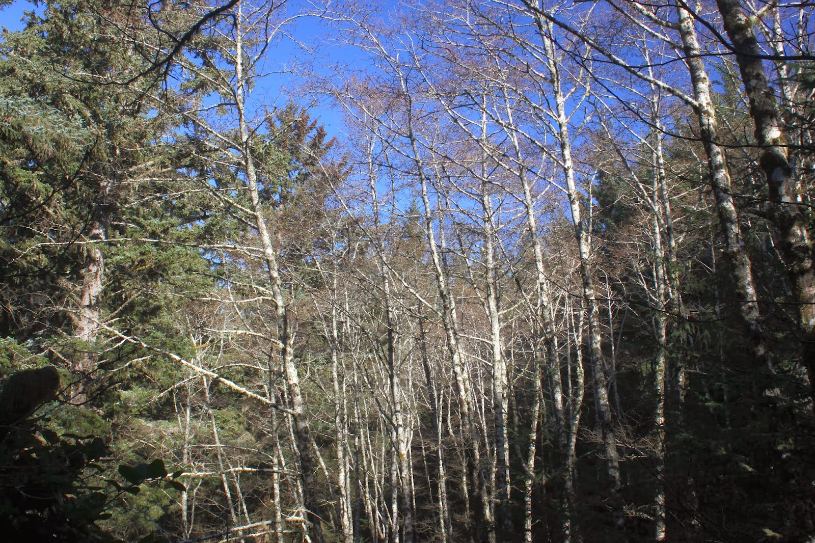 |
| Naked alders |
Much of the trail is spent in beautiful coastal woods that alternated between spruce trees with sunbeams sliding between branches, spotlighting ferns and salal on the forest floor; and bare white-trunked alder trees clawing at the blue sky draped above. Periodically, small breaks in the dense growth provided stunning views of the blue-green ocean with rock islands strewn randomly about like freckles on a face.
 |
Miners Beach
|
Drawing in tourists and visitors are some prominent landmarks such as the aptly named Arch Rock, Thunder Rock, and Natural Bridges. Call me a tourist then, as I stopped often to take pictures of the attractions thereof. After Arch Rock, the OCT dropped precipitously down to idyllic Miners Beach with its photogenic collection of islands and stacks, each crowned with a clump of spruce trees that reminded me of my son's latest haircut.
 |
| Arch Rock |
From there, the trail climbed relentlessly back up to the highway and then dropped back down to the Natural Bridges, consisting of several rock arches with the sea flushing and rushing through the narrow arches like an oceanic enema. Uncharacteristic of January at the Oregon coast, the temperature was in the 60's and I daresay I broke out in a mild sweat.
 |
| Ooh....aah! |
On an uphill section, a pair of hikers were coming down the trail and I stepped aside to let them pass. Equally polite, they stepped aside to let me pass and darn it, I had to keep walking uphill. Lowering my head, I charged up the trail and I heard a confused "...is that Richard?" Turned out it was
Glenn and Carol, my hiking friends from Medford, and we exchanged pleasantries in a nice and unexpected encounter. We both were well out of our normal hiking haunts and the improbability of our encounter kept me chuckling throughout the day, not that I need any help giggling mindlessly.
 |
| Thunder Rock |
My original plan was to hike about 5 miles out and 5 miles back and just under the 4 mile mark, the trail dropped rapidly, switchbacking through a dark forest. A sheer cliff bordered the trail on the right where a large landslide had taken place and I was walking on a new trail that had been routed on top of the slide debris. Coming out of the forest, a bay full of roiling waves greeted me as the trail ended unceremoniously at the ocean's edge.
 |
| End of the trail |
A left turn on the beach would take me round a small point and a beach walk on China Beach before the OCT would climb steeply away to the next adventure on the trail. But with the tide as high as it was, there was no going south today and the hike was cut shorter than intended.
 |
Sunset started as I finished
|
The return trip was even better as the sun sank lower in the sky, providing ample reason to stop and take pictures as the ups and downs became downs and ups on the return leg. The last several climbs back up to the car were particularly taxing and I simultaneously cursed and praised all things Samuel as the afternoon eased into sunset. But mostly I'm grateful to the two Sams for providing a nice 8 mile hike on a sunny winter day, I couldn't have done it without them.
 |
| View through a trail window |
For more pictures of this hike,
please visit the Flickr album.


Looks like you were treated to some great views just as we were. Great to see you at the coast. Will have to check the upcoming hikes for Friends of the Umpqua to see if any are down our way. Feel free to call us if you are coming this way to see if we can hookup for a hike.
ReplyDeleteYou mean actually meet up on a planned basis, lol? Yeah, I'll keep you two in mind as I'll be hiking in the Siskiyous before long if this run of nice weather keeps up
ReplyDelete