Saturday, January 2, 2016

Klamath River Overlook


Ice, ice, baby. I was so excited to go hiking in California's Redwoods National Park and it was quite the frosty letdown to encounter a closed gate at the northern entrance to Prairie Creek State Park. Behind the gate, the road headed uphill underneath the gigantic redwood trees and clearly visible on the pavement was a sheen of ice. No problem, I'd head to the south entrance to the park. Crap, that road was closed too for the same reason. California's reputation for sunny weather and palm trees was greatly exaggerated, if New Year's weekend was any indication.

Ice, ice, baby
So what's a dressed up and incredibly handsome hiker to do when Plans A and B were iced over? Why, go looking for another trail, of course! Several years ago, Dollie and I had been on the section of California Coastal Trail that ran from False Klamath Cove to the Klamath River Overlook and a hasty retreat was beat to the familiar Lagoon Creek trailhead from the frozen wasteland of Prairie Creek.

False Klamath Cove
Starting at the picnic area at Lagoon Creek, it wasn't much warmer but at least the California Coastal Trail (hereafter referred to as the CCT) was not closed. The temperature was 27 degrees and ice crunched noisily under my boots as I set foot on the shady trail. The bridged crossing of Lagoon Creek was just yards away from the parking lot and just yards away from the bridge was the first of several trail junctions. Lagoon Creek is a popular spot as it accesses scenic False Klamath Cove and its beach. 

False Klamath Rock
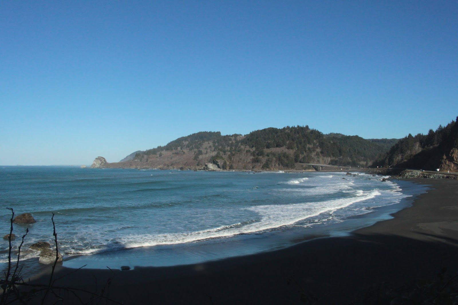
The CCT led out to a viewpoint that offered a grand vista of False Klamath Rock, a pyramid-shaped island at the entrance of False Klamath Cove. There is no True Klamath Rock, it's all falsity and lies here at the cove. The rock and cove got its name from misled sailors from the days of yore who were expecting this cove to be the entrance to the Klamath River. On this day, the sky was a crystalline blue but icicles still formed on my runny nose. A couple from Sweden stopped by to admire the view while I was there and with teeth chattering, they uttered "is, is, baby" which is Swedish for "ice, ice, baby".

Hidden Beach, on the return leg


From the cove overlook, the trail ducked back into the frozen woods and stayed there for several miles, climbing gently up the mountainous coastline. At about the 1.5 mile mark, I took a side trip down to Hidden Beach, a beach which is just that. The secluded cove was littered with driftwood, all coated with ice as the beach was still in shade. Not wanting to risk injury by scrambling over piles of leg-breaking icy logs, I backtracked up to the CCT and continued hiking upwards.

Trees and sky
This is a beautiful trail, there is simply no other way to state it. Ferns flanked the trail and skeletal alder trees raised their white bony fingers to the blue sky. Sunlight slanted through the trees and moss grew everywhere. I know it's not yet spring but candyflower was blooming along the trail, impervious to the cold snap of weather. A few layers of clothing were shed due to the exertion of hiking and life was good.


Ocean view, as the storm blew in
Eventually, the trail crested and at about that point, left the forest and contoured across a steep and grassy slope with "wow" views. The ocean stretched out to the other side of the world and glistened brightly, reflecting the sun in the sky. My pace slowed considerably as I became a slave to my photography muse.


Sun art
Slow as it was, progress was steadily made and the trail terminus at a tourist overlook of the Klamath River was eventually arrived at. The California Coastal Trail runs from Oregon to Mexico but alas, much of the route is on highways and roads. At the overlook, this particular CCT trail section ended with some road hiking to follow for those trekkers continuing south. Lunch and a lollygag at a picnic table was in order and I obliged, while enjoying the view of the mighty Klamath,

The mouth of the Klamath River
The Klamath River met the sea below the trail and a large sand bar blocked most of the river's egress. I've seen pictures of the river taken at different times and the mouth of the river tends to shift in relation to the bar. Today, the river's mouth was on the south side of the bar. As I ate lunch, clouds began to scud in, no doubt it was the predicted storm arriving. It was still pretty cool as the sun poked holes in the thin cloud cover with rays of light dancing and reflecting upon the sea. More photography ensued.

Candyflower


The blue sky disappeared completely during the 4 mile return to the trailhead but it didn't matter, the scenery was unrelentingly fantastic, reminding me once again why I hike. On the walk out to the Klamath River, I had exchanged pleasantries with hikers traveling in the opposite direction. On the way back, we re-exchanged pleasantries, just a bunch of yo-yos yo-yoing back and forth. All in all, a good day except for the relentless beat of "Ice, ice, baby" syncopating in my head in an endless tape loop.

If I don't go in, the deer can't eat me
For more pictures of this hike, please visit the Flickr album.


Friday, January 1, 2016

Point Saint George

It's been getting hard to hike lately. Some of the impediments to happy hiking were self-inflicted like when most October weekends had really cool concerts going on in Eugene. I may have missed a hike or two but on the other hand, I did get to see the Quick and Easy Boys on Halloween night. And all I can say about that is "Halloween in Eugene", no further explanation is needed. The rest of the non-concert weekend travails simply could not be helped, though: illness, holidays, weather, and one very large landslide on Highway 42 all conspired to keep me grounded. Although I was not going to hike 500 miles like I did in 2014, the limp final quarter of 2015 left me at 374 miles for the year. But 2016 is a brand new year and I'd best go hiking or just give it up entirely.

Welcome to sunny California!
New Year's weekend in Roseburg was forecasted to be very cold while on the sunny side. I thought I'd head out to the coast for somewhat warmer temps but that darn landslide meant I'd have to go way north or way south. Since I've hiked everywhere (or so that's what it feels like) on the Oregon coast south of Yachats, I opted to head much farther south and visit Redwoods National Park. 

Bright but cold, just like me!
It was a long and slow drive because all the high points on the drive were all pretty icy. Come to think of it, the low points were equally iced over and the temperature was consistently below 30 degrees until I reached California's Crescent City. There is plenty of snow in the Siskiyous and while the white stuff does not present optimal conditions for hiking, it was nice to look at as I crept along the treacherous roadway. So there I am in Crescent City, half a day spent getting there with half a day left to kill. And that is how I wound up at Point Saint George, a Crescent City landmark.

View to mountainous Oregon
The point sits at the southern end of very large and sweeping Pelican Bay. The view from the top of the windswept and sunny point was stunning, especially since some very large mountains loomed over the northern end of the bay. The mountains in question were Vulcan Peak, Red Mountain, and Chetco Peak, all located in Oregon's Siskiyou Mountains. Hooray for Oregon!


Just watching....
A quick scramble off the point led to the sand below and from there it was a northerly beach walk into Tolowa Dunes State Park. Although the sun was out and the sky was blue, my down jacket stayed on. By all appearances it looked like California but felt like Oregon, or maybe even Iceland. About a mile away from the point, I pretty much had the beach to myself, unless you count the millions of gulls watching me...just watching.

Dead Lake outlet creek
There were several creeks crossing the beach but the outlet creek from Dead Lake was a bit too wide to hop across. Since I was wearing tennis shoes and jeans, it was as good as any other point to turnaround at. So back me and my dry feet go as the sun sank low in the afternoon sky. The gulls moved aside for me as I approached and just watched me...always watching. On the way back, I encountered a couple of beachgoing treasure seekers carrying a fair haul of amber colored agates in a bucket.

The cliffs of Point St. George
Upon my return to Point Saint George, I grabbed a trail that led out to the point and wandered around on top for a bit, taking pictures of the scenic rock islands and stacks just off shore. I called it cold at that point and headed into Crescent City for dinner and lodging. Hopefully, the next day's hike would be just as scenic (it was) but warmer (it wasn't).

Afternoon, in black and white
For more pictures of this hike, please visit the Flickr album.

Saturday, December 26, 2015

North Bank Deer Habitat 12/2015

I have met my nemesis and it is cheesecake. I was good at Christmas dinner and ate just one small slice of the calorie-laden carb-infused delicious goo-on-a-pie-crust. However, the leftovers mysteriously wound up inside our refrigerator and just as mysteriously, a large portion was consumed by some anonymous sugar-eater. It surely wasn't me and that is my story and I'm sticking to it. However, just to be sure, the day after Christmas was an opportune time for yet another calorie burning hike in the North Bank.

Leafless oak on a winter morn
The weather had not been very hiker-friendly in December but there was a short break in the deluges the day after Christmas and grandson Aiden and I were appreciative of the dry weather, although it could have been just a tad bit warmer. Actually, it could have been a lot warmer as the temperature was well below freezing as we set out in the early morning. Aiden was sporting a lot of warm weather clothing, courtesy of Santa Claus. I had received a lightweight hammock and rainfly as my reward for being nice all year (stop with the snickering, already) but the hammock is of little use in cold weather. Aiden must have been nicer for a larger part of the year.

Don't want to talk about it
At any rate, it was a frosty walk to the wet lowland sporting the hilarious name of Soggy Bottoms. I told Aiden that Soggy Bottoms was my nickname in grade school but I didn't want to talk about it. For added emphasis, I hung my head down as if in shame. Without missing a beat, he dropped his head down and said "It happened to me, too". He's from my gene pool, he can't help it.


Ice, waiting for the boy
We took the Soggy Bottoms Road because it is the easiest way to get up to the high ridges of the preserve. Any other trail would be a grueling test of manhood but the Soggy Bottoms Road settles for for merely going uphill. The air was crisp and ice crunched under our feet as we walked. Frozen puddles offered a certain grandson the opportunity of noisily cracking the ice crust.

The pooologist
The habitat's sole reason for existence is to preserve a herd of endangered Columbia white-tailed deer and we saw several deer scampering through the woods of Soggy Bottoms. The cougars consider the habitat to be their fast-food restaurant and we stopped to examine some predator poo which contained hair, bone bits, and maybe a white tail or two. I'm just saying, but pooing bone bits...yikes!

Bad creek!
As we walked, we had to ford several creeks while blue jays shrieked at us as annoyingly shrill as a sister. Soggy Bottoms was just that, and the water laden hillsides had slid down over the trail in a couple of spots. The swollen creeks had taken out part of the road beds here and there and the maintenance crew will have a lot of work to do once things dry out a bit.


Trail, at snow line
"What is that thing?" asked Aiden.  It was white and small, about the  size of a silver dollar. When we picked it up, it was hard but extremely cold.  Yes, it was our first glimpse of snow on Soggy Bottoms. As we reached the head of the valley, we were walking in perma-shade and more and more snow appeared along the trail. We are not talking ski-country snow and snow shoes certainly were not needed, but it was fairly unusual to see the white stuff lying below the leafless oaks.


Why we hike
As the trail left Soggy Bottoms and began angling uphill to the northern ridge, the air temperature dropped considerably and we encountered more and more snow and ice on the way. The views improved as we gained elevation with layers and layers of snow covered peaks dotting the horizon to the south. By the time we reached the Powerline Road and Grumpy's Pond, we were hiking in a veritable winter wonderland. The hills were bald and covered in white (just like my head!) and we enjoyed the scenery as we ate a hurried lunch at Grumpy's Pond. We were not the only ones lunching however, a lone hawk patrolled the snowy fields in search of a tasty mammal morsel.

One small leap for boykind...
Aiden started out being fairly ambitious at the start of the hike and was game for a 10 miler. However, his youthful enthusiasm waned once we reached the top of the boundary ridge. All that puddle stomping had wet his feet and he was getting both tired and uncomfortable so we grabbed the Blacktail Basin Road, which sadly took us out of the snow and down into the soggy bottom of the basin. And thus began the descent and a few moments of wet hilarity at a creek mishap.

Creek, crossing the trail
Because of the long run of wet weather, creeks were full and there was a particularly deep creek running across the trail in Blacktail Basin. I just waded through but Aiden bushwhacked downstream in search of a narrower crossing. The perfect spot for a leap across was found and he took off his hat and lobbed it across the creek. He tried to take off his brand spanking new Christmas winter jacket but the daypack was in the way so he sort of removed both at the same time. Grabbing a shoulder strap, he slung the pack across the creek. Unfortunately, the jacket was still entangled in the pack and while the pack sailed across the creek, the jacket separated in mid-air and floated down into the icy stream. I didn't know jackets could float like that and I didn't know Aiden could run along the bank that fast either. The jacket was safely plucked from the water just as it was about to go over a 4 foot waterfall and disappear forever.  

Tree under the incoming clouds
From there it was a quick walk back to the car as clouds scudded over and took away the blue sky. Obviously, it's time for another round of winter storms, darn it.

We walked in a winter wonderland
For more pictures of this hike, please visit the Flickr album.


Saturday, December 5, 2015

Hall Lake

The rain was just pouring sheets of water early in the morning. Just the kind of morning that causes all good hikers to stow their boots back on the basement shelf and call the hike off. I woke up and readily admitted to Dollie that I really didn't feel like going hiking in the wet and cold weather. But I just knew I'd appear at the library parking lot and three hardcore hikers (actually, I used the term "morons") would show up and I'd have to take them out on the dunes in the crappy weather. And sure enough, waiting for me at the meeting spot lot was Kevin (accompanied by dog Wish) and John, with Rachel later showing up at the trailhead. Yup, three hikers and I called it.

On Planet Arrakis
As it turned out, the weather was not all that bad on the coast. The day was overcast, the temperature cool but not cold, and the wind blustery but about 40 m.p.h below hurricane strength. That would change though, as a nasty storm system was supposed to hit late afternoon so the plan was to keep the hike relatively short and make the great escape back to Roseburg in semi-safe driving conditions.


Must..kill...hiking leader
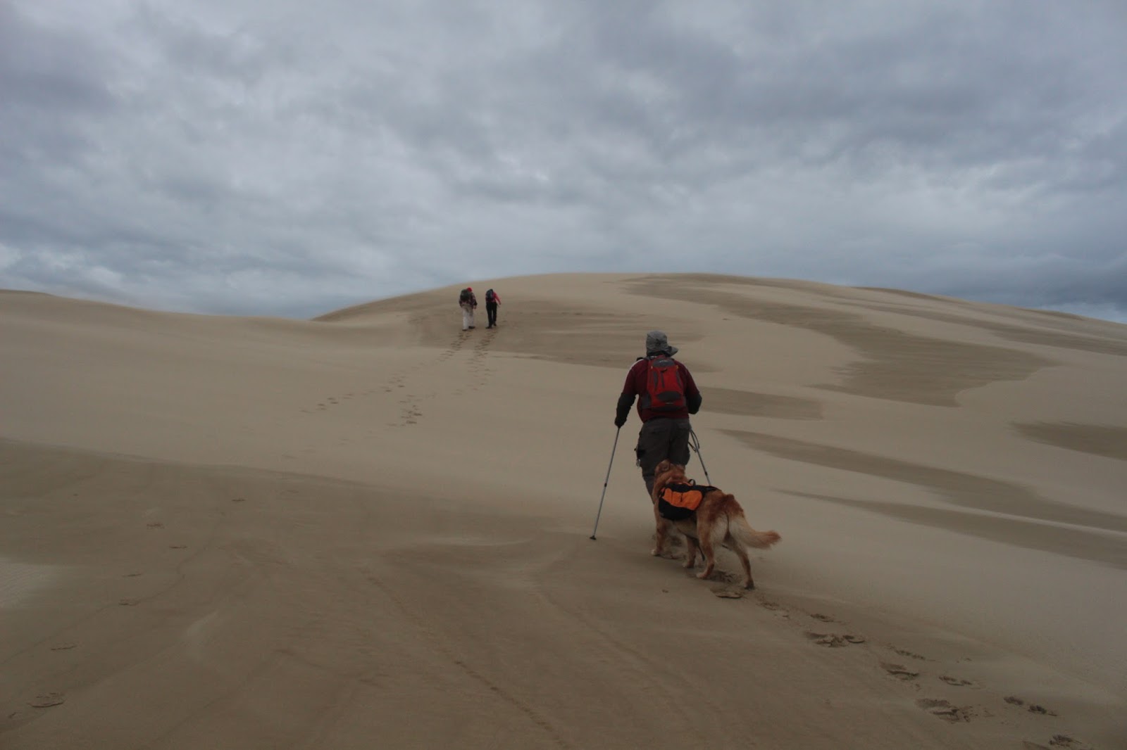
We had all been on Dellenback Dunes many times before, making the unique challenge posed by Dellenback to keep the dunes interesting for erstwhile jaded hikers. One way to ward off hiking ennui is to vary the route. None of my hiking comrades had ever been to Hall Lake before so a challenging hike to the picturesque lake was just the ticket. Upon entry into the expansive dunes an immediate hard right turn was the move that took three-quarters of our group onto a new and different Dellenback Dunes experience. The hard right turn also sent our little band of merry hikers painfully trudging in soft sand up the tallest mountain of sand within several miles.


More ups and downs in our future
This hike would be less about the mileage and more about walking up tall mountains of sand. Once atop the tall first dune, the view of the sandy expanse of Dellenback Dunes was much appreciated by hikers sporting burning leg muscles after less than 0.5 miles of hiking. The ocean was visible under the dark clouds and off in the distance, Arago Peak rose above Cape Arago. Unfortunately, eminently visible to the north was a successive series of sand alps paralleling the tall sand pile we were currently standing on. Ever the cruel hike leader, I pointed out that we would be hiking up and over each tall dune in due time. I get pretty brave when I'm leading just three hikers. 

Grave marker
Down we go and up we went to the top of the second dune, dotted with hummocks of beach grass. The second dune is pretty cool because there is a ghost forest on top. At some point, a thriving knot of trees grew here but were eventually overwhelmed by the marching sands. All that is left of the forest is a tree cemetery comprised of lifeless snags.

Let the skin exfoliation begin!
The third and fourth dunes were not all that tough to climb up, thanks to the elevation gained climbing the second dune, they were each summarily polished off in short order. However, the fifth dune was a rather imposing wall of sand that was hard work to get to the top of. It was two steps up and one slide down in the soft sand as the wind began to increase in velocity. But hiking stubbornness won out in the end and four persevering hikers and one mindlessly happy dog staggered to the top of the fifth dune.

We're number 5!
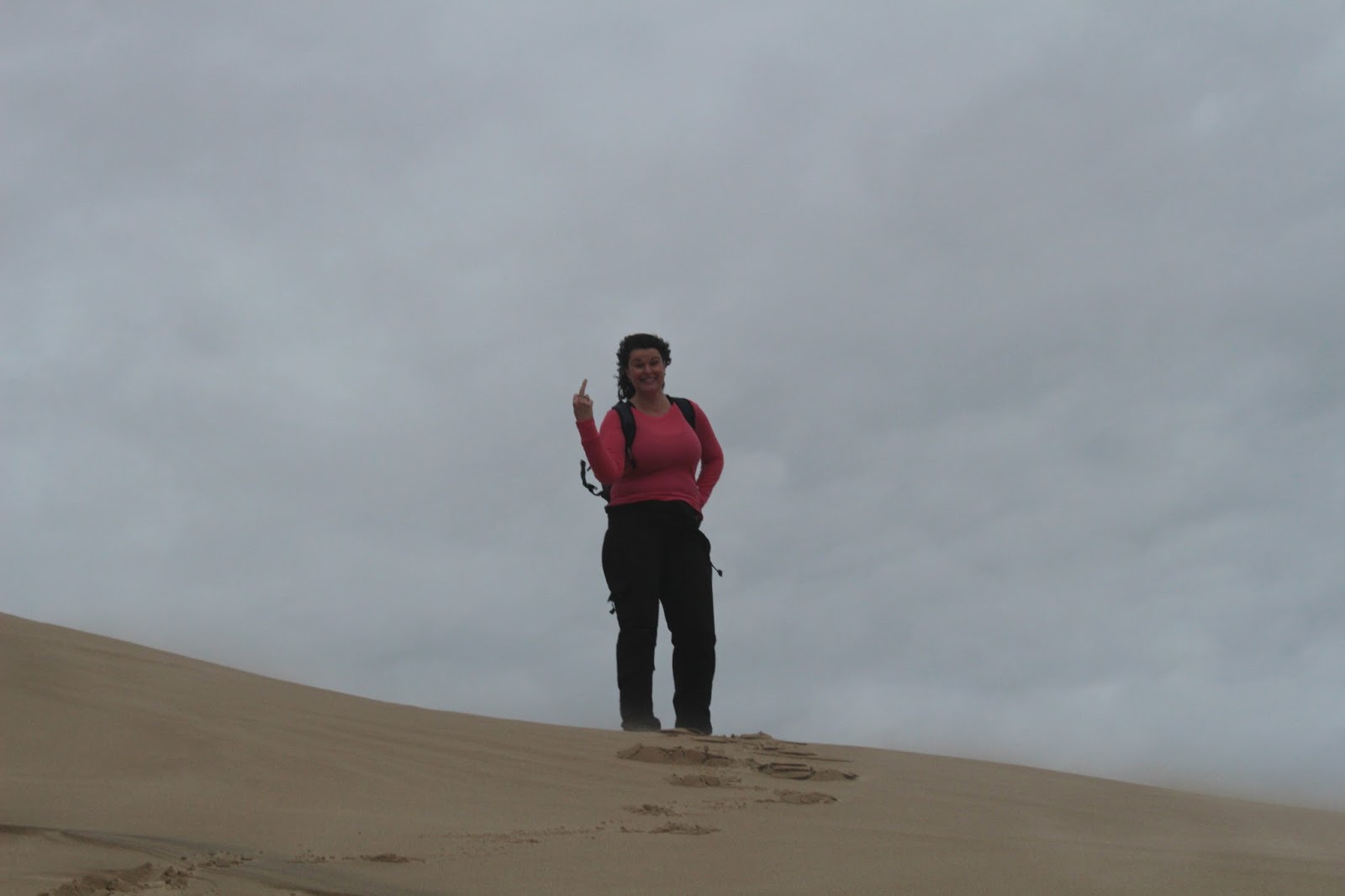
We had been photographically commemorating our dune climbs by holding up fingers denoting the cardinal order of the dunes. That is, we held up two fingers for the second dune, three for the third dune, etc. However, on the fifth dune, Rachel was about four fingers short of five, maybe that is how they mark five in England, I don't know. But the good news was that the fifth dune overlooked Hall Lake.

Hall Lake
Hall Lake sits in a bowl where forest and dune meet, the view of the lake from the dune overlook is impressive. The dark waters invited a closer look-see and accordingly we sat down at the water's edge, grateful to get out of the wind. Lunch was eaten there as tree tops swayed in the boisterous breeze.


Whee!
Because the wind was picking up in advance of the coming storm, an impromptu decision was made to cut the hike short and circle back to the trailhead. So back up to the large dune we went and we were immediately sandblasted by the wind driving fine particulate matter over the dune crest. And to think, people pay thousands of dollars for skin exfoliation and dermabrasion treatments! Walking on top of the dune crest, we were being flayed alive by wind and sand, but at least we no longer had acne. The sand was whipping without mercy at dog level but Wish didn't seem to mind. The route lead downwards, dropping down towards the flat part of the dunes bordering the forest growing behind the beach foredunes. 

Wish takes his human for a walk
From there, it was a series of mild ups and downs before a sandy draw led to the exit point off of the dunes. Later that night, I checked the weather report and 30 foot ocean swells, driven by strong winds, were marching up the Umpqua River at Winchester Bay. Absolutely made the right call in leaving early and we were able to enjoy a nice hike unlike some of our namby-pamby hiking buddies who stayed at home. Plus, we went home with clean and fresh faces, thanks to the wind-supplied skin spa treatments.

Blurred lines
For more pictures of this hike, please visit the Flickr album.


Saturday, November 21, 2015

North Bank Deer Habitat 11/2015

It's always the wife. I know, because I'd been ill with the flu crud for a couple of weeks and had my fill of daytime true crime TV shows. The husband thinks he has a happy marriage and is blissfully unaware that his "loving" wife has been lacing his Jello with Lemon Pledge furniture wax, he just thinks he has the flu crud while his wife knits in the rocker, looking at him and smiling that unsettling smile. The poor guy has absolutely no idea what his scheming wife is up to.  And there I am, thinking I have just the flu crud, and Dollie is just sitting there in the rocking chair, knitting and intensely watching me with an odd little smile on her face. She offers me Jello and I run out of the house screaming. Better to get out on the trail, where it is safe.

Issiah sets sail
Because of that aforementioned flu crud making its way around Roseburg, it'd been several weeks since I'd exercised in any way shape or form so a short hike in the North Bank Deer Habitat with the hiking club fit the bill for my reintroduction to the rigors of the trail. Issiah, my 10 year old grandson, came along to tend to his wobbly grandfather. However, in the North Bank, it is less about the mileage and more about the steep trails so this would not be a hike for namby-pambies, despite the short 5 mile distance.

Trees reach for the sky
It has been raining virtually non-stop in the Pacific Northwest for months and months that feel like years and years. However, on this day between winter storms, the day dawned clear, crisp, and gorgeous as a bowl of unlaced Jello. At the start, the trail ambled gently up and down through a flat known as Soggy Bottoms. But hiking in the habitat will involve some serious uphill at some point and  a left turn onto the North Gate Road marked the start of our North Bank leg cramps.

Let the huffing and puffing begin!
As the trail increased in grade, so did the huffing and puffing from hikers young and old. Didn't take long to start working up a sweat and get overheated, we stopped several times to remove layers of clothing. I think Issiah figured out that removing clothing was a way to cheat and grab an unauthorized rest stop. It wasn't long before we were bringing up the rear of our group, but what else is new?

I hate hiking
Just past the intersection with the Wrong Way Trail, the grade ramped up and the uphill became as serious as untreated flu crud. It was about then that I decided I hate hiking. But at least the sun was out, the views of the valleys below were stunning; or so I've been told, it wasn't me looking at the view when bent over, hands on knees, panting for breath during numerous post-flu rest stops.

Hey, let's make fun of Richard!
Walk uphill enough, and eventually a point is reached where all the bad uphill ends and such was the case when the North Gate Road intersected the Middle Ridge Road. A picnic table was strategically placed there and Issiah and I sat down for lunch as I endured verbal slings and arrows of outrageous fortune from my snarky hiking friends.  Something to do with arriving last but hey, I had a camera AND a 10 year old.

On Middle Ridge
My grandchildren are all fussy eaters, don't like this and don't like that, but they all think sardines are pretty cool. I have strange grandchildren and they have a strange grandfather. So Issiah and I enjoyed a restorative lunch of crackers and sardines on Middle Ridge. I had encouraged Issiah on the big climb by telling him it would be all downhill once we hit Middle Ridge. And as he so often pointed out on the descent, literally that was not quite true.

Running downhill
Yes, we were going downhill but this is the North Bank and even as we lost elevation, there were some steep hills to climb as we descended. Issiah had pretty much given it his all on the climb to Middle Ridge and he trudged slowly with frequent stops every time the trail went uphill, Naturally, we lagged far behind our comrades again.

Exploring, as only children can
At the West Barn Road, the trail dropped (with no uphill portions, this time) down from Middle Ridge to the trailhead and there was much rejoicing from a certain 10 year old grandson. He kept telling me how tired he was, yet he had enough energy to walk on muddy berms and slither into hollowed trees. On the way down, he told me he loved going hiking because in the outdoors there are no sisters yelling all the time. Well, OK, that's not particularly why I go hiking, but any reason to get out onto the trail is good.  Like not eating laced Jello.

Fantastic view to the North Umpqua River
For more pictures of this hike, please visit the Flickr album.