Sunday, September 8, 2013

Tidbits Mountain

Lions and tigers and bears, oh my! In my many trail miles, I've run into the hiking equivalent of those fearsome creatures in the form of bears, rattlesnakes, cougars, and deer. And after last weekend on Tidbits Mountain, yellow jackets have been duly added to the list. At least the bears and cougars ran away from me, but the yellow jackets buzzed angrily towards me en masse with malevolence in their hearts. 

Either a sinkhole or the world's biggest wasp nest
The hike got off to an interesting start when a sign proclaimed the parking lot was closed due to a sinkhole. Stepping around the small pit, we (brother Don and friend Jesse) set out onto the Tidbits Mountain Trail. I must have left my brain in the sinkhole because I'd forgotten to put a fresh battery into the camera. Of course, I didn't realize it until we'd hiked a half-mile or so, I did a quick dash back to the car to retrieve the spare battery. Gotta get my extra miles in, somehow!

Making movies of the trail kind
Hiking for reals now, the trail angled gently for the most part through some beautiful forest typical of the west-side Cascade Mountains: lots of tall fir trees, lush undergrowth, and sunlight filtering through a green canopy of vine maple leaves. On occasion, the trail went steep, and we got to exercise our heavy breathing muscles.  Don was making videos and I was taking pictures, so it was a stop-and-go hike. 

Reenactment of me running from the wasps
About halfway up, I noticed a swarm of flies buzzing on the trail.  Curious, I stopped to see what the buzzing was all about. My mistake! The flies were not flies at all but yellow jackets nesting on the trail. My first inkling that I might have misidentified the insects was communicated to me by the nerve endings in my calves which reported to my brain that my legs were on fire in multiple spots, like a forest the day after a lightning storm. The darn wasps were stinging me and I got my morning sprint in on this hike. And I didn't even get a picture of the wasp nest!

"Trail" to Road 1509
At a wooded saddle, the Tidbits Mountain Trail intersected with a trail that had been long abandoned. Timber and rusting metal marked the site of a former shelter, also long abandoned.  A sign marked this as the Gold Hill Trail and pointed us in the direction of the Tidbits Mountain Lookout, also abandoned a long time ago.  Too bad those yellow jackets couldn't abandon the trail.

Tidbit gives us a finger
After a short climb through the forest, the trail spit us out like chewed up sunflower seeds onto a talus slope right below Tidbits Mountain proper.  From the slope we could see down the Canyon Creek drainage as it emptied into the Santiam River drainage, also visible.  On the western horizon, Mary's Peak on the Coast Range poked up out of the haze.  And above us, small rocky columns on Tidbits Mountain waved greetings, looking like Three-Fingered Jack's other two fingers.

Just about at the summit
A short and steep climb through a forest spit us out like watermelon seeds onto the summit where we whooped with joy. Well, we might have been a bit premature with the whole whooping thing because the actual summit was behind us, requiring another short but steep push up a rock cliff where mild use of hands was required. Apparently, the lookouts used to climb a ladder and the rotting timbers of the ladder still lie on the mountainside.

But who's taking a picture of me?
From the summit, we could see some more stuff.  Tidbits Mountain had a twin and we watched peregrine falcons soar and float around the sheer cliffs.  On the eastern horizon, we had nice views of the Cascades from Diamond Peak to Mount Jefferson, with the Three Sisters being the nearest.  Way cool, and we enjoyed a lengthy lunch and gawk.

Camera gear abandoned to the yellow jackets
On the way down, I got to share the wasp love with Don as he was tagged just before I got tagged a couple of more times on the legs before I could laugh at his discomfiture.  What possessed these yellow jackets to build a nest right on the trail tread?


The children climb Wolf Rock


After the hike, we drove up the Blue River to visit impressive Wolf Rock which had been eminently visible from Tidbits Mountain. Don wanted to take me scrambling up the 1,300 feet or so of cliff to the top of the massive monolith. Heeding the advice of my inner physical therapist, I declined as my surgically repaired wrist is still not ready for such adventure. Don and Jesse scrambled up a rocky amphitheater on their way to the summit while I stayed behind. At least there were no wasps to sting me as I waited for the two tykes to return.
Tidbits Mountain's twin


For more pictures of Tidbits Mountain and Wolf Rock, stop by and visit the Flickr album.

Saturday, September 7, 2013

Little Belknap Crater

Back when my three daughters were infants, I had occasion to change their diapers despite my best efforts to avoid that onerous chore. Peeling back the diaper, it never ceased to amaze me how much ejecta could emanate from such a small source, just like Little Belknap Crater. And isn't ejecta such a nice word for <censored!>?.

Sunscreen is required
Surrounded by tall volcanoes such as the Three Sisters, Mount Washington, Black Crater, and Belknap Crater, the wee volcanic pimple that is Little Belknap Crater is the source for most of the lava flows in the McKenzie Pass area with the amount of lava totally incommensurate with the diminutive size of the small cone. But all that lava makes for an interesting and moderate hike on the Pacific Crest Trail through a stark moonscape comprised of all that black rock ejecta.

Mountain ash berries, in another sign fall is here
The Pacific Crest Trail begins in a forest as it contours up and over and around a pair of tree islands spared the destruction from the lava flows of a bygone age or two.  Huckleberry bushes, totally gleaned of the delicious berries by passing hikers, were all turning red in a sad reminder that this summer is about to end.  


Rough trail
Entering the lava lands, it was time to say bye-bye to all the nice trees as it would be several miles before I'd see a live tree again. The PCT trail tread has been chiseled into the rock and was always easy to follow as it gained elevation. Round rocks rolled under my boots and one really has to step carefully to avoid a twisted ankle. Every where I looked was jagged rock and I gave silent thanks that there was a trail to walk on, it'd be nearly impossible to travel cross county here.

Belknap Crater
Since there were no trees, there was plenty of stuff to see under a crystal clear blue sky. To the south, North and Middle Sister dominated the view, with glaciers clinging to each sister for dear life. Nearer and to the east, was the aptly named Black Crater, although it looks red from the Matthieu Lakes. But the north grabbed my interest the most as the PCT kept me pointed to the sandy tan cone of Belknap Crater and the inconsequential little red mound that is Little Belknap Crater.

The "forest" on Little Belknap Crater
I actually saw two live, albeit stunted, trees attempting to survive in a lava field. A clump of dead white trees which I dubbed the "Little Belknap National Forest" gave mute testimony to the precarious existence in a would-be lava bed arboretum.


Signpost in the middle of nowhere


After a couple of miles, a sign post seemingly in the middle of a black rock nowhere proclaimed the junction with the Little Belknap Crater Trail. A short walk down this equally rugged trail lead to its namesake crater. 

North and Middle Sisters entertained all day


Up close, Little Belknap Crater did not look so little, a short but steep scramble up a bright red cliff with the scramble involving some use of hands, delivered me to the crater's summit. The views were tremendous, as from the top one can see the rivers of lava carving their way through the lowlands below the surrounding mountains.  

Mount Washington and friends
Despite the sunny day, a chill wind blew and I quickly donned a jacket and sought a lunchtime shelter in the fancy summit windbreak, complete with a couple of benches.  Food tastes better with great views, and I enjoyed the already-mentioned Sisters but to the north I now could see Mount Washington, Three-Fingered Jack, and Mount Jefferson.  

Belknap Crater lost the argument
After the Little Belknap Crater lunch-and-gawk, a short hike further on the PCT brought me to the forested jump-off point for the Belknap Crater climb. I had a little argument with myself because I had already been on Belknap Crater but I'd never been farther north on the PCT. In the end, I decided to continue on the PCT in search of a closer look at Mount Washington; I guess I both lost and won the argument.

Entering the burn zone
Forests must be a precious commodity here because about a half mile past Belknap Crater, the PCT entered a forest that had been recently burned in a wildfire and I walked in a graveyard of trees. Between Belknap Crater and Mount Washington, there is a large ravine of sorts and the trail began losing elevation at an alarming rate, my joy at walking downhill tempered by the knowledge I'd surely have to walk back up.

Mount Washington

Near the bottom of the slope, the snags opened up enough for an iconic picture of Mount Washington, its rocky needle rising above all the burned trees. On the return leg, I actually encountered more hikers while heading down to the car late in the day. My candidate for father of the year was a gentleman taking his three young sons on an overnight camping trip in all the ejecta.

For more pictures of this scenic hike, please stop by and visit the Flickr album.

Saturday, August 31, 2013

Cowhorn Mountain

Cowhorn Mountain used to be a lot taller. But in 1911 a storm dehorned the mountain like a bleating 4-H project lamb. However, the natural desecration of an iconic landmark can be cause for celebration as the mountain summit is now much easier to attain.  

Cowhorn Mountain, from the Pacific Crest Trail
So with an "everybody say moo" where I was the only one mooing, the Friends of the Umpqua Hiking Club sallied forth onto the Pacific Crest Trail on a beautiful, albeit very warm, day. My recollection of this trail from prior hikes was that it was a  4 mile gradual climb to the mountain but the climb didn't seem all that gradual on this day. More than likely it was just me, the trail probably didn't steepen since the last time I hiked here.

One of the Windigo Lakes
The trail basically followed a rocky ridge leading straight to the 'horn. Most of the time was spent in the forest with occasional views to the local landmarks of Mount Thielsen, Mount Bailey, and the two Windigo Lakes below the trail. It wasn't long before camera-addicted hikers such as myself lagged far behind the main group.

We have to climb that?!


Periodically, we had nice views of Cowhorn Mountain which always looked insurmountably craggy and always was demoralizingly much higher than our viewpoints. Eventually the PCT brought us to the base of the mountain where a rock cairn marked the trail jump-off point.


Up, up, up....
Whew!  The trail immediately shot straight up the mountain in soft brown and black pumice. The trees thinned out and those trees attempting life on the mountain were gnarled and stunted. The slopes were littered with dead trees glinting white like bony skeletons. The top of the hill was actually a saddle and false summit combo where we traded black lava for bright red lava, it was like the mountain version of Jupiter's red spot.


Only another half a cowhorn to go
Jane and Robin were  lunching there, content to soak in the views from halfway up the mountain when I arrived.  The peak's jagged summit was right above us and I could see the little dots on top that was the remainder of the hiking club. Unfortunately, I could also see the faint path zigzagging back and forth up the spine of the crest leading to the summit. I tell you, I need to quit looking ahead.

Crescent Lake distracts from the scramble up
Just short of the summit, the path petered out altogether and the summit was attained by scrambling up a rocky stairway.  Use of hands is required and I put my surgically repaired wrist to the test. As I neared the summit, I could hear the heathens on top saying "Here comes yon laggard" or something along those lines.

Diamond Peak and Summit Lake
Cowhorn Mountain sports one of the best views in the Oregon Cascades. Directly to the north was large Crescent Lake, it's sapphire waters in a bowl surrounded by miles of forest. Surrounding the lake were a number of lesser lakes comprising the Windy Lakes and the Oldenburg Lakes.


Sawtooth Peak


We could see some mountains too, notably Diamond Peak and immediate neighbor Sawtooth Peak. In the far distance were snowy North Sister, Middle Sister, and the top of Mount Jefferson.


Al, on the Cowhorn dismount
After lunch, we picked our way carefully down the mountain where all that leg-braking left my legs wobbly as a jellyfish in a sea current. Walking 4 miles back to the car on tired legs in the heat made for slow going and I straggled in behind everybody else. It could have been worse, though, Cowhorn Mountain could have its horn and be taller than it is now.

The Pacific Crest Trail
For more pictures of the hike, please visit the Flickr album.     

Sunday, August 18, 2013

Matthieu Lakes Loop

For most of this summer, southwest Oregon had been on fire. We've had to give up hiking along the Rogue River, the Illinois River, and up the South Umpqua River. To a lesser extent, we've also had to give up blue summer skies as a smoky haze periodically filled the Umpqua Basin, depending on how the wind blew that day. But the fire gods have been kinder north of us and on a crisp clear day on McKenzie Pass, I gave thanks for smoke free air. Of course, my thanks were somewhat in vain as fire did eventually become part of my hike, but more on that later.

Gotta love that wilderness solitude


It was a gorgeous day at McKenzie Pass, nary a cloud in the sky, a breeze kept things cool, and the air sparkled with clarity. Of course, a nice day just invited like-minded people and the Pacific Crest Trail parking lot at Lava Camp Lake was full of cars, backpackers, and day hikers. One gentleman with two young boys stopped by to ask for directions to North Matthieu Lake as I was lacing up my boots. Carry a map, boys and girls, your family and your local search and rescue department will thank you.

Happy place!
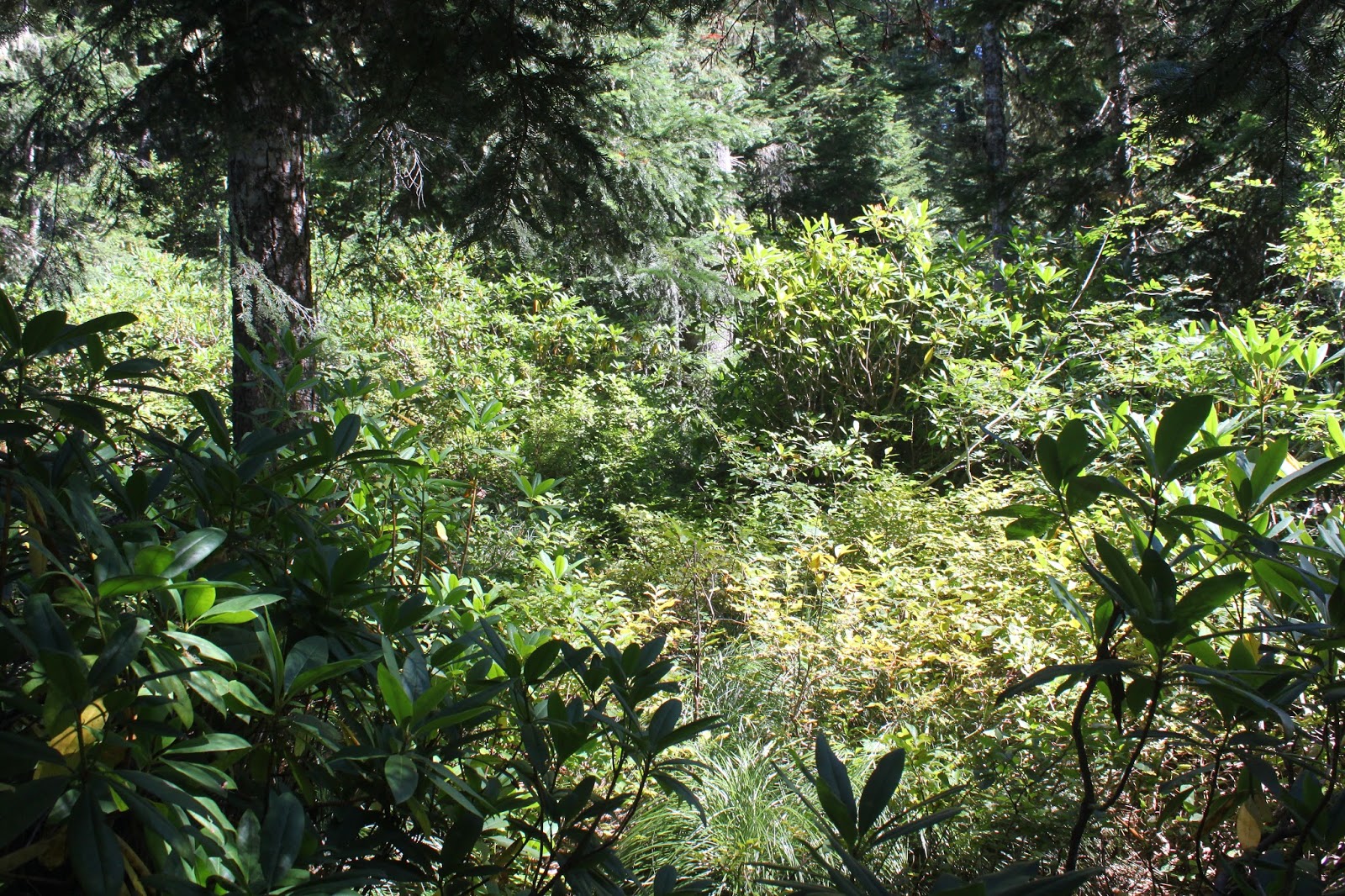
Entering the Three Sisters Wilderness, the first part of the hike was in viewless forest (with no mosquitoes!) on the Pacific Crest Trail, hereafter referred to as the PCT. There were a number of through hikers on their way to Canada. The through hikers were easy to distinguish from the weekenders due to their athletic builds, light packs, and a certain "air" about them that lingered in the forest long after they passed by. At about 1.5 miles of steady climbing, the PCT left the forest and the fun stuff started.

Ooh...aah!
These are lava lands and rivers of black rock coursed along the trail before emptying into a black rock sea. Small cones dotted the landscape like geological gooseflesh, but it was the larger peaks of the Cascades that commanded attention. Spaced equidistant and arrayed in a row like trail cairns for the hiking gods, were the volcanoes of Belknap Crater, Mount Washington, Three-Fingered Jack, Mount Jefferson, and 80 mile distant Mount Hood.  Truly a vista for the ages,

South Matthieu Lake
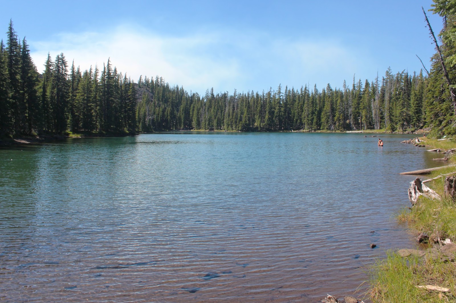
At around the 3 mile mark at Scott Pass, South Matthieu Lake lay nestled between the two red cones flanking the high pass.  From the north side of the lake loomed nearby Black Crater, looking more red than black.  But it was the south side view that stole the show as the upper half of craggy North Sister loomed over the blue lake.  A breeze was blowing but the reflection must be particularly beautiful on a calm morn.

"Richard...Richard..."


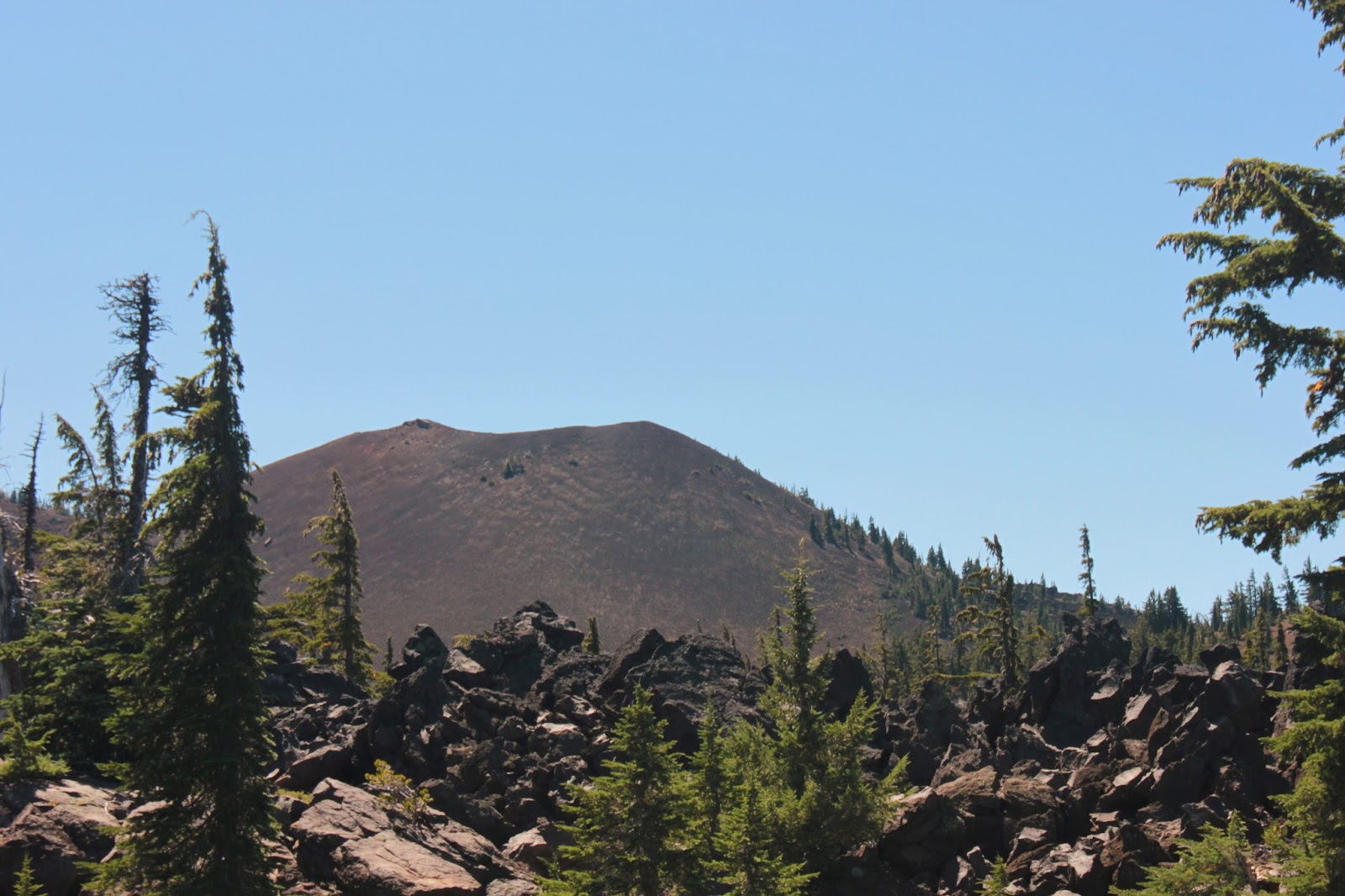
I hadn't planned to hike very far as it had been a 3.5 hour drive to the trailhead.  I figured I'd just grab the trail to North Matthieu Lake and then loop back to the trailhead for a moderate 6 miler. But Yapoah Crater, a symmetrical cinder cone responsible for the massive lava flow next to the PCT, called me "Richard...Richard..." My feet began moving and it was futile to resist.

No shade for me


Leaving South Matthieu Lake it was just me and acres and miles of black rock with North Sister looking down at me like the big sister she is. The wind died and I began to bake like a spaghetti squash with the crunch-crunch of footsteps in pumice as my only companion. At the base of of the crater, the PCT snaked its way up and around the cone.


At the base of Yapoah Crater


A tip of the hat to the Yapoah Crater groundskeepers is in order, here. The cone was perfectly conical and the grounds were seemingly raked smooth as a major league baseball diamond. I briefly entertained a notion of hiking to the top of the crater but it was way too hot and I still had to hike around the cinder cone to get to the summit use trail. Saving a crater climb for a cooler day, I turned around and headed back north on the PCT.

Wildfire smoke arrives at North Matthieu Lake
On the return to Scott Pass, I did take the trail to North Matthieu Lake which dropped several hundred feet below the PCT.  A short downhill hike brought me to North Matthieu Lake where I exchanged pleasantries with the weekenders ringing the shoreline. I was glad to see the guy with his two sons had found the lake because of, or in spite of, my directions. As I left I caught a whiff of campfire smoke.

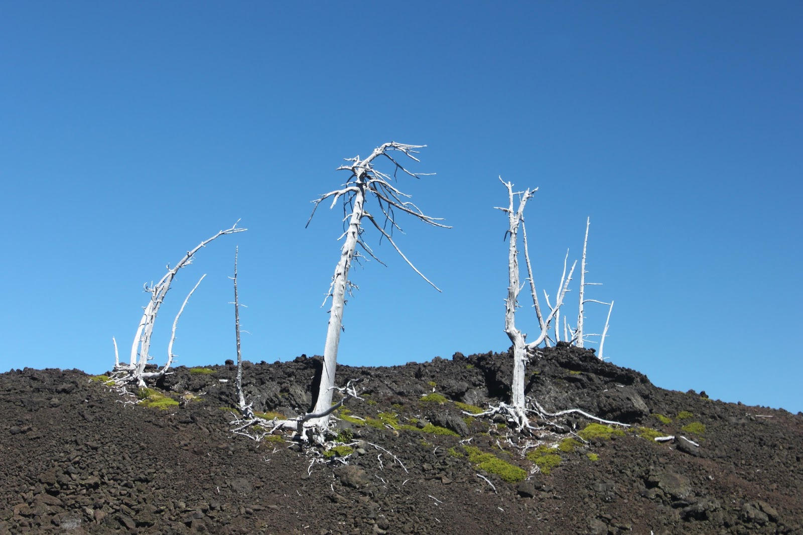
Orange light indicated a fire was nearby


Internally hurling invective at stupid campers willfully ignoring a fire ban in fire season, I continued hiking. However, the weird orange color that happens when sunlight filters through a seine of smoke began to color the air. The forest filled up with thick smoke and ash flakes flitted through the trees like moths of death. And I had no idea where the fire was. The hikers I encountered on the trail had no idea either. I soldiered on quickly, listening for the crackling of flames while plotting escape routes should it come to that. Disconcerting, to put it mildly.


Yapoah Crater's lava flow
As it turned out, 4 miles away, the Hand Lake Fire decided to announce its presence that afternoon. By the time I drove home a massive plume was rising from the lake basin like an ashy tornado. Fire fighters and equipment were gathering at the Hand Lake Trailhead where I found out they don't like cars to stop and take pictures. Despite that failing, a round of applause for the fine work they do as the Hand Lake Fire was fully suppressed after it had grown to ten acres.

For more pictures of this hike, but not the fire (I put my camera away and walked fast to the car, sorry I wasn't thinking about my readers), see the Flickr album.

A time to reflect


Saturday, August 10, 2013

New River

About 150 years ago it rained in Oregon. Not an especially rare event but on this particular occasion it rained enough to fill up the rivers. In other parts of the world, this is referred to as "flooding" but as "just another storm" in our little waterlogged corner of the sandbox. So, you can imagine the surprise farmers and ranchers residing in the Langlois area felt when they found a river coursing through their pastures, no doubt causing cow's milk to sour while still in the udder. The obvious observation to be made in this case was something along the lines of "Hey, that's a new river!" And that, roughly, is how the New River came to be.

If not the New, then it's good as New
The New River is a work in progress as its mouth has migrated quite a bit north over the years. In fact, the mouth of the river is about 5 miles further north than the current maps show, answering the question of where does a river go: anywhere it wants to. The New River parallels the Oregon coast directly behind the beach foredunes and I've bumped into the New a time or two on various hikes, but this would be the first time I'd ever visited the New River Natural Area.

Manzanita trunk after the morning rain
The trails in the New River are too short for my standards but since 5-year old Coral Rae was spending a weekend with Grandpa, the New River was just right for both new and old hikers.  Beginning at the nature center, we grabbed a sandy track through coastal woods bursting with the green growth of madrones, manzanita, salal, rhododendrons, and huckleberries.

Hey, we have a hike to finish!


Ah yes, the huckleberries. Intent on imparting my formidable fount of knowledge to the young, I showed Coral Rae how to distinguish the huckleberries from all the other greenery. Of course, the berries kind of helped with the plant identification. Once Coral Rae sampled a single berry, she grazed with the best of them. It was slow going because she apparently wanted to eat every berry she saw.

That's my girl!
We took a berry break and ate lunch at boat ramp next to the New River.  The River was shallow but fairly wide and neither one of us wanted to wade across to the beach, particularly as the weather was threatening rain.  Coral Rae found a small garter snake and just like a true descendant of mine, she touched the slithering reptile on its back.  My heart nearly burst with pride!

Slug aerodynamics
This was definitely a tactile hike as Coral Rae had to touch everything from soft moss to slimy slugs.  There were a number of large slugs on the trail and she carefully transported several of them to safety off trail.  On one occasion, the slug rescue was rewarded with a discovery of a thicket of ripe blackberries.


When I grow up I want to be a purple poop pooper


Speaking of ripe berries, we came across some bear poop, stained purple from the berries.  Coral voiced her ambition to eat enough berries to turn her poop purple. It's nice to have goals.


Insect social on a Queen Anne's Lace
After visiting Mud Lake, which was not muddy, we returned back to the nature center, closing out this three mile hike. Inside the center, animal skulls were arrayed on a table and much skull touching ensued from a delighted 5-year old before we headed back to Roseburg.

For more pictures of this short hike on the coast, please visit the Flickr album.