Tuesday, August 7, 2012

My summer vacation

Last month, we took the entire month off and headed up north to British Columbia. The hiking adventures will and have been documented in stand-alone posts but I thought I'd gather up the loose ends of the trip to beautiful Rossland in British Columbia and post them in this missive.

The Columbia River, at Trail

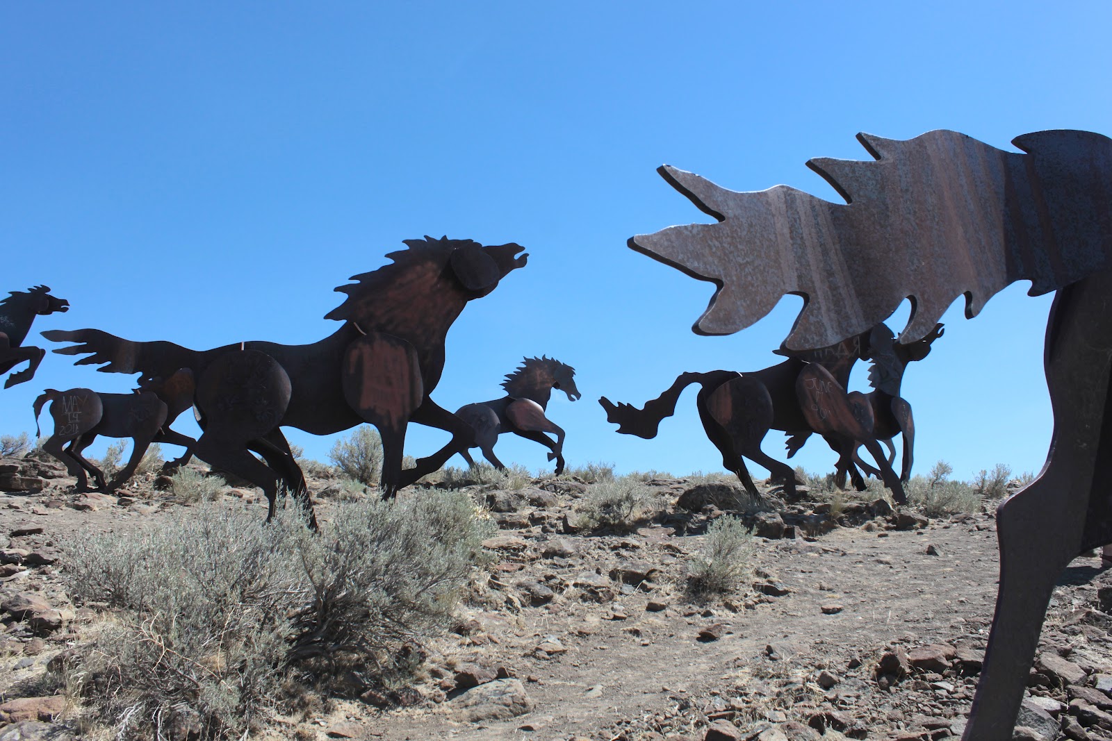
After hiking up Bear Creek Mountain with Jim, we left Yakima and headed up to Spokane. On the way we broke up the trip by cruising the Wild Horse Monument overlooking the Columbia Gorge in central Washington. The monument is a collection of metal horses, collectively known as the sculpture "Grandfather Releases The Ponies" which while growing up, was time for us children to leave the room in a hurry.

Horsies!

Horseshoe Lake at night


In Spokane we camped at Horseshoe Lake and I had fun despite having to spend an entire day with Dollie's family. And if any of the inlaws reads this:  relax, I say the same thing about my family. And if any of my family reads this: I didn't know  you had Internet. When evening fell we launched a firework over the lake and then spent the rest of the evening searching for Maggie as her little dog brain can't handle loud explosions. I finally found her walking along the road about a mile away.

The Columbia River


In Rossland, British Columbia, we enjoyed a super hike on the Seven Summits Trail. We also ambled around Nancy Greene Lake, named after a local skier who won a gold medal in the Grenoble Olympics. It was a short and pleasant walk that didn't quite rise to the level of "hike". Other activities we partook of while in Rossland were daily afternoon dips in the Columbia River where retired miners recounted old mining stories, a bike ride in Trail, a car tour up the Kootenay River to Nelson, and a visit to a winery that had a red wine to die for.


All the Rossland fun would not have taken place without our host Sabra and her cohort Scotty. We are absolutely indebted to you two.

Monday, August 6, 2012

Seven Summits Trail

Sabra and co-host Scott on the trail
Hooray, it's summer vacation time in the O'Neill household! Our previous hike into the Washington's Goat Rocks was the opening salvo. Migrating north like Canada geese in spring, but with considerably less honking, we found ourselves in Rossland, British Columbia and yes, we were in Canada.


Sabra, our host, suggested we hike on the Seven Summits Trail and all I needed to hear was "Seven Summits" and I was in. The Seven Summits Trail is primarily renown as an epic 22-mile mountain biking trail and we shared the trail with many bikers who were mostly walking their bikes up the trail, a steep trail being the apparent equalizer between hikers and bikers.

Indian paintbrush along the trail

Sabra, Dollie, Moose,
John, and me
Joined by new found Canadian friends Sabra, Scott, John, and Moose (you know you are in Canada when you have a friend named Moose), we set out on the trail which initially was fairly level through a wooded forest. But that would change and change it did as we started to climb through the wooded trail. At nearly two miles, Dollie and I found ourselves well ahead of the Canadian contingent and we had to backtrack to rejoin the group at the Sun Spot, a viewless backwoods shelter.


Mount Crowe
Continuing on, Dollie and I hiked to Lepsoe Basin, a relatively nondescript open spot on the slopes of Mount Lepsoe. We enjoyed  a nice view of Mount Crowe (no relation to Russell) as we lunched on a rocky bench. After lunch, the trail went uphill in earnest, contouring relentlessly upwards through the woods.
The reason we hike
After several miles, we encountered a hiking group coming downhill and they advised us to keep going as there were good views near the Lepsoe summit. We were wondering at the time whether to keep going or not and we were glad we heeded their advice.

Old Glory, in all its glory
The forest did thin out, spitting us out into wildflowered meadows under a blue sky while the trail grade eased up a couple of percentage points. We could see some stuff, too, Old Glory being the nearest mountain with a deep river valley below. In the distance were some very large mountains, begging another visit to this beautiful corner of British Columbia.


Orange agoseris
We turned around where the trail began to descend to a saddle between Mounts Lepsoe and Plewman, bikers literally whooped with joy at the descent. We enjoyed the scenery all over again on the way back while picturesque thunderheads formed over Mount Crowe. I wasn't even disappointed we bagged only one out of seven mountains.


Thursday, August 2, 2012

Bear Creek Mountain

Peaks of the Goat Rocks Wilderness


I always figured Washington's Goat Rocks was named after goats clambering on the rocks. Webshots buddy Jim (who resides in nearby Yakima and who also agreed to tour-guide Dollie and I into the Rocks) even stated we might see some goats on this hike. However, after driving on one of the worst forest roads ever (with much oil pan banging, bumper scraping, and wife sighing) I am now of the opinion Goat Rocks was named for all the rocks and boulders in the road and for the fact the road is suitable for high clearance, four-wheel drive goats only.

But the main thing is we made it and therefore we set out on the Bear Creek Mountain Trail, passing a wet puddle in a meadow that went by the simultaneously grand and bland name of Section 3 Lake. It wasn't long before the trail entered a series of alpine meadows, the grass being just an inch or two in height like a putting green due to recently departed snow. A mile or two ahead loomed a snow-flecked ridge which would be our destination.

Happiness is a flat trail in a meadow

Ever get that sinking feeling?
About halfway through the hike, we started to enter intermittent snowfields gone slushy with the onset of summer. The thawing snow ran downhill, proliferating many mud holes and rushing creeks. I stepped into a muddy spot and my foot kept sinking and sinking, virtually all the way to my knee before I pushed off with the other foot. I probably would have appeared in China the way I was sinking, blasted quicksand.


At the base of a rocky and snowy wall, Jim stopped and said, somewhat sheepishly "This is where Dollie will start to hate me." The trail, which was sketchy at this point, disappeared under a large patch of snow so we just scrambled up the scree and talus towards the top of the ridge, kick-stepping our way carefully through the snow. Maggie, our dog, was cavorting merrily in the snow and swimming in ponds of glacial melt. She had to wait for us quite a bit as we were nowhere as nimble and agile.

Humans are, like, so slow

Blame them all!


Dollie hates stepping in mud, scrambling up scree slopes, sloshing through wet creek fords, and kick-stepping in snow; Jim delivered all of these things, totally unaware of the peril he had placed himself in. Of course, my fall-back defensive position was "Hey, it's Jim's hike, blame him!"


Mount Ranier, from Bear Creek Mountain


No worries, though, as we made it to the top of the ridge and were able to resume walking on bona fide trail tread again. A short walk brought us to the top of  Bear Creek Mountain and a view for the ages. Bear Creek Mountain was situated equidistant between Mount Adams and Mount Ranier, each with clouds draped upon their snowy cones. A jumble of snowy peaks marked the Goat Rocks Wilderness with the actual Goat Rocks mixed in with some of the other mountains.


Another reason it's called Goat Rocks

Such a view requires a lengthy taking in thereof and we obliged, snapping pictures while Jim and I talked peaks, hikes, gear, cameras, and wildflowers like a couple of hiking geeks. We could see a couple picking their way up the same slope we did but the guy did not appear to be afraid of his wife. To be fair, the views were so awesome and stunning that Dollie was (as was I) quite grateful to Jim for being gracious enough to take us up here.


Good thing I have the car keys!
All good things must come to an end, though, and we commenced to picking our way carefully off of the mountain. Dollie three-pointed quite a bit, putting one hand on the rocks, mud, and/or snow each time she slipped but never actually completing a fall. We made it safely out, despite the oil-pan banging and the bumper scraping, and this wound up being one of the best hikes I've ever been on. I need to come back to the Goat Rocks again, only next time in a high-high clearance vehicle.


Saturday, July 28, 2012

Bandon cycle trip

My view for 92 miles
Occasionally, a hiking weekend is set aside for a bike hike.  In this case, it seemed simple: A ride with our Umpqua Velo Club friends from from Frona Park, located about 18 miles northeast of Myrtle Point. The mileage was 46 miles to Bandon which sounds simple enough, as long as the 4 hills in between aren't mentioned.


Because the going was so tough, I did not take any pictures on the ride other than a few desultory shots of Dollie pedalling ahead of me. We arrived in Coquille and lunched at a vegetable stand which despite its main raison d'etre, does a fine double duty as a deli and taqueria. Nothing like a hot Texas Burrito to raise the spirits of a flagging biker.

Umpqua Velo Club
The cutoff from Coquille to Bandon had filled me with dread because the West Beaver Hill Road is the usual route for going to the coast on all our hikes. The grade makes our car tired, we didn't have a chance on bikes. We did get halfway up the 12% grade before hopping off the bikes and walking off the remaining climb. Some of our velo mates passed us, pedalling well into granny gear but not travelling much faster than our walking speed.

 
Riding from Whiskey Run

Once across Highway 101, the road leveled out and Dollie resumed speaking to me. An exhilarating drop took us down to Whiskey Run Beach where we took a lollygag, walking across the sand all the way to the water's edge. Some cyclists actually walked their bikes to the shore, ritually dipping wheels into the  Pacific Ocean.

Whiskey Run Beach

A short sub-10 mile ride brought us to Bandon where we were assigned the very same apartment we had stayed in when we rode the Oregon Coast several years ago.  Harold and Susan were booked next door, too. The club regrouped and ate a nice dinner in town, exchanging war stories of the ride.

Blinded by the light

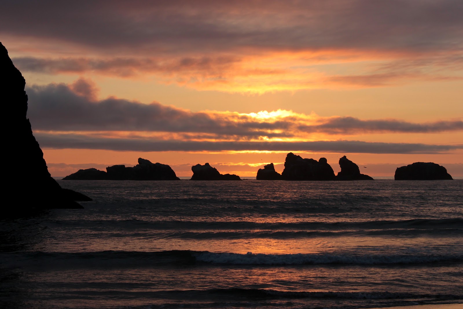
After dinner, Harold, Susan, Dollie and I strolled on the beach to work off the hamburgers and to enjoy the sunset on scenic Bandon Beach. The sunset did not disappoint and much photography ensued before returning to the motel. We went to bed early, as we had the trip in reverse to ride the next morning.

Sunset


So, the next morning, it was the same up and down the over the same 4 formidable hills in the same 46 miles. I think we cycle because it's fun, but at times I'm not sure how much fun we are having. Maybe it's for the sunsets...yeah, that must be it.
Oooh, aaaah...


Saturday, July 21, 2012

Lower Berley Lake

Ssssssssss..... 

Stupid snow!
That is the sound of the air being let out of this "lakepalooza" hiking balloon. Originally, the plan was to hike the Oregon Skyline Trail and visit 5 lakes before camping at the sixth lake: Jorn Lake. However, snow on the ground insured that only one lake on the itinerary would be visited.


Look Ma, no trees!
Beginning at Santiam Pass, the first two miles of the Pacific Crest Trail climbed gently through the burn zone of 2003's B&B Fire. Ghostly white snags were all that remained of the forest but the increased sunlight gave rise to a vigorous green undergrowth comprised of bear grass, bracken fern, and wildflowers of every color.


Lupine
The openness of the forest combined with a gentle breeze made for a mosquitoless hike at first and the bottle of insect repellent was stored away in my pack. The lack of trees also helped the views, particularly to Mount Washington with North and Middle Sister peeking from behind.

Hmm, I wonder where mosquitoes come from
At a low saddle crowned by a rocky pile, I bid adieu to the Pacific Crest Trail and descended gently into the Lost Creek canyon. Leaving the dead forest, I entered the live forest and the high-pitched whine of millions of mosquito wings proclaimed the one-sided joy of mosquito and hiker reunion. A frantic applique of repellent was quickly slathered on in panic.


Lower Berley Lake on the first visit
At a rock cairn at a faint use trail, I dropped my pack and headed to Lower Berley Lake. Water dogs splashed in the shallows, startled by my arrival. The tip of Three Fingered Jack was just visible from the lake. After snapping a few pictures, I hoisted my pack and continued on the Santiam Lake Trail, unaware at the time that Lower Berley Lake would wind up being the only lake successfully visited on this hike.

A long and dusty trail
The next mile or so was through a dry and dusty plain comprised of volcanic ash.  The soft sand is so much fun to hike through with a fully loaded pack, and yes I am being sarcastic. Cresting at a wooded saddle at 5400 feet of elevation, the trail disappeared under a large snowdrift.

Stupid snow...redux

For the next mile or so, the going was fairly tedious as a search for trail tread ensued after each snowdrift crossing. Descending rapidly, the snow got deeper and deeper in indirect proportion to the loss of elevation. The trail finally disappeared for good just after passing a small unnamed lake. Camping at the lake was briefly considered but rejected due to the muddiness of the surrounding earth that was not covered by snow.


Lower Berley Lake on the second visit


So back up through slushy snow, so much fun with a fully loaded pack and there's some more sarcasm for you. Retracing my steps through the dry and dusty plain, I set up camp on a dusty bench above Lower Berley Lake, startling two ducks in the process. To be fair and balanced, a galloping horse coming up the trail startled me, balancing out the fear factor, especially since the horse was equally startled. Oh, the rider was startled because the horse was startled because I was startled and let us not forget the ducks were startled too.  


A fingernail of Three Fingered Jack

After watching the last light of the day on the tip of Three Fingered Jack, I slept in the open, suitably awestruck by the Milky Way glowing above this very small and insignificant (in the larger scheme of things) hiker. In hindsight, sleeping in the open was not the greatest idea because my sleeping bag became quite soggy due to the dew.


No mosquitoes!


After all the backtracking done the day before, it was a short three miles back to the trailhead. And best of all, most of the three miles were done without the benefit of mosquitoes.


Sunday, July 15, 2012

Buck Canyon

This year, discerning readers will note that I've been hiking either on the coast or in the Siskiyous.  The Cascades have been ignored just like the tatooed in-law at Thanksgiving dinner who was just released from prison. But the Cascades do have some beautiful scenery and they are closer to my home; eventually I had to make a foray into the heretofore ignored mountain range. So, on a beautiful sunny day, Maggie the Hiking Dog and I found ourselves in Buck Canyon, waiting to get bit by hordes of buzzing mosquitoes.

My mosquito fear was not misplaced. Several years ago, Dollie and I hiked along Muir Creek on the 4th of July and were lucky to survive our exsanguination. However, much to my surprise, there were none of the winged vampires in Buck Canyon.  Nada. Zilch. Ninguno. It was eerie and I didn't know whether to be creeped out or to be joyful, although I mostly opted for the latter. Just starting at the trailhead was reason enough to be joyful as we parked next to a small meadow with a full-on display of flowering lupines.

Peavine
After a short walk through a shady forest, the trail spit us out into a series of small meadows and it was slow going due to having to stop and take pictures of every flower, or so it seemed. There was larkspur, groundsel, hellebore (which is what they call me behind my back on the party circuit), queen's cup, and Columbia windflowers.

Hellebore, in bloom

A pine white enjoys a flower
After wading across the West Fork Muir Creek, the meadows became more expansive; in fact, becoming expansive enough to merit a name:  Hummingbird Meadows. We didn't see any hummingbirds but this hike was all about the meadows as we continued up the West Fork Muir Creek, flanked by mountains that formed Buck Canyon proper. The sky was a brilliant blue and the meadows were humming with bees and butterflies but no mosquitoes.


Once this meadow was a lake
After several miles of this, the path arrived at Devils Slide.  Many thousands of years ago, a piece of the mountain broke off and slid down into Buck Canyon, damming the West Fork Muir Creek. A small lake formed behind the slide and after an epoch or two, the lake filled up with silt and debris. Nowadays, the slide is just a pile of rocks and the once and former lake is a long meadow with the West Fork Muir Creek snaking its way through it.


And speaking of West Fork Muir Creek, Maggie wasted no time jumping in for a swim with utmost canine exuberance, replete with yips of joy. Mind you, this is a dog that I must subdue with a hammerlock and full Nelson at bath time. I could only watch in amazement, thinking to myself,  "Who are you really and what have you done with my dog?"

Wheee!


Hummingbird Meadows


Somehow, because of my creek wading, a wet sock was forming a blister on my big toe so we cut the hike short a bit and turned back at the slide. The meadows were every bit as sumptuous on the way back. We definitely had a buckin' good time in Buck Canyon.  I'll have to return with a backpack next time as Buck Canyon begs further exploration.


Saturday, July 7, 2012

Siskiyou Peak

Siskyou Peak looms ahead
This was an adlib hike. The original plan was to hike the Pacific Crest Trail (PCT) from Donomore Meadows to the top of Observation Peak. However, the only snow drift in existence within miles and miles was covering the road about 13 miles from Observation Peak. In the hiking equivalent of making lemonade when having lemons, we parked the car and headed to nearby Siskiyou Peak.


A hike for suntanners
It was a beautiful sunny day and in a taunt to my friends back east sweltering in a prolonged heatwave, I will note that here in Oregon we are also baking as it got all the way up to 75 degrees. That's a good thing, too, as the terrain here is fairly treeless and would be miserable on an overly hot day. The lack of trees also provide magnificent views of the Siskiyous and we literally looked down our noses at California from just inside Oregon.


My pets enjoyed Siskiyou Peak's summit


Siskiyou Peak was within a mile of our snow-induced parking lot and a short climb brought us up to the summit with some nice views. South lay snowy Mount Shasta rising up from the volcano lands dotted with small cinder cones. On the horizon were the alsothe  snowy Trinity Alps and to the southwest rose Preston Peak and other Siskiyou Mountains friends. The Siskiyou Crest extended westward and we could see Dutchman Peak in the area we had wanted to hike in originally.

Aah, smell the socks!
It hadn't been much of a hike, distance-wise, so we continued past the car and headed east on the PCT towards Grouse Gap at the foot of Mount Ashland. The pumice slopes were covered by a low growing mat of dirty socks, a low-growing buckwheat. One sniff of this flower makes it obvious why the flower is called dirty socks, it was like sticking your nose into my racquetball shoes after an eight-game night.

Meadow, near Grouse Gap
After a mile or so, the trail dropped steeply down into the meadows at Grouse Gap. A spring ran across the trail with crystal clear water and Maggie the Hiking Dog gratefully lapped up about six gallons of the precious liquid followed by a 4 gallon pee session. 


Lunchtime at Grouse Gap


We lunched and lazed at the rustic Grouse Gap shelter watching clouds form directly overhead while their shadows danced on the grassy slopes of Mount Ashland. Perfect. Eventually we got up and continued eastward on the PCT. On the PCT, we found an unattended little bulldog out for a hike while we could hear the owner calling frantically at some distance away. Tucking the little guy under my arm, we returned the lost canine to a grateful owner.


Yikes!
The meadow at Grouse Gap/Mount Ashland is world class and I was happily taking pictures of scarlet gilia, elderberry, larkspur, buttercups, et al.  There was a moment of disconcertment when a large buzzing near my head turned out to be a gigantic hornet with several hornet friends hovering nearby. Yikes! It was time to take my hike elsewhere.

Meadow on Mount Ashland
So it was back to the car where Maggie cavorted in the snow while Dollie and I unlaced our boots. All in all, another great hike in spite of (or because of) the improvisation.