Showing posts with label cape blanco. Show all posts

Wednesday, December 1, 2021

Blacklock Point


Of the six hikers in our little group, only I knew the secret route to a hidden epic viewpoint overlooking the Oregon coast north of Blacklock Point. Naturally, it was incumbent upon me to lead us all on a scrubby and cliff-hugging journey to Mother Nature's observation deck. As we worked our way through cruel growths of scratchy brush, somebody asked "Are you sure you know where you are going?" and my cruel heart was immediately gladdened. Nice to know I still have the touch, even on a hike that I was not formally in charge of.

The Oregon coast calls, and I must go

I've been to Blacklock Point like a million times or so and have had plenty of miles in which to experience Blacklock's many moods, ranging from icy windstorms to stifling heatwaves. Today's offering was sunny and mild, with just a hint of windy bluster (just like me!). Given the cool and wet conditions so prevalent on the coast on most any given day, we gratefully accepted the bright and breezy bounty from the weather gods.

The difference between evergreen and perennial, illustrated

Things got off to a little bit of an awkward start when I tried to find the path running behind the runways of nearby Cape Blanco.  A faint track overgrown by thorny gorse discouraged most of us from taking the loop route to Floras Lake and after a brief discussion (mutiny, really) it was decided by majority vote that 1) the hike would be an out-and-back and 2) nobody should follow me down any further overgrown paths that might otherwise arise during the hiking of this hike.

There were whole entire worlds inside the puddles

The trail from the airport to the Oregon Coast is an old road and as is an old road's wont, potholes had formed on the dirt road. And as are potholes' wont, over time they had grown larger and then had filled up with water during recent rainy weather, testing hikers' mettle and determination both. And as are hikers' wont, an unofficial system of footpaths were illegally braided through the brush for the express purpose of walking dry-footed around the bodies of water. While I'm not particularly averse to hiking with wet feet, some of those puddles were large enough to host a yachting regatta, so we used the detours like everybody else.

Light beams slice through the forest

The Oregon Coast Trail basically contours along and atop the coastal cliffs keeping the ocean from overrunning the rest of Oregon. Apart from occasional bushwhacked-to overlooks, most of the hiking was through dense coastal forest, the trees twisted into phantasmagorical shapes by the near-constant sea breeze. It was both dark and light in those woods, with sunbeams slicing through the deep shade like giant light-swords wielded by angry samurais. The air was slightly misted which provided some heft to the sunbeams and I soon lagged behind, completely engrossed with the light show.

The footing was treacherous on this bridge

After a walk of several miles, made slightly longer by side trips to several coastal overlooks, the trail dropped down to a small creek. There usually is a small wooden footbridge spanning the creek but given the proclivity of winter rains, the span is often transported downstream in one piece or sometimes in many pieces. On this day, the rustic bridge was found intact but downstream. A test step revealed that the small span was somewhat slippery so I opted to just get across the creek with one long-legged stride.

Hiking on a beautiful day

We ate lunch on the beach, sitting on driftwood logs while debating whether to continue walking on the beach all the way to Floras Lake. The tide was receding but the sea was still an angry seething cauldron of turbulent water and there was not a lot of beach between watery maw and unyielding cliffs. Several years ago, a hiker and his young child had tragically lost their lives there so our consideration was indeed somber and serious. It was eventually decided to turn around and catch Blacklock Point on the return leg.

Life on the edge

So, it was back the way we had come, through the same old dark forest accentuated by the same old bright sunbeams. Halfway back to Blacklock Point, I led my gullible and trusting comrades on the previously mentioned bushwhack venture to the epic viewpoint. From atop an ochre colored bluff, cliffy ramparts marched in stately procession for many miles north before fading into the misty distance. Waves continually broke at the edge of the vast blue ocean and nearby rocky Battleship Bow imposed its bulk and will upon the beach below. As a bonus, a small waterfall trickled over the cliff's edge and splashed onto the beach below. The awesome scenery was well worth the many aspersions cast in my direction to go along with the scratches.
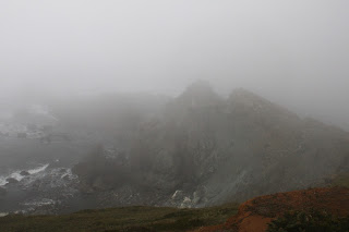
See Blacklock Point?
Me, neither!

At Blacklock Point, we only had a few minutes to enjoy the view of the craggy point and its chain of rocky islands. While we were there, a fog bank rolled in from the ocean and within minutes, Blacklock Point was just a ghostly outline in the mist. I'll have to add thick fog to the catalog of weather conditions I've experienced at Blacklock Point. From the point, it was a perfunctory hike back to the trailhead, bypassing the familiar potholes and puddles. Hearts were gladdened by today's endeavor and also by a stop in Bandon for some restorative ice cream.

The day completes the transition from blue to gray

For more photos of this hike, please visit the Flickr album.

Sunday, June 6, 2021

Blacklock Point


With a missionary's zeal, I preach the Gospel of Hiking and to indoctrinate a would-be lifelong devotee, it usually takes one good hike explicitly selected by yours truly for that purpose. However, some converts are more challenging than others. Case in point being long-time friend Anne, who submitted a voluminous pre-hike list of things that could not occur on this outing. Apparently she reads my blog so the list had things like "...no poison oak, no ticks, no wading of rivers...etc." It also had more esoteric items like "...no puns, no spontaneous songs, no armpit farts..." Sheesh, I wasn't sure I had any such hike (or behaviors) in my repertoire!

Archway on the beach

Also enumerated on that list were some weather-related edicts like no thunder, lightning, hail, wind, rain, or any combination thereof. Fortunately, a perfect day awaited the three of us (Anne's husband David came along, too) at the Oregon coast. The forecast had called for a cold, windy, and sometime rainy day but the reality was that the sky was cloudlessly blue, the temperature mild, and the breezes minimal. All signs pointed to a great hike for distrusting newbies and one erstwhile jaded veteran.

The Oregon Coast Trail tunnels through a dark forest

The long version of the Blacklock Point hike is a loop route and we opted to do the less scenic portion of the hike first. That meant starting out by walking behind an airport runway while keeping an eye on the sky for any approaching planes (running from airplanes was on Anne's list, too). After that propeller-free travail, the next couple of miles were a gradual descent on a jeep road through what admittedly were beautiful woods, even if there were no big-ticket items to see.

This bud's for you!

It was late spring and accordingly, the rhododendrons were still putting on a show. The large pink flowers festooned branches well above our heads and my two charges soon found out I brake for flowers. Close to the ground, the trail was flanked by blooming trapper's tea bushes and one patch of beargrass, somewhat out of place at the coast, proffered their distinctive white flowery plumes beneath the rhodies for our perusal. 

Our view of Floras Lake

Well, after a nice little three mile stroll through the trees and wildflowers we popped and plopped out onto a bare open area overlooking Floras Lake. This little lake is often busy with gossamer-winged kite surfers but not today, probably due to the lack of wind. David has a friend who lives at Floras Lake and he tried to spot the home from our vantage point. Whether looking for homes or kite surfers, we all agreed this was the first of many grand views on the day.

Fern tentacles

We backtracked a little bit on the Oregon Coast Trail which tunneled through a forest of dense trees twisted into all sorts of phantasmagorical shapes by near-constant sea breezes. The mix of sun and shade dappled the trail and delighted us hikers striding purposefully on the path. Rhododendrons were not as much of a thing in this part of the forest but the trail was graced nonetheless by ample quantities of wild irises ranging from purple to pale lavender in color.

It's a Richard Hike!

So far, I had managed to keep within the bounds of Anne's oppressive pre-hike manifesto, but a foot-deep creek presented the first test of our friendship. I simply splashed through, David walked across on some small branches, and Anne, surrendering to the inevitable, took off her shoes and waded barefoot, the mud presumably oozing between her toes. Expecting to immediately get unfriended, I was pleasantly surprised when she said the cool water felt good. 

Life on the edge

There is a viewpoint atop the coastal cliffs that, in my opinion, presents the Best View Ever. In years past, a bushwhack through dense coastal shrubbery was required to get there but eventually that faint path became overgrown and lost forever. Nonetheless, we tried to use the old path but couldn't get past the impenetrable growth and we all sported scratches as souvenirs of our failed attempt. Fortunately, I knew of an easier way to get there ("Why didn't you go there in the first place?" says everybody) and while that did require some bushwhacking, at least the bushwhacking took place on the edge of a sheer cliff. 

Our reward for the bushwhack

We did attain the intended viewpoint where the cliffs were covered by dense mats of inch-high dwarf lupines. We all plopped down to lupine level to take photographs of the diminutive flowers and their many attendant bumblebees. And of course, there was the epic surf, coast, and cliff scenery curving to the north under an amazingly superlative blue sky. Much nature appreciation abounded.

Cape Blanco presides over this bay

On the latter part of the hike, we stopped at other, and easier to access, viewpoints but none were imbued with the very secretness enhancing the vista seen from the special hidden overlook we had visited. However, the ever evolving coastal panoramas were still worthy in their own right. The last of these viewpoints was atop Blacklock Point itself, with a row of islands stretching west like an oceanic chain of pearls. Wind-stunted wildflowers grew on the point's summit while Cape Blanco presided at the end of a long curving beach to the south and we just sat and soaked in the view for a while.

One hiker is warier than the other

While I profusely apologized to Anne for the scratchy bushwhack thing, she said that if that was the worst thing that happened to her, then this had been a good day. Deciding to push my luck, I whipped out Anne's weighty tome of hiking don't-do's and found out that eating ice cream was not included in that interminable screed. So we did that very thing in Bandon to close off what had been an awesome 9.7 mile hike with some awesome friends.

Best View Ever

For more photos of this hike, please visit the Flickr album.

Saturday, November 9, 2019

Cape Blanco (via Sullivan Gulch)


Cape Blanco State Park is one of my favorite places to hike at. To nit-pick a bit though, there's a sameness to the trail network in that all possible routes essentially follow the coast from the Sixes River to the Elk River or vice versa. Yes, you can hike either atop the forested coastal bluffs or on the beach but either way, you are pretty much hiking from the Sixes River to the Elk River or vice versa. But as I recently found out, there is an inland approach that begins at Sullivan Gulch. Yay, somewhere I'd never hiked before, and naturally, the alluring "new trail" siren song called out to me. Powerless to resist its haunting melody, I soon found myself lacing boots at the cattle gate that serves as the Sullivan Gulch trailhead.

For some reason, we did not take this trail, not really sure why that was

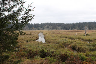
Accompanied by my trusty sidekick Lane, I opened the cattle gate and our hiking festivities commenced with a walk up a grassy ranch road flanking the west side of Sullivan Gulch. Per the Oxford English Dictionary, "gulch" is defined as a "narrow and steep-sided ravine marking the course of a fast stream". Well, Sullivan Gulch is not narrow, nor is it what I would call a ravine, and good luck finding a fast stream in the marshy wetlands. The wide swale with plenty of standing water in it does have steep sides though, but the trail here sort of cheats past by finding a gap in the steep sides on its way to the beach.


Waterway in the Sullivan Gulch wetlands

The first part of the route followed the wide grassy marsh containing ponds, drainage ditches, and various other forms of standing water in and among the marsh grasses. Ducks make a home in the ponds and regrettably, our arrival caused them to flee their watery abode in quacking panic. A more intimate exploration of the gulch was effectively discouraged by wire fencing and standing water, so we just looked and did not touch.

Mother and child, toxic mushroom style

It didn't take long for both of us to decide we really like this trail. The path gradually left the edge of the marsh and we hiked in woods sublime. White-trunked alder trees were already leafless, proffering their bony limbs to the sky in supplication for the return of leaves purloined by winter's arrival. Closer to ground level, the greenery was still thriving, unwilling to surrender their leaves like weak-willed alders. Ferns draped over the trail and mushrooms were everywhere. This was too much to expect two dudes with cameras to walk through without engaging in much photography. Consequently, it was slow going through the woods to an overlook of the beach from atop a tall dune.

Bushwhacking is fun!

Before we hit the beach though, we followed an obvious path leading into the forest, curious to see where it went. 
As it turned out, it pretty much went nowhere. The well-defined path quickly degenerated into a loose network of deer paths, game trails, and thick forest clawing at us as we fought our way up a ridge. Eventually, we wound up at the edge of Sullivan Gulch, wrestling head-high grasses while mud sucked at our boots. While fun, the bushwhack venture yielded little reward, so we bushwhacked back to the sandy saddle above the beach.

The mighty Elk River

The tide was out and the exposed wet sand was hard-packed (just like my abs, hah!) and perfect for hiking on. We beach-walked south for about a mile before the swiftly moving Elk River barred further progress south. Surprisingly, the fairly remote river was in use by a moderate population of salmon fishermen. After an obligatory lunch and laze next to the river, Lane and I returned to the overlook atop the dunes.

A sea of silver mercury

Feeling adventuresome and walky, always a potent situation, we grabbed a footpath that headed straight up through some woods. The whole vibe of this section of trail felt like wilderness because we did not see a single soul as we trudged upward. The trail served up some expansive views of Sullivan Gulch and the beach south of Cape Blanco as our route zigged and zagged from the ridge crest to the east side and then back again. After a mile or so of this, the path crested at what presumably is the tallest point in the park.

Flocks of geese head north

Oh, the things we could see from the top! The beach lay immediately below our clifftop perch, albeit several hundred feet below. Fishermen and beachgoers looked like ants on a kitchen counter and their vehicles like little Matchbox toys waiting to be picked up by a giant hand. Offshore loomed the ocean, glinting silver in sunlight diffused by an indistinct cloud layer. Ah, now this is why we hike!

Lane and Richard go for a hike

After admiring the view from our clifftop aerie, it almost seemed anticlimactic to cut across the horse camp and take the trail back to Sullivan Gulch. However, the forest was lush and green and the trail challenged our legs as it dropped straight down into the gulch. I do mean straight down, for the trail plunged as fast as a wingless duck, putting our quad and glute muscles to the test as we bravely resisted the pull of gravity on the way down. Once back down to gulch-level, the hike was finished off with a short walk on a grassy path covered with crawling newts. I think this is my new favorite hike at Cape Blanco State Park.

They say the spirit of Sullivan still haunts the park

For more photos of this hike,
please visit the Flickr album.


Saturday, May 6, 2017

Blacklock Point

Blacklock Point is a frequent repeat customer hike of mine. Rinse, wash, repeat: Blacklock Point, over and over again, like a trail version of Groundhog Day. But why not? The coastline is particularly dramatic with imposing cliffs looming over a narrow beach, and the trail spends lots of quality shade time in between all the awesome viewpoints. Catch this little section of the Oregon Coast Trail in spring and you will be rewarded with impressive wildflower displays of rhododendron, lupine, iris, wild strawberry, and coastal huckleberry (see photo above). Frogs and newts populate the vernal pools covering the trail and naturally, feet get wet and muddy, always the sign of a great hike. Of course, catch the Blacklock Point and Floras Lake area in winter, and hikers will be "rewarded" with nasty wind and rain; been there and done that, too. But for me, the prime attraction is one clifftop viewpoint in particular that seems to get harder and harder to get to due to encroaching brush. But until it becomes impossible, as opposed to plain old very difficult, I'll take yet another spin on the Blacklock Point merry-go-round.

Yes, it was windy
I'm not the only one that feels that way, for The Friends of the Umpqua Hiking Club is also a frequent flyer to Blacklock Point and thus, an early May hike was scheduled there. It was time to get back on the Blacklock Point hamster wheel to renew my never-ending acquaintanceship with the aforementioned fantastic coastal scenery. Grandson Daweson had never been, though, so he was only too eager to come along with me.

Daweson demonstrates the proper technique
for getting past standing water
It was a gorgeous day at the coast. The sun was out, the sky was blue, and the trail was covered with deep puddles that were nearly ponds, or whatever is the next rank up from deep puddles. Well, two out of three isn't bad! When we arrived at the first puddle covering the trail, Daweson looked at me, and I at him, and without discussing the matter further, we simply splashed through like the two boys we are. Once across, we had to wait for our comrades to finish beating their way through the brush and side trails to get around. It's amazing the lengths people go through just to keep their feet from getting wet, like the Wicked Witch of the West was their podiatrist, "My feet are melting! My feet are melting! Oh what a world!"

The trail was newty

Snakey, too!
Newts and cute little baby garter snakes were in abundance on the wet trail, delighting amateur herpetologists and horrifying squeamish hikers with equal amplitude. Neither specie was afraid of the puddles, either. Anyway, after dodging puddles, newts, and snakes; we arrived at the junction with the Oregon Coast Trail and made the left turn toward Blacklock Point.

Into the deep, dark, woods
The woods were as dark and cool as a troll's lair, and I liked it. Shade loving plants like rhododendron and skunk cabbage thrived in the undergrowth just off trail. And just past an awesome backpacking campsite (I speak from personal experience), the forest ended and we walked out into bright sunlight, blinking myopically like so many cave newts. Sun and blue sky, it's finally summer: not! Despite the sunny day, a blustery arctic wind had teeth chattering in no time at all, while cuffing us around on the grassy cliff south of Blacklock Point. Jackets were quickly donned, and loose hats and caps were quickly doffed and stuffed into packs and pockets so they wouldn't blow away.  

View to Cape Blanco on a fine day
Despite the wind that made photography difficult (lets see you try to take a picture while staggering in the wind like a spastic marionette!), the views were awesome. To the south, the coast arced gracefully to Cape Blanco with the little bay bisected by the Sixes River and Castle Rock. Wind-driven whitecaps dotted the deep blue ocean's surface like a bad case of marine dandruff. I thought I spotted a tell-tale spout from a whale's blowhole but really, it could have been a whitecap too, it really was hard to tell the difference.

Yay,we got us some cliffs!
A short walk along the grassy edge of the Oregon world brought us to the Blacklock Point overlook. Directly below, reposed the black rocky crag of Blacklock Point itself, with a chain of islands dot-dot-dotting a stepping-stone path away from land. Normally, we stop longer to enjoy the view but the consensus was we all just wanted to get out of the wind. It really was cold!

This was the easy part of the bushwhack
So, back to the coastal trail we go and the next item on the itinerary was a clifftop viewpoint overlooking a waterfall. Rheo swears there is a path to the cliff but once again (this happened last year, too) we didn't see an obvious path. There was a less obvious path though, and for some reason, I found myself in front, leading the way for a pack of increasingly disgruntled hikers.

Straight down
The brush was thick and scratchy and we had to duck a number of scraggly tree limbs, the clawing branches seemingly intent on applying a tree tribal tattoo to the unwilling. The end result was we didn't get to the cliff Rheo wanted but we did manage to get to my favorite viewpoint in all of Oregon. Or, at least my favorite view until the next great view on the next great hike. 

No caption needed
The cliff here is orange dirt and is oddly barren. But oh, the view! The abrupt and cliffy edge of Oregon was visible for maybe about 20 miles or so with the sandy coastline curving north towards an unseen town of Bandon. And yes, we could see a bit of the waterfall, even though Rheo said the view thereof was cooler from the southern cliff. For some reason, nobody wanted to bushwhack over to the other viewpoint to the south. A hasty retreat was beat to tall grass, and lunch was eaten in an impromptu windbreak of grass and coastal scrub. 

Bushwhackers, and not all that happy, either
The enjoyment was short-lived however, as again I was designated like a Vibrum-soled and incredibly handsome Moses, to lead my people to the Promised Land, the sanctified destination in this case being a return to the trail. Yikes! I was familiar with the bushwhack route away from the viewpoint but the brush has really overgrown what was really a faint path to begin with. I knew I was about to get foul invective hurled my way when I had to butt-scoot, fully prone on my back, under a dense thicket of wind-twisted spruce trees. When we finally made the trail with most of us scratched and bloody, six-year old Emma (our youngest hiker) sported a toothy grin and gave me a high-five. "That was fun!", she said. I couldn't agree more, although most hikers agreed less.

A rock arch decorates the beach below
Our next little bushwhack venture further down the coastline, was to an overlook of a stately rock arch on the beach below. However, the bushwhack was nowhere as arduous as what we had done earlier, darn it. At this point, we split up into two groups with six mileage addicts following me further down the coast.


Trail through woods most excellent


The Oregon Coast Trail here peels away from the coast and follows an old road bed through a sublimely beautiful forest. The undergrowth was lush and green, and the tree branches overhead were as gnarled and twisted as a wizened hag's fingers, but enough about my ex-wife!. You could almost hear the Wicked Witch of the West cackle from the tangle of limbs "Come here, my prettys!". Then suddenly, we strode out into bright sunlight where we overlooked wind surfers flitting on and above Floras Lake, our turnaround point.  

Boots were harmed in the hiking of this hike
Daweson and I explored the beach a bit while the others headed back on the Oregon Coast Trail. The OCT had more puddles deep enough to nearly attain pond status. Frogs jumped into the water in panic but we could see them on the bottom, eyes closed and clicking their webbed heels frantically: "There's no place like home, there's no place like home, there's no place like home!" 

Cleared for takeoff!
Well the OCT portion of the route, while pretty and all, was over 3 miles long in returning back to the trailhead at Cape Arago Airport. At the airport, the proper and safe route calls for hikers to cross a field above the runway and return via the Blacklock Point Trail. But tired hikers and tired grandsons cheat and walk down the runway, nervously looking over their shoulders for incoming planes. As Daweson and I drove home to Roseburg, he started planning a return trip for his younger brother Issiah. Looks like Daweson, wants another ride on the Blacklock Point Twirl-a-Whirl, and I completely understand.

Rhododendron bugs me
For more pictures of this hike, please visit the Flickr album.