This seemed like such a simple undertaking. Hike about 2.5 level miles to the beach, follow a ridge to the Cape Blanco Lighthouse, make a beach walk to the Elk River, and then back on a flat trail to the trailhead. So easy, what could ever go wrong? Well, the weather, for starters. An eight-foot foot high tide, too. And a mile of mud puddles, let's not forget those, either. Nice to know I still have the Richard Hike touch.
 |
| Twenty-nine hikers took the green flag |
The weather forecast called for 100% probability of rain but you'd never know that when the Friends of the Umpqua gathered at the meeting place in Roseburg. My theory about only three morons show up for a hike in poor weather was put to lie by eight hikers who piled into cars under a remarkably clear blue sky. While the weather was somewhat cloudy and foggy by the time we arrived at Cape Blanco, the air was nonetheless happily dry and there were twenty-one more hikers waiting for us, courtesy of our sister club the South Coast Striders. Wow, twenty-nine hikers to keep track of and I immediately felt sorry for the hike leader, which was me.
 |
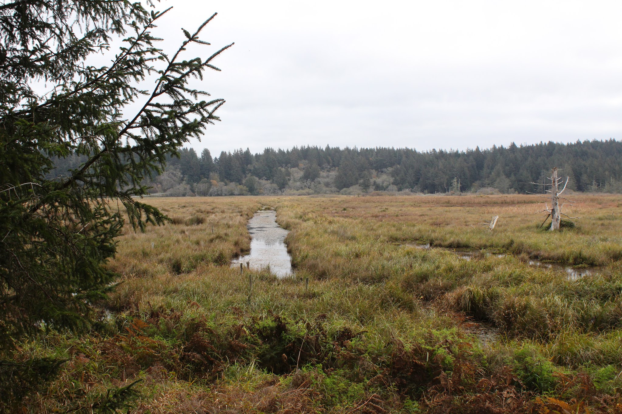
| Wetlands, accent on the wet |
From a large parking lot on the Cape Blanco park road, we executed a short walk on the road to a gate, opened said gate, and then commenced hiking in earnest. The first part of the hike was on a grassy path that looked like it had been a jeep or farm road in in its prior incarnation. The path basically followed the edge of Sullivan Gulch, a large marsh in a broad valley. The waterlogged gulch was full of overgrown ponds, canals, and other amorphous wetlands that faded into the fog. Didn't see any waterfowl though, they had either sought shelter from the impending storm or had fled the arrival of twenty-nine hikers. Smart birds, either way.
 |
| Scraggly alder trees |
Besides sideswiping Sullivan Gulch, the trail provided plenty of quality coastal forest time over the several miles to the beach. Leafless alder, their branches stark against the gray sky, contrasted nicely with the evergreen conifers flanking the path. In a taste of things to come, large muddy puddles lay across the trail, forcing dainty hikers to tiptoe around them to keep feet clean and dry.
 |
| Nice view for a few minutes |
After a pleasant walk to the dunes overlooking the beach between Cape Blanco and the Elk River, the first little downer reared its salty water head. I knew it was going to be high tide (check your tide tables before you go beach hiking, boys and girls) but since the beach here is fairly wide, I was hoping there'd be some way to hike to the Elk River. The decision to hike to the Elk was postponed until we could visually assess the situation and one look at the eight-foot tide covering ALL the beach sent me figuratively scrambling for Plan B.
 |
| The storm arrives |
Plan B was a hike up the spectacular coastal bluffs where we'd eat lunch on the high point thereof, followed by a short amble to the cape itself. After a brief uphill ridge walk, we all sat down upon arrival at the high point, munching our various lunches and snacks, and admiring the awesome view as we ate. While slightly overcast, the sunlight made it past the clouds here and there, casting spotlights that flitted and fluttered upon the silver ocean surface. Further to the south, the sky was ominously black and the rugged Oregon coast simply disappeared into the heavy dark mist. The storm was coming and mere minutes later, it was pretty much arriving, about as welcome as a visit from the mother-in-law, as we cut our lunch short to skedaddle.
 |
| Remnant of a steam donkey |
From our lunchtime coastal overlook, the trail ducked into a heavily wooded forest with traces of mist sifting through a skein of tree branches. Some of us stopped to gawk at the ruins of a steam donkey, the mossy and massive timbers a nostalgic reminder of logging operations of yore.
 |
| Here is where the rain caught us |
We grabbed the Oregon Coast Trail at the campground and the trail spit us out onto the windblown and barren grassy bluffs just south of the lighthouse. Naturally, since we were out in the open, it figured that would be where the storm would catch us, all unprotected and exposed like that. By the time we reached the lighthouse parking lot, there was unanimous and silent wordless agreement that this was as close to the lighthouse as we needed to be. The wind was gusty, but not as yet as powerful as was forecast. The rain did pick up in intensity, putting all our rain gear to the test. It was at this point I ruefully removed the battery from my camera and stowed the camera in its case, to be safely inoperative for the rest of the day. From prior experience, it's kind of an awkward conversation between me and Mrs. O'Neill when the conversation begins with "I have to buy a new camera!", no sense repeating that dismal experience for the fourth time.
 |
| Stormy afternoon at Cape Blanco |
Too bad the camera was temporarily retired because it might have been fun to photograph hikers navigating deep and wide mud puddles for a mile or so before the trail plunged rapidly down to Sullivan Gulch. First there was one small puddle and hikers could step over and around with no problem. Next puddle was larger and the dense coastal huckleberry bushes flanking the trail effectively deterred hikers from bushwhacking round. Then the puddles were tens of yard long and ankle deep and the only thing to do at that point was just splash through, dry feet be damned. My feet were fairly dry because my high-ankle boots are waterproof but most hikers had trail-runners or some facsimile thereof, and the sound of water squishing inside shoes could clearly be heard, along with mutinous mutterings about a certain gleeful hike leader who was obviously enjoying the whole splashy experience.
 |
| Misty forest |
The precipitous descent down to Sullivan Gulch was safely executed, and I witnessed no pratfalls, be they mine or anybody else's. Most hikers were fairly philosophical about the hike, noting that we were hiking at the coast in January and the inclement weather is to be expected. But they didn't thank me, either.
 |
| Rain clouds deliver |
Because of the heavy rain, I didn't take my usual quota of pictures, but what few I did take are in the Flickr album.