Saturday, April 30, 2022

Kentucky Falls


They say what goes down must go up and vise versa. I'm not sure who "they" are or why we put so much stock in what they say but I bet they haven't ever hiked with the Friends of the Umpqua to Kentucky Falls, because we've always happily hiked eight downhill miles to the North Fork Smith River Trail terminus. Unfortunately though, the bottom half of that route currently lies under a bunch of trees knocked down by a severe storm, so on this day, we'd be hiking down to Kentucky Falls and right back up again, I guess "they" might have really known what they were talking about...this time.

Random snippet of a saturated forest

At least it was raining when we started walking. You'd think we were hiking in Oregon or something. It never really rained hard during our visit to Kentucky Creek but hours of hiking in a continual downpour soon rendered us as sodden and soaked as the forest we were hiking though. Puddles lay on the trail and encroaching ferns were only too happy to transfer water from frond to clothing. Suffice to say, our raingear was put to the test today. 

A veritable carpet of false lily-of-the-valley

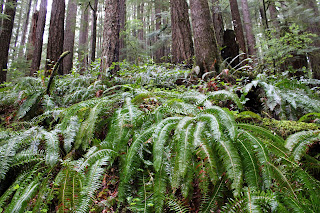
The noisy rat-a-tat-tat on hat brims from the steady rainfall would be a constant throughout the hike. However, no complaining allowed because rain makes the forest green and we do enjoy hiking below tall trees with a healthy understory of ferns, salal, and other assorted vegetation growing underneath. Moss claimed all that did not move and cliffs, boulders, and fallen trees alike were covered by a soft mossy blanket. Green was the watchword here as we hiked in a verdant forest beneath a brooding sky.

Kentucky Creek was always heard and/or seen

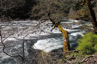
Once raindrops roll off trees, branches, leaves, and hikers, they eventually find their way into Kentucky Creek. Rain makes creeks flow and a very wet spring had Kentucky Creek coursing along in rather vigorous fashion. The stream tumbled through its creek bed of mossy rocks, the whitewater seemingly luminous amongst the dark trees under the dark clouds on a dark day. Several small unnamed waterfalls dropped over several equally unnamed ledges in what was a prelude to the Kentucky Falls main event.

Translucence in a trillium flower

Rain renders trilliums soggy, too. Like some people, trillium flowers tend to show their age by changing color from pale white to dark maroon as they get older. The current rainstorm pelted tired pink trillium flowers with an incessant deluge and the semi-transparent petals became quite saturated with water, folding over on themselves like wet crepe paper lying in a spilled drink on the dance floor.

My favorite fungus-bearing footbridge

About halfway down to the upper falls, the trail crossed Kentucky Creek on a rustic footbridge that seemed to be more moss than wood. On the bridge, bird's nest fungus grew in prolific bunches on the rails and posts of the span. Normally, I find this particular fungus on the ground and am always grateful to see them flourishing on this bridge, for I don't have to lie down on the ground like normal to get a photograph, especially on a wet day when the ground is muddy,

Upper Kentucky Falls

A roar sounding like the world's largest fire hose advertised the presence of Upper Kentucky Falls. The trail made several switchbacks from above the falls down to the cascade's splash basin, each switchback providing an opportune vista point from which to admire the photogenic cascade. Just like me, the falls were impressive and noisy, and that only stood to figure because the creek was so full of water. The mist emanating from the waterfall blew into our faces but from our standpoint, it was just more water in the air and no different from our hiking experience up to this point.

North Fork Smith River Falls (left)
and Lower Kentucky Falls (right)

Another mile or so of hiking down the forested creek canyon delivered us to Lower Kentucky Falls where it was more of the same but twice the fun. Here, Kentucky Creek plunges over a ledge to create Lower Kentucky Falls. Approximately 25 yards to the left, the North Fork Smith River does the same so you have two large waterfalls thundering next to each other for all of perpetuity. It's not often you get to see two waternal-twin waterfalls tumbling side-by-side in such close proximity to each other.

A fern asks for a peanut

We tarried at the lower falls for a bit to admire the view but mostly to postpone the hike up and out of the canyon for as long as possible. It had been all downhill to this point and we'd regrettably "enjoy" the uphill yang to the downhill yin on the return leg. Good thing I brought the uphill legs! I actually felt walky and pretty much power-hiked my way up the canyon in the rain.

Bird's nest fungi on a footbridge post

I was trying out a new raincoat and it was waterproof for most of the hike. However, by the time I reached the trailhead, the coat had given up the fight and I was soaked thanks to the fabric's acquiescence to the elements. The temperature was pretty chill too, and I gratefully partook of the car heater while I waited for my comrades to straggle back to the trailhead. Good things come to those that wait, they say, and there I go again, giving credence to what "they" say.

Smith's fairybells were seen on occasion

For more photos of this hike, please visit the Flickr album.

Saturday, April 16, 2022

Elk Creek Trail


In hiking, weather is a much considered, oft-discussed topic. Generally, we hikers carefully parse the weather forecast before deciding when or if we get out on the trail. Failure to do so can mean enduring a wet or wintry hike without proper gear. Now, some wags will point out that we often hike in wet or wintry weather anyway, but at least it's an informed decision when we do. Usually, the forecasts are reasonably accurate but then again, there are hikes like this one at Elk Creek, where no deliberate or measured prediction could ever accurately foretell the chaotic nature of the day's weather.

Escapees from the facility

When we parked at the upper Elk Creek trailhead, the weather was a combo of sleet, snow, and rain that had us all hurriedly putting on rain gear right at the start. This was a Friends of the Umpqua venture that yours truly was leading and the weather's poor outlook meant I had only four friends on this day. This was about four more friends than I normally get and our meager party set out on the paved trail next to a very full Elk Creek, 
scrunching our necks down into our shoulders in a vain effort to keep dry.

On the trail to Sevenmile Swimming Hole, in the rain

After a mile or so, we traded in the old historical paved roadway for a dirt path that traversed through a pasture to a local landmark known as Sevenmile Swimming Hole. There was no need for us to go swimming today for there was more than enough water (in all its forms) in the air to satisfy any urge to become completely wet. Besides which, it was pretty cold, the falling inclement being just this side of actual snowfall. 

Elk Creek did not entice us to go swimming

Elk Creek was rain-swollen and in a semi-flooding state, the noisy creek running rampant through stands of maple and alder trees that would normally be on dry banks overlooking the stream. The creek curved past some mossy cliffs and entered the deep and silty waters of Sevenmile Swimming Hole that none of us took the opportunity to jump into. We found out Shannon likes rocks as she combed the banks and stuffed her coat pockets with souvenirs just like my daughters used to do when they were very young. Rocks in the pockets would be another pretty good reason not to jump into the swimming hole.

It was colder up there

As we departed from our little side trip to Sevenmile Swimming Hole, the heavy cloud cover began to lift, offering tantalizing peeks at the mountains flanking either side of Elk Creek's pronounced valley. Clearly and quite obviously, all had been well dusted by snow during the storm's wintry visit. But hey, if the clouds are lifting, then sunny weather can't be far behind, can it?

The trail is an old decommissioned roadway

The answer to that question was answered by a vigorous hailstorm. Apparently, it can hail quite heartily from lifting cloud cover. I can also say, from personal experience, that hail on a hat brim makes quite a racket, rendering any would-be conversation futile, not that any one of my companions wanted to talk to me anyway, seeing how this was all my fault. This ten-minute squall was the first of three notable hailstorms on the day.

Shadow Man came to visit us like every five
minutes or so, and he did not stay very long, either

We stoically endured our pelting by millions of high-velocity ice pellets and after a bit, the clouds really did begin to break apart, with blue sky leaking through the seams. Eventually, the sun shone and the day became hot enough to get us removing coats and sweatshirts. But then after that ten-minute heat wave, another hailstorm had us putting them back on to stave off the cold. Sheesh, would you make up your weather mind? You could almost hear sardonic chuckles from capricious weather gods as we geared up or down, depending on the climate of the moment and the whims of the deities.

Jan and Shannon hike past a peace
offering to the weather gods

We turned back at the five-mile mark, making for a nice little ten-mile round-trip hike. On the return leg, the clouds generally stayed high and we enjoyed brief sunny interludes between rain and heavy cloud cover, the weather changing like every two minutes. A highlight of the trip was a short visit to some homestead ruins, adorned with occult spray-painted runes that just might explain the manic weather.

This last hail storm was the nastiest one

About a half-mile from the finish, the day darkened once again, the wind picked up, and horizontal rain became horizontal hail. Apparently Elk Creek wanted to give us a pneumonia diagnosis to remember it by. As we leaned into the sheets of hail coming at us, the trailhead seemed so far away. But then, to no surprise, the wind died down, the hail changed to rain, and then the rain died out. By the time, we reached the trailhead about fifteen minutes later, the sun was out again. Go figure!

Nearby mountains disappear behind the hail

The story of this hike was all about the wild and ever changing weather we had walked in. If you noticed, I haven't really talked about the scenery, which is a shame for Elk Creek and its valley are quite scenic. But then again, it's going to be all about the weather when the day is either sunny, cloudy, snowy, rainy, cold, warm, hailing, windy, or all of the above and sometimes all at once!

Don't like the weather?
Just wait a minute!

For more photos of this hike, please visit the Flickr album.

Wednesday, April 6, 2022

North Bank (West Loop)


I went with some friends the other day on a mid-week hike at our frequent hiking haunt, the North Bank Habitat. Our route of choice was the loop which I have always unimaginatively and directionally referred to as the West Loop, but today I heard it cited as the Boot Camp Loop. It sort of fits because the steepness of the trails that wind up and down the various high points on the north ridge will have your wishing for an honorable discharge in no time at all.

Simply a beautiful spring day at the Habitat

It didn't take long for the seven of us to separate into two distinct hiking cadres: me and Penny, and everybody else. Guess which two hikers had cameras? At any rate, the morning was crisp and clear, the hills were bathed in green grass, and the floral end of the gene pool was in full spring symphony, be it in flowers or leaves. So we walked slow and enjoyed the scenery while our comrades marched in double-time up and down the hills at some unseen distance ahead of us. Just so they wouldn't wonder whether or not we had carked it on the trail, we sent a text message advising the speedsters not to wait for us.

Maple trees were in full flower

The first part of the route initially followed a gravel road through ranch pastures where bemused cows placidly chewed cud as we hiked by. A right turn put us on a dirt road accompanying barely trickling Chasm Creek flowing through some peaceful and serene oak woods, the trees still bereft of any leaves. Branches were draped with long strands of lichen that swayed with the slightest air current while birds musically chirped their mating calls in feathered hopes of scoring an avian romp in the woods. Wild iris, shooting stars, henbit, buttercup, and Oregon grape bloomed amok in the green grasses reposing under a vibrant blue sky, making bees and butterflies happy. Life was good and colorful here.

One steep trail in a Habitat full of them

The colorful beauty was soon forgotten though, supplanted instead by the immediate urgency of  burning leg muscles when the trail headed uphill in earnest, seemingly in a hurry to get up to North Boundary Ridge. Didn't anybody ever hear of a switchback?  But, if you are going to struggle on a hike, you should have beautiful things to look at, and we did. As we gained elevation, white baby blue-eyes populated the grassy parts, while flower friends desert parsley and purple sanicle aided and abetted. Penny and I spent more than one occasion crawling through the aforementioned green grass like human sheep, just to photograph the flowers.

The dark leaves of Satan's favorite shrub 

Spring is the optimal season to visit the Habitat in my opinion. As mentioned, the hills were wrapped in a vivid shawl of green grass; that is, if you ignore the dark bloodshot leaves of poison oak. Ignore at your own risk, though, for the plant is quite profuse and is ever ready to award rashes to inattentive hikers. The accursed plant was everywhere, and while I have issues with its itchy malevolence, the new red leaves do impart a splashy, flashy, yet rashy burgundy vibe to the hike. 

Gentle and rolling

As we gained elevation, the trees thinned out and then it was all gentle and rolling green hills dotted with small stands of oak trees. I've often said the gentle rolling hills are only gentle when you don't have to hike up them and that wry observation still holds true. At any rate, the more we climbed, the more we were treated to some amazing views of the peaks and valleys surrounding the North Umpqua River, ever flowing below our North Boundary Ridge aerie in a series of serpentine bends with the water glinting silver in the noonday sunlight. 

Trail on top of the North Bank world

Part of the reason we could see so far was that the weather was perfect. It was never too hot, the sun was out, and the sky was blue and cloudless. The clarity of the air meant that we could see many leagues in every direction, although the air did haze up a bit as the day wore on. As an example, the distant peaks of the Siskiyou Wilderness, located just over 100 miles away in California, were faintly visible to the naked eye on the southwestern horizon.

It's all (not!) downhill from here

Once on North Boundary Ridge, the Boot Camp aspects of the hike were on full display as the trail went up and down, always steep, and never level. The trail summited what felt like 5,532 high points and promontories, the only saving grace being the totally awesome views of the terrain flanking the North Umpqua River. But once we hit Middle Ridge, it was mostly downhill, the irony being there were still several steep uphill pitches on the descent, even though the trail was generally pointed downward. In the North Bank, even the downhill hiking can qualify as a Boot Camp Hike.

Butter cups by the cupful

All good Boot Camp Hikes do come to an end though, and this one ended at a noteworthy field of buttercups at the trailhead. One buttercup does not an awesome sight make, but cram millions of them into a grassy pasture then you then have a visual buttered French Toast ready to be slathered in sticky syrup. The sight of that golden parcel of pasture was more than adequate reward for the Boot Camp trials and tribulations on the day for us two plebes.

An agoseris blooms in the low grass

For more photos of this hike,
please visit the Flickr album.

Tuesday, April 5, 2022

Shore Acres/Sunset Bay State Parks


Last time I was here at Sunset Bay during a high surf event, I wound up running for my life when a big wave tried to eat me. However, at low tide you do have a little bit more time to recognize a man-hungry wave roaring in from the sea, and thereby avoid that ungainly panicked sprint to high ground and safety.

A ferny trail took us atop the coastal bluffs at Sunset Bay

I'm happy to report no danger-filled episode took place on this outing in the Cape Arago area. The sea roared and seethed well offshore and politely stayed away from fragile hikers and beachgoers at Sunset Bay. However, the nearby rocky islands were receiving a royal and personal pummeling from King Neptune himself. High tide was several hours away yet, so hiking buddy Dianne and I felt quite safe as we commenced hiking up to the forested coastal high ground overlooking the bay.

Qochyax Island guards the gates

The first little highlight of this hike occurred when we grabbed the unofficial path to Qochyax Island, forever standing guard (and taking serious surf abuse, too) at the entrance to Sunset Bay. The island was bare and rocky, the only adornment a sad little stand of long-dead trees that imparted a forlorn and mangy kind of air to the island eternally standing resolute and stalwart in the middle of an unappreciative ocean. 

What's that skunky smell?

The hike was mostly about the waves but not entirely. The coastal forests were lush and green and spring was on the way in form of pungent skunk cabbage flowers (the odor of which I unjustly blamed Dianne for), dangling bells of salal blooms, and blossoming heads of coltsfoot calling in bees and butterflies alike. Dianne is as camera-afflicted and addicted as I am, so our hiking pace was properly slow and contemplative as we clicked the day away.

Dianne unhappily hikes in my elements

On the way to a coastal vantage point, the trail became quite muddy and boots were tasked in keeping us upright and from sinking up to neck level in cold muddy goo. I enjoyed this part of the hike but Dianne did not. Enterprising hikers had fashioned a primitive walkway by tossing a series of branches into the mire. The crude walkway was slipperier than a boogery eel but it did the trick as we did not sink higher than an ankle or two.

Boom!

Once we entered Shore Acres State Park proper, the waves began to really put on a show. Here, the waves collided with exposed sedimentary layers inclined at a uniform 45 degrees by ancient seismic processes. When an unstoppable force meets an immovable object, a huge amount of angry energy gets released in the form of massive white-watered explosions. As we walked, walls of white water rose 20 feet or so above us, while the beautiful clear day was rent with a roaring cannonading blast of sound and fury.

The waves were spectacular as the tide came in

I daresay we tarried there quite a bit, happy to be close (but not too close) to the raging chaos. Our next stop for the wave fun was at the observation area at Shore Acres. Here we could see from a short distance, the same waves that we had earlier been craning our necks skyward at in order to comprehend the full breadth and scope. From the cliffside vantage point, we could see and appreciate the awesome perspective of massive wave in comparison to the little ants that were actually people doing what we had been doing just a short while prior.

Sound and aqueous fury

After sideswiping idyllic Simpson Beach, not quite as idyllic on a raging high-surf day, we grabbed a series of use trails that led us to the edge of several bluffs that were a little bit on the wild side, as they don't see as many people as Sunset Bay and Shore Acres do. Same old gigantic waves though and we spent another fair amount of time watching the perpetual war between sea and land. Plus, we had a good view of the Oregon coast to the north getting hammered over and over again by the relentless ocean. We tried to find a short-cut or bushwhack route back to the proper trail but the coastal shrubbery was too thick to make our way through. Defeated by plants, we hiked out on the same old trail we had come in on, our heads hanging in shame.

Not your basic native plant

On the way back, we swung by the formal gardens at Shore Acres and enjoyed the geometric contours of the formal garden and bricked paths, while appreciating the cultured beauty of the flowering daffodils and azaleas. Here, we rejoined with Connie who had been hanging out in the gardens all day while Dianne and I hiked along the coast.

Coltsfoot kept the bees and butterflies entertained

This had to be the slowest hike ever. Basically, we hiked 7 miles and it took us nearly 5 1/2 hours, a pace of 46 minutes per mile. To put it in more understandable terms, we walked slower than a narcoleptic sloth, slower than a Jeep with a broken transmission (personal experience, here), slower than a teenager getting ready to mow the lawn, etc. But can you blame us? There was just too much to savor and appreciate on this fine day.

Things calmed down when the tide began receding

For more photos of this hike, please visit the Flickr album.

Sunday, April 3, 2022

North Umpqua Trail (Jessie Wright Segment)


"Water heal my body, water heal my soul.
When I go down to the water, by the water I feel whole"

The River
by Coco Love Alcorn

On the way home from this hike, I switched on the radio and the first thing I heard were the above lyrics. Serendipity, the words perfectly summed up my relationship with the North Umpqua River and its namesake trail. The North Umpqua River is always near the North Umpqua Trail and the constant soothing sound of water moving past the forested slopes is like a metaphysical back rub to the soul, although I am nowhere near as eloquent as Coco Love Alcorn, a statement readily confirmed by a random reading of any of my blog entries.

Lots of plants!

Roll the tape back to the middle of the week when I got a text from young Coral Rae who requested her grandfather (me!) take her hiking. Well, when that rare and wondrous event happens, the only proper response is to make it happen. Coral wanted to hike where there were "lots of plants" so we decided on the Deer Leap Segment of the North Umpqua Trail.

A herd of fawn lilies graced the mouth of a cave

I had been on the Dear Leap several years ago and at Medicine Creek, a ginormous boulder had crushed the bridge spanning the small creek. I held hope that perhaps the bridge had been replaced but once we arrived at the site, my hopes were as crushed as the bridge, which was still in pieces right under the guilty slab of rock. I was game for bushwhacking across rain-swollen Medicine Creek, but Coral's shoes were not sufficiently waterproof for that endeavor. 

Not a lot of plants!

No biggie, though, we hiked back to the car and improvised by driving to the Jessie Wright Trailhead, where Wright was right, as far as giant boulders rolling onto trail bridges were concerned. I assured Coral Rae we would see lots of plants but she had her doubts at the start, for the forest was scorched, charred, and mostly dead. Fire is a frequent visitor here and the Jack Fire had hung out here last summer, leaving the trees worse off for the fiery visit.

This trillium patrolled by guard spider

But, as I've stated before, life still thrives in a burn zone and this blackened forest was no different. The ground was carpeted with trillium plants, all displaying flowers with tri-petaled elegance, except for one double-flowered mutant that sported least three-hundred frizzled petals. Crab spiders lurked within the flowers and I found several of them for Coral to gawk at. However, if you are a flower-visiting insect, death also thrives in a burn zone, meted out by the fangs of hungry crab spiders.

Go see what's inside the cave!

At the intersection with the trail coming in from Illahee Flat, there is a large cave sited at the bottom of a sheer cliff. Impressive, to be sure, but the cave's inky black maw was upstaged by a large patch of fawn lilies blooming right in front, the flowers nodding in unison as if to agree with the wise words that leave my mouth, and I liked that. I sent Coral Rae into the cave to check for bears and am glad to report she did not find any.

Water, heal my soul

As stated, the hike began in a burn zone but within a half-mile of hiking, there was sufficient vegetation and live trees to satisfy Coral Rae's plant-centric criteria for the day's hike. The trail contoured up and down before dropping down to river level at a river viewpoint that is one of my favorite places on the North Umpqua Trail. The river widens out here and fans out over several white-watered stair-steps before disappearing around a scenic bend. 

The weirdest flower ever

A sunlit cliff next to the trail provided an opportunity for Grandpa Richard to point out all the plant life clinging to a moist cliff, while Coral Rae surely rolled her eyes behind my back. The flora-based education of Miss Coral continued when I showed her how to find the brown and hairy flowers of wild ginger, and the tiny cups of birds nest fungi. 

Wild strawberry, in its pre-berry phase

This hike was never intended to be an epic test of manhood (or girlhood), so we turned back here. On the way back, we enjoyed the beautiful scenery all over again and the uphill hiking not as much. Coral was excited to find a wild strawberry flower and stated we had to come back to eat the tiny but very tasty berries. Sounds like a good plan to me and like the request to go hiking, it'll be my job to make that happen.

The always scenic North Umpqua River

Inspired by Coco Love Alcorn, I took a post-hike stab at writing beautiful heartfelt lyrics in homage to the river:

"Water heal my back, water heal my knee.
Drink enough water, then I have to pee."

I think I better stick to my day job, even though I don't have one. Plus, I really can't sing either.

The North Umpqua River, 'nuff said

For more photos of this hike, please visit the Flickr album.