Friday, November 24, 2017

North Umpqua Trail - Swiftwater Segment

I'm going to give one of my favorite hiking and backpacking equipment stores a plug here. REI has it right as far as I'm concerned. You can always rely on knowledgeable staff and a liberal return policy that really gives you the opportunity to thoroughly field test gear before deciding to keep it. But where they really have it right is on Black Friday, that insane shopping frenzy that takes place the day after Thanksgiving. On that day, REI closes its doors and admonishes its would-be customers "Get outdoors, instead". 

Mushrooms, on a decaying log
Our little Black Friday expedition ran the gamut of all possible Black Friday outlooks on life. Luna and I needed no particular color or day of the week as an excuse to get out on the trail, we are always all in. Son Carl was 50/50 on the matter but was up for a short hike. Liam, however, was 90/10 in favor of hitting the stores on Black Friday. His inner 10% made him happy to be out on the trail, but the remaining 90% reminded him that every step carried him further and further away from a good deal on a pair of socks. The poor boy was sorely conflicted about hiking on this hallowed holiday of sorts.

Mossy forest
Since the requirements handed to me were that the hike had to be reasonably short and close to home, we headed up the North Umpqua Highway. This summer, the North Umpqua area had been ravaged by forest fires and last I heard, much of the North Umpqua Trail was closed to hiking because of fire damage in the form of fallen trees and burned bridges. So, our plan was to hike from the first trailhead that was open for hiking. As it turned out, the first trailhead open for hiking was the first trailhead of the North Umpqua Trail, located at Swiftwater Park.

Deadline Falls was not very "fally"
The weather had been pretty crappy all week, but we picked a glorious day to go hiking. It was crisp and chilly, but sunlight and blue sky sort of greeted us as we set out on the North Umpqua Trail. It is a North Umpqua truism that no matter which side of the river you hike on, the other side will be bathed in sunlight while you shiver in the shady cold, and this day was no exception. Below the shady trail, the North Umpqua was running full of rain water and Deadline Falls was not a waterfall on this day, as it was overwhelmed by the swollen river.

Dead fireweed leaves rattled as we hiked by


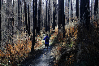
However, due to the Cable Crossing Fire from several years ago, we eventually enjoyed the sunlight we were so rightfully entitled to. Because of the fire. the trees are all dead here and a healthy waist-high cover of fireweed, dried and desiccated from the winter die-off, rattled like the last gasp of an asthmatic skeleton as we hiked past. The ample fireweed patch indicated the dead trees had met their demise years ago instead of perishing in the raging fires of last summer.

A small piece of Fern Falls
Fern Falls showed up a couple of miles into the hike, and both Carl and Liam were impressed. The falls have lost their luster over the years a little bit, as fire debris in the form of black logs, branches, and other detritus have visually cluttered up the delicate little waterfall. But it was still an enjoyable stop as the fresh waterfall breeze cooled us off a bit, not that we particularly needed cooling off on this winter morn.

Gotcha, finally!
We continued on the up-and-down trail, listening to twittering birds, babbling brooks, and Liam loudly complaining about not being at the mall on Black Friday. At Deception Creek, a stout footbridge spanned the creek and we stopped for a moment to enjoy the scenery and the sunnery. A pileated woodpecker was working over a tree, high up the trunk. I've seen these birds a time or two but they are hard to get a picture of as they have a knack for circling around to the back side of the tree just as you set the f-stop, ISO, and aperture settings on the camera. However, this time I was able to get a decent photo of the red-crested woodworking bird and that alone, made this hike memorable.

Jumping for joy


We didn't really have a destination in mind, excepting Liam, who had fixated on the mall as a perfectly good destination in mind. So, at a little over 2.5 miles, we showed him some mercy and turned around. He was practically giddy with joy, and beat us back to the trailhead. Despite the relative puniness of the hike, a good time was had by all and we all agreed to make a more serious effort on any other day besides Black Friday.

A leafhopper, currently not hopping
For more pictures of this hike, please visit the Flickr album.


Sunday, November 19, 2017

Siltcoos Trails

This hike was destined to be short. The Siltcoos Trails aren't very long in the first place but I could have certainly added some more miles by hiking further along the beach. However, heavy rain was in the forecast and high winds were expected to arrive around 4 o'clock in the afternoon. Lucky Luna, though, she got to come along on this 4 mile exploration of the Siltcoos Recreation Area that was more photo shoot than hike. My arm can only take so much mindless leash pulling too, so there's one more reason for the shortness of the hike.

A bench with a view
There are three not-very-long trails in the Siltcoos River vicinity: Lagoon Trail, Chief Tsiltcoos Trail, and the Waxmyrtle Trail. All of them meet in the middle, so to speak, the middle in this case being the Stagecoach Trailhead. Item number one on the diminutive hiking itinerary was the Lagoon Trail, a pretty little loop path that showcases man's insensitivity to the environment.

The still waters of Siltcoos Lagoon
The Siltcoos River runs from nearby Siltcoos Lake to the ocean and it used to snake back and forth in a pronounced oxbow bend. I say "used to", because in the 1930's, the road leading to the campgrounds and beaches was laid right across the neck of the oxbow, effectively cutting it off from the river. So nowadays, the river runs straight, paralleling the road, while the tepid lagoon pools with standing rainwater. In yet another fine exhibit of our proclivity to mess with the environment, an invasive reed known as parrotfeather is taking over the swampy lagoon and over time, the lagoon will dry up and become a meadow, which will, in turn, eventually be swallowed up by the coastal forest.

Typical trail scene on the Tsiltcoos Trail
But for now, the lagoon is not without its attractions. A series of boardwalks ambled next to the black waters of the picturesque lagoon and I took a series of photographs of the glassy surface, before I let Luna frolic in the still water. Upon her frenzied entrance into the lagoon, the surface was glassy no more, The short loop followed the lagoon's edge and several benches allowed hikers to sit and contemplate a fetid swamp, if they so desired.

Translucence
Next up was the Chief Tsiltcoos Trail, which was basically a walk through a coastal forest. The trail did provide a brief uphill section, though, imparting a mild burn to lazy leg muscles. Much photography ensued, mostly of sunlight slanting through the trees, mushrooms sprouting everywhere, and all the ferns, moss, lichen, and salal you could ever want to point a camera lens at. Much berry grazing also ensued, as the coastal huckleberry bushes were amply adorned with juicy black berries.

Behold the mighty Siltcoos!
So, two loops down, one to go. Well, to be technical, the Waxmyrtle Trail is not a loop but an out-and-back venture, running from Stagecoach Trailhead to the beach south of the Siltcoos River. After crossing on a roadway bridge, Luna and I grabbed the dirt path on the opposite side of the river. The trail was right on the edge of the river and when I say "right on the edge", I mean right on the edge. If the river level was to rise a foot or so, then it certainly would be a wet hike to the beach, making a certain water-addicted dog very happy. If you are not sure which dog I am referring to, her initials are Luna.

The Siltcoos journey ends here
After a short walk, the path peeled away from the river and headed uphill on a mossy set of stairs. Now sticking to the bluffs above the river, the route continued to amble through a lush coastal forest. Periodic breaks in the vegetation provided openings from which to gape at the Siltcoos River below. If there weren't openings in the tree cover, not to worry, there were plenty of use trails leading to plenty of viewpoints. The river wandered through a grassy delta in several sweeping oxbow curves before becoming one with the now-visible ocean.

Clouds were blowing in
The trail quickly morphed from a forested trail to a sandy track running through the marshes behind the foredunes. More quality splashing time for Luna and more quality camera time for me. We each do enjoy hiking in our own different way. A quick and sandy up-and-over the foredunes brought us to the beach where Luna was demonstrably overjoyed to become unleashed. She probably ran 10 miles within two minutes as she splashed in the waves and scattered seagulls, all the activity accompanied by exuberant yips of doggie delirium.

Luna hikes into wind-driven grains of sand


Off shore, there were clouds hovering over the ocean but it seemed the forecasted storm had not yet arrived. However, the high wind advisory was warranted as the wind was blowing, by my guess, close to 40 miles per hour. I considered walking north on the beach but the idea of leaning into the wind and high velocity sand grains for a mile or so on the way back wasn't very appealing so the hike was done at this point.

Yum!
Fortunately, the high winds were just that: high winds, in that they were blowing high above in the treetops while leaving us ground-dwellers alone and unmolested. Well, unmolested unless I lay down to take a photo of a mushroom, then a dog licked my ear whenever that opportunity presented itself. On the drive home, a brisk rainstorm overtook us; it certainly was nice to avoid all that on this short hike on the Oregon coast.

My hiking companion
For more pictures of this hike, please visit the Flickr album.


Saturday, November 11, 2017

Golden Coyote Wetlands

In the 1840's, gold was discovered on Coyote Creek, and the rush was on! Speculative prospectors flocked to the small creek and eventually the town of Golden sprung up in response to the sudden influx. Although two churches were constructed, amazingly there were no taverns or saloons in the town of Golden. Makes me wonder what they did on a Saturday night to blow off some steam. Anyway, a subsequent gold rush on distant Salmon River lured gold miners away from Golden. Chinese miners then moved in to mine Coyote Creek, but when the Salmon River gold rush went dry, the original Goldenites returned and drove out the Chinese miners. At its peak, Golden had a whopping 150 residents but by 1920, the post office closed and Golden was abandoned.

A forest sprouts on a pile of mining debris
The ghost town then languished over the intervening decades and in 2011, the State of Oregon acquired the property and designated Golden as a State Heritage Site. Several of the old historical buildings remain, including the Golden Community Church, and one can wander around and get a glimpse into Oregon's gold mining era. Across Coyote Creek Road, one can also get a glimpse of the dubious environmental "heritage" left by the very same mining history.

Wetland pond
They did placer mining on Coyote Creek, meaning the alluvial deposits in the actual creek bed was mined for gold, and piles of mining debris are still clearly visible today. In 1993, a non-profit group managed the Coyote Creek area and I'm not sure if the site is still being managed by the non-profit group, Josephine County, the state, or none of the above. At any rate, ponds were created and hiking paths were installed and when I visited this area in 2011, I was impressed with the wetlands project. However, based on this visit, I unfortunately got the feeling that the wetlands are falling into disuse.

A two-holer made for social pooping
I had an idea about leading a hike here for the hiking club and needed to see if I could squeeze 5 or 6 miles of trail out of the wetlands. Luna, my dog, didn't care about all that, she was just mindlessly happy to accompany her incredibly handsome master on a hike. We cruised through the old buildings and relics in the Heritage Site before crossing the road and walking into the wetlands. It was interesting to see a two-hole privy which always makes me wonder. I just can't imagine dropping a deuce next to another dude doing the same, but I digress.

Blackberry, going scarlet
The path down to the first pond was in good shape and we startled some ducks who flew away in quacking panic. The pond was ringed with yellow-leaved willows, and blackberry vines were offering scarlet leaves to the gray sky. So far, so good!

Road next to Coyote Creek
On the other side of the pond, a gravel road was our route down Coyote Creek. On my 2011 visit, paths ringed a series of ponds but today, the ponds were empty and the paths severely overgrown. So, we just followed the road, stepping around the frequent mud puddles in the way. Well, I stepped around while Luna happily frolicked through. 

A mushroom emerges
The wetlands have not been feeling the love lately and there was all kinds of trash strewn about. Signs are posted banning motor vehicles but you could see tire tracks on the piles of mining debris. There were even a couple of burned out autos rusting next to the creek. But it wasn't all bad, either. Coyote Creek was always nearby, mushrooms sprouted underneath the pines and firs, and there was still plenty of autumn color on the trees and shrubs. 

I bushwhacked a little bit and found a berm where an old mining ditch had diverted some of Coyote Creek's flow back in the day. A pile of old boards was decaying nearby, indicating some kind of structure or building had collapsed here years ago. This trail wound up being about a 3 mile round trip amble, so I won't be returning here with the hiking club, it's too short of a hike. This walk wound up being more photo shoot than hike, but still, it was an interesting little peek into Oregon's past. 

Coyote Creek
For more pictures of this hike, please visit the Flickr album.


Saturday, November 4, 2017

Kentucky Falls - North Fork Smith River

It had been a while since I'd been to Kentucky Falls. The hike down to the falls and back is a shortish 4 miles round trip venture and considering the long drive to the trailhead, it just doesn't seem worth the trouble for a mileage-addicted hiker like your merry blogster. However, Kentucky Falls becomes a worthy destination if you continue beyond the falls on the North Fork Smith Trail for a more reasonable 9 mile hike. But that's a shuttle hike venture, so a friend with another car is a minimum requirement, and I don't have any friends. Plus, two winters ago, floods washed out bridges and trail alike and it was nearly a year before the Forest Service was able to restore the trail from the effects of the rampaging river. For all of the preceding reasons, it had indeed been a long time since I'd hiked in the North Fork Smith River area.

Knobby and mossy maple tree
Good news comes in threes and the Forest Service had re-opened the trail earlier this year; the hiking club had a Kentucky Falls hike scheduled; and there were enough people with cars to ferry hikers back and forth from (and to) this end-to-end hike. The bad news was that the weather was somewhat damp and because the trail had not been usable for over a year, the trail was a little bit on the rough side. But hey, that's how the Friends of the Umpqua roll, we like our hikes wet and rough as a cat's tongue (without that dead tuna smell).

Small creeks ran across the trail
Actually, any complaints about the weather should be pretty mild. It had been raining heavily for a solid week and another storm was on the way. But as it turned out, the day of the hike lay between the two storms and was expected to be relatively dry. When the hike started, there actually was blue sky overhead but that didn't last very long. At least the rain didn't show up until we had hiked 5 out of 9 miles.

Follow the Yellow-Leaf Road!
It was obvious, once we started dropping down into the Kentucky Creek canyon, that autumn leaves would be a major portion of the hike narrative. Bigleaf maples had divested their leaves, so to speak, and the trail was covered by a thick mat of leafy duff. The sound of boots scuffing through rustling leaves was a constant all day long and there'd be no sneaking up on deer today, not that we'd ever want to do such a thing. But, on the plus side, there'd be no deer sneaking up on us, either!

Upper Kentucky Falls


A short walk down a leaf-covered path brought us to Upper Kentucky Falls. The waterfall basin was misted over, partly from encroaching cloud cover and partly from the waterfall itself. The recent rains made for high water volume and a loud roar from the falls. After a few minutes of oohing and aahing, we continued onward, crossing Kentucky Creek on a moist and leafy bridge. Everything was moist and leaf-covered on this hike.

Lower Kentucky Falls
The trail continued to lose elevation as it switchbacked further down into the canyon. At a little over the 2-mile mark, Lower Kentucky Falls came into view and we took a rough path down to a rickety wooden viewpoint below the falls. This particular spot serves up one of the most amazing sights in Oregon. Lower Kentucky Falls tumbles over a rocky ledge and about 20 yards to the left, North Fork Falls does likewise. How often do you get to see two large waterfalls do their thing side-by-side like that? I was so happy taking photographs of Lower Kentucky Falls that I soon found myself all alone on the wooden viewing platform, as all my friends had left. I hurriedly headed up the trail to rejoin everyone but It was about a mile later that I realized I had taken nary a photograph of the two cascades in their eternal and fraternal free-fall. Oops. I nearly wanted to turn back and execute a photographic do-over.

The North Fork flows through the dead leaves
Kentucky Creek came to an end shortly after the falls, as it ran into the larger North Fork Smith River. Likewise, the Kentucky Falls Trail came to an end as it ran into the longer North Fork Smith Trail. Initially, the new trail ambled relatively close to the North Fork but that all ended when the path made an abrupt left turn and charged uphill as madly as a bull in Pamplona.

Moss covers all that does not move
I had mentioned earlier this trail had been closed, and clearly it hadn't been maintained in the interim. Ferns, logs, and all kinds of other vegetation had encroached the path, which was barely visible at times. Good thing all those leaves had fallen, it kind of gave us a Yellow-Leaf Road to follow. In a forest of moss-covered trees, the route sort of leveled out high above the heard-but-not-seen river. The path was narrow and clung precariously to a steep slope and it was not unusual to step in a hole, or off the trail, or accidentally roll rocks down the hillside. With the tread being so covered by leaves, you really could not tell what you were stepping on and there was more than one pratfall by more than one hiker, your merry blogster thankfully excluded.

Valerie and David execute a creek step-over


Many small creeks were running down the hillsides and across the trail as we contoured the heavily wooded slopes of Baldy Mountain. Looking at the map, Kentucky Creek lies halfway between Roman Nose Mountain and Mount Popocatepetl, in a curious geographical dedication to three primitive cultures with forgotten dialects. Baldy Mountain is more of a geographical taunt to the hair-challenged, though.

Rheo shows us how to reach the hiker's bridge
Approximately 3.5 miles from the end point, we ran into obvious flood damage. Clearly, the river had appropriated the trail bed and now there were small braids of river current flowing where the trail should have been. Here, the trail crosses the North Fork on one of the more impressive hiker bridges ever to span a river. However, we had to ford several small branches of the river in order to get to the bridge and the formerly-stout span was now sagging in the middle. Upstream, there was a brand new bridge but not yet a trail leading to and from the bridge, it looks like the Forest Service is going to abandon or tear down the old bridge. All those years of faithful service, and the poor bridge doesn't even get to see out its remaining days getting pampered in an assisted-living facility.

One of dozens of leaf-covered footbridges on this trail
It was just after we crossed the bridge that I said "Hey. it hasn't even rained today!" Yes, I really did say that and yes, I really should know better. You all know what happened next: the clouds began dumping water on us in response to my impertinence. Oh well, there's not much to do about it except keep on walking. Complaining helps, too! Anyway, the final three to four miles were rather on the wet side as the trail ambled up and down through the woods along the river. Despite the rain, though, it had been a nice reacquaintance with this green trail in Oregon's Coast Range.

The North Fork, as the rain fell and the day darkened
For more pictures, please visit the Flickr album.