Showing posts with label cape sebastian. Show all posts

Tuesday, February 4, 2020

Otter Point


Way back when Oregon was being created, the Grand Terraformer put the finishing touches on the coast, looked upon her handiwork and decided something was missing. But what? "Oh, I know!" she said, brightly snapping her fingers for emphasis "There otter be a point!" And that is my theory as to how Otter Point got its name. Of course, the point could have also gotten its name because otters live there but that would be too easy.

One small piece of the beach treasure chest
Weak puns aside, it was a glorious day at the Oregon coast. The sun was out, the sky was blue, and boy howdy, was it ever cold! The sun was about as useful as a bubble gum machine in a tetanus ward, and five seconds after I removed my jacket, I hurriedly put it back on to stave off immediate hypothermia. A brisk breeze was moving all that cold air around, cutting right through the fabric of all my layers of clothing, rendering them as useful as a sprinkler system in a Fizzie factory. Ok, I'll quit.

The Queen
While I started this hike with chattering teeth, my companion had no issues at all with the chill air as she mindlessly sprinted to and fro on the beach. Luna, my canine hiking buddy of the day, has only one speed and that is a full sprint. Sadly, she's been showing her age lately and I've decided I need to start curtailing her hiking (she gets pretty gimpy the following day). When I informed her she had to stay home today, she just looked at me with those sad eyes which turned out to be way more effective than rubber lips on a woodpecker, and that's how she got invited to come along.

The jetty ends here


The hike began on the north jetty flanking the mouth of the mighty Rogue River where it empties its rather large flow into the Pacific Ocean. A short walk on the jetty delivered us to a beach comprised of rounded pebbles, the surf making a gravelly sound with each pebble-filled wave. This beach (hereafter referred to by its proper name: Bailey Beach) is a beachcomber's paradise but we had a hike to perform, so we didn't stop too much to browse for beach treasure.

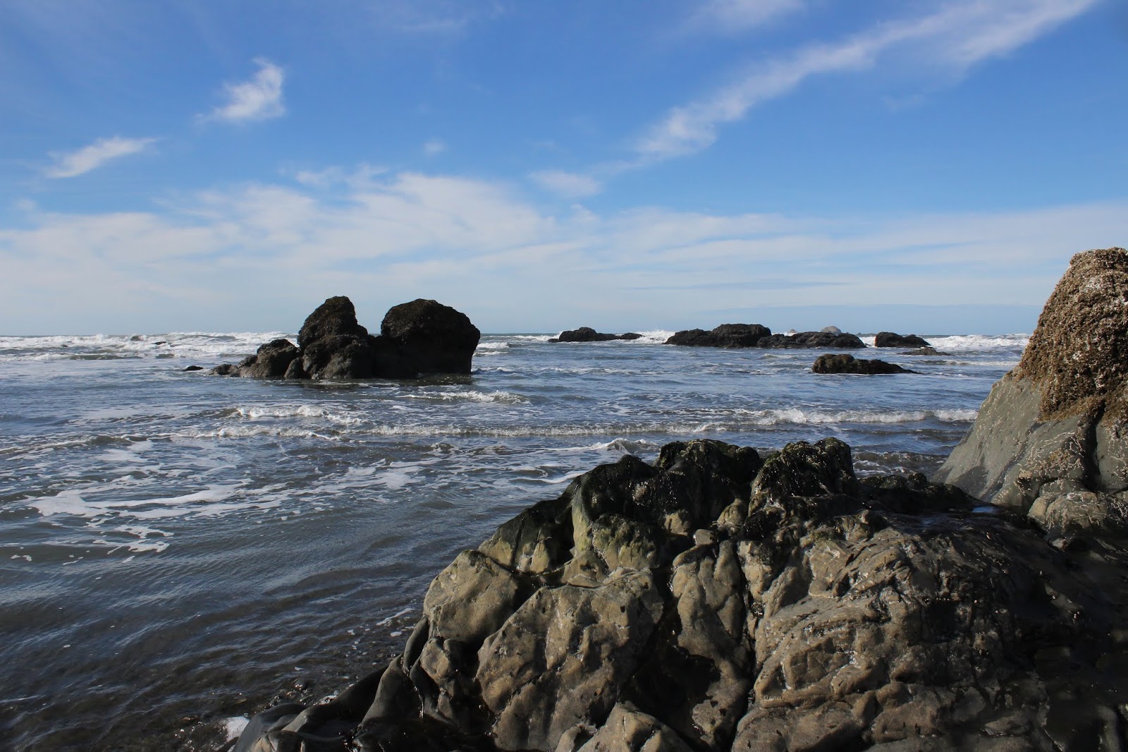
Lots of islands dotted the surf
We left the luxury homes overlooking the beach behind when we rounded a small point after nearly a mile of hiking. In front of us stretched the wild Oregon coast all the way to distant Humbug Mountain. Halfway in between, a low brown bluff was Otter Point (today's hiking destination) still waiting for us from several miles away. In the surf, dozens of small rock islands, seemingly flung into the ocean during a divine temper tantrum, provided some photographic stops every now and then. The beach was remarkably free of seagulls, thanks to my four-legged bird enforcement officer.

One creek splits into thousands of braided creeklets
There were a number of small nameless creeks fanning out across the beach, their shallow rivulets as intricately braided as a reggae hairdo. None of them were running deep so only boot soles and the bottoms of paws got wet. The wet sand and trickling creeks sparkled in the noonday sun like a thousand points of light reflecting from a mirror ball in a concert hall. Much photography ensued.

The Oregon Coast Trail heads up to Otter Point
After about three miles of pleasant beach walking as the tide waned noticeably, the cliffs of Otter Point blocked further progress northward. Time to grab the Oregon Coast Trail off the beach, the short climb to the top of the point having legs burning in short order.

Hubbard Mound got its name
because...because...ah, I got nothing
We didn't tarry too long atop Otter Point, for the wind was cuffing us around pretty good. However, we did stay long enough to appreciate the view to Hubbard Mound, the next point to the north. Try as I might, I haven't yet been able to come up with a dumb story as to how Hubbard Mound got its name, but I'm still working on that.

Bailey Beach in the afternoon light
Below and to the south of Otter Point, lay glistening Bailey Beach with nary a soul to be seen on the silver sands. After a quick snack break for Luna and I on a strategically sited bench at a forested overlook, we made the short descent down to the beach and headed back in the direction of the Rogue River.


Luna is off and running


It was low tide and the beach was as wide as two time zones. All the little rock islands were just rocks now, stranded high and dry by the retreating ocean. And as the sun lowered in the sky, the sea glimmered like so many twinkling diamonds. Luna finally gave up on beach running and began walking at my speed, a rarity for her. At any rate, the hike finally came to a close at Doyle Point, which is a good thing because without the point, the end of this hike would be pointless, like the end of this blog.

Abstract art painted by sand and tide
For more pictures of this hike, please visit the Flickr album.


Sunday, June 9, 2019

Pistol River Beach


After  a couple of memorable hikes on the Oregon coast, made memorable for both right and wrong (tick bite reference from the day before) occurrences, it was time to head back home. Katchan would head to the Bay Area by way of Roseburg, and the rest of us back to good old Douglas County to stay. John and Edwin were in such a hurry to get home, they got away before Katchan and I could invite them to a getaway hike on Getaway Day. 

Low tide on Pistol River Beach
Still designated to be in charge by my one remaining follower, I chose Pistol River Beach, so off we went to Myers Creek Viewpoint, which overlooks the beach reposing on the south side of imposing Cape Sebastian. The tide was well out and the numerous islands and sea stacks were now bona fide landforms instead of islands, as they had been stranded by the retreating tide. 

Myers Creek sparkles in the sun
After scrambling down to the beach, we crossed Myers Creek, which was no great feat as the creek had fanned out across the sand, becoming no deeper than an inch or so. The morning was glorious what with a clear blue sky, imbued with that crystalline air quality normally reserved for a cold winter day. The sun sparkled on the creek like so many diamonds tossed by a jilted fiancée throwing a temper tantrum. Despite the sun, it was frigid cold, thanks to a stiff breeze blowing across the beach strand.

Time for all good hikers to go explore some islands
What makes Pistol River Beach special though, are the numerous islands and rock formations. These sea stacks rival those of Bandon Beach, which is more renown solely because it is located in a city, albeit a small one. Pistol River Beach is located between Gold Beach and Brookings and is not as visited because of the work to drive there. At any rate, the low tide had exposed all the islands and we were able to walk the sandy maze between them.

Walls of rock dwarfed us little people
It is a Pistol River Beach truism that every island has another island behind it. "But Richard," you say "that would make them endless!" To which I reply, "Yup". They did seem endless as we wandered between them. In some little bays, the walls of the islands loomed maybe 100 feet above us, and it felt like we were walking among the ruins of an ancient citadel. An island just off shore looked like an Aztec frog statue from the time of Nezahualcoyotl, waiting for stone flies to eat for all of eternity.

Anemones wait patiently for prey
As we made our way south along the beach, the large rock islands and towers abruptly ended at a series of tide pools sited in a field of small kelp and algae-covered rocks. Pink and blue anemones were "blooming" in the crystal water, resembling colorful flowers instead of the predatory organisms they are. Small sculpins (a spiny fish that inhabits tide pools) darted furtively among the nooks and crannies of the pools. Small crabs brandished their pincers to hopefully deter being picked up by curious humans. Beds of mussels were being preyed upon by colorful starfish and we spent a few minutes discovering and uncovering the various forms of life that exist in this small vignette of marine ecology.

Cross currents and tides
So, now that we hiked past all things rocky and islandish, be they gigantic, large, or small, it was all sandy beach walk across exposed tidal flats to the Pistol River, located about a mile beyond the tidepools. The river was flowing deep, the relatively clear water running with an aqua tint to it. Obviously, there'd be no wading across today, it would have to be a healthy swim instead, for those inclined to do such a thing.

The Pistol River blocks our way south

Blocked from further hiking southward, we followed the river inland until Highway 101 blocked further progress eastward. Here, the river pooled languidly behind the beach dunes and we explored the would-be lagoon until there was no more shoreline to explore. But hey, there were a whole bunch of sand dunes between lagoon and beach and we scrambled up the soft sand to attain the dunes.

Trails, used by the current residents of the dunes
Judging by the many footprints, this area gets a lot of visitors but not of the human kind. All manner of critter tracks criss-crossed the pristine sand and it was almost a shame to mar the dunes with our comparatively clunky boot tracks. By the time we reached the actual beach strand, the low tide had gotten even lower than a grifter's scruples, exposing and stranding even more islands than before.

Land forms on an alien planet
On the hike back to Myers Creek, we had acres and acres of glistening sand to walk on. The sand had been carved by retreating water into abstract formations that resembled a satellite map of a river delta in miniature. The even lower tide allowed for further exploration of the numerous stranded islands and we partook thereof before Katchan and I departed for home. This short hike was just perfect for Getaway Day.

A cinnabar moth basks on the beach
For more photos of this hike, please visit the Flickr album.