Showing posts with label Mount Washington Wilderness. Show all posts

Saturday, August 20, 2016

Black Crater

Black Crater owed me one. Last year, I had hiked to the summit in what basically was a winter storm, minus the snow. Gray clouds covered the summit, an arctic wind froze the snot dripping from my nose, and the view was akin to sticking your head inside an old pillowcase. Somewhat disappointed, I vowed to hit Black Crater again on a sunny and very warm day. Unfortunately, on my latest visit, wildfire smoke really impinged the views so while the temperature was an improvement, my head still remained inside a metaphorical pillowcase. 

Broken Top and the Three Sisters
And now a word about the warm weather: The night before, I had "stealth camped" by parking my car on a forest road and walking into the forest where I hung my hammock between two trees. The temperature was plenty warm so I slept in board shorts and no T-shirt. This was my first time using my new hammock and I learned that unlike sleeping on the ground, you are completely surrounded by air as you dangle between two trees. So, when you go to bed and it's near 90 degrees but in the night it drops to 44 degrees, you wake up in the middle of the night with teeth chattering. Where's a heat wave when you want one?

Ugh! Uphill in the warm sun
Anyway, after I thawed out, the hike to Black Crater began in the early morning. Didn't take long to get warmed up because this is one steep trail, gaining 2,200 feet in just over 3 miles. Dripping with sweat and removing layers, I yearned for the 44 degree nighttime temperature. There is just no pleasing some hikers!

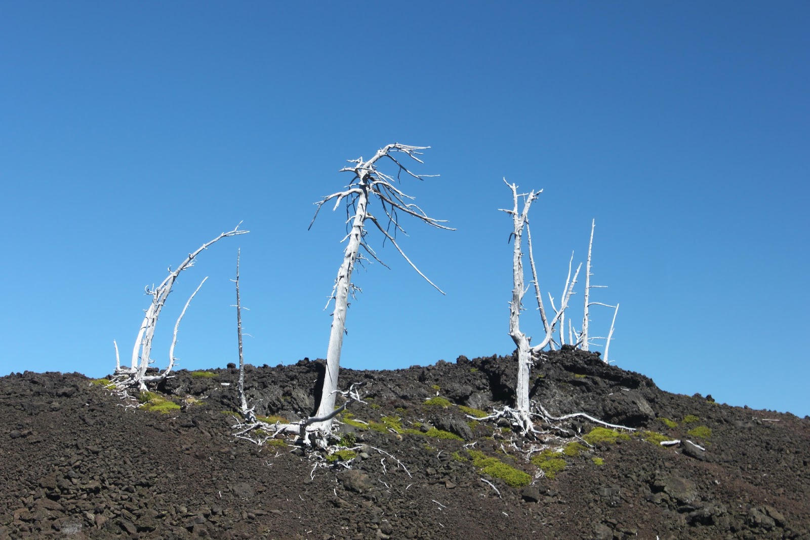
Trail through the forest
My legs were feeling the prior day's hike up to Four-In-One Cone so I adjusted my pace to a slow and steady trudge up the trail. There really isn't much to report about the first couple of miles as the trail switchbacked to and fro through a viewless forest. However, with about a mile to go the forest thinned out, the trail rounded the mountain to the east, and the stunning views opened up.

Sisters and Redmond, hidden in the haze


Well, I imagine under optimum conditions they could possibly be stunning views. However, on this day wildfire smoke really made it hard to see any distance, particularly to the east. On my cloudbound hike the year prior, as bad as visibility was, I could see the towns of Sisters and Redmond. On this sunny and cloudless day, the two towns remained hidden under the smoky haze. I should open up a gas mask store in Bend, I'd probably make a killing.


A bee photobombs an Indian Paintbrush
The open slopes were covered in aster and Indian paintbrush blooms and I made steady progress since there were no smokeless views to distract me. After several uphill switchbacks, the trail leveled out and yay, I was on top of the crater rim. Black Crater is more red than black, and the lava cinders crunched noisily under my feet as I walked to the summit, a small pile of rocks on the rim. And even though the haze limited visibility, the 360 degree panorama was still nothing short of stunning.

Black Crater is more red than black
To the north were the usual Cascade Range suspects normally visible from the McKenzie Pass area: Belknap Crater, Mount Washington, Mount Jefferson, and Mount Hood. To the south and much closer, were snow-flecked North and South Sister, with Middle Sister's peak just barely visible behind North Sister. To the left of the Sisters and all by itself, was Broken Top.


Mount Jefferson, from Black Crater
Much photography abounded and many oranges were eaten as I lazed on the summit perch. The slopes of Black Crater dropped dramatically away and one does want to watch their step near the edge. At least, this "one" does. Directly below and to the northwest was the actual crater of Black Crater. And oddly enough, ladybugs swarmed all over me on the summit, dubiously making me a lady's man of sorts.


Black Crater's crater


It had warmed up quite a bit by this point, so it was a slow tired trudge down to the trailhead and by the time I reached the parking lot, I was pretty well drenched with sweat even thought the return leg was all downhill. The idea of freezing again while hanging between two trees and whiffing my man funk trapped inside an enclosed sleeping bag was not very appealing so I cut the trip short a day and headed back to warm and funky Roseburg. I think Black Crater, while improving upon last year's trip, still owes me.

Trail on the rim
For more pictures of this hike, please visit the Flickr album.


Friday, August 19, 2016

Four-In-One Cone

Regular readers of my blog (if I have any regular readers, maybe I'm being presumptuous) will note a recent preoccupation with the month long run of hot weather. And why should this blog entry be any different? It was 110 degrees in Roseburg and I thought about running away to the coast but the coast was an uncharacteristic 90 degrees itself. Wherever can one go to escape the heat? Well, the Three Sisters Wilderness was running about 25 degrees cooler than western Oregon and by golly, that was an excellent reason to pay the McKenzie Pass area a visit. Especially since I placed the weather cursor right on Four-In-One Cone and got a forecasted high of 75 degrees!

Small meadows flanked the Scott Trail
From the Scott Trail trailhead, the path crossed Hwy 242 and then ducked into a lodgepole forest on a dusty trail. McKenzie Pass sits in the middle of like a million volcanoes and lesser cones so the fact the trail was comprised of dusty pumice is not surprising. The trail was flat and passed past several open meadows hovering in that weird color between green and brown. Enjoy the flatness while you can, Richard, because after a half-mile, the trail turned to the left and let the climbing begin! 

Ah, blessed be the shade!
The trail would gain about 1,500 feet over 5'ish miles so while steep in places, the grade was not all that daunting, just steady and non-stop. But at least it was in a shady forest which was welcome because it would have been a lot warmer without the shade. I don't have any empirical data but based my skin-o-meter, I'd guess it was about 85 degrees or so.

Huckleberries!


The forest was pleasantly lush with a leafy undergrowth comprised of huckleberry bushes. Huckleberries? Did somebody say huckleberries? The bushes were laden with plump black berries and all hiking came to a screeching halt while I grazed, purple juice running down my chin. Eventually, after I consumed enough berries to ensure purple poop for at least a week, hiking resumed as I mastered scooping the berries on a walk-by without breaking stride (too much). 


Blueberries! This was a berry yummy hike
This late in summer, all the wet spots were dried up but the path did pass through some low-growing ankle-high blueberry bogs. Blueberries? Did somebody say blueberries? Hiking again came to a sudden and fruity stop while I grazed on my hands and knees like an ungainly, yet incredibly handsome elk. Blueberries AND huckleberries? This hike was a whole other fruit salad of berry awesome.

Abrupt end to the forest
As the trail climbed, it sadly left all the berries behind and entered a decidedly drier and less lush forest before a 20-foot high wall of rock put an abrupt end to all that forest stuff. The extensive lava flows in the McKenzie Pass area are byproducts of numerous small and relatively insignificant cinder cones. The rock wall the trail was running into was from both Collier and Four-In-One Cone(s). And unerringly, the trail found a small seam between the two flows as it crossed over to the east side of the Collier flow. Good thing the seam was there, because the flow would have been nigh impassable without some serious engineering and dynamite.

Hello, North Sister!
The trail would, for the next mile or so, hug the east edge of the flow, meaning there was a 20 foot wall of jumbled and jagged rock on my right hand side. Straight ahead and above the flow, both North and Middle Sister showed their pointy heads with Collier Glacier perched precariously between them.


Black Crater rises above the cinder
plain below Four-In-One Cone
The trees on the left side of the trail gradually thinned out until I found myself walking in a barren cinder plain, with a sun-bleached trail sign as its only feature. On the left hand side of the plain was the indistinctly shaped pile of volcanic cinders that is Four-In-One-Cone. The cone got its name because it sports four distinct vents and a corresponding lava flow for each vent.  With the chaos ensuing from having four vents, Four-In-One never had a chance to form a nice symmetrical cone; it's more like an elongated amorphous blob.

North and Middle Sister from the cone's rim
My boots crunched in the cinders as I walked up the slope of the cone, and a stupendous view greeted me as the rim was attained. North Sister was the closest and biggest peak while Middle Sister demurely stood at her sister's side. To the south was the tan cone of Belknap Crater, followed by Mount Washington, Three-Fingered Jack, and a ghostly Mount Jefferson (the view was somewhat limited by smoky haze from several small wildfires burning nearby). Below the mountains were rivers of black rock cutting large swaths through the forests. The rivers of black rock were old lava flows, courtesy of small cinder cones such as Collier Cone, Yapoah Crater, Little Belknap Crater, and Four-In-One Cone.

Hazy view to the north
Such a view requires a lengthy contemplation but I didn't stay all that long, I still had 5 miles back to the car and besides which, there were still some berries needing my attention.


Sickletop lousewort, also known as parrot's beak
For more pictures of this hike, please visit the Flickr album.


Sunday, September 27, 2015

Black Crater


Here it is, late November, and it's quite obvious to anybody living in Oregon that winter has come. Of course, a couple of months ago it was not so obvious and yes, I really am a couple of months behind in my blog postings. At any rate, Anjuli, Daweson, Issiah, Coral Rae, and I enjoyed a beautiful sunny day on a hike to Little Belknap Crater in late September. And while sunny, the air did have a little nip to it and we wore jackets and sweaters as we enjoyed the view from the top of the small crater. Flash forward another week and the weather gods were not as kind.

Little Belknap Crater
Little Belknap Crater is surrounded by taller peaks and cones, one of which is prominent Black Crater. Since I'd never been, it was about time for a Black Crater visit. The weather forecast called for partial sun but it was mostly clouds when I arrived at the Black Crater trailhead. In fact, it was all clouds. mist, and fog...no sun at all, darn it. It was frigid c-c-cold too and I quickly donned a few extra layers as teeth chattered in my skull. I daresay it was cold enough to snow but fortunately, there was no precipitation while I was there.

Entering the wilderness


The trail wasted no time charging uphill and that was the pattern for the first mile or so. The forest was fairly homogenous with identical looking trees draped with old man's beard swaying in a soft breeze. It was like hiking through the ZZ Top Tabernacle Choir. There were a couple of open spots offering views of the McKenzie Pass lava flows. Sparse meadows, all gone brown in advance of winter's arrival, flanked the path. I should have been able to get a magnificent look at Mount Washington but there was a large cloud bank where the mountain should have been.

The Black Crater summit is up there somewhere
The trail started out on the north side of Black Crater and would eventually wind its way over to the east side. Fortunately, the grade eased up a bit after the first mile and there actually was a downhill stretch of trail. The crater summit was hidden by the cloud bank camped on the rim but it was a fast moving cloud bank. Obviously, it was windy at the top but the cone was blocking the wind and call me grateful.

Awesome panorama toward Sisters
The route began switchbacking as the forest thinned out, transitioning from tall trees to gnarled and stunted whitebark pines. Despite the cloud cover, there were still some fantastic views to be had. It was kind of like peering under a table because of the cloud cover, but it was an awesome panorama to the towns of Sisters and Redmond with the crags of Smith Rock being faintly visible in the misty distance. Black Butte was mottled with cloud shadows dancing on the perfectly symmetrical cone. It sort of cheesed me off to see sunny patches everywhere else than where I was standing at.

"Crunch, crunch, crunch" go the boots on pumice
By this time, I was hiking in a world of red and brown pumice with stunted windblown trees for company. Because of the mist and clouds, all was quiet and still except for the crunching of pumice underneath my boots. One last switchback delivered me to the crater rim and I quickly took off my pack and retrieved a stocking cap, mittens, and another fleece jacket. Dang, it was cold! The wind was moving the clouds quickly along, biting through multiple layers of clothing.

Awesome view (not!)from the crater rim
The trail wove its way along the rim and I was slightly amused to see a couple arrive on the rim, about 100 yards behind me. Mimicking perfectly my movements from a few minutes prior, they dug through their packs and frantically donned extra layers, mittens, and stocking caps. 

The actual summit of Black Crater
A rocky crag, barely visible in the fog, was the actual summit of Black Crater and I scrambled up to the top just to say I reached the summit. There were no views at all and it was cold, so I didn't tarry and made my way down in haste. 

The lava flows at McKenzie Pass
On the way down, the trail dropped below the cloud cover and I enjoyed the same partial views that I enjoyed on the way up. On a clear day, this has just got to be a truly spectacular hike. The clouds thinned out some and several times on the descent, my shadow made brief appearances. I ran into a couple backpacking up, the dude was taking his wife on her first backpack trip. Hope their marriage survives!

Black Butte
For more pictures of this hike, please visit the Flickr album.

Sunday, September 20, 2015

Little Belknap Crater

"Take me to Mordor!" So said daughter Anjuli as we were discussing hiking destinations. Apparently, she had been browsing hikes on the Internet and had found some pictures of "Mordor" and wanted me to take her hiking in the stark black rock moonscape. To explain what she meant, she showed me the photos she had come across and I just had to laugh: The pictures were mine, taken on a prior trip to Little Belknap Crater!

Little Belknap Crater just got a little taller
McKenzie Pass is situated between the massive volcanoes of the Three Sisters and much older Mount Washington. All the magma burbling miles below our feet has spawned an underground industry of all kinds of cinder cones, pun intended. It is somewhat ironic that it is not the giant volcanoes of the Three Sisters but instead the seemingly insignificant little cones that have produced the massive rivers of hardened lava in the McKenzie Pass area. The lava flows are basically nature's asphalt blacktop and just like the Walmart parking lot, not much grows through the pavement. Just miles and miles of black jagged rock that explains Anjuli's Mordor reference. That, and she's my daughter, too.

My people
Little Belknap Crater is just a little red pimple in the lava fields, dwarfed by nearby (big) Belknap Crater. The hike to the crater on the Pacific Crest Trail is fairly easy and eminently spectacular, the short 5 mile round trip is perfect for children: so grandchildren Daweson, Issiah, and Coral Rae came along with Anjuli, with me being the biggest kid of all!

Suitably awestruck by Black Crater
Leaving McKenzie Pass behind, the Pacific Crest Trail headed up through two tree islands, created when hot lava surrounded a couple of high points, forever isolating the forest on the high points. Once we left the forest, we were treated to an awesome view consisting of the PCT winding up through miles of rock towards Belknap Crater, colored the same tan hue as the cat vomit on the living room carpet that I pretend not to see so Dollie will have to clean it up. In unison, the kids uttered an awestruck "wow!" and I silently patted myself on the back in self-aggrandizing satisfaction.

Heading towards Belknap Crater
It was somewhat of an uphill slog so it wasn't like the kids scampered carefree up the trail, progress was slow and steady through the incredibly rough lava field. We got to see lava in many forms such as the boot-eating jagged rock created when foamy lava hardened before it could melt down like bubble bath foam in a drained bathtub. Thick rolls and braids, resembling the belly folds of a sumo wrestler, were where currents of thick viscous magma once flowed. Lava tubes were a common sight and the kids were tempted to go exploring the tubes like the little geomonkeys they are.

Little Belknap Crater
After a couple of miles of this and right below Belknap Crater, a trail sign marked the intersection with the Little Belknap Trail, the white wood of the sign visually at odds with all the black rock. Seen from McKenzie Pass, Little Belknap Crater had been barely distinguishable in the lava flows but up close, it didn't look so little any more and it was mostly red colored too. The kids clambered nimbly up the slippery slope, stopping to explore a couple of large lava tubes. They were thrilled to enter one and appear about 30 yards downstream, their heads popping up out of the rock like unsuspecting moles in a Whack-a-Mole game.

View of Little Belknap Crater's lava flow
Little Belknap, as previously mentioned, is a small and insignificant pimple surrounded by large and majestic volcanoes and cinder cones. However, the views are anything but small and insignificant, situated as it was in the middle of all the geologic action. Snow capped North and Middle Sister, the two massive volcanoes dominating the view to the south. To the north was pointy Mount Washington, the peak being the inspiration for Anjuli's earlier Mordor reference. Beyond Mount Washington was the tip of Three Fingered Jack with snowy Mount Jefferson just beyond Jack and his three fingers. And all around were rivers of black rock, permanently frozen in time. Just an awesome panorama and kids, both young and old, enjoyed the view.

North and Middle Sister, on the way back
After a lazy lunch, we headed back the way we came, down through the miles of black and jagged rock. The only difference was that we were gawking at the two Sisters the whole way down, instead of gawking up at Belknap Crater like we did on the incoming leg. I'm glad to report a good time was had by all and no orcs were harmed on our hike to Mordor.

Mordor (actually, it's Mount Washington)
For more pictures of this hike, please visit the Flickr album.

Always have time for a selfie!


Saturday, September 7, 2013

Little Belknap Crater

Back when my three daughters were infants, I had occasion to change their diapers despite my best efforts to avoid that onerous chore. Peeling back the diaper, it never ceased to amaze me how much ejecta could emanate from such a small source, just like Little Belknap Crater. And isn't ejecta such a nice word for <censored!>?.

Sunscreen is required
Surrounded by tall volcanoes such as the Three Sisters, Mount Washington, Black Crater, and Belknap Crater, the wee volcanic pimple that is Little Belknap Crater is the source for most of the lava flows in the McKenzie Pass area with the amount of lava totally incommensurate with the diminutive size of the small cone. But all that lava makes for an interesting and moderate hike on the Pacific Crest Trail through a stark moonscape comprised of all that black rock ejecta.

Mountain ash berries, in another sign fall is here
The Pacific Crest Trail begins in a forest as it contours up and over and around a pair of tree islands spared the destruction from the lava flows of a bygone age or two.  Huckleberry bushes, totally gleaned of the delicious berries by passing hikers, were all turning red in a sad reminder that this summer is about to end.  


Rough trail
Entering the lava lands, it was time to say bye-bye to all the nice trees as it would be several miles before I'd see a live tree again. The PCT trail tread has been chiseled into the rock and was always easy to follow as it gained elevation. Round rocks rolled under my boots and one really has to step carefully to avoid a twisted ankle. Every where I looked was jagged rock and I gave silent thanks that there was a trail to walk on, it'd be nearly impossible to travel cross county here.

Belknap Crater
Since there were no trees, there was plenty of stuff to see under a crystal clear blue sky. To the south, North and Middle Sister dominated the view, with glaciers clinging to each sister for dear life. Nearer and to the east, was the aptly named Black Crater, although it looks red from the Matthieu Lakes. But the north grabbed my interest the most as the PCT kept me pointed to the sandy tan cone of Belknap Crater and the inconsequential little red mound that is Little Belknap Crater.

The "forest" on Little Belknap Crater
I actually saw two live, albeit stunted, trees attempting to survive in a lava field. A clump of dead white trees which I dubbed the "Little Belknap National Forest" gave mute testimony to the precarious existence in a would-be lava bed arboretum.


Signpost in the middle of nowhere


After a couple of miles, a sign post seemingly in the middle of a black rock nowhere proclaimed the junction with the Little Belknap Crater Trail. A short walk down this equally rugged trail lead to its namesake crater. 

North and Middle Sisters entertained all day


Up close, Little Belknap Crater did not look so little, a short but steep scramble up a bright red cliff with the scramble involving some use of hands, delivered me to the crater's summit. The views were tremendous, as from the top one can see the rivers of lava carving their way through the lowlands below the surrounding mountains.  

Mount Washington and friends
Despite the sunny day, a chill wind blew and I quickly donned a jacket and sought a lunchtime shelter in the fancy summit windbreak, complete with a couple of benches.  Food tastes better with great views, and I enjoyed the already-mentioned Sisters but to the north I now could see Mount Washington, Three-Fingered Jack, and Mount Jefferson.  

Belknap Crater lost the argument
After the Little Belknap Crater lunch-and-gawk, a short hike further on the PCT brought me to the forested jump-off point for the Belknap Crater climb. I had a little argument with myself because I had already been on Belknap Crater but I'd never been farther north on the PCT. In the end, I decided to continue on the PCT in search of a closer look at Mount Washington; I guess I both lost and won the argument.

Entering the burn zone
Forests must be a precious commodity here because about a half mile past Belknap Crater, the PCT entered a forest that had been recently burned in a wildfire and I walked in a graveyard of trees. Between Belknap Crater and Mount Washington, there is a large ravine of sorts and the trail began losing elevation at an alarming rate, my joy at walking downhill tempered by the knowledge I'd surely have to walk back up.

Mount Washington

Near the bottom of the slope, the snags opened up enough for an iconic picture of Mount Washington, its rocky needle rising above all the burned trees. On the return leg, I actually encountered more hikers while heading down to the car late in the day. My candidate for father of the year was a gentleman taking his three young sons on an overnight camping trip in all the ejecta.

For more pictures of this scenic hike, please stop by and visit the Flickr album.