Showing posts with label McKenzie River. Show all posts

Saturday, August 25, 2018

Tidbits Mountain

When compared to the larger peaks in the Cascades, Tidbits Mountain barely registers on the chart. The reason we hike to the top of this inconsequential small pimple of a peak though, is Tidbits serves up an epic panorama of those larger peaks. The expansive view from the Tidbits summit is the reason hikers drive all the way from Roseburg to make the 4.5 mile round trip hike to the top. However, on a day when a major forest fire breaks out, those views aren't so epic after all.

The elegant blue color of gentian
On our drive up the McKenzie Highway, we sort of knew we were in for it when smoke first appeared, soon becoming thicker and thicker, like some toxic fog. We pulled over and after a quick roadside confab, decided to keep going and see what conditions were like closer to the Tidbits Mountain Trailhead. Turned out that the day before, the Terwilliger Fire had broken out, sending the nude bathers at Terwilliger Hot Springs running down the trail in be-sandaled panic. I don't know how clothed they were but literally, the bathers had to run for their lives. While we didn't have to run for our lives (or frantically put on clothes) we did have to drive through increasingly acrid smoke.

Baneberries added some color to the hike


Good call on our part, for as we gained elevation the smoke cleared and we found ourselves above the mess as we drove to the trailhead on a gravel road. However, there wasn't any clear blue sky above because the larger (or I daresay huge) fires in California contributed a high cover of gray smoke. At least we were above the Terwilliger Fire smoke but underneath the California smoke, kind of like a metaphoric slice of baloney in a smoke sandwich.

Be afraid...


Several years ago, a small sinkhole had formed at the trailhead and the it was still there, but some wag had labeled the hole with a sign that read "Welcome to Cornhole Canyon". I could almost hear distant strains of banjo music in the still air. From that dubious start, the trail ducked into an incredibly lush forest that would be a worthy hiking destination in itself without the added bonus of having to walk to the summit of Tidbits Mountain.

Sour-tasting thimbleberry
A starry universe of green vine maple leaves shaded the trail, not that there was shade needed on this smoky overcast day. While there were some flowers blooming (like fireweed, pearly everlasting, and penstemon), most of the plant life had gone to fruit already. Accordingly, we grazed on ripe huckleberries and spit out sour thimbleberries. On the unpalatable side were pithy mountain ash fruits, marbled Solomon seal "berries", and the dark black beads that give bead lily (also known as Queen's cup) its name.

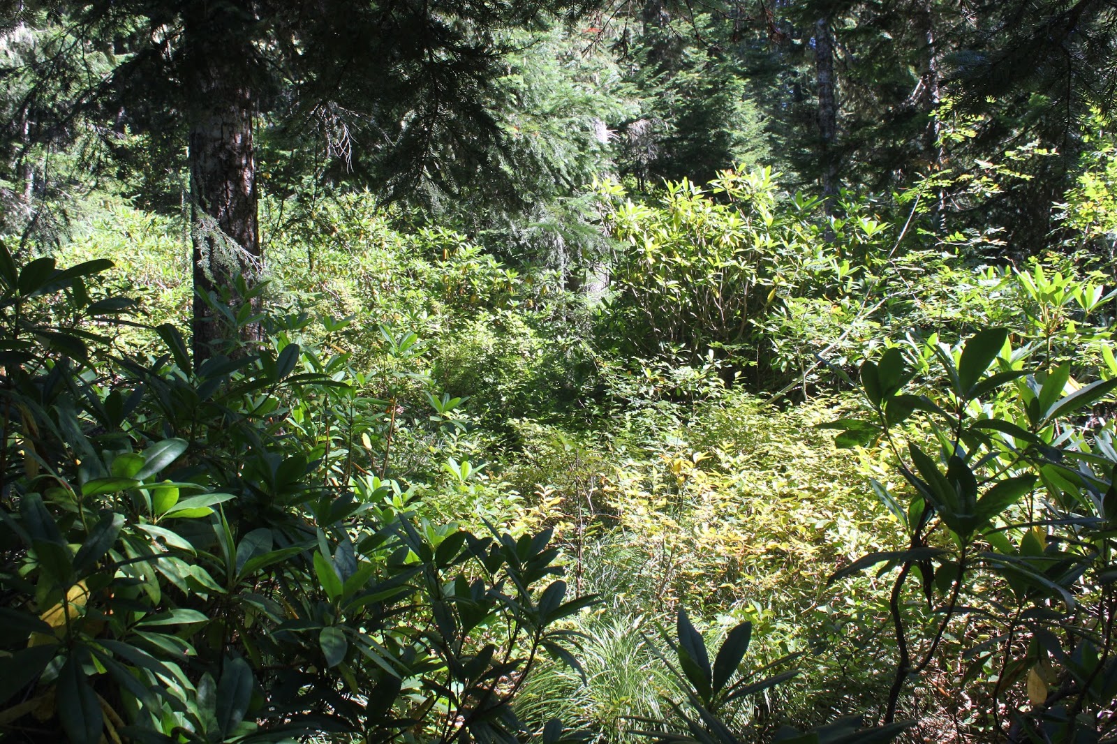
Trail through a beautiful forest on Tidbits Mountain
The steady climb through the beautiful and peaceful forest soon weeded camera toting hikers from non-photographers, and those who were out of shape from the uber-hiking crowd. Since Lane and I were both out of shape and toting cameras, we were in short order, way behind everybody else. The trail soon crested at a forested ridge at the site of the former Tidbits Mountain Shelter, right where two trails met.

Dense canopy of vine maple
When I had been here before, the trail coming in from or going to Road 1509 was an abandoned tangle of impenetrable brush. However, on this day, the trail had been cleared and reconstituted, offering a worthier hiking distance to Tidbits Mountain. I'm thinking I may try that next year during autumn, when the vine maples are sure to put on a show.

Smoky view to the west 
At any rate, we had a temporary reprieve from both taxing grade and viewless forest as the trail contoured across Tidbits Mountain. Already, we could see the first of our group of hikers standing on the summit laughing at us laggards. The path was crossing an avalanche slope with rocks deposited courtesy of Tidbits Mountain over the epochs. No trees grew in the rocks so we enjoyed the expansive view to the west, extending all the way to the coastal ranges of Oregon.

Just a short scramble left to attain the summit
Our reprieve soon ended when the trail circled around the mountain and then charged up the final push to the summit. Decaying boards, remnants from the ladder to the former lookout atop Tidbits, were strewn about on the last rocky bit which required mild use of hands (or use of mild hands) to ascend to the actual summit. 

Fire smoke filled up the valleys below the mountain
Actually, the Terwilliger Fire smoke made the view quite interesting. The brand new fire (already at 4,000 acres after burning for a day) had filled up all the river valleys with an ashy blanket of smoke, while surrounding peaks and hills poked their forested heads through the the smoky tapestry. Tidbits Mountain is actually two mountains and the near Tidbits twin was eminently visible. To the east were the Three Sisters, mostly hidden but with their pointy heads eerily rising above the smoke, like ancient pyramids of mystery from Teotihuacán. As far as seeing any further peaks, forget about it, the haze kept views near and dear to us Tidbitters.

Patty picks her way down the summit
After a lunch and laze atop Tidbits, we carefully picked our way down the rocky summit and Lane and I decided to take the lesser-used path round the back side of the mountain while everybody else used the regular trail for their return. Good move, everybody else! The path the two of us we were on grew fainter and sketchier and soon petered out altogether leaving us lost in the forest. Good thing we both had GPSs! We bushwhacked and scrambled down, popping out onto the trail just behind our bemused comrades. 

Yummy huckleberry
From there, it was another slow hike through a beautiful forest while nibbling on huckleberries and taking photos. In no time at all, Lane and I were soon lagging behind, per usual. The Terwilliger Fire wound up being a pretty big deal, eventually burning 11,555 acres. Had we hiked this trail a day or two afterwards we would have definitely hiked in unpleasantly thick fire smoke. So all things considered, we didn't do too bad by sneaking this one in when we did.

Bead lily beads
For more pictures of this hike, please visit the Flickr album.

Saturday, October 21, 2017

McKenzie River Trail

When I got up in the morning, the rain was just pouring down in sheets, loudly pelting the living room windows and disturbing the cat's sleep. "Watch", I told Dollie "I really don't want to go hiking today but there'll be three morons at the parking lot and I'll have to lead the hike anyway". John was the first to show and he said "Good morning, Richard" and I replied "One moron, two to go" Number two presented arms a few minutes later when Diana arrived. And right on cue, Lane appeared seconds before deadline. "Three morons, I called it", my hostile-sounding remark eliciting a puzzled look from Lane.

The Moron Hiking Club is now called to order
Lane picked up Ceresse in Springfield and after initiating her as an honorary member of the Three-Moron Club, we then headed up the McKenzie Highway, 5 intrepid hikers strong. The original plan was to hike around Clear Lake but I was watching the temperature gauge and it was just a few degrees above freezing. The east side of Clear Lake is all exposed lava fields and the idea of hiking through that in a rain/slush/snow combo just didn't sound very appealing. After a quick roadside confab, we made the impromptu decision to hike on the McKenzie River Trail instead. The thinking was that we'd see the fall colors that make the McKenzie River area so spectacular in October. Plus the thick forest would possibly provide some protection from the rain. 

Diana crosses Scott Creek
It was really pouring and it was cold. That about sums it up, weather-wise. The raindrops were heavy and fat, it was like being pelted by ice-cold water balloons without the balloon part. It was so wet that even the salmon stayed indoors. The overhead forest protection delayed the inevitable in that we were soaked within 5 minutes instead of immediately. Ceresse was heard to mutter to Lane about me "Doesn't he know that we could have mall-walked instead?" What, and miss all this?

Soggily spectacular
Rain notwithstanding, the vine maples were out-of-this-world spectacular. The maple growth underneath the tall firs was thick and profuse and all of it was tinted some variation of bright yellow. The day was dark and gloomy, yet the forest seemed to glow with a gold light from within. I'd like to say the fall colors were so spectacular that we forgot all about the cold rain but no, it was so darn wet we could not help but wonder what the heck we were doing out there.  Oddly enough, we never saw another hiker all day, not sure why that was. Come to think of it, we didn't see any mountain bikers, equestrians, or river rafters, either. Not even deer, raccoon, or newt; just us, all alone in the wet woods.

Trail shot


After nearly two miles, we crossed the McKenzie River on a road bridge and the trail was less groomed and more like a real trail. Meaning, the low spots in the trail were full of water and that was where I found out I have worn a hole in my boots. Oh well, at least my feet were wet and cold, didn't want them to miss out on all the watery fun. It was somewhere around here that I removed the camera battery and stored the camera in a waterproof trash bag for safety's sake.

You have to admit, it is an unbelievable display of color
I began to sense waning enthusiasm from my charges, a subtle sign of such was when Diana, Ceresse, and Lane turned back, each telling me in no uncertain terms I am no longer on their Christmas card list. Plus, my phone number has been blocked and they are not answering my text messages. John, though,  was still up for more and I figured he and I could turn around at the intersection with the forest road, winding up with a soggy 6 mile hike. As we continued on, the puddles became deeper and deeper, along with increasing frequency. Eventually, the trail was just one long continuous puddle and my cold wet feet got colder and wetter, if such a thing was possible. After all the spectacularly wet trail miles, it was almost anticlimactic when we turned around at the nondescript gravel road, but at least we got to splash through the puddles all over again on the way back.

Trail through the golden arches


I wound taking just 36 photos, a far cry from the 597 photos I brought home from the Upper Rogue River. I also wound up with 55 pounds of wet day pack, boots, socks, and other assorted clothing, but at least the camera still works. Once inside a dry car with the heater cranked up to full, we all stated that we enjoyed the experience and that we all felt sorry for all the people cooped up in their homes, foolishly staying out of the rain. Yup, we were 5 pretty proud morons!

A river and yellow leaves just about sums it up
For more pictures of this hike, please visit the Flickr album.


Saturday, July 22, 2017

Olallie Mountain

Olallie Mountain had been on my list for quite some time and I finally made it. Unfortunately, though, several weeks after this hike, the Rebel Fire set up camp below Olallie Mountain so I'm not likely to return there in the near future. At the time of this writing, I'm not sure whether there will be any shady forest left on the Olallie Trail after the fire, either. It would really be a shame if the fire overran the Olallie Trail, because the lush vegetation and deep shade were some of the main attractions on this green hike. But at least I made it before fire season began in earnest in Oregon.

Beargrass was common in the meadows


Accompanied by trusty canine friend Luna, I set out upon the Olallie Trail and entered the Three Sisters Wilderness almost immediately upon leaving the trailhead. The Olallie Trail pokes into a corner of the wilderness on the western border, so the Three Sisters were fairly far away despite our hiking in the namesake wilderness. As a result, the Three Sisters would be pretty much a non-factor on the lower (and forested) section of this hike.

Salmonberry, not quite ready for eating


The tree cover was as thick and lush as a young man's mane, and the shade dark as a teenager's mood, but a whole lot more pleasant to be around. Spring was definitely going on, and I spent a lot of time low to the ground, sometimes lying on it (while a dog licked my ear) taking pictures of bunchberry, wild ginger, coneflower, penstemon, Columbia windflower, and goat's beard. And speaking of goat's beard, I probably should shave soon.

"To sit in the shade on a fine day and look upon
verdure is the most perfect replacement" - Jane Austen
The trail angled steadily uphill through the forest before crossing a small creek in just under a mile. Intrepid bushwhackers can follow this stream to its source at Wolverine Lake. However, I was expecting a clearer route; the hillside was covered with thick vegetation and fallen trees and while Luna was not averse to a good bushwhack, I wasn't in the mood, so we kept hiking on the Olallie Trail.

Humid meadow on Olallie Mountain
And now a word about the weather. On the drive up, there was a chill in the morning air and geese were flying south in their traditional "V" formation. In sunny exposed areas along the roadway, vine maples were showing their first autumn blush. Winter is coming. But not so fast, Richard, by mid-afternoon, the oppressive heat had taken care of all that winter chill. While the forest was shady, it was fairly warm despite the shade. Meadows were worse, where the sun baked both dog and hiker noggins. The stultifying heat had us both panting to keep cool, while the humidity had us all sopping wet in short order. Note to self: don't wear a black shirt when it's hot and humid like that.

Looking down the French Pete Creek valley
From the junction with the Olallie Trail and the Olallie Mountain Trail, it was all meadow and it was all uphill, too. I bonked, and it was a slow trudge for the remaining mile or so to the Olallie Mountain summit. Gone were all the shade loving flowers but on the plus side, I got to take pictures of sun-loving beargrass, Washington lily, lupine, and Indian paintbrush.

The Three Sisters, from Olallie Mountain
One last steep push delivered us to the Olallie summit where an old lookout and prodigious views were our reward for all the hard work. And best of all, the rustic and dilapidated lookout provided shade on one side, so we plopped down and enjoyed the expansive panorama before us. The Three Sisters were directly to the east and easily dominated the view. North of the volcanic sisterhood was Mount Washington, Three-Fingered Jack, and snowy Mount Jefferson. In the haze to the south, Mount Thielsen was barely visible. On the west side of Olallie Mountain, the valleys and canyons of Rebel Creek and French Pete Creek dropped off into the South Fork McKenzie River, all winding up in the prominent McKenzie River valley. In the distance, were the faint blue ridges of the Coast Range. Pretty awesome view,  if I do say so myself.

South Sister, on the way down
After a lengthy lunch, view-soak, and photo-shoot combo, we reluctantly left the summit and headed back down the trail. On the way down, we ran into another hiker who had one of Luna's kind with him, much to the enjoyment of both our dogs. He had just done a PCT section hike and was looking to hike the trail around the mountain. Unfortunately he had to give that idea up, stating the Olallie Trail, just past the junction, was pretty much lost to the vegetation. Of course, the following week, the Willamette National Forest posted an announcement that they had finished brushing out the Olallie Trail. And of course, a week later, the Rebel Fire set up camp for the remainder of the summer. I guess my timing was both good and bad for this hike, but at least my very lengthy list became one hike smaller.

The seldom seen fringed pinesap
For more pictures of this hike, please visit the Flickr album.


Friday, July 22, 2016

Lowder Mountain

So Richard, where did you go hiking?

I said "Lowder! And why are you yelling at me?" Yeah, yeah, I know...weak pun but that's my tortured segue into a discussion about hiking on Lowder Mountain and I'm sticking to it.

Prince's pine
The night before, I had enjoyed some good music at Sam Bond's Garage, which is rapidly becoming a second home away from home now that I'm retired. So while the concert was pretty cool (even though it was Lowd), it made for a very late night by the time I drove back to Roseburg. And since late nights are not conducive to early morning risings, especially in my retirement years, it stood to reason that any hiking done the day after would have to be late in starting, and moderate in length and ambition. Ergo, I began my hike on Lowder Mountain at the shameful hour of 2:00PM, and why are you yelling at me?

Beautifully shaded trail
After just 5 yards of hiking, it was apparent that the main attraction (for the time being) would be the lush forest. Green vegetation and dark shade was the theme and the forest floor was carpeted with green leaves and delicate accents of foamflower sprays. Fragrant heart-shaped leaves of wild ginger hid the ugly brown flowers underneath, but I knew how to find them. Large clumps of pink woodland phlox and prince's pine were abloom on the forest floor and a profound hush permeated through the trees. Yes, I said hush, there was nary a mosquito whine to be heard and I almost missed the little buggers.

Vine maple provides green-colored ambiance
The trail climbed up through the forest in a series of switchbacks but the grade was fairly gentle. The map said I was walking above Quaking Aspen Swamp which I looked forward to exploring. However, the thick forest prevented access and vision thereof, no swamp or quaking aspen for me. But a dense canopy of vine-maple leaves colored the air green and kept the temperature mild; life was good on the trail despite the lack of quaking, aspens, or swamps. Periodically, the trail would enter open meadows clinging to the slopes of Lowder Mountain, where columbine, tiger lily, and coneflower bloomed the day away under a cobalt blue sky. 

Meadow on Lowder Mountain's slopes


As the trail gained elevation, the trend was toward less forest and more meadows. And with the meadows came views of the deep valleys of the South Fork McKenzie River, one of which contained Cougar Reservoir hiding below. One of the mountains on the other side of Cougar Reservoir is called Deathball Mountain and I would love to know the story behind that name! With a moniker like that, I should climb it and just make up the story of how it got its name. It would save me some tedious factual research!

Zen moment


In a grassy meadow, a worn down trail sign marked the intersection with the trail leading to Yankee Mountain and then down to Cougar Reservoir in a knee-taxing descent. I looked on the map and the trail either loses or gains elevation, depending which way you are hiking it. Either way, the elevation change is 3,300 feet in 1.9 miles: whew! With stats like that, that particular trail just got on my list for future hikes!


Just follow the cairns


Anyway, after the intersection, the Lowder Mountain Trail started to climb in earnest, leaving the meadows behind and entering anew a dark and shady forest. Again, switchbacks kept the grade manageable for the most part. Suddenly, the trail spit me out onto an unexpected pumice barren and my eyes squinted myopically in the bright sunlight. The trail became somewhat faint but there were a series of rock cairns to keep me on track.

The Three Sisters


Horsepasture Mountain across the East Fork
South Fork McKenzie River canyon

Karl and Ruth Lakes
Lowder Mountain doesn't seem like much of a mountain when you are hiking on it as the summit is as large and flat as an Arizona mesa. The trail really became hard to follow in the vegetation as it went around a rather large and sparse meadow ringed by trees. The meadow (and Lowder Mountain, too) abruptly ended at a very tall cliff and the view from that rocky perch is why we hike. The snowcapped peaks of Middle Sister and North Sister hugged each other in permanent sisterhood while South Sister stood by her aloof self . Beyond green and forested Horsepasture Mountain rose Mount Jefferson and a cloud bank on the distant Columbia River hid Mount Hood from view. In between were lesser peaks such as Three-Fingered Jack, Mount Washington, Belknap Crater and Broken Top. To the south, the tip of Diamond Peak was visible. And directly below, Karl and Ruth Lakes lay in a forested basin. A view for the ages, once again!

Thimbleberry was everywhere
As I left, another hiker emerged from a nearby viewpoint and I greeted him with a "I thought I had the mountain to myself!" He smiled and replied "Well, I was here first". He was Brian, from Eugene, and we happily talked trails on the way back from the mountain, making the miles go by quickly. When we reached the trailhead I asked him "What was the name of this mountain, again?"

Golden yarrow


"Lowder", he helpfully replied.

"What was the name of this mountain, again?"

He seemed to be such a nice guy too, but he did leave in a hurry for some reason. He didn't even say good-bye but that's OK, his actions spoke Lowder than words. 

Cow parsnip catches some afternoon light
For more pictures of this hike, please visit the Flickr album.

Sunday, September 8, 2013

Tidbits Mountain

Lions and tigers and bears, oh my! In my many trail miles, I've run into the hiking equivalent of those fearsome creatures in the form of bears, rattlesnakes, cougars, and deer. And after last weekend on Tidbits Mountain, yellow jackets have been duly added to the list. At least the bears and cougars ran away from me, but the yellow jackets buzzed angrily towards me en masse with malevolence in their hearts. 

Either a sinkhole or the world's biggest wasp nest
The hike got off to an interesting start when a sign proclaimed the parking lot was closed due to a sinkhole. Stepping around the small pit, we (brother Don and friend Jesse) set out onto the Tidbits Mountain Trail. I must have left my brain in the sinkhole because I'd forgotten to put a fresh battery into the camera. Of course, I didn't realize it until we'd hiked a half-mile or so, I did a quick dash back to the car to retrieve the spare battery. Gotta get my extra miles in, somehow!

Making movies of the trail kind
Hiking for reals now, the trail angled gently for the most part through some beautiful forest typical of the west-side Cascade Mountains: lots of tall fir trees, lush undergrowth, and sunlight filtering through a green canopy of vine maple leaves. On occasion, the trail went steep, and we got to exercise our heavy breathing muscles.  Don was making videos and I was taking pictures, so it was a stop-and-go hike. 

Reenactment of me running from the wasps
About halfway up, I noticed a swarm of flies buzzing on the trail.  Curious, I stopped to see what the buzzing was all about. My mistake! The flies were not flies at all but yellow jackets nesting on the trail. My first inkling that I might have misidentified the insects was communicated to me by the nerve endings in my calves which reported to my brain that my legs were on fire in multiple spots, like a forest the day after a lightning storm. The darn wasps were stinging me and I got my morning sprint in on this hike. And I didn't even get a picture of the wasp nest!

"Trail" to Road 1509
At a wooded saddle, the Tidbits Mountain Trail intersected with a trail that had been long abandoned. Timber and rusting metal marked the site of a former shelter, also long abandoned.  A sign marked this as the Gold Hill Trail and pointed us in the direction of the Tidbits Mountain Lookout, also abandoned a long time ago.  Too bad those yellow jackets couldn't abandon the trail.

Tidbit gives us a finger
After a short climb through the forest, the trail spit us out like chewed up sunflower seeds onto a talus slope right below Tidbits Mountain proper.  From the slope we could see down the Canyon Creek drainage as it emptied into the Santiam River drainage, also visible.  On the western horizon, Mary's Peak on the Coast Range poked up out of the haze.  And above us, small rocky columns on Tidbits Mountain waved greetings, looking like Three-Fingered Jack's other two fingers.

Just about at the summit
A short and steep climb through a forest spit us out like watermelon seeds onto the summit where we whooped with joy. Well, we might have been a bit premature with the whole whooping thing because the actual summit was behind us, requiring another short but steep push up a rock cliff where mild use of hands was required. Apparently, the lookouts used to climb a ladder and the rotting timbers of the ladder still lie on the mountainside.

But who's taking a picture of me?
From the summit, we could see some more stuff.  Tidbits Mountain had a twin and we watched peregrine falcons soar and float around the sheer cliffs.  On the eastern horizon, we had nice views of the Cascades from Diamond Peak to Mount Jefferson, with the Three Sisters being the nearest.  Way cool, and we enjoyed a lengthy lunch and gawk.

Camera gear abandoned to the yellow jackets
On the way down, I got to share the wasp love with Don as he was tagged just before I got tagged a couple of more times on the legs before I could laugh at his discomfiture.  What possessed these yellow jackets to build a nest right on the trail tread?


The children climb Wolf Rock


After the hike, we drove up the Blue River to visit impressive Wolf Rock which had been eminently visible from Tidbits Mountain. Don wanted to take me scrambling up the 1,300 feet or so of cliff to the top of the massive monolith. Heeding the advice of my inner physical therapist, I declined as my surgically repaired wrist is still not ready for such adventure. Don and Jesse scrambled up a rocky amphitheater on their way to the summit while I stayed behind. At least there were no wasps to sting me as I waited for the two tykes to return.
Tidbits Mountain's twin


For more pictures of Tidbits Mountain and Wolf Rock, stop by and visit the Flickr album.