Showing posts with label Bullards Beach State Park. Show all posts

Wednesday, February 17, 2021

Cut Creek/Bullards Beach Loop


During my usual wintertime pastime of browsing brochures, guidebooks, and websites, I came across a horse-trail map of Bullards Beach State Park. If I began at the Coquille River Lighthouse, I could cobble together a seven to eight mile route through the coastal woods and dunes lurking behind the beach. The allure of this route was that I had never been on the Cut Creek Trail, Northern Loop, and Tsunami Trail before, so all these routes were already pre-permeated with the alluring scent of new trail. Best of all, the terrain was fairly flat for the hernia-impaired and whatever could go wrong?

New camera took a picture of an old rock

Heh heh, a lot apparently, but more on that in a bit. First off, I was really excited about this hike because not only was this a brand new trail for me, but it was both a new trail AND a new camera! I had been having technical problems with my old camera so I ordered my accountant (to whom I'm married) to drop everything immediately and buy me a new camera, stat! That didn't work too well and I had to rephrase and resubmit so it sounded more like a politely worded request, plus I had to actually ask for permission, saying "please" and "thank you" and all that stupid polite stuff. But, after four days of impatient waiting, the camera arrived and it was now time to go play and hike. I think I was so overjoyed that I nearly ran across the dunes and capered through the woods like some of my uninhibited canine friends, hernia notwithstanding.

The mighty Coquille River

At any rate, the hike began near Bullards Beach Campground and I followed the paved trail overlooking the wide Coquille River to the Cut Creek Trailhead. Along the trail, Scotch broom heralded the coming hay fever season with a few desultory but vibrantly-colored yellow flowers. The paved pathway morphed into a soft brown trail comprised of decomposing pine needles flanked by a green coastal jungle and my new camera was immediately put to work.

Yes, this really is the trail

The Cut Creek Trail is primarily a horse trail and accordingly, begins at Bullards Beach Horse Camp. Upon entering the woods right at the start, I had to step around a puddle of water on the trail. The puddle was only an inch or two deep and I could nearly step across it with one manly stride. But that was too good to last. After the first puddle came another, and another, and another, etc. Each puddle was wider and deeper than the preceding puddle. It was kind of like a computer game in that you could brag "Hey, I made it to Puddle Level 14 today!" 

A knee-deep section of trail with a nice reflection

I'm not sure who Jack was but there is a Red Jack Trail and a Black Jack Trail that lead away from Cut Creek Trail to the beach. Both trails are about a quarter-mile long and hiking on either trail was eschewed in favor of the dubious hiking glory that awaited me on several miles of water-covered Cut Creek Trail. The surrounding terrain was heavily wooded and the thick growth made it nigh impossible to bushwhack around these puddles that now bordered on the size of small lakes. To make it worse, years of usage by the horse-riding crowd had turned the trail into an earthen trough and the puddles, just like teenagers the world over, now had a lot of lip. At some point, water began pouring into my erstwhile waterproof boots from above the ankles, making feet wet and cold. My boots were still mad at me over the Threemile Lake expedition and soon became pretty warm with justified ire. However, the icy coldness of the water kept any sweltering of feet to a minimum, but I got the point.

Trail shot (kidding!)

Suddenly, the path exited the woods and traversed a sandy track that was awesomely dry. Heh heh, that was just a joke played on me by trail-makers because the deep puddles soon resumed even if the dense woods did not. This was open marsh and beachgrass country and I found myself merrily splashing past a series of lakes and ponds that fortunately, were not part of the trail. I ran into several people exploring the dunes on horseback and while they seemed nice and all, I couldn't help but notice their steeds wading in water that nearly came up to their bellies, realizing that they were walking on the trail waiting for me in my immediate future. But after steeling my resolve and hoisting the new camera high, I bravely waded across while the riders, who had stopped to watch, applauded either my bravery or foolishness.

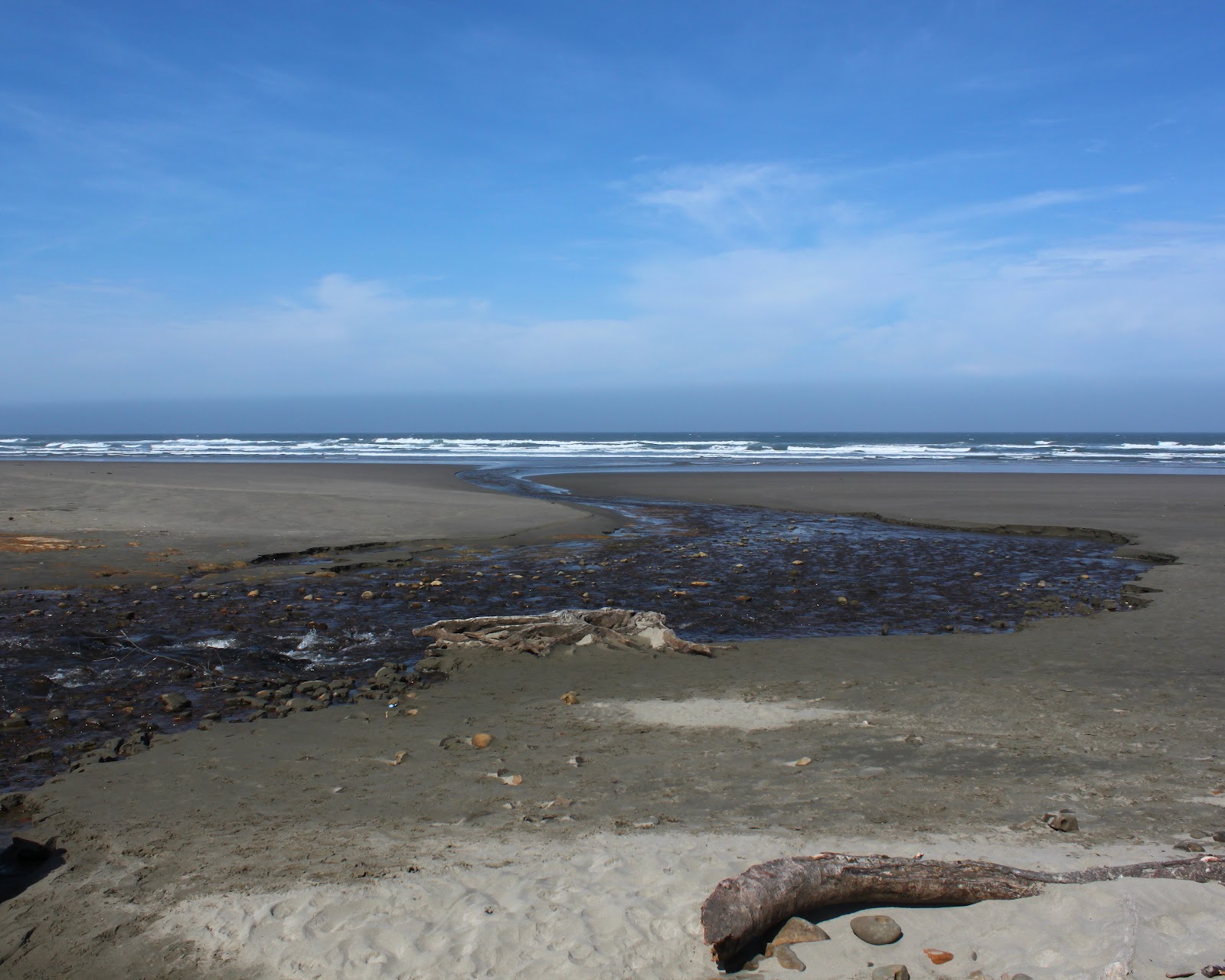
Pictures you take when standing in the surf

Well, after nearly three miles, it was nice to get out of all the standing water and on to the relatively dry confines of Bullards Beach. I had given up on the rest of the Northern Loop which, at a trail junction, appeared to have even more water on it than the Cut Creek Trail. Anyway, my loop route would be closed by a less taxing return on Bullards Beach. As I headed south towards the Coquille River, the day gradually changed from sunny to cloudy, and the surf transitioned to high tide. Normally, I'd run from the incoming waves but what the heck, my boots and the feet contained within were already soaking wet so what would be the point. I stayed put, letting the surf wash around my ankles while I photographed the scene. 

The North Loop was even more waterlogged!

So, to summarize, this was one wet-footed endeavor whether on beach or through woods. Sounds like a great hike to me, and don't listen to my boots! For more photos of this hike, please visit the Flickr album.

Saturday, December 5, 2020

Coquille River


Didn't see that coming! At the end of my hike in the Bullards Beach State Park area, there was parked a van covered with all kinds of decals for windsurfing gear and paraphernalia. The striking combo of white van and dramatic background of dark and foreboding clouds triggered my inner photographer. The rear doors of the van were open so I casually approached the vehicle with the benign intent of politely asking the occupant for permission to take a photo. Yikes! The van was solely occupied by a pair of rabid dogs (wolfhounds from Hades, even!) that let me know vociferously and with much rabidity that my presence anywhere near the vehicle was most definitely not canine approved. I staggered backward in surprise and shock, but really, that was just the last travail on a hike that did present several other trials and tribulations. Also, it was the only travail that involved snarling and sharp teeth but then again, I wasn't hiking with my wife.

The lighthouse presides over the mouth of the Coauille River

There is no official trail along the Coquille River but one can follow a series of use paths tamped out by curious rivergoers or simply follow the wide river when the paths peter out. After shooting some photos of historical Coquille River Lighthouse, I began walking upstream on the aforementioned paths. The sun was out and the river sparkled in the morning light while the town of Bandon sprawled peaceful and quiet on the other side of the river.

Remnants of a bygone era

Bandon's been around since the 1850's or so and much of its history is that of port and harbor on the Coquille River. Once the lighthouse environs were hiked away from, I observed vestiges of that former history in the form of pilings and wooden pillars where once stood viable piers, wharves, and maybe a crab shack of ill repute or two. Notably, the tide was visibly surging upstream through the decaying pilings. Good thing I'd be well off the river banks by the time the tide actually crested.

Raccoons patrol the sandy banks of the Coquille

For the most part, hiking along the river was fairly easy. The tide was rising but not yet fully risen, the ground was firm, and the weather bright and sunny. And yes, you guessed it, that was all too good to last. Bad weather was in the afternoon forecast and by mid-morning, a dark cloud bank scudded over and that was it for the nice sunny day. Additionally, the hiking became a bit tedious when a water-filled slough entered the river at right angles to my route. Time for some bushwhacking!

One of a whole slew of sloughs

It was just a little slough, yet it was too wide to jump over and too deep to wade across, so I followed its banks inland until the watery channel petered out. Part of following the channel involved beating my way through dense patches of Scotch broom, scratchy low-growing conifers, and thorny bushes of gorse. Eventually a pile of logs provided the means of getting across the channel and I made my way back to the river, which acted like nothing out of the ordinary had ever happened at all.

"Make speed in the gathering storm..."
(Paul Kelly)

That was just the beginning. The sloughs came with increasing frequency with each one being wider and deeper which was really annoying because ahead, I could clearly see Bullards Beach Campground, my intended destination. The campground was less than a mile away but it might as well have been located on Jupiter's twelfth moon, thanks to the intervening sloughs. As I negotiated my way around each water channel, the daylight dimmed considerably thanks to increasingly dramatic clouds emoting over the coast. The wind picked up and obviously, rain would be happening at some point in the afternoon.

A waterfowl flees the scary hiker
trying to cross the water channel

What was also increasingly obvious was that the water channels would not let me get to the campground via the Coquille River. The largest slough yet pushed me well to the west and nearly all the way to the beach foredunes, which was almost where I had started this hike from. Giving up on the river-walk thing in entirety, I veered north through some scrubby hinterlands, eventually crossing the Bullards Beach roadway. From there, I grabbed the paved trail leading to the campground, the path providing nice overlooks of the wide river. However, the weather was trending toward downright belligerence, so it was deemed prudent to start heading back to the lighthouse before things got too miserable.

The wind moves sand at high velocity

After taking a sandy footpath that led to the beach, I commenced hiking south into the wind. Airborne rivers of fine particulate matter flowed just a few inches above the sand and my booted and pantsed (panted?) ankles and shins didn't care. My pace was not all that quick because the foreboding clouds were wildly photogenic in a moody and stormy way; naturally, lots of photography ensued. High tide was surging and I had to run from waves every now and then. The constant wind and surf churned up small clouds of seafoam that were spirited away by the breeze to points unknown. Hiking on the beach in stormy weather is wild, yet totally exhilarating, and I enjoyed every tempestuous minute of it. 

This van guarded by devil dogs


After an adrenaline-fueled backpedal away from that van full of snarls and growls, I heard a chuckle from in back of me. It was the wetsuited owner of the van and devil dogs, quite amused by my discomfiture. But, he did let me take my photo and that capped off a great hike and photography combo.

A storm cometh. It has been foretold.

For more photos of this hike, please visit the Flickr album. 

Saturday, February 10, 2018

Bullards Beach to Seven Devils Wayside

That's it, I quit! No more hiking inland! Lately, every time I hike in either the Cascades or the Siskiyous, the weather's been rainy, cold, or all of the above. In contrast, almost every time I've hiked at the coast in the last few months, the weather has been absolutely glorious with spring time sun shining brightly with perfectly mild temps. The latest case in point was a recent hike from the Coquille River to Seven Devils State Recreation Site (which is just a glorified name for "picnic area on Seven Devils Road").

Between the Friends of the Umpqua and the South Coast Striders (a sister hiking club from Coos Bay), we had nearly 20 hikers presenting to arms. By the time we showed at the meet-up point at Seven Devils, the Coos Bayliens had already worked out the intricate machinations of the vehicle shuttle. By way of explanation, the shuttle process was required because this was a one-way beach walk of 8.2 miles with drivers needing a ride back to their vehicles at Bullards Beach after the hike was over. We left a couple of cars at Seven Devils for that express purpose and began hiking from the Coquille River and its attendant lighthouse and river jetty.

This fossil found a fossil
The lighthouse used to be sited on an island in the middle of the river entrance but man in his infinite wisdumb, constructed a rock jetty to shepherd the river safely out to sea. The normal oceanic shoreline currents were interrupted and impeded by the jetty, with the result that backfill soon connected the lighthouse's island to the shore. I think that also as a result of this particular instance of man tampering with nature, is that Bullards Beach is always (within my experience, at least) littered with rocks that make this beach the beachcomber's equivalent of a yard-sale addict with $500 to spend at an estate sale. 

Sanderlings do the wave dance
Well, it didn't take long for me and several other beachcombing like-minded individuals to start walking slower, eyes carefully scanning the ground for beach treasure. Directly related to said activity, my pack soon weighed more that it did when I had started hiking, due to my toting a healthy sampling of clam fossils and petrified wood. My buddy Jay was similarly afflicted and burdened.

Our basic view for 8 miles
Although a cool breeze was a constant and the temps were somewhere in the low 50's, the sun was out and there was no chance of rain. The Oregon coast stretched out in front of us and we could see all the way to Cape Arago. I told Jay we were hiking all the way there because it was  so much fun to hear him cry with dismay.

The tide was out, to put it mildly


The tide was receding and by the time we reached Cut Creek at the 4 mile mark, we had acres of sand to walk on as the ocean had sullenly withdrawn from all beach proceedings. Tidal flats and sand bars were exposed by the retreating sea, and there was more slow walking due to some more obligatory beachcombing. There was probably like 40 or 50 yards of wet sand that was firm enough to provide a nice hard surface for easy hiking.

Jay ponders how to cross without getting feet wet
The next landmark after Cut Creek was Whiskey Run, a medium sized creek that sinuously S-curved its way to the much larger ocean. A pair of kite surfers were doing their thing in the choppy surf while fisherman were filling up their buckets with perch, enjoying peaceful beachy solitude as they plied their avocation. At the water's edge, flocks of sanderlings comically darted in and out, matching the ebb and flow of the waves.

Tidepool scenery at Fivemile Point
About a mile past Whiskey Run, Fivemile Point seemingly blocked the way. Now, I've hiked around the point a time or two, but always on a receding tide. In each instance, it had been tricky scrambling over the rocks while waves tried to eat me. But ah, at low tide, no such issues at all, it was merely a simple walk around the point.

Exposed shoals at low tide
Well, maybe not all that simple, for the retreating tide had left numerous tide pools that just called for exploration and photography. Jay and I, who were already lagging far behind the main body of power-hikers, soon lagged even further behind but on the other hand, we both have lots of photos of the scenic pools and rocky islands at Fivemile Point. 

Twomile Creek beelines for the sea
Even though it is only a mile further past Fivemile Point, the creek there is called Twomile Creek. Around here, they must use the metric system when naming their landmarks. But Twomile Creek marked our exit point off the beach and the end of this 8.2 mile beach walk. We all really enjoyed this sunny day on the coast, made perhaps even more memorable by comparison to the next day's hike in a swirling snowstorm on the North Umpqua Trail. Seriously, I'm just going to hike at the coast from here on in.

Nice haul!
For more pictures of this hike, please visit the Flickr album.


Sunday, May 13, 2012

Sacchi Beach

So my alarm rings early Saturday morning but instead of bounding up out of bed with unbridled enthusiasm, I dispiritedly slap at the alarm clock and go back to sleep. And when I woke up several hours later, I had missed a hike with the Friends of the Umpqua Hiking Club. D'oh! It's too bad, because they were hiking from the Seven Devils Wayside, north of Bandon, and I had never been hiking there. After a day of rest and chore-avoidance, I (and Maggie, our happy-to-be-out-hiking dog) drove out to Seven Devils Wayside and performed a solo reenactment of the hike.

Twomile Creek on Merchants Beach

Maggie sprints to Fivemile Point
It was a gorgeous spring day and Twomile Creek burbled merrily onto the beach. We too, burbled happily onto the beach and crossed Twomile Creek and headed south to Fivemile Point. Seven Devils, Twomile, Fivemile: lots of numbers in these parts! Maggie, with unbridled and simple canine enthusiasm, ran ahead and then ran back to make sure I was coming, she got the double mileage award as a result.


Fivemile Point

Fivemile Point is a fairly innocuous looking point that juts out into the sea. Rounding the point at any other time besides at low tide would be anything but innocuous, however. Fortunately, the tide was retreating and we had no issues. Well, Maggie did have an issue as she was getting used to wading through the ankle deep puddles in between all the rocks. Not paying attention, she blundered into a tidepool that was about 5 feet deep and she paddled frantically back to relatively dry land, much to my amusement.


Whiskey Run Beach stretched ahead of us when we rounded the point and there was a noticeable dearth of rocks. It was just miles and miles of sandy beach fading away into the misty yonder. We walked as far as Whiskey Run, a creek that flows through and from its namesake wayside and picnic area. Since it was another 7 miles or so further to Bandon and Bullards Beach and since there really weren't any major sights to see, we turned around and re-rounded Fivemile Point.

Whisky Run, full of water...boo!

Agate Beach rocks!


Heading north, we left the tidepools at Fivemile Point behind and continued north past the Seven Devils Wayside. Rounding a small point, we ambled onto Agate Beach. The beach is covered with rocks of every shape and color, most rounded to smoothness by centuries of wave-on-sand action.  I spent a lot of time prone on the ground, squinting through the camera viewfinder while Maggie plopped down on the sand, bored with the whole photography process. My grandchildren would have a field day on this beach, we'd never get them to leave! Plus, I'd have to carry the bucket of rocks back.


At the north end of Agate Beach was an unnamed point that also would be impassable at high tide, just like Fivemile Point. Rocks and tidepools abounded with starfish clinging to rocks covered with mussels and barnacles. Waiting for us as we rounded the point was the long and secluded cove of Sacchi Beach.

This hike was not pointless

Oceanic mayhem at the end of Sacchi Beach


Arago Peak, above Cape Arago, had been off in the distance when we began this hike but now it was kind of close in an indicator of just how far we had walked. There were some pretty fancy homes, castles really, perched on top of the massive cliffs above the sandy beach. These homes probably have a limited shelf life, judging by the amount of debris at the base of the inexorably crumbling cliffs. At any rate, we walked to the end of the beach which is bordered by a cliff at the north end and observed the waves crashing on the jagged rocks and pinnacles beyond the beach.

One small treasure
It seemed like the tide was beginning to rise so I put the camera away and walked really fast to the unnamed point, having no desire to get stranded at Sacchi Beach. They make horror movies about people who get stranded in remote areas. I need not have worried, for we had plenty of dry land at the point and the camera came out again.


Before we end this blog, a brief word about pelicans. We obviously were walking under a pelican flyway as squadrons of them flew silently and mysteriously above us. This was like an interstate freeway for the odd--looking birds as formation after formation flew north.  Needless to say, my picture collection now has lots of pelicans in it.

Strafe the hiker!


Saturday, March 10, 2012

Bullards Beach

Bullards Beach, on a rare sunny day in March
Way too many years ago, I volunteered to lead a couple of hikes for the Friends of the Umpqua Hiking Club. I chose two hikes at random (Mule Mountain and the Sandstone Trail) simply because I'd never been on them. What seemed like a good idea at the time turned out to be two very steep trails up to the top of a mountain and my friends accused me of attempted homicide by hike. After the hike I had fewer friends in the Friends and that was the very first time I heard the phrase "...it's a Richard Hike". 

A bridge to nowhere does not a Richard Hike make

Nowadays, new hikers are warned by experienced club members that a Richard Hike is one that is uphill both ways or otherwise involves some another degree of difficulty. But Bullards Beach is flat and easy, the very antithesis of a Richard Hike, what could possibly go wrong?


We began our hike at the historic Coquille River Lighthouse. The lighthouse was originally built on a small island but when man decided to tame the Coquille by constricting it in a jetty, they also messed with the tidal currents. The result was the ocean backfilled the gap between island and land and to this day, large logs get routinely deposited near the lighthouse site.

The Coquille River Lighthouse

But enough history and implied criticism of man's propensity to tinker with the environment, we have a hike to do. March was so miserable, weather wise, it had only one nice day all month and this was the day. The sun was out under clear blue sky and the ocean and river sparkled like Tinkerbell casting a spell. We headed up the Coquille River without benefit of trail, following the muddy shoreline for a couple of miles.


A small creek trickles into the Coquille River
Eventually, we ran out of muddy shore to slog through, winding up at the paved Park Road at Bullards Beach State Park. Crossing the road, we grabbed the manicured, sometimes paved, and always more civilized trail through the park's campground. Most of the park was closed as March in Oregon is not the optimal camping season so we appropriated an unsused picnic table in Loop B and enjoyed a lunch in the sun.

Stop! Slow down!  It's like my wife came along
Then the "fun" began. The trail leaving the campground had yellow tape in front of it with a "trail closed" sign posted. All eyes looked to me for guidance, I shrugged my shoulders and walked around the barrier. Up and over the forested dune we go, then dropping into the grassy marshlands behind the beach foredunes. We then found out why the trail was closed:  there was several feet of water on it. 

News Flash: Hike leader killed by disgruntled hikers! 

A wave of dismay rippled through my school of fish, aqueous puns intended. There was more dithering about what to do than can be heard at a congressional committee in session. Clearly, some firm leadership was called for, so I just waded in. It was amusing to me, because I could immediately sense the shocked silence in back of me. I figured it would be a short wade but it was close to 3/4 of a mile before we found dry land again; I heard the customary pejorative muttering of "...it's a Richard Hike".

Any residual hostility towards me was quickly dispelled by what amounted to a pleasant beach walk under the warm sun as we closed the loop by returning to the lighthouse. We scrambled over (some scrambled more easily than height-challenged others) the pile of logs at the jetty and enjoyed the jetty views of Bullards Beach and the Coquille River. Everyone enjoyed the hike, at least as far as I could tell, despite the fact that an easy hike became hard at one point.  But would we expect any less from a Richard Hike?

Me, behaving maturely on the north jetty