Showing posts with label Brookings. Show all posts

Friday, June 7, 2019

Oregon Coast Trail (Thomas Creek Bridge to Lone Ranch Beach)

"You're in charge, Richard!" Bwah-hah-hah, oh how I love to get the mantle of leadership conferred on me. It's like being given free rein to come up with a Richard Hike. Of course, my three comrades John, Katchan, and Edwin were all up to the task and to be honest, a Richard Hike is much easier than a John, Katchan, or Edwin hike, anyway.

A carpet of false lily-of-the-valley
This was the first day of a weekend campout at Harris State Beach, located near the town of Brookings, Oregon. Since the consensus was that I was the only one even remotely familiar with this area, I could and should choose the hikes. Feeling some responsibility for coming up with a challenging hike, I settled on a rugged section of the Oregon Coast Trail that ran through the southern half of Samuel Boardman State Scenic Corridor. Basically, the Oregon Coast Trail lives and breathes in the narrow strip of land between Highway 101 and the ocean. Despite the narrowness, the coast here is nothing but scenic with a plethora of viewpoints and coastal landmarks to gawk at. And when not gawking at landmarks, we could simply enjoy the lush coastal jungle growing on near vertical slopes that are the rugged line of demarcation where the Pacific Ocean begins and Oregon abruptly ends.

Tangled tendrils on a coastal manroot
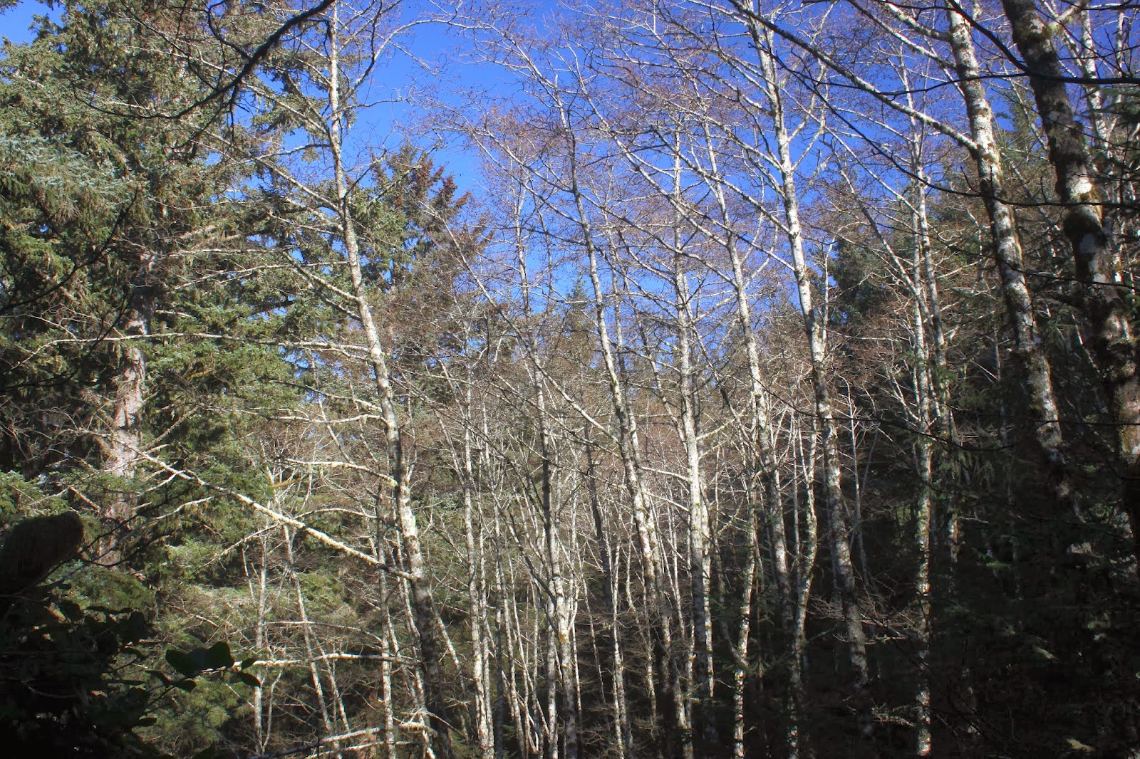
The plan was to begin at Thomas Creek Bridge, a highway bridge spanning the narrow canyon of Thomas Creek. At 271 feet above creek level, Thomas Creek Bridge is noteworthy because it is Oregon's highest bridge. It is hard to get a good look at the bridge even on a good day, but it's completely impossible when the viewpoint is closed because of construction, which was the case on the day of our hike. 

John takes the scramble trail down to the Oregon Coast Trail


No worries, even though the viewpoint and trailhead were closed, we followed a scramble path (with some use of hands required) that dropped precipitously to the Oregon Coast Trail contouring through a dark and shady forest. The Oregon Coast Trail in Samuel Boardman Park is notoriously rugged as it constantly goes up and down but rarely level, and suffice to say we got plenty of exercise within the first several miles.

Katchan stops for a photo-op
As we were maybe just starting to get habituated with the forest, the forest suddenly stopped and we found ourselves perched high above a narrow defile, with surf crashing against the rocks well below our trailside aerie. It would be just a few horizontal steps to get to the beach but it'd be roughly about a thousand foot drop to get there so we decided it'd be best to stay on the trail. 

A patch of lupines perch several
hundred feet above the ocean
As the trail descended through trees and salal, stunted and shaped into phantasmagorical forms by the constant sea breeze, we enjoyed an awesome view of the Oregon coast stretching north. Massive cliffs and steep slopes, all densely forested, plunged more daringly than a courtesan's neckline at a royal ball. Below the cliffs were some incredibly narrow but scenic beaches which would be amazing to explore, were it not for the nigh impossible task of getting down to them. Scattered randomly offshore were a myriad of islands big and small, collectively dotting the azure sea like a rash of black measles on a Smurf.

Douglas iris was all along the route
On the trail, Douglas irises were blooming in veined purple profusion and the two hikers with cameras (Katchan and your merry blogster) soon found themselves lagging behind the two without. While the trail steadily lost hard won elevation, we were not going all the way down to the beaches below. Instead, we leveled out at beautiful and fascinating Indian Sands.

Sand dunes at Indian Sands
Indian Sands are a series of sand dunes but what makes them unique from other Oregon sand dunes is the fact they are perched atop a cliff a couple hundred feet or so above the sea. I'm not sure what geological or meteorological mechanism creates and replenishes these dunes but who cares, they are still way cool. 

The rocky bowl at Indian Sands
If the dunes weren't attraction enough, there is a spectacular rocky bowl complete with arch, waterfall, and ocean pulsing through the arch and into the bowl. This whole little scene is ringed with dense and close-to-the-ground patches of purple lupine and bright red Indian paintbrush plants. Just wow, already.

The Oregon Coast Trail was not always this well defined
After an appreciative view-soak at Indian Sands, we bushwhacked uphill back to the Oregon Coast Trail. After the tedious bushwhack, it was a happy occasion to attain the nicely maintained trail, From there, it was another forest walk on a trail lined with lush ferns to an egress at the road leading to Whaleshead State Beach. Unfortunately for us, we could see the Oregon Coast "Trail" continuing on the other side the road.

Yes, this is really the Oregon Coast Trail
Why did the hikers cross the road? Why, to search for the trail, of course. The Oregon Coast Trail was not at all nicely maintained here and in fact, I'm speculating it had not seen a weed whacker at any time since the invention of weed whackers. At any rate, we discerned the route by hiking in brush that was marginally not as dense as the surrounding vegetation. Obviously, most hikers walk down the road to get to the beach. Our reward for this brush beater of a trail was a nice lunch on real picnic tables in the park.

Some of that Whaleshead Beach scenery
The formal Oregon Coast Trail route calls for a wade across shallow Whaleshead Creek fanning out across the beach strand, followed by a mad quad-straining charge up the same hill we had just struggled to come down, and on the same "quality" of trail, too. I told the guys I knew a much better way and even they all should know better, they agreed to follow me.

Tidepools aplenty on Whaleshead Beach

It was a two mile walk on the scenic beach and we explored the many tide pools full of mussels, barnacles, and starfish that had become accessible during low tide. But when the sandy shoreline ended where a creek tumbled over some rocks and boulders to reach the beach terminus, we had to scramble up a cliff, with heavy use of hands required, to gain a faint path on the grassy slopes.

This section of trail was challenging, to say the least
Now, I'd done this trail before and it always had been sketchy at best. In fact, at the upper end, there is a sign discouraging hikers from taking that trail down because of the level of difficulty. On this day, the trail had become even more sketchy, to the point of being nearly nonexistent. Fortunately, there were old trail markers we could follow and if we couldn't find the next marker, sometimes we'd get lucky and find a faint piece of the old trail. As if this degree of difficulty wasn't challenging enough, the route was incredibly steep. The funny thing is, as we worked (emphasis on "worked") our way up, I daresay we all had joyous grins of enjoyment on our faces. On the plus side, the views of Whaleshead Beach and House Rock, a house-shaped island in the ocean, were eminently enjoyable, especially when bent over with hands on knees, trying to restore overworked lungs back to anything resembling a normal respiratory rate.

Back on a civilized trail
Once we enjoyed a felicitous reunion with the blessedly civilized Oregon Coast Trail, it was a relatively level hike through a dark forest, way darker than normal, to the House Rock Overlook where we took a well-deserved break from hiking. From there it was back down through a thinning forest to open grassy slopes on windblown Cape Ferrello.

Windy Cape Ferrello
Did I mention Cape Ferrello was windy? If not, just let me tell you it was breezier than the inside of a wind tunnel at Boeing. All the grass on the cape was laying down sideways and any plant that was not a grass specie did not grow any taller than an inch high. We all put on jackets and layers and it didn't matter, the cold wind forced its way through each and every microfiber as if we weren't wearing any protective clothing at all. Having duly whined, though, the view to the rocky cape from our clifftop perch was pretty cool and was worth battling the buffeting air currents for.

Blackberry was in full flower near Lone Ranch Beach
Instead of backtracking back to the Oregon Coast Trail, we rounded the cape and then performed a tedious bushwhack (grasswhack?) up a windblown grassy slope to where we correctly surmised the trail would lie. Ah, a real trail is so much easier than rough ground, especially when it gently switchbacks down through dense patches of blackberry brambles being tended to by fuzzy bumblebees. As we descended, we enjoyed the panorama of arcing Lone Ranch Beach with a populous congregation of islands afloat in the bay. We also really enjoyed the view because our arrival at Lone Ranch Beach would bring this long and rugged trek to a close. A short boardwalk, in the literal sense of the word, for the boardwalk was just an actual board spanning Lone Ranch Creek, closed this hike out and there was much rejoicing.

A small creek tumbles across the trail
So, this tough 9.4 mile hike was an epic Oregon coast sampler, but not the ultimate Oregon coast sampler. For that, we drove into Brookings for Mexican food and craft beer. Now, THAT was the ultimate Oregon coast sampler!

Oh, what a tangled web of branches we weave!
For more pictures of this epic coastal hike, please visit the Flickr album.


Sunday, November 30, 2014

Whaleshead Beach to Cape Ferrelo

My little tour of the southern Oregon coast continued with a recent hike from Whaleshead Beach to Cape Ferrelo. Unlike the prior hike on Cape Blanco, the weather was only considering dropping water on me instead actually doing the wet deed. Just the same, I brought my raincoat along.

"Trail" is loosely defined, here
There are two basic routes to to Cape Ferrelo from Whaleshead Beach. Option One is to hike away from the beach up on the Oregon Coast Trail. The main drawback is that the trail is incredibly steep. Option Two is to hike down the beach and then take the connector trail up to the Oregon Coast Trail. The main drawback is that the trail is incredibly steep. Option Three is to stay home and not do this hike at all. The main drawback to that is staying home and not doing this hike at all.


Deer track also known as
the Oregon Coast Trail
Since steep was going to be part of my miserable experience anyway, I started high and went low, taking the Oregon Coast Trail down to the beach. This was a trail more suited to goats or deer than hikers and I could only pity anyone brave or naive enough to carry a backpack up the steep and muddy path. I can't believe they even call it a trail, for the path down (or up) is not worthy of the word.

Whaleshead Beach
The good news though, it was nothing but blue skies in the early morning as I slid down the hill to the beach. Immediately, there was a nice view of a couple of islands, one of which is Whaleshead Island, so named for a blowhole which just like me, puts on a spouting display when the tides are right.


The most spectacular waterfall
you've never heard of
There were several creeks to wade across on the beach and one of them was the proud owner of a world class waterfall. If any readers are wondering why they have never heard of this watery wonder, it's because the spectacular cascade is inaccessible by trail. I suppose the waterfall could be accessed via a bushwhack up an overgrown cliff, but I was still sober in the early morning.

House Rock, all by its loneseome
After a mile or so, the beach petered out at a pile of rocks and now it was time to begin The Big Climb. Because the trail is so ill-defined at beach level, some mild mountaineering was required to reach the actual trail tread about 20 feet above the sand. The bluff here was grassy and windblown and quickly provided views of House Rock to the south. Looking like ants crawling across the kitchen floor, a couple out for a walk made slow progress on the beach below. The dude spotted me up the hill and pointed me out. The woman then shook her head and they both turned around and walked back the way they had come. No words were necessary for me to understand their conversation.

Deer cave
After gaining 500 feet in a half mile, the junction with the Oregon Coast Trail was reached and call me thankful I didn't have to climb 501 feet. The trail then spent a lot of forest time as it headed south to Cape Ferrelo. The coastal woods were beautiful and heavily mossed while ferns sprouted everywhere beneath the trees. Unfortunately, the trail insisted on going down then up then down then up then...repeat for the next couple of miles.

Either a big mushroom or a small head
Seeing how the woods were fairly damp and moist due to the recent rains, it was not at all surprising to see a fair amount of slugs sliming up the the trail. Nor was it surprising to see mushrooms of all sizes, shapes, and colors bursting forth from the muddy depths of wherever they hang out when not bursting forth. What was surprising was to find woolly bears in fuzzy abundance in the grassy areas of the trail. It seems to me that late November would not normally be time of year where one would expect to find fuzzy caterpillars in such great numbers. Maybe they know something we don't about the upcoming weather.

The view
A little after the three-mile mark, rocky Cape Ferrelo hove into view. Grass replaced the forest and the wind cuffed me about as I approached the Cape. Solely for the sake of closure, I took a left fork down to Lone Rock Beach, my intended turnaround point. However, when the steep, slippery, and muddy path disappeared into Lone Ranch Creek, I called "dry feet" and proceeded to walk back uphill to Cape Ferrelo.


Island vista, near Lone Ranch Beach
The spectacular view from the cape just called for a more contemplative stop and I obliged, eating lunch in the damp grass. There were a few other hikers out and about and a friendly dog came by to visit and politely inquire as to the availability of any doggie treats; no snacks were handed out, but he did get a friendly head pat in the process. Gone were the blue skies from the morning, replaced by dark gray cloud cover that presaged an incoming rainstorm. Rays of sunlight leaked through holes in the cloudy tapestry, the resultant spots of light dancing across the ocean and islands. I would have stayed longer but I could just sense the coming rain.

House Rock enjoys the light show
So back I go, down and up and up and down and down and up through the damp forest. However, instead of taking the goat path down to the beach again, I stayed high, following the Oregon Coast Trail. The OCT is not the most well marked trail in the world and a number of confusing intersections befuddled me a bit, not that it's particularly difficult to confuse me. At any rate, several of my trail choices wound up with me walking along Highway 101 a bit before reaching the trailhead.

Late afternoon panorama
As I was divesting myself of my backpack and wet boots, a car pulled into the parking lot and a young man and his dog got out. He asked me about the trail to the beach and I made sure to stress how godawful steep the trail down was. He smiled and said "I'm good with that". Me too.

Alder going all leafless for the winter
For more pictures of this hike, please visit the Flickr album.


Monday, January 20, 2014

Samuel Boardman Park

About halfway through my hike on a small piece of the Oregon Coast Trail, the path spit me out onto a parking area just off of Highway 101. Next to a trail marker there, a small plaque honored Samuel Dicken, founder of the Oregon Coast Trail. In addition to honoring his contribution to the establishment of the trail, he was further honored by having this particular section named after him. Since I had reached this commemorative site after several miles of seemingly needless ups and downs, I agreed: This trail was indeed the Dicken's.

Incoming!
I'm not sure how Samuel Boardman became involved but there is a nice state park named after him. Basically the park is the 27 mile long strip of land between the ocean and the highway with the Oregon Coast Trail (hereafter referred to as the OCT) running the length of the park. Arguably, the park sports the most scenic stretch of coastline in Oregon. Last weekend, I partook of the ample coastal delights by hiking on Samuel's trail in Samuel's park.

Up, up, up....
Beginning at a pullout on the coast highway, the OCT entered the park by descending rapidly for about 50 yards after which the trail immediately ascended in equally rapid fashion. Up and down all day long would be the theme. Yes, I'm whining but in part that's my self-deprecating humor at work. But mostly, it's whining because they could have made the trail level in a lot of places but they didn't and a big phooey on trail engineers.

Naked alders
Much of the trail is spent in beautiful coastal woods that alternated between spruce trees with sunbeams sliding between branches, spotlighting ferns and salal on the forest floor; and bare white-trunked alder trees clawing at the blue sky draped above. Periodically, small breaks in the dense growth provided stunning views of the blue-green ocean with rock islands strewn randomly about like freckles on a face.

Miners Beach


Drawing in tourists and visitors are some prominent landmarks such as the aptly named Arch Rock, Thunder Rock, and Natural Bridges. Call me a tourist then, as I stopped often to take pictures of the attractions thereof. After Arch Rock, the OCT dropped precipitously down to idyllic Miners Beach with its photogenic collection of islands and stacks, each crowned with a clump of spruce trees that reminded me of my son's latest haircut.

Arch Rock
From there, the trail climbed relentlessly back up to the highway and then dropped back down to the Natural Bridges, consisting of several rock arches with the sea flushing and rushing through the narrow arches like an oceanic enema. Uncharacteristic of January at the Oregon coast, the temperature was in the 60's and I daresay I broke out in a mild sweat.

Ooh....aah!
On an uphill section, a pair of hikers were coming down the trail and I stepped aside to let them pass. Equally polite, they stepped aside to let me pass and darn it, I had to keep walking uphill. Lowering my head, I charged up the trail and I heard a confused "...is that Richard?" Turned out it was Glenn and Carol, my hiking friends from Medford, and we exchanged pleasantries in a nice and unexpected encounter. We both were well out of our normal hiking haunts and the improbability of our encounter kept me chuckling throughout the day, not that I need any help giggling mindlessly.

Thunder Rock
My original plan was to hike about 5 miles out and 5 miles back and just under the 4 mile mark, the trail dropped rapidly, switchbacking through a dark forest. A sheer cliff bordered the trail on the right where a large landslide had taken place and I was walking on a new trail that had been routed on top of the slide debris. Coming out of the forest, a bay full of roiling waves greeted me as the trail ended unceremoniously at the ocean's edge.

End of the trail
A left turn on the beach would take me round a small point and a beach walk on China Beach before the OCT would climb steeply away to the next adventure on the trail. But with the tide as high as it was, there was no going south today and the hike was cut shorter than intended.


Sunset started as I finished


The return trip was even better as the sun sank lower in the sky, providing ample reason to stop and take pictures as the ups and downs became downs and ups on the return leg. The last several climbs back up to the car were particularly taxing and I simultaneously cursed and praised all things Samuel as the afternoon eased into sunset. But mostly I'm grateful to the two Sams for providing a nice 8 mile hike on a sunny winter day, I couldn't have done it without them.

View through a trail window
For more pictures of this hike, please visit the Flickr album.


Saturday, May 18, 2013

Brookings and Gold Beach road trip

This was a weekend of diminishing expectations. Originally, the plan was for Dollie and I to do a weekend backpack trip. However, in order to keep things relatively happy and calm in the O'Neill household, the destination was moved from the Siskiyous to the Oregon coast. When the weekend weather was prognosticated to be wet, the backpack trip morphed into a dayhiking weekend with a motel involved. When my hip popped while executing the dangerous and tricky getting-out-of-the-car maneuver, the trip became a road trip unless I wanted to hike with a walker.


Add a few throw rugs and call it a home
We began Saturday morning by hobbling through Azalea Park in Brookings. Well, to be honest, Dollie spryly walked while I gimped, dragging my right leg behind me. We were a week early for the Azalea Festival but we could nonetheless enjoy the tree-sized azaleas blooming in the park's manicured grounds. The rhododendrons were putting on a show with a veritable floral rainbow as rhodies of every color bloomed alongside the colorful garden paths.


Dollie considers going for a swim
After our park walk, we headed over to the coast proper, stopping first at Harris Beach. After a brief overlook it was time to head into the beautiful Samuel Boardman State Park. The Boardman park is one of the most scenic and hiker friendly stretches of the Oregon cast and we stopped at Lone Ranch Beach, Cape Ferrelo, and Whalehead Beach. It seemed like I was walking my way out of whatever injury I had accrued so we actually took a short walk on the Oregon Coast Trail on the grassy slopes of Cape Ferrelo. Dollie provided some amusement crossing Lone Ranch Creek on some slick logs but managed to avoid an early spring swim. 

Bowl, at Indian Caves
Feeling "walky" by now, the short hike to Indian Sands was in order. A brief descent through a coastal forest on a trail covered with slugs and mating centipedes brought us onto the sands. The dunes are kind of oddly located, being perched high atop a rocky cliff. The ocean pours into an incredibly scenic rocky bowl replete with waterfall and a rock arch. Wild iris was blooming everywhere, augmented by scarlet Indian paintbrush, white wild strawberry, and purple lupines.

Ah-choo!
Returning to our rustic cabin room, the last little item on the day was a pre-dinner walk along what I presume is Gold Beach's Gold Beach. The clouds were dark and moody (no sunset on this evening) as the wind gusted, messing up what little hair I have. Lupines and beach peas were blooming away in the dunes but the Scotch broom was the invasive star of the show. Brought to our shores by those darn Scottish settlers from days of yore, the plant has made a happy home for itself in the New Country. Incredibly invasive, the broom crowds out native plants and is not welcome (Curse you, McBroom!). Despite the pernicious aspects of the shrub, the bright yellow flower masses are quite spectacular, unless you are hay-fever afflicted like my wife.

Yup...
So, despite the lowering of standards for the weekend, we covered quite a bit of ground and managed to get some hiking in...and I didn't even need a walker! 

Visit the Flickr album for more pictures of this wonderful little corner of the Oregon sandbox.
Gold Beach at twilight