Showing posts with label soda springs. Show all posts

Sunday, June 14, 2020

Pine Bench

Back in the day, when I used to be gainfully employed and not slothfully retired, Jay was a co-worker and (still is) a friend and on occasion, he joined me on a hike or two. Regretfully, his time here in the United States is coming to a close and he will be returning to Gujurat (in India) in a few months time. That leaves us just a narrow window of opportunity to get some more hikes in and we availed ourselves of that very thing on a sunny weekend day,  heading up to Pine Bench for Jay's first official wilderness hike, seeing as how Pine Bench is sited squarely in the middle of the Boulder Creek Wilderness.

Can't say we weren't warned
Last time I was in this area, the Bradley Trail had been heavily infested with vile and loathsome ticks. Naturally, a different and more civilized route was called for and that would be on the Soda Springs Trail. However, the road to Soda Springs was gated shut so by default, we were going to hike on our old overpopulated-with-ticks friend, the Bradley Trail. 

You could just feel the ticks hiding in the brush


Apparently, they don't have ticks in Gujurat, for Jay was asking what they looked like. I took a look at the Bradley Trail stretching in front of us and if anything, it was about 200% more overgrown with brush than a month prior, when I had last set foot on the Bradley. "Don't worry" I replied "I'll show you one when we stop for one of our frequent tick checks". It was a foregone conclusion that we would be plucking off hundreds, if not thousands, of the accursed eight-legged blood-sucking fiends.

Candystick adds a bit of sweetness to the hike
If having to worry about a veritable universe of biting ticks wasn't attraction enough, the trail was not only encroached with tick-friendly buckbrush, but with poison oak as well. Shoot, all we needed to complete the trifecta of itchy misery would be dense swarms of mosquitoes, but fortunately we were still a bit early for mosquito season. I've trained Jay well, and he was able to readily discern and avoid the itchy fronds of oily poison oak leaves as we hiked.

Moss claims all that does not move,
ticks claim everything else
Besides being brushy, the Bradley Trail was rough in tread as we sidehilled across like-named Bradley Ridge, testing the mettle of both sets of ankles. Basically we were heading downhill to an intersection with the Soda Springs Trail. And when we espied the orange waters of the springs gushing in the woods below the rough tread, the two trails met, right on cue.

Rock formations in the forest
So, we had been dealing with ticks, poison oak, and rough trail, what other element of a Richard Hike was missing? Hmm..."Oh I know!" he said, snapping his fingers for emphasis.  Yup, we hadn't hiked uphill yet, it was time to remedy that. The trail is pretty steep as it climbs away from Soda Springs and before long, legs and their respective owners were soon complaining about the grade. Some would say legs and their respective owners were whining, even. 

This area sees frequent fires
This area has been ravaged by at least three large forest fires in the last twenty years or so and fat chance of any forest growing in the basin below Pine Bench. So, no shady succor for us as we trudged steadily uphill in the warm sun that we had been ignoring during our forest time. Despite all the dead trees standing ghostlike on the rocky slope, there was plenty of life as the land attempts a recovery from fire. Sun-loving vegetation flourished on the open slopes on either side of the trail with enough enthusiasm to severely encroach the trail. And regrettably, the vegetation was dominated by the tick-friendly buckbrush and requisite tick checks were performed every fifteen minutes or so.

The parklike setting of Pine Bench
Pine Bench is a beautiful place and it's pleasantly flat, a genuine plus after the rigorous uphill pull to get there. The frequent fires have cleared out the underbrush and the mixed stand of ponderoas pines and Douglas fir generally survived the wildfires. So basically, you have a shady forest standing in a parklike setting of green vegetation and tall trees.

Sadly and truly, this is the Pine Bench Trail


I must say, I was really disappointed in the condition of the trail. In keeping with the theme of the day, the trail was heavily overgrown with tall grass and more tick checks ensued. It's too bad, because when the trail was kept up, Pine Bench was such a great hike in the Boulder Creek Wilderness. Despite our grousing about all the itchy travails of the hike, Pine Bench did still retain its beauty but it would have been nice to hike on a trail that was much easier to follow than this one.

Ticks can cause dementia


We ate lunch on the rim of Boulder Creek's formidable fire-ravaged gorge and appreciated the scenery as we ate. Across the gorge rose Spring Mountain, Harding Butte, and Illahee Rock, with a lookout tower perched atop like a fez on an Ottoman soldier's head. But we couldn't stay there forever and besides which, ticks were patiently waiting for us on the four miles or so of trail between us and the car. Don't want to disappoint our fans, do we?

Pine Bench overlooks the North Umpqua River canyon
We had been both lucky and vigilant so far, managing to pluck off ticks before they did any damage. But on the long climb on the Bradley Trail, maybe about a half-mile from the finish, I heard a keening wail behind me. Seems Jay had found a tick on him. Worse, said tick was embedded head first in his abdomen and I think Jay thought the wound was fatal, to judge by his panicked hyperventilations. No big problem though, the tick was promptly removed, and all was well again except for maybe the deep-rooted lifelong mental scarring from the experience. 

Survived his one and only tick bite
My philosophical take of this little incident is that during its short stay underneath Jay's skin, the tick no doubt drank some of Jay's blood. After the odious creature was extracted, it was unceremoniously hurled down a steep slope off trail. Eventually this particular tick will die and like all things do in the end, will gradually decompose into the ground. Part of the molecular structure of the tick will include the small bellyful of blood, so it's like Jay can never leave Oregon. In a way, the tick bite was a good thing but I doubt Jay agrees with me on this last point.

Beautiful section of trail untouched by fire
For more photos of this hike, please visit the Flickr album.


Friday, May 1, 2020

Deer Leap - Bradley Trail Loop

The trail stretched out before me, cutting a swath through the brush high above the North Umpqua River. The tension was palpable as I stood there, paralyzed with fear, struggling to convince myself to push forward. Seconds, and then minutes began to tally, amassing in some unseen ledger of time: tick...tick...tick. But this was not the ticking of a clock. Nope, these were actual ticks. Lots of them. Lots and lots and lots of them, each patiently waiting on branches, twigs, flowers, and leaves, ever ready to bury their heads under the skin of their one true Tick King. I couldn't stand here dithering forever so with a philosophical "Oh well, Lyme waits for no one", I stepped forward and waded into the tick-infested shrubbery of the North Umpqua Trail. 

What could ever go wrong on such a beautiful trail?
This short hike was memorable for all kinds of obstacles, some bigger than others, and not all of them were tick related. Of course, none of the obstacles were anticipated when putting together the original plan for an elegantly simple out-and-back hike on the North Umpqua Trail's Deer Leap Segment. Hiking the entire segment was not a realistic option, for that would have made for a longish sixteen mile hike from Medicine Creek Road to Toketee Lake and back. However, the idea of hiking just four or five miles before turning around sounded appealing on an overcast spring day. Ah, but the best laid plans of mice and hikers often go awry, and some on-trail mayhem forced me into an ad lib route through a veritable gauntlet of blood-sucking ticks.

A pile of trees lay across the trail
In a harbinger of things to come, just a mere hundred yards into the hike, a jumbled pile of trees lay across the trail. A pain in the derriere to scramble over but based on past experience, winter downfall would more than likely get worse as the hike continued. However, I would never know how much more trail was covered with tree wreckage because in less than a half-mile of hiking, the bridge spanning burbling Medicine Creek was in sore need of some healing medicine itself.

Bridge with some back trouble
Seems a huge house-sized slab of rock had tumbled down from the slopes above and the sheer ponderousness of its bulk leveraged a large tree to effectively karate chop the bridge in two. I scrambled partway down the bridge and debated scrambling over to the other side but really, that looked kind of dangerous. The other option was to bushwhack down to the rushing creek, wade across it, and then bushwhack back up to the trail, with the opposite effect on the hike back out if one was so inclined. One was not.

Oregon grape, putting on a yellow show
So it was a walk back to the trailhead at Medicine Creek Road, with yours truly barely warmed up from just 0.8 miles of hiking. Fortunately, the North Umpqua Trail is seventy-eight miles long and there were still plenty of those miles available for hiking in the opposite direction, provided no other rocks, trees, or slides had taken out the route. As it turned out, a fallen tree had taken a pretty good bite out of the trail when its root ball was upended but other than that, the path was in pretty good shape and not in need of any medicine at all. Bug repellent might have been required, but more on that later.

An empty bird's nest fungus on a decaying log
The trail headed steadily downhill for a couple of miles through forest lush and green from the winter weather. Oregon grape and wild strawberry were blooming all throughout the verdant forest while plenty of seasonal creeks splashed over the footpath. On the arboreal side of things, dogwood trees were putting on a show with copious amounts of elegant and stately flowers twinkling like so many little white stars. In a hint of things to come, curious mosquitoes stopped by to visit and inquire as to how I was doing, but they weren't yet biting as it's still a bit early in the year for that wonderful experience.

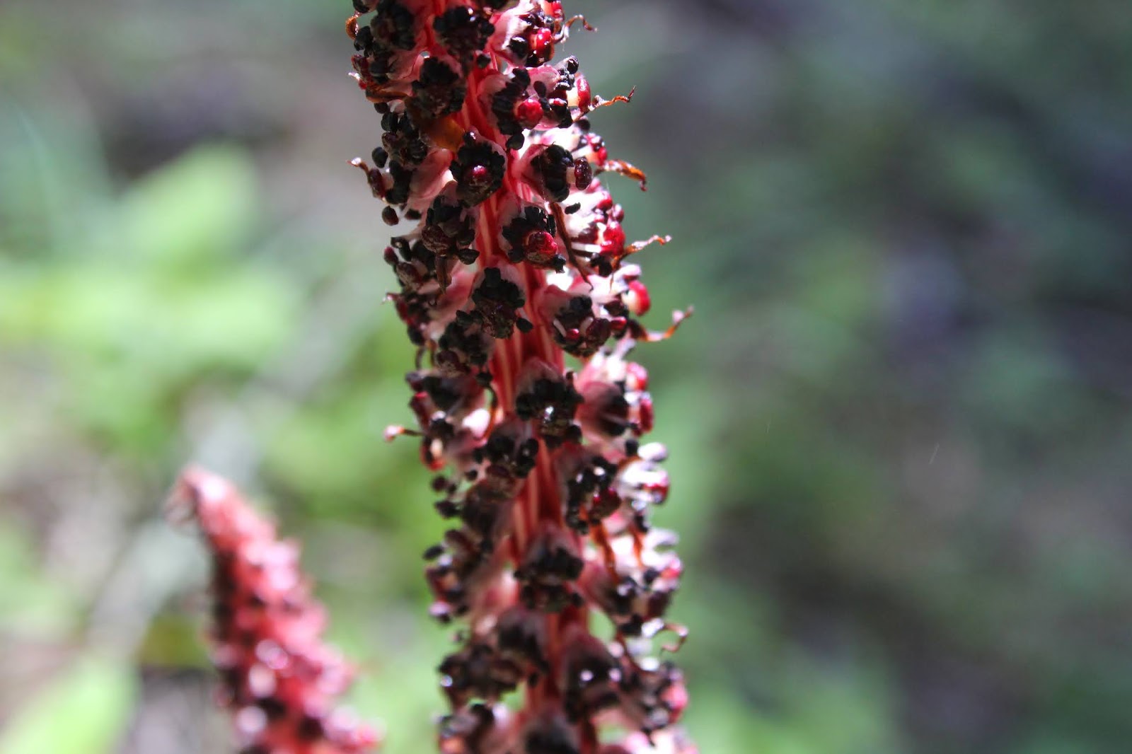
Candystick sweetens up the hike
The North Umpqua River  was mostly hidden from view because the trail starts out fairly high and well inland from the river, with a whole lot of forest between trail and river to effectively block the view. Eventually, the river did make a token appearance when the route neared the impound area of Soda Springs Reservoir where the river pooled behind the like-named Soda Springs Dam. The air was still and the lake's surface was as smooth as glass just for a moment, until rain started roughing up the waters. The day had been cloudy when hiking activities commenced in the morning, but now the clouds were making good on their promise of inclement weather. Fortunately, the squall lasted only a few minutes and that was the worst of it for the day. 

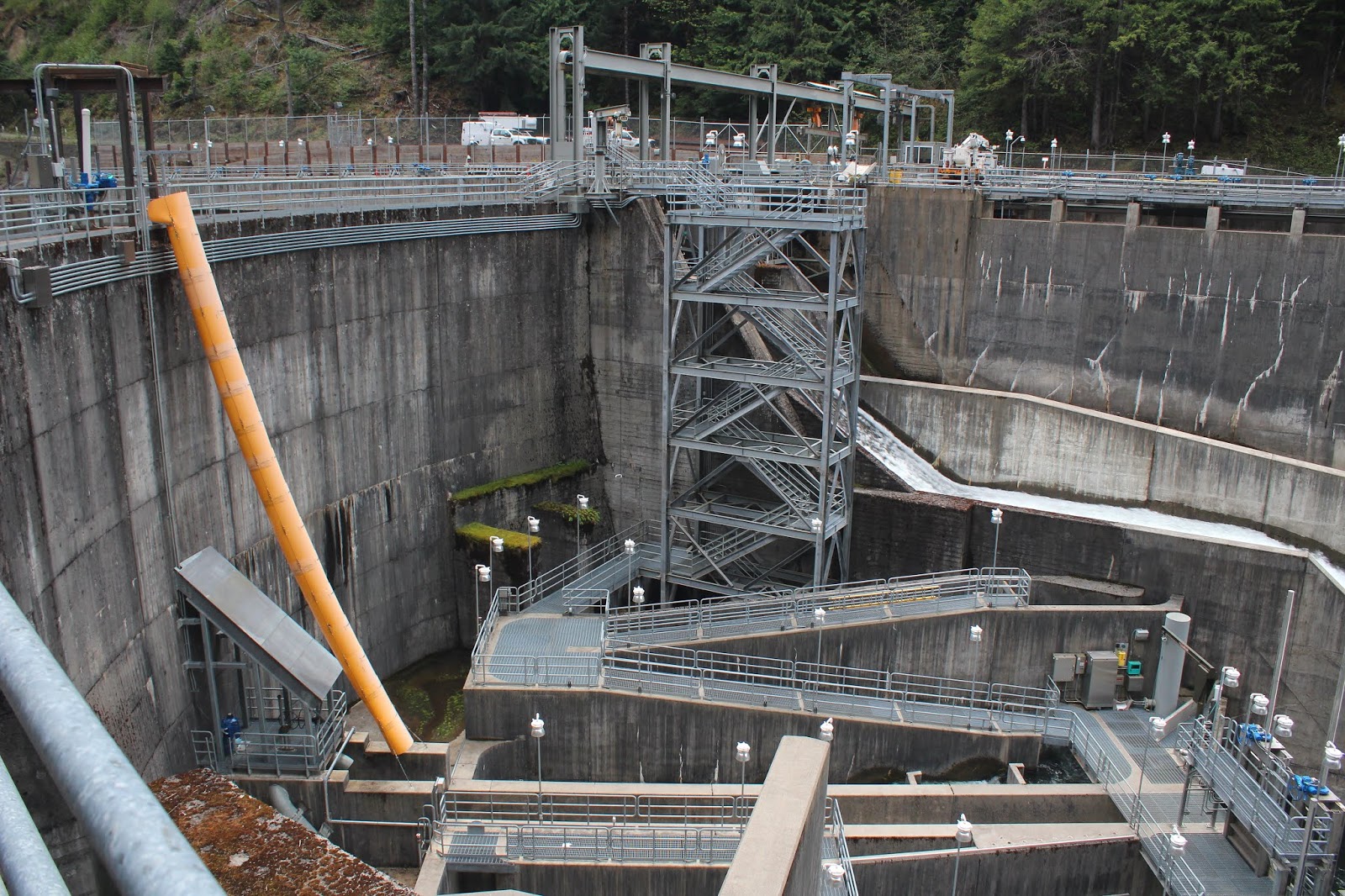
Fish and human ladders at Soda Springs Dam
After taking in impressive Soda Springs dam with its maze of fish ladders, catwalks, and human ladders, I continued hiking toward Soda Springs Trailhead. As the dam receded behind, an alarm intermittently buzzed, always a disconcerting sound when hiking below a dam doing its level best to restrain thousands of cubic feet of water. However, apart from the sound, nothing untoward happened riverwise to further worry a certain lone and incredibly handsome hiker making his way along the North Umpqua Trail.

Tick tock, the tick crawled up my sock!
As the trail neared the trailhead, it began to go in and out of grassy meadows and ticks live for moments such as this. After negotiating the first fifteen yards of knee-high grass, a perfunctory tick-check revealed two tick interlopers crawling on my calves. I just knew it! And that was the pattern for the grassy patches of trail: I'd hike through the grass and then stop to remove the ticks crawling on my calves (maybe long pants should have been worn, instead of shorts). And after finding the first couple of eight-legged vampires, my creeped-out imagination could just feel the legs of millions more crawling all over me. At some point, it becomes a bona fide mental condition.

The Soda Springs "spa"
At any rate, it had been a fairly short hike down to Soda Springs Trailhead and this was a hike that needed a destination and a few more miles. Soda Springs is always an interesting visit so I headed up the trail to the rust-colored springs. I'm not sure how salubrious the waters of Soda Springs are, seeing as how the mud is colored an unappealing orange-brown hue, but the meadow surrounding the springs is incredibly lush, vibrant, and healthy. Where the water flowed, it was crystal clear but just the same, no need to risk good health by drinking the water.

The tick-harboring brush on the Bradley Trail
Since I had gone to the trouble of hiking to the springs, it seemed like the thing to do was to continue uphill for another quarter mile and grab the Bradley Trail to turn this hike into a loop. The Bradley Trail basically parallels the North Umpqua Trail but at a higher elevation. The terrain is somewhat drier in places, particularly as the area has undergone several wildfires in the last decade or so. Replacing the trees were dense thickets of twiggy buckbrush, tick-laden enough to make hikers pine nostalgic for the tick-infested grasses encountered earlier. The ticks were so pervasive that the numerous oily red-leafed poison oak fronds waving across the trail barely registered. Many scuttling ticks were frantically plucked from my precious body, giving rise to speculation that the reason it's called Deer Leap is because the deer leaped in desperation to get away from those nasty little arachnids.

A small earwig hangs out on an iris
In the open areas were lots of yellowleaf iris, blooming profusely in low ground-hugging mats. My wildflower guidebook says these flowers are uncommon but obviously the book's author has not seen the densely packed iris displays on the Bradley Trail, for they were everywhere.


A smaller sibling of Soda Springs


On either side of the trail, numerous springs (some were orange colored à la Soda Springs) seeped down the hillside, creating thick beds of moss that covered rocks and logs alike; the moss beds being interspersed with healthy patches of tall tick-harboring grass. More tick removal operations ensued. I was grateful to get out of that brushy area and into a tick-free forest where all my only worry was giant sized boulders rolling down the hill.

I like dogwood, there's no ticks on them!
No official score was kept but the final tally must have been up to two dozen of the creepy crawlies, but it's the ones you don't find that you have to worry about. Hours after arrival at home, two more of the little buggers were found stealthily crawling on me. Despite the imagined sensation of thousands of phantom tick feet doing parade maneuvers on me, apparently all of the arachnid marauders had been interdicted before any burrowed under my skin...at least that I know of. However, it had been a good hike, despite the tickitude. It's always nice to get out and commune with nature, even though it's not always as nice when nature communes back.

The forest has loose morels
For more pictures of this hike, please visit the Flickr album.


Saturday, April 25, 2015

Pine Bench (with Boy Scouts)

Once it was discovered Daweson's grandfather is the "hiking dude" that writes for the News-Review, it was only a matter of time before I'd be asked to help his Boy Scout Troop 82 with a hike or two. Pine Bench was suggested as a destination because it is a short hike and the trailhead is fairly close to Roseburg. Of course, the last time I was there a couple of weeks ago, I wandered off trail and lost the trail altogether, so I'm not sure that I may not have been best choice to lead newbies into the wilderness. But they did not know that....

All hail Lord Daweson!
Because the scouts were a relatively inexperienced bunch, I gave them a speech about what to do when lost, showed them what poison oak looked like, crossed my fingers, and uttered a silent prayer to the hiking gods asking that I be allowed to return with the same amount of scouts we started out with. And with that invocation, we ducked under the large water pipes below Soda Springs Dam and headed up the trail. I was glad to see the fallen tree that had sent me astray several weeks ago had been cleared off the trail.

Uphill through a forest


Because my young charges were inexperienced, they were quickly huffing and puffing as the trail headed uphill to Soda Springs. Along with the huffing and puffing came the "How much further?" type of questions and along with the questions came my stock answer "we're halfway!" no matter whether we were halfway or not. Daweson and Issiah know the drill as they have hiked with me a time or two and they were just happy to be out on the trail. They also knew (from past experience) not to ask me how much further to go.

Stormy view down to the North Umpqua
All the bad uphill stopped after crossing a burn zone with the trail leveling off in the pastoral woods atop Pine Bench. The day was overcast and the skies were threatening, making for a moody and portentous view into the North Umpqua River canyon.


Pinnacle overlooking Boulder Creek
We ate lunch at the spring which had a nice overlook of the Boulder Creek chasm. Across the canyon, Illahee Rock was dusted with snow. As we ate and as the boys explored a nearby rocky pinnacle, the temperature dropped, a brisk breeze rolled in, and then it started to hail. Lunch was officially over and we headed back in the suddenly less than optimum conditions.


There's snow in them hills
I was bringing up the rear and noticed part of the group had missed the left turn at a trail junction.  I yelled at them and then we counted heads once everybody came back. We were one scout short: my Issiah. In his quest to be first back to the trailhead, he didn't get the message to turn back and now he was somewhere on his way down to the North Umpqua Trail.

Little Boy Lost
Remember my little lecture about getting lost?  Well, Issiah paid attention and once he figured out he was by himself, he did what his grandfather said to do: he stayed put! He did hedge his bets a little bit by taking his bright red poncho out of the pack and draping it over a small tree off trail for added visibility.  And sure enough, Scoutmaster Dave spotted the poncho well below us. I was quite pleased with Issiah's coolness under duress, that can make all the difference sometimes.

Witch's butter
So now that we had the proper number of scouts, we returned to the trailhead under blustery conditions but at least the rain held off for the most part. After it was all said and done, the boys were openly appreciative of the experience. I think we're halfway there!

We're halfway there!
For more pictures of this hike, please visit the Flickr album.


Sunday, March 29, 2015

Pine Bench

Robinson Crusoe was lost and until he made friends with his man Friday. The Lost Boys were just that in Neverland until Peter Pan and his Tinkerbell showed up. America got "Lost" every week until ABC ended the show. Will Robinson, Robbie the Robot, and the simpering Dr. Smith took a wrong turn just past Mars and became lost in space in what has to be the worst navigating job ever. The Donner Party got lost and ate each other. Lost happens. While I don't ever like to say I've been lost, I have been location challenged, or misplaced, a time or two. I just didn't expect to be lost...er, make that "alternately located"...on a trail that I've hiked a million times. But hey, lost happens.

Bird's nest fungus
The night before, Dollie and I had gone to Eugene for a Kitty, Daisy, and Lewis concert. By the way, here's my plug: Great band! Since we rolled into into Winston around 2 AM with ears still buzzing from the show, it made for a late start for the next day's hike. Gotta get my beauty rest, you know. Because of the much needed sleep-in, it stood to reason it'd have to be a short drive to do a short hike and Pine Bench fit the bill.

Spring fed water for your health
Beginning at the ungodly hour of high noon, a short walk away from the North Umpqua River brought me to Soda Springs. The rust colored waters seep from a steep hillside and in spite of the rather putrid looking water, the grasses surrounding the springs were green and lush. Little froggies hopped frantically in front of me as they fled the big scary, yet incredibly handsome, hiker. Deer tracks were visible in the orange muck but hey, deer will drink anything. I don't know if the water is drinkable or not, but the springs do support an abundance of flora and fauna. I wasn't going to try the water because I generally like my water clear and sparkling, and not rusty orange.

What a bushwhack looks like
Rejoining the trail after visiting the springs was where I went wrong. The clearly defined trail paralleled a large waist-high fallen tree before crossing a small creek and then disappearing altogether. This particular area is in a burn zone from the 2008 Rattle Fire and the undergrowth was brushy and full of brambles. Fallen trees littered the slope in chaotic profusion. I made the incorrect assumption the trail had been lost to the fire regrowth, something that happens all too often in fire-scarred Oregon.

So glad to see the poison oak!
I knew if I kept walking uphill, I'd eventually hit the Bradley Trail so I struggled uphill in all the junk. I kept going and going and going and going and....but never did find the Bradley Trail. My visual tether was a small creek canyon way below; the GPS also helped. When the creek canyon disappeared from view, it was time to turn back before I became lost for real. Later, after looking at the map, I discovered that I was basically paralleling the Bradley Trail. While I would have eventually reached it by walking uphill, it would have been another mile or more. Glad I turned back.


A good trail is not overrated
So back down I go to the burbling creek, stepping over the trickling waters.  And just on the other side of the creek was the well-defined Soda Springs Trail. Turned out, that tree next to the trail was actually lying upon the trail. All I had needed to do was clamber over the tree trunk and continue on my merry way. The path I had taken was probably a side trail that provided a brief look at the small creek. Once I stepped over the creek, there was no more trail and the bushwhacking commenced.

View towards Mount Bailey
Now on a real trail, I merrily skipped uphill towards the burn zone from not one, but two fires in proof that lightning does strike twice. But lightning requires clouds and there weren't any on this day, making this a pleasant electricity-free hike. In between the ghostly snags, nice views were had up the North Umpqua River canyon with snowy Mount Bailey reposing above. The peaceful view was interrupted by a noisy roar from a presumably large rockslide that lasted about 10 to 15 seconds. I could not see the slide and the cars on the North Umpqua highway inched forward like ants on a kitchen countertop; clearly the slide had not covered the busy road.

View across the Boulder Creek chasm
The trail leveled out on Pine Bench and I followed the grassy path under the pines and firs to the intersection with the Boulder Creek Trail. After a nice lunch at a grassy lea overlooking the chasm containing Boulder Creek, I headed down a short distance towards the North Umpqua Trail but began imagining the route below covered by that unseen and mysterious rockslide. I didn't want to discover an impassable trail below and then have to backtrack back for a long and arduous hike in the little daylight that was left. I'd done enough bushwhacking and backtracking for one day. So back on the Bradley Trail I go, plucking off the occasional tick crawling on me. I made it back to the trailhead without getting misplaced again.

Snow queen
For more pictures, please visit the Flickr album.