Showing posts with label Rogue River National Forest. Show all posts

Monday, September 19, 2022

Upper Rogue River Trail (Crater Rim Trailhead)


Rough Rider Falls is like the hiking version of Moby Dick. Ever elusive, the cascade remains an obsessive quest for me and if I don't ever get there, it won't be for lack of trying. Maybe my new trail name should be Captain Ahab. Although, I prefer to think of the unobtainable waterfall as the hiking equivalent of the Holy Grail, if only because Sir Galahad is a much cooler trail name than Captain Ahab. At any rate, my Rough Rider Falls saga continued with yet another attempt to get there.

Wet from the morning rain

Faithful readers (all three of you) will recall that on two previous occasions I had tried to hike to the falls on the Upper Rogue River Trail (URRT) via Hamaker Trailhead. The same readers will also note that the attempts both failed when huge piles of fallen trees blocked further progress along the trail. So, why not try it from the upper end of the URRT? What could ever go wrong?

Pretty much all the 10 mile hike was like this

Missy, Terry, and I set out from the Crater Rim Trailhead with a cheery "Call me Ishmael". That only makes sense if you've read "Moby Dick", which might explain the puzzled looks received from my two companions. This area had been totally charred in the 2015 Crescent Fire, and a new forest is sprouting below the acres and acres (and even more acres) of dead lodgepole pine trees. This hike would be all about hiking in a burn zone in both a good and bad way.

Fortunately, we didn't have to dodge lightning bolts

The Crescent Fire had been set alight by a lightning storm and coincidentally, there was a chance of lightning in the current forecast. The day was dark and cloudy, but electric death rays from the sky never materialized and while we did get a few drops of rain, the day went sunny at one juncture too. At any rate, we hiked on a wildly spectacular cloud day.

The massive canyon of the Upper Rogue

Just a few miles removed from its inception at Boundary Springs, the Rogue River flowed below the trail. The soil here is all pumice and soft volcanic ash, delivered no doubt when Mount Mazama experienced the cataclysmic eruption that created Crater Lake. Soft soil is no match for persistent running water, and consequently, the river has carved out an incredibly deep gorge north of Crater Lake. Since there was no more forest to clutter up the view, thanks to the Crescent Fire, we enjoyed constant views of the massive canyon.

Cottonwood Creek's canyon rivaled the Rogue's in size

We were basically following the gorge's rim but at one point the trail peeled away from the rim and commenced a rather lengthy detour around Cascade Creek. Soft volcanic soils are no match for persistent creeks either, and Cascade Creek had carved out its own gorge, rivaling the Rogue's in deepness and size, yet totally incommensurate with the creek's small water flow.

Hiking on an increasingly sketchy trail

The farther we hiked from the junction with the Boundary Springs Trail, the sketchier the path became. Fallen trees were strewn about, and the hike became all about getting over, under, or around them. No trees means increased sunlight, which means increased vegetation, which in turn means a disappearing trail. However, the Siskiyou Mountain Club had cleared this trail several years ago and we navigated by looking for log cuts and stumps left over from their handiwork. If we couldn't find those signs, then we just simply walked along the rim until we did.

The trail disappeared from view at times

We did find the trail going down into the canyon, but it was in poor shape. Besides the obligatory fallen trees and encroaching vegetation, we had to contend with scrabbling across a couple of small landslides. When we reached the bottom of the canyon, a short confab was convened where I consulted with my GPS to see where we were in relation to the falls.

Down in the Rogue's canyon

Things I learned about GPSs and online maps because of this hike: If you switch to street map to topographical to terrain view, objects (like Rough Rider Falls) can appear and disappear. The same thing can occur if you zoom in or out. The practical application of all this took place on the trail when I could not locate Rough Rider Falls on my GPS (because I had zoomed in). I could see an unnamed waterfall upstream of us but getting there was impossible because of the amount of fire debris and downfall clogging up the river canyon. As it turned out in hindsight, the falls were only about a third of a mile on the trail ahead of us. So close! 

Bushwhacking, if you overlook the lack of bushes

Believing that we could not get to Roughrider Falls, we turned around and headed back through the many miles of dead trees. At Cascade Creek. Missy suggested we go cross-country to the URRT and that sounded fun so off we went. I hesitate to call it a bushwhack because that would imply bushes, and there really weren't any. Also, it wasn't like there was that much difference between our overland route and the trail anyway.

Fireweed thrived in the burn area

So, the URRT is where hiking dreams go to die. But not completely, though. A friend of mine did reach the falls by starting at milepost 115 on the nearby highway, and then bushwhacking to the trail.  Armed with this knowledge, I can already envision a fourth attempt to capture my great white whale of a hike. Aargh, just call me Captain Ahab.

This was the closest we got to the Rogue River

For more photos of this hike, please visit the Flickr album.

Monday, September 12, 2022

Upper Rogue River (Hamaker Meadow)


I was cruising through the Internet the other evening and came across a boastful blurb stating the Siskiyou Mountain Club had cleared the Upper Rogue River Trail (URRT) to Rough Rider Falls. Whoops of joy then filled the exalted air of my man cave, for several years ago I had tried to hike to the cascade but had been thoroughly repelled by tonnages of fallen trees laying across the trail. As an added degree of excitement on that particular hike, I also had a close encounter with a mama bear and her two cubs when returning from said piles of fallen trees. Rough Rider Falls wasn't very user-friendly to me that day but since the trail allegedly had been cleared of piles of fallen trees (and hopefully of bears, too), it was time for another attempt to reach the ever so elusive Rough Rider Falls. 

Just beautiful weather for hiking in

It was a perfect day for hiking this more recent time out. The sun made an appearance but the temperature remained mild, part of a recent cool-weather trend that was hopefully aiding and abetting the fire crews doing battle with the Cedar Creek Fire. That in turn, might also hopefully ease the smoke befouling the air in the McKenzie and Umpqua Valleys. At any rate, I was happy to be out hiking in cooler weather.

Got plenty of quality forest time in

Beginning from the trailhead, the path wandered north on an up and down route next to the Rogue River. Sometimes above the river on a forested bench, sometimes down in the riverside brush, the trail clearly could not make up its mind as whether to stay high or low. My legs appreciated the mild exercise though, as the ups were not all that challenging or daunting.

The river is amazingly clear

When the trail ambled down by the river, the water was remarkably clear, which stood to reason seeing as how we (my imaginary friend and I) were only about five miles from Boundary Springs, the fountainhead of the mighty Rogue. Occasionally, green meadows were spotted on the other side of the river. I say occasionally, for the brush and forest really made it hard to see down to the river in the first place, much less to any surrounding landscape or meadows.

No-Name Falls labors in anonymity 

About a mile into the hike, a roar emanating from the river announced the presence of No-Name Falls. Officially, the cascade does not have a name but is referred to by regulars as No-Name Falls, which is almost like a name. I scrambled down to the cascade for a better look and spent a few minutes simply appreciating the sight and might of the Rogue River rumbling and tumbling down the cascade's narrow chute.

At times, the trail went sketchy on me

Despite the claim that the trail had been maintained, signs of trail love were in short supply. The track was littered with small branches and storm debris and where the vegetative growth was vigorous and robust, the trail was faint and a little hard to follow, especially where knee-high bracken fern encroached the trail. Unless an intervention soon occurs, the ferns will win out and claim the trail wholly for themselves.

Time to admit defeat, again

Just short of three miles of hiking fun, a large tree lay across the trail. I swear it was the same tree from when I had hiked this trail several years ago. And sure enough, then there was another fallen tree sprawling on the trail much like an somnolent guest at a Nyquil convention. And then there was another fallen tree, and another, and another, etc. I literally crawled under or over the first eight or ten to get by but when a large Empire State Building of logs blocked further progress north, it was deja vu all over again. 

Sunlight slants through the forest in the afternoon

Soundly defeated, it was a turnaround hike back to the trailhead where I then crossed Forest Road 6530 and picked up the resumption of the Upper Rogue River Trail heading south. This section of the URRT had its tree issues too, but there were none as formidable as the daunting piles blocking the way to Roughrider Falls, and I was able to make acceptable progress along the trail.

A brief glimpse of very large Hamaker Meadows

Basically, the route contoured along the edge of massive Hamaker Meadows, although it was hard to tell as the path stayed in mostly viewless forest above the meadows. Periodic openings in the forest provided brief peeks at the grassy expanse below and on one occasion, I bushwhacked down into the meadows proper. It didn't take long for boots to start sinking into the boggy soil so I didn't get all that far into the scenic greenery reposing below forested Hamaker Butte. After a mile and a half contouring above Hamaker Meadows, the trail crossed the river on a stout footbridge at Hamaker Camp and that was my cue to turn around and leave all things Hamaker behind.

The Rogue kept me company throughout the day

Even when you don't reach your destination, it's still a good hike and this venture was no exception. I got to spend all day in beautiful forest with a clear-running river flowing below the trail and there's nothing wrong with that at all, especially when there's no scary bear encounter involved. However, Roughrider Falls still remains as elusive as ever and my next plan to get there will involve hiking the Upper Rogue River Trail from the Crater Rim Trailhead. We'll see if I'll be more successful or not.

Hamaker Meadows, from Hamaker Camp

For more photos of this hike, please visit the Flickr album.

Wednesday, July 20, 2022

Stuart Falls


In 2017, the Blanket Fire burned around 5,000 acres of the southwest corner of Crater Lake National Park, along with a much larger tract of the Rogue River National Forest. Flash forward five years and the area is well on its way to recovery and is beautiful in its own stark way. However, the lack of viable forest meant that much of our thirteen-mile hike to Stuart Falls was done in open sunlight, which can get pretty warm in this summer of global warming. And surprise of surprises, the heat got to me.

"But Richard said this hike was easy!"

There is a shorter route to Stuart Falls that approaches from the west but I'm not sure if that trail or trailhead is open, given the fire that wreaked so much havoc in the area in 2017. Besides which, there's so much more glory to be gained by hiking the thirteen mile route beginning from Crater Lake National Park. I enticed Cleve, Terry, Edwin, and Missy to come along by telling them it was only ten miles long and it was all downhill, purposely omitting the part about having to walk uphill in the hot sun on the way back.

The Pumice Flat Trail was flat and full of pumice

We started out on the Pumice Flat Trail, which basically follows an old roadbed through some relatively thin forest. In keeping with its name though, the one overriding feature of the Pumice Flat Trail is that it is virtually flat for three miles in what is a rather utilitarian route to the Pacific Crest Trail.

Typical forest scene on the Stuart Falls Trail

We'd only be on the PCT for a hiker's minute though, as we'd peel off onto the Stuart Falls Trail and basically commence the real hike. Here, the PCT runs along a ridge perched above the headwaters of Red Blanket Creek and the Stuart Falls Trail would then drop us several miles down into the creek’s canyon. The fire damage was readily apparent as the Stuart Falls Trail was surrounded by a vast expanse of dead trees.

Paintbrush livened up the rock gardens

Despite the death and destruction surrounding the faint (at times) trail, the hike was eminently beautiful. Green grass, fireweed, and bracken fern carpeted the ground beneath the tree skeletons in vegetative homage to the increased post-fire sunlight. Rocky outcroppings cropped up above the trail, and rock gardens abounded. Stuffed into cracks between individual boulders were stonecrop, blooming pale yellow; and paintbrush with its eye-scalding bright red color. 

If the trees were living, we wouldn't be
able to see Tom and Jerry Mountain(s)

I'm beginning to sound like an advocate of burn areas as I continue to extol the virtues thereof, and one of those virtues was increased visibility due to the dearth of live trees. Readily visible, the nearest peak to us was the symmetrical volcanic cone of Goose Egg. There was a complex of more rugged peaks to the west that were Tom and Jerry Mountain, located in the Seven Lakes area. And let us not forget the disturbingly-named Bald Peak looming on the north side of Red Blanket Creek's canyon.

Sketchy trail, to put it mildly

Because of the abundance of meadows and flourishing vegetation, the trail was overgrown and very sketchy, to state it charitably. But while it was challenging to stay on course, it never got to the point where the tread completely disappeared. More concerning was the continual loss of elevation as we hiked. It was nice to hike downhill but we all knew that an arduous hike back up to the PCT awaited us on the return leg. 

Stuart Falls was simply beautiful

Finally, we arrived at a backpacking campsite next to Red Blanket Creek. And just upstream was Stuart Falls itself, delicately fanning white across a cliff comprised of dark black rock. Much oohing and aahing took place and we all scrambled upstream to the base of the falls, happy to bask in the cool mist emanating from the cascade.

All those trees and no shade

After a lengthy lunch and general all-around gawkery at the picturesque waterfall, it was time to begin the slog back up to the PCT. By now the day had warmed up considerably and with no shade to shelter us from the sun, the hiking became as scorching as an illicit affair. I noticed that my legs felt tired and my mouth was as dry as the dust my listless feet were kicking up, no matter how much water I drank. My real cause for worry came when the dry heaves started. The struggle was real but I hiked piecemeal, making frequent stops along the way. So not fun.

Life flourishes at the feet of dead trees

I was so glad to reach the PCT, for it would be flat and slightly downhill to the trailhead. Even though the forest surrounding the trail was thin and sparse, faint shade is better than no shade at all, like in the tree graveyard within Red Blanket Creek's canyon. The hike was closed out in the lengthening afternoon shadows and despite the travails of the heat, I really did enjoy the beauty of the scenery I had been retching in.

Typical scenery along the trail

At the trailhead, Missy doled out seltzer water from an ice chest she had hidden in her car. My recovery was immediate and total upon drinking the precious liquid, although I think we would have all been better served if she would have toted the ice chest down to Stuart Falls.

Red Blanket Creek, below Stuart Falls

For more photos of this hike, please visit the Flickr album.

Saturday, June 18, 2022

Da-Ku-Be-Te-De Trail


Da-Ku-Be-Te-De just nicely rolls off the tongue, doesn't it? Well, maybe not. I was watching a YouTube video by some dude who hiked on the Da-Ku-Be-Te-De Trail and boy, did he ever struggle to pronounce the trail's name. He eventually gave up after he sprained his tongue and suffered severe mouth contusions. Speaking from personal experience though, it's pretty simple to say when your other native language is Spanish. Fortunately for the linguistically challenged, pronunciation and elocution are not a prerequisite for enjoyment of the hike. Just let your boots do the talking, the trail will always understand.

"Once upon a morn so dark and dreary,
while I hiked, weak and weary..."

It had been raining the week prior to this hike along the shore of Applegate Lake. When I began walking, the sky was overcast, dark, and dreary, matching my mood perfectly. Stepson Carl had been badly injured in a work accident and the worry about his well-being definitely harshed my mellow. Hopefully the sun would just stay hidden behind the moody clouds, no need to unduly mellow my harsh. However, as I hiked along the trail, the day would eventually bifurcate into equal parts sunny and cloudy, improving my mood and overall outlook, despite my best intentions to do otherwise.

Not your basic wilderness hike

The Da-Ku-Be-Te-De Trail is part of a trail network that circumnavigates Applegate Lake and this hike began at Hart-tish Park which boasts a campground, picnic area, boat ramp, small general store, and hundreds of squealing children recreating in the lake's cold waters. The civilized start to the hike continued as I walked past the campground, especially since the trail was paved at that point.

Mirrory

After several years of minimal precipitation and maximal wildfires, it was nice to receive a lot of rain last winter, leaving Applegate Lake full to the brim with water, as every lake should be. The air was quiet and still, and the lake reflected the gray clouds in the sky on its mirrory surface and I don't think "mirrory" is really a word, but I'm still going with it. In general, the body of water sported an alpinesque vibe, seeing how the narrow fiord-like lake is surrounded by tall craggy peaks still flecked with snow.

Mule Mountain rises beyond the lake's dam

Even though the trail closely followed the shore, dense woods surrounded the track and at times, it was like there was no lake at all. But periodic openings in the tree cover allowed me to observe some of the surrounding lakeside topography, like Little Grayback Mountain, whose tip-top generally hid somewhere within the low cloud cover. Across the lake was Elliot Creek Ridge with Stein Butte being the most prominent high point on the forested ridge. Not all the scenery was mountain-centric though, as the pronounced bay of Squaw Creek's arm reposed on the opposite shore below Elliot Creek Ridge.

Golden yarrow brightened up the trail

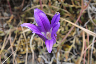
Wildflowers were a thing on this hike, too. Much of my time was spent bent over or lying prone on the trail, photographing small plants with colorful blooms representing all colors of the rainbow. Many of the plant species were regular Siskiyou denizens, seemingly exotic to this particular denizen of the Oregon Cascades country. Elegant brodeaia, ookow, checkermallow, golden yarrow, and paintbrush all did their part in colorizing the hike and much photography ensued.

The ticks await my presence on the trail

Intermittently, the woods gave way to small meadows and open grassy fields. Somewhat paranoid about the small biting creatures that lurk in the grass, I performed frequent tick checks, particularly right after a round of photo-grazing at grass level. I'm glad to report only one eight-legged vermin was found crawling on my pants leg, and luckily that was before it found its way to the delicious O'Neill blood flowing underneath my preciously soft and tender skin.

The Da-Ku-Be-Te-De Trail follows
the shore of Applegate Lake

As the miles slowly accrued, the lake's dam, eminently visible at the beginning of the hike, soon receded from view and it was easy to pretend Applegate Lake was then a natural body of water. On a clear day, the high peaks of the Red Buttes Wilderness, most notably those of the Red Buttes themselves, are an impressive sight from the shore. Unfortunately though, all that sumptuous snow-capped mountain scenery was hidden from sight by the brooding cloud cover on this latest visit.

Trail intersection near Watkins Campground

After about four miles of pleasant and mostly level hiking, a wooden footbridge and trail intersection marked my arrival at Watkins Campground. To continue hiking further around the lake required a fairly lengthy road walk, which made the campground my logical turnaround point. If I wanted to hike on pavement, I would have just walked back and forth a bunch of times on the campground path at Hart-tish Park.

I can see most of the Red Buttes

On the way back, the whole semi-stormy vibe completely changed as the clouds began to break up and dissipate. More and more, blue sky began to hold sway above the lake, but the clouds resisted mightily while I hiked below, fully entertained by the meteorological contest of wills. At the end of the hike, the Red Buttes, looming large on the Siskiyou crest, did finally make a brief appearance.

Blue sky began to rule the day, come afternoon

This hike had been another exercise in mental health, allowing me to assimilate myself back into civilization and generally mimic socially acceptable behavior. Totally enjoyable it was and I'll probably return to this trail in the future, for the backpack trip around Applegate Lake is on my to-do list. Because the trail around the lake is relatively level, it would be a pleasant backpack trip and probably is as easy as pronouncing Da-Ku-Be-Te-De.

Easy for you to say!

For more photos of this hike, please visit the Flickr album.

Friday, May 27, 2022

Rogue River Trail (backpack)


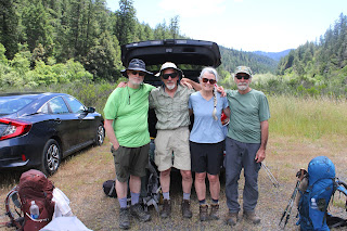
So there we were on the last day of our Rogue River Trail backpack trip, eating lunch in the shade and sitting next to the trail. A fellow backpacker came up from the opposite direction and as is customary, we greeted each other, he by giving us a friendly nod and a curt acknowledgment of "Gentlemen". Three out of the four people in our party thought it no big deal while one was singularly nonplussed. The one irritated member of our quartet was not gentleman nor man and Missy was fuming at being so mistaken for a member of the male species. "Couldn't he see that I'm not a man?" she wailed, our laughter no tonic for her discomfiture. We decided Missy's trail name could be Sir or Mister, but looking at her long braids draping over the front of each shoulder, I'm of the opinion that our erstwhile dude could have no greater honor than to accept with pride, her given trail name of  "Willie Nelson".

Day 1

Golden iris put on a show for
the entire time of our visit

The first day of our forty mile journey was overcast but we (Rogue River Trail newcomers Missy, Mike, and Terry) were off and hiking anyway, except for yours truly, who had to backtrack to the car to retrieve a rain hat, which would be sorely needed on this trip. But at least I get the Golden Boot Award for hiking farther than everybody else. 

Whiskey Creek, as we arrived

All participants were familiar with the first three miles to Whiskey Creek, but once we passed that first major stream, it was all new trail for my Rogue River Trail newbs. However, by the time we reached Whiskey Creek, we had all become accustomed to the basic pattern of the trail, consisting of a climb to a cliff overlooking the river in its canyon and then a descent down to a tributary creek, followed by another climb away from the creek to a cliff overlooking the river. Up and down, in and out, and repeat for forty miles. Also repeated for forty miles were the soft caresses of poison oak leaves on our arms and legs as that pernicious shrub was constantly encroaching the trail.

These flower smelled lovely, Blogger
needs to add a scratch n' sniff option

We passed creeks Whiskey, Alder, Russian, Bronco, and Bunker over the first nine miles of trail and so far so good as far as my aged legs were concerned. However, the next three'ish miles had some pretty steep grades and by the time we reached Horseshoe Bend I was thoroughly pooped, but on the plus side, we had knocked off nearly twelve miles which wasn't bad for us old hikers.

Day 2

A cloudy dawn yet Terry said
the storm was dissipating

Day 2 will live in infamy in the memories of all participants. Although, there were just some clouds in the sky when we struck camp, the day would soon be as wet as the interior of a water balloon, Terry's cheery and overly optimistic prognostication of "it's dissipating" notwithstanding.

Missy has a bonding moment with the wet earth

After an hour or so of hiking on a trail covered with numerous piles of bear poop, the first raindrops began to fall. We hiked another hour or so before we all began to feel the need to put on raingear. Missy should have put on mud gear too, for she took a spill crossing a creek and suffered an ignominious sit-down upon the wet earth. 

OK, it's raingear o'clock

One highlight of the second day was a side trip to Zane Gray's cabin, a rustic ramshackle cabin in the middle of a grassy meadow where the famed author stayed when he fished the Rogue. Shortly after leaving the cabin and resuming our hike on the Rogue River Trail, we ran into a party of about eight day hikers. It was our friends, the Friends of the Umpqua Hiking Club, day hiking to the cabin and they looked wet. They probably thought we looked wet, too.

The rain did not dissipate

After exchanging pleasantries with our friends, we continued on and at the eleven-mile mark, we arrived at the Rogue River Ranch, now a historical backcountry museum. And that was when the wind started. We were all soaked at this point, having hiked in the rain for the last six hours or so, and that wind had us all shivering in no time flat. Backpacking is so much fun!

Arrival at Rogue River Ranch

We went to the ranch and sat on the porch with about a half-dozen other backpackers in a vain attempt to seek shelter from the elements. The caretaker offered the services of his wood stove to dry out clothing and gear but we all politely declined for there's no wood stoves in backpacking. He was a nice guy though, and it was a relief to know hikers in trouble could have a place to go to for help, if needed. At any rate, we camped by the river and all of us were in our tents by three o'clock in the afternoon, listening to the wind and rain raging on the other side of our flimsy tent fabric.

Day 3

Still not dissipating, Terry

The ranch caretaker did share with us that the storm would abate this morning, but you'd never know it from the rain that was still vigorously pelting our campsite. Humorously enough, we held a quick meeting to decide that we'd start our hike later in the morning when the weather would break, the humor being that the meeting was held verbally, each one of us participating from inside one's own tent. It was like the backpacking version of a Zoom Meeting.

Overjoyed when the sun broke out

From the ranch, there is a short road walk to the Marial Trailhead and it was somewhere around there that the mid-morning sun came out, warming limbs and souls alike. From Marial, the trail entered an amazing world comprised mostly of black jagged rock at the bottom of the river canyon. Here, the Rogue funnels into narrow Mule Creek Canyon, famed as a formidable challenge for rafters. The precarious trail is etched into a cliff face and you really want to watch your step here, for the drop-off from the trail is sheer. The highlight of this section is Stair Creek, which tumbles into the Rogue in a series of awesome waterfalls. One other highlight was that because of the sun, we removed rain gear, jackets, pant legs, and applied sunscreen to our pale and pallid skins. 

Precarious trail etched onto a cliff

Continuing onward, we passed through the grounds of Paradise Lodge, which was not as backpacker friendly as it had been in years past, although they graciously let us picnic on their deck. From there it was the usual up and down ramble over flowing creeks, through lush forests, and across dry and open cliffs. At the ten mile mark, we set up camp at Tacoma Camp, well populated with rafters camping there.

Day 4

Tacoma Rapids as we began the hike out

Day 4 was getaway day. It also was our shortest day, coming in at a paltry 7.9 miles. Good thing too, because hiking in wet shoes during Day 2's deluge had given me some blisters. Of course, the last and easiest day also had the best weather, something that had also occurred during my two other through-hikes of the Rogue River Trail. It must be a rule.

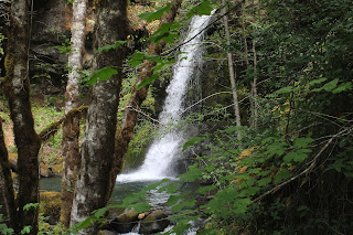
Peaceful Flora Dell Falls

The main highlight as we left Tacoma Camp was Flora Dell Falls, where Flora Dell Creek tumbles over a cliff to splash into its basin. The weather wasn't particularly warm but the cool spray blowing off the picturesque cascade still felt refreshing.

Pathway through the woods

The remainder of the hike crossed several creeks and was mostly wooded. The Rogue had been the official Wild and Scenic Rogue River during our hike but here, the river widened and began flowing a lot more in keeping with its now ponderous bulk. Welcome to the Tame and Civilized Rogue River, boys and girls. We did have two steep uphill sections to hike over though, as the trail had to detour around some private property parcels, much to our annoyance.

Advertisement for "Come to Oregon!"

The end of the Rogue River Trail was pretty spectacular, though, as it went through a long extended pasture in a valley ringed by forested mountains.  As we hiked by, appreciating the postcard view under a blue sky, incurious cows impassively gazed at us. The trailhead put an official end to the Rogue River Trail but we still had a short walk on a roadway to where my car was waiting for us at Foster Bar.

We did it!

We did it! Even though this was my third go-round with the Rogue River Trail, I still felt a profound sense of accomplishment. No doubt my newbs felt a similar sense of accomplishment, unburdened by the ennui that multiple hikes on the same trail can engender. And as a reward, we stopped in Gold Beach for barbecue sandwiches that were to die for, in our deprived post-hike condition. There are some things about civilization that you just appreciate more after a long backpack trip.

Elegant brodeaia, looking elegant, as always

For more photos of this hike, please visit the Flickr album.