Showing posts with label Cave Junction. Show all posts

Sunday, June 22, 2014

Polar Bear Gap

Leaving the small eccentric hamlet of Takilma, I drove up a rough and rickety road to a rocky ridge above the East Fork Illinois River. Silently grateful Dollie was home and blissfully unaware of what her jeep was doing, I drove around Crazy Peak before arriving at the trailhead. If the last half of the previous sentence doesn't sum up my recent run of  hiking weekends, nothing else will.

Evening, from my tent
The drive to the Black Butte Trailhead is about 3 1/2 hours from Roseburg so I threw in some camping gear and headed out late Saturday afternoon, timing it so I'd arrive in the early evening.  My tent was hurriedly set up on a flat rocky patch of earth about a quarter mile up the trail. Black Butte loomed over me as the sun set and it was nice to camp without having to lug a heavy backpack full of gear. 

Sunrise
I woke up at day break with the eastern skyline glowing red through the trees. Fortified with a quick breakfast, I set out on the trail, snapping a picture of Black Butte at the outset. Later at home, I would notice the time stamp on the photograph, it turned out this hike began at the improbable hour of 5:55 AM. Yet, somehow it is exceedingly difficult to get to work by 9:00 AM. I wonder why that is. 
This, before coffee

If the Siskiyou Widerness was located anywhere near a major population hub, the wilderness would be world famous. However, this California wilderness area is accessible mostly through Oregon and the remoteness means one is likely to have the place to one's self. Hiking in the Siskiyou Wilderness is challenging, to say the least. The mountains are incredibly rugged and the trails equally so. As a measure of how challenging the hiking is, I offer without shame or embarrassment that I hiked at a 55 minute per mile pace. The Black Butte Trail basically stayed high on the east side of the East Fork Illinois River canyon but even so, the trail went up and down and was rarely level. The rocky path was sketchy at times and potentially treacherous to inattentive ankles.

Mountains and deep valleys
Ah, but the views are amazing! Tall pointy peaks abound everywhere up and down the East Fork's canyon. Prominent to the west were craggy Sanger Peak and nearer Young's Peak. On my side of the canyon was Polar Bear Mountain and its offspring Bear Cub. Looming above and forever keeping the two polar bears in order were the jagged peaks of The Lieutenants. Due south and down the Clear Creek valley was a partial cone looking like a molar whose filling fell out; that would be Bear Mountain whose crater is the repository of Devil's Punchbowl which is on "the list". Black Butte, whose slopes I was walking on, is also prominent but I was too close to see it, if that makes any sense.

The trail was sketchy, at times


Polar Bear Gap is a fairly short hike, so at a trail junction I continued on the Black Butte Trail for some extra exploratory mileage. I had some vain notion of hiking the 5 miles to Young's Valley but this was some really tough hiking. From the junction, the trail dropped rapidly down into the East Fork canyon, sometimes not even pretending to switchback. The path was faint and overgrown and at times, was pretty hard to follow. The tread was uneven and full of rocks and I spent a lot of time scrambling over fallen trees. 

A small creek crosses the trail


The Black Butte Trail crossed over a couple of small forks of the East Fork and there were backpacking campsites at each of the streams. The thought of lugging a backpack down and up this rugged terrain nearly made me want to cry with empathy for the abject human misery that particular labor had to have entailed. After crossing the second of the two East Fork forks crossed on this hike, the trail followed an extremely rough roadbed and I made the decision to then backtrack to Polar Bear Gap. 

Ugh!
The impetus for the decision was that I could see the path charging down towards the East Fork itself, still several hundred feet below. Above me, the headwall of the canyon loomed several hundred feet above and I was painfully aware the trail would then have to climb up and over that to get to Young's Valley. Trail designers will not go to heaven! 

California lady's-slipper
So the steep knee-straining descent now became a thigh-burning ascent. But frequent rest stops allow one to stop and smell the figurative roses. Feathery plumes of beargrass were abloom and insects were grateful. Other spring flowers spotted along the trail were columbine, starflower, windflower, paintbrush, and thimbleberry. However, this is the Siskiyous and there were plenty of Siskiyou-only plant specimens such as luina, Sadler oak, and California pitcher plants (also known as darlingtonias). Next to the darlingtonia bog was a patch of California lady's-slipper, an attractive orchid of note.

The drab and nondescript snow plant
There were so many different kind of flowers a second paragraph is merited. So, also seen were bog wintergreen, azaleas, stonecrop, lupines, and an odd yellow-colored coralroot orchid thingy. I also spotted a couple of snow plants, colored bright red among all the greenery. Lots of pictures were taken which may have, in combination with the rough trail and steep climb, had something to do with 55 minute miles.

Broomrape
Once back at the trail junction, I continued uphill, switchbacking through a shaded forest with a couple of boggy springs where fairybells bloomed. Oh, and I found some yellow-colored broomrapes of some sort. So many odd little flowers that they have spilled into a third paragraph. Anyway, back to the hiking: eventually the trail left the shade and spit me out onto a dry grassy slope where I got a neck strain peering up at very close and craggy Polar Bear Mountain.

Lookout Mountain at Polar Bear Gap
When the trail leveled out shortly thereafter, the flatness of the grade was my cue that I had arrived at Polar Bear Gap, situated right between Polar Bear Mountain and Lookout Mountain. While Polar Bear Mountain dominated the near scenery, a nice view was had to the southeast where a ghostly Mount Shasta was faintly visible in the wildfire smoke from mostly likely the Bryant Fire, near Bonanza. Oddly enough, I saw no polar bears.

Black Butte at the trailhead
After a fly-swatting lunch 'n laze in the warm sun, it was time to head back, carefully leg-braking on the way down. I got to enjoy the views all over again with the big difference being the hiking in warm sun versus the cool shade at the early morning start. This hike just barely scratched the Siskiyou Wilderness and I promised myself a return visit to sample further the rugged delights in this little corner of the Siskiyou Mountains sandbox. As I reached the end of the hike, Crazy Peak loomed right in front and I was hiking straight towards it. Somehow, that seemed fitting.

Polar Bear Mountain
For more pictures of this rugged and unique gem of a wilderness, please visit the Flickr album.

Lurker in the beargrass


Sunday, May 20, 2012

Kerby Peak

Proof we were there
Several weekends ago, Ray and I opted to do Kerby Peak as an impromptu Plan B hike when Plan A was snowed over. Plan B did not pan out that day either because of a road closure but we were very impressed with the massive rock wall that is Kerby Peak. Our legs trembled with both fear and anticipation at hiking up to the Kerby summit, a paltry 2,600 feet above us. So, when the aforementioned road opened, we found ourselves craning our necks once again to peer at the summit all those thousands of feet above us.

Hiking is fun, right?
The trail wasted no time heading uphill and we stopped at every other switchback panting with the exertion. Thank goodness there were switchbacks, it could have easily been a lot worse as the old trail simply charged straight up the forested slope that was nearly a vertical wall. Periodically, a break in the forest would show us that Kerby Peak was so far above and so far away. Better to head back into the forest and focus on getting to the next switchback.

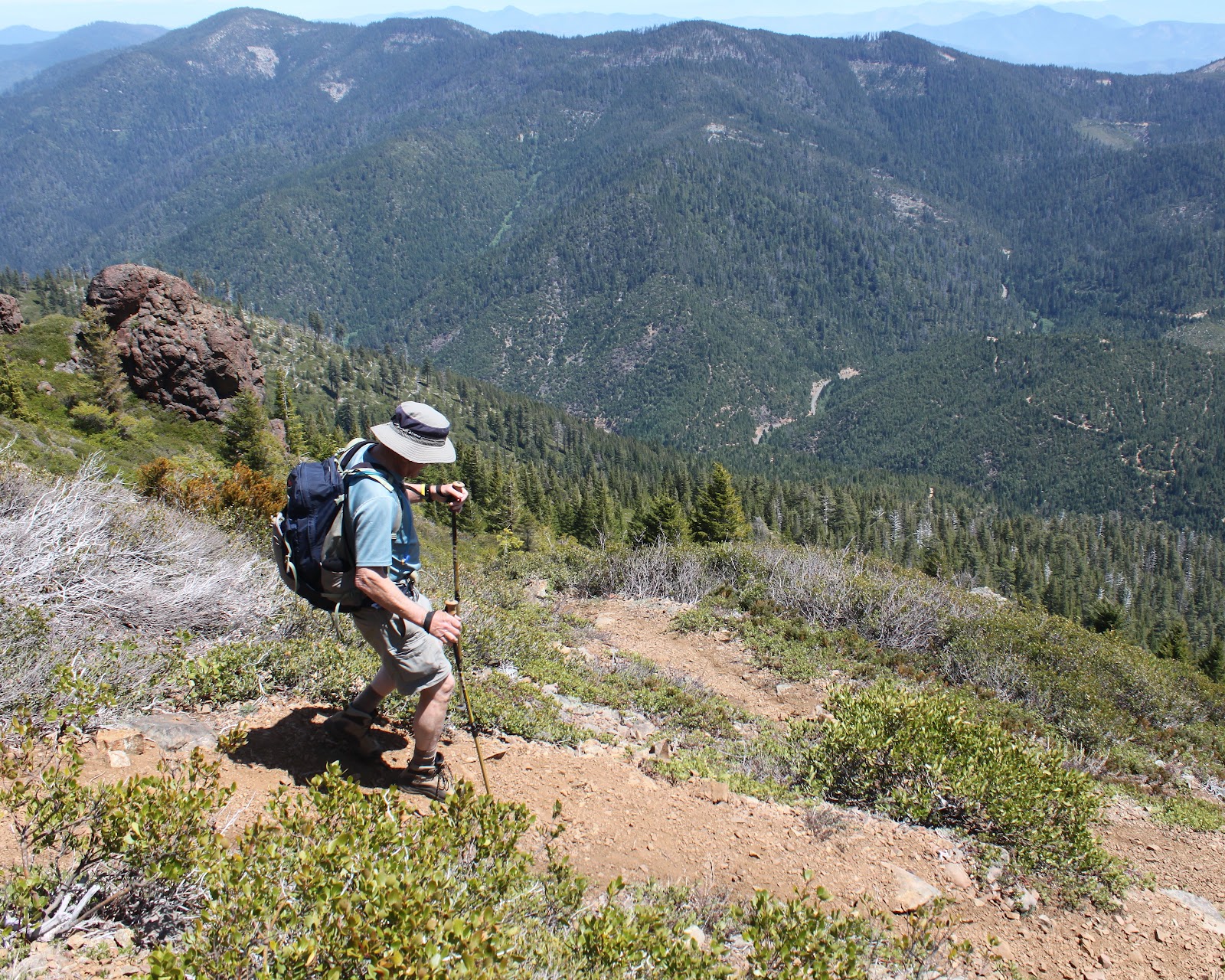
I'm NOT TIRED, I tell you!
At least spring was happening on the forest floor and I stopped to take pictures of all the flowers because I like to take pictures and I was NOT TIRED.  Suffice to say, lots of pictures were taken on the climb up.


Siskiyou lewisia
At the halfway point, the trail spit us out onto a rocky cliff totally devoid of trees. Little rock gardens consisting of pink mats of phlox, stonecrop (not yet blooming), and cliff maids (also known as Siskiyou lewisia) colored the rocks nicely.  

And we are only halfway up!
But really, this was all about the view. The Illinois Valley lay spread out below us with green pastured farmland straddling the Deer Creek valley. Rising beyond the small town of Selma were the orange-brown mountains of the Kalmiopsis Wilderness, all stripped clean of trees by the 2002 Biscuit Fire. And, unfortunately, Kerby was still high above and far away. Sigh.

Time to break out the sunscreen
We had been switchbacking back and forth on the north face of Kerby and eventually the trail surmounted a ridge and put us on the sunnier south slope. The vegetation changed, there were more ponderosa pines and cedars and a whole lot more sunshine. And blessedly, the trail switched from steep to merely uphill.


Brewer's weeping spruce, taken by a weeping hiker
Brewer's weeping spruce made an appearance also, the branches drooping sadly like our heads. The trees then thinned out together and the trail began switchbacking through an open slope of low-growing manzanita, just the right height for scratching hiker's shins. I made the comment to Ray that this must be the final push but a couple of miles later we were still hiking upwards. Just like child labor, it was a long and painful push.

One of many false summits

Summit cairn


Rocky towers loomed above the trail, contrasting nicely with the blue sky and we were ever hopeful that one of these towers would be the actual summit. But Kerby was a cruel and capricious taskmaster and was merely throwing false summits at us. It was almost anticlimactic when I strolled onto a flat spot with a summit cairn on it.
Magnificent view from the top

Climber's ritual of adding to the summit cairn


A magnificent panorama awaited us at the top and we soaked in the views while waiting for the feeling to return to our quavering legs dangling over the edge as we lunched. We could see the towns of Selma, O'Brien, Murphy, and Cave Junction as they sprawled in the valley dotted with farms. The rugged Kalmiopsis Wilderness dominated the northern view and we could see the snow cone of Mt. McLaughlin, and the gray mounds of Grayback Mountain and Mount Elijah. To the southwest were the snowy peaks of Preston Peak, El Capitan, The Lieutenants, and Bear Mountain, all located in California's Siskiyou Wilderness.

Going down is also "fun"
All good things must end, and we headed downhill towards the trailhead.  Going down was harder than going up with all the leg braking, but it was quicker: it took three hours to reach the summit but only an hour and a half to get down. Ray summed it up best when he said "That was the hardest 7 miles I have ever hiked!" Short, succinct, and entirely accurate.