Saturday, August 31, 2013

Cowhorn Mountain

Cowhorn Mountain used to be a lot taller. But in 1911 a storm dehorned the mountain like a bleating 4-H project lamb. However, the natural desecration of an iconic landmark can be cause for celebration as the mountain summit is now much easier to attain.  

Cowhorn Mountain, from the Pacific Crest Trail
So with an "everybody say moo" where I was the only one mooing, the Friends of the Umpqua Hiking Club sallied forth onto the Pacific Crest Trail on a beautiful, albeit very warm, day. My recollection of this trail from prior hikes was that it was a  4 mile gradual climb to the mountain but the climb didn't seem all that gradual on this day. More than likely it was just me, the trail probably didn't steepen since the last time I hiked here.

One of the Windigo Lakes
The trail basically followed a rocky ridge leading straight to the 'horn. Most of the time was spent in the forest with occasional views to the local landmarks of Mount Thielsen, Mount Bailey, and the two Windigo Lakes below the trail. It wasn't long before camera-addicted hikers such as myself lagged far behind the main group.

We have to climb that?!


Periodically, we had nice views of Cowhorn Mountain which always looked insurmountably craggy and always was demoralizingly much higher than our viewpoints. Eventually the PCT brought us to the base of the mountain where a rock cairn marked the trail jump-off point.


Up, up, up....
Whew!  The trail immediately shot straight up the mountain in soft brown and black pumice. The trees thinned out and those trees attempting life on the mountain were gnarled and stunted. The slopes were littered with dead trees glinting white like bony skeletons. The top of the hill was actually a saddle and false summit combo where we traded black lava for bright red lava, it was like the mountain version of Jupiter's red spot.


Only another half a cowhorn to go
Jane and Robin were  lunching there, content to soak in the views from halfway up the mountain when I arrived.  The peak's jagged summit was right above us and I could see the little dots on top that was the remainder of the hiking club. Unfortunately, I could also see the faint path zigzagging back and forth up the spine of the crest leading to the summit. I tell you, I need to quit looking ahead.

Crescent Lake distracts from the scramble up
Just short of the summit, the path petered out altogether and the summit was attained by scrambling up a rocky stairway.  Use of hands is required and I put my surgically repaired wrist to the test. As I neared the summit, I could hear the heathens on top saying "Here comes yon laggard" or something along those lines.

Diamond Peak and Summit Lake
Cowhorn Mountain sports one of the best views in the Oregon Cascades. Directly to the north was large Crescent Lake, it's sapphire waters in a bowl surrounded by miles of forest. Surrounding the lake were a number of lesser lakes comprising the Windy Lakes and the Oldenburg Lakes.


Sawtooth Peak


We could see some mountains too, notably Diamond Peak and immediate neighbor Sawtooth Peak. In the far distance were snowy North Sister, Middle Sister, and the top of Mount Jefferson.


Al, on the Cowhorn dismount
After lunch, we picked our way carefully down the mountain where all that leg-braking left my legs wobbly as a jellyfish in a sea current. Walking 4 miles back to the car on tired legs in the heat made for slow going and I straggled in behind everybody else. It could have been worse, though, Cowhorn Mountain could have its horn and be taller than it is now.

The Pacific Crest Trail
For more pictures of the hike, please visit the Flickr album.     

Sunday, August 18, 2013

Matthieu Lakes Loop

For most of this summer, southwest Oregon had been on fire. We've had to give up hiking along the Rogue River, the Illinois River, and up the South Umpqua River. To a lesser extent, we've also had to give up blue summer skies as a smoky haze periodically filled the Umpqua Basin, depending on how the wind blew that day. But the fire gods have been kinder north of us and on a crisp clear day on McKenzie Pass, I gave thanks for smoke free air. Of course, my thanks were somewhat in vain as fire did eventually become part of my hike, but more on that later.

Gotta love that wilderness solitude


It was a gorgeous day at McKenzie Pass, nary a cloud in the sky, a breeze kept things cool, and the air sparkled with clarity. Of course, a nice day just invited like-minded people and the Pacific Crest Trail parking lot at Lava Camp Lake was full of cars, backpackers, and day hikers. One gentleman with two young boys stopped by to ask for directions to North Matthieu Lake as I was lacing up my boots. Carry a map, boys and girls, your family and your local search and rescue department will thank you.

Happy place!
Entering the Three Sisters Wilderness, the first part of the hike was in viewless forest (with no mosquitoes!) on the Pacific Crest Trail, hereafter referred to as the PCT. There were a number of through hikers on their way to Canada. The through hikers were easy to distinguish from the weekenders due to their athletic builds, light packs, and a certain "air" about them that lingered in the forest long after they passed by. At about 1.5 miles of steady climbing, the PCT left the forest and the fun stuff started.

Ooh...aah!
These are lava lands and rivers of black rock coursed along the trail before emptying into a black rock sea. Small cones dotted the landscape like geological gooseflesh, but it was the larger peaks of the Cascades that commanded attention. Spaced equidistant and arrayed in a row like trail cairns for the hiking gods, were the volcanoes of Belknap Crater, Mount Washington, Three-Fingered Jack, Mount Jefferson, and 80 mile distant Mount Hood.  Truly a vista for the ages,

South Matthieu Lake
At around the 3 mile mark at Scott Pass, South Matthieu Lake lay nestled between the two red cones flanking the high pass.  From the north side of the lake loomed nearby Black Crater, looking more red than black.  But it was the south side view that stole the show as the upper half of craggy North Sister loomed over the blue lake.  A breeze was blowing but the reflection must be particularly beautiful on a calm morn.

"Richard...Richard..."


I hadn't planned to hike very far as it had been a 3.5 hour drive to the trailhead.  I figured I'd just grab the trail to North Matthieu Lake and then loop back to the trailhead for a moderate 6 miler. But Yapoah Crater, a symmetrical cinder cone responsible for the massive lava flow next to the PCT, called me "Richard...Richard..." My feet began moving and it was futile to resist.

No shade for me


Leaving South Matthieu Lake it was just me and acres and miles of black rock with North Sister looking down at me like the big sister she is. The wind died and I began to bake like a spaghetti squash with the crunch-crunch of footsteps in pumice as my only companion. At the base of of the crater, the PCT snaked its way up and around the cone.


At the base of Yapoah Crater


A tip of the hat to the Yapoah Crater groundskeepers is in order, here. The cone was perfectly conical and the grounds were seemingly raked smooth as a major league baseball diamond. I briefly entertained a notion of hiking to the top of the crater but it was way too hot and I still had to hike around the cinder cone to get to the summit use trail. Saving a crater climb for a cooler day, I turned around and headed back north on the PCT.

Wildfire smoke arrives at North Matthieu Lake
On the return to Scott Pass, I did take the trail to North Matthieu Lake which dropped several hundred feet below the PCT.  A short downhill hike brought me to North Matthieu Lake where I exchanged pleasantries with the weekenders ringing the shoreline. I was glad to see the guy with his two sons had found the lake because of, or in spite of, my directions. As I left I caught a whiff of campfire smoke.

Orange light indicated a fire was nearby


Internally hurling invective at stupid campers willfully ignoring a fire ban in fire season, I continued hiking. However, the weird orange color that happens when sunlight filters through a seine of smoke began to color the air. The forest filled up with thick smoke and ash flakes flitted through the trees like moths of death. And I had no idea where the fire was. The hikers I encountered on the trail had no idea either. I soldiered on quickly, listening for the crackling of flames while plotting escape routes should it come to that. Disconcerting, to put it mildly.


Yapoah Crater's lava flow
As it turned out, 4 miles away, the Hand Lake Fire decided to announce its presence that afternoon. By the time I drove home a massive plume was rising from the lake basin like an ashy tornado. Fire fighters and equipment were gathering at the Hand Lake Trailhead where I found out they don't like cars to stop and take pictures. Despite that failing, a round of applause for the fine work they do as the Hand Lake Fire was fully suppressed after it had grown to ten acres.

For more pictures of this hike, but not the fire (I put my camera away and walked fast to the car, sorry I wasn't thinking about my readers), see the Flickr album.

A time to reflect


Saturday, August 10, 2013

New River

About 150 years ago it rained in Oregon. Not an especially rare event but on this particular occasion it rained enough to fill up the rivers. In other parts of the world, this is referred to as "flooding" but as "just another storm" in our little waterlogged corner of the sandbox. So, you can imagine the surprise farmers and ranchers residing in the Langlois area felt when they found a river coursing through their pastures, no doubt causing cow's milk to sour while still in the udder. The obvious observation to be made in this case was something along the lines of "Hey, that's a new river!" And that, roughly, is how the New River came to be.

If not the New, then it's good as New
The New River is a work in progress as its mouth has migrated quite a bit north over the years. In fact, the mouth of the river is about 5 miles further north than the current maps show, answering the question of where does a river go: anywhere it wants to. The New River parallels the Oregon coast directly behind the beach foredunes and I've bumped into the New a time or two on various hikes, but this would be the first time I'd ever visited the New River Natural Area.

Manzanita trunk after the morning rain
The trails in the New River are too short for my standards but since 5-year old Coral Rae was spending a weekend with Grandpa, the New River was just right for both new and old hikers.  Beginning at the nature center, we grabbed a sandy track through coastal woods bursting with the green growth of madrones, manzanita, salal, rhododendrons, and huckleberries.

Hey, we have a hike to finish!


Ah yes, the huckleberries. Intent on imparting my formidable fount of knowledge to the young, I showed Coral Rae how to distinguish the huckleberries from all the other greenery. Of course, the berries kind of helped with the plant identification. Once Coral Rae sampled a single berry, she grazed with the best of them. It was slow going because she apparently wanted to eat every berry she saw.

That's my girl!
We took a berry break and ate lunch at boat ramp next to the New River.  The River was shallow but fairly wide and neither one of us wanted to wade across to the beach, particularly as the weather was threatening rain.  Coral Rae found a small garter snake and just like a true descendant of mine, she touched the slithering reptile on its back.  My heart nearly burst with pride!

Slug aerodynamics
This was definitely a tactile hike as Coral Rae had to touch everything from soft moss to slimy slugs.  There were a number of large slugs on the trail and she carefully transported several of them to safety off trail.  On one occasion, the slug rescue was rewarded with a discovery of a thicket of ripe blackberries.


When I grow up I want to be a purple poop pooper


Speaking of ripe berries, we came across some bear poop, stained purple from the berries.  Coral voiced her ambition to eat enough berries to turn her poop purple. It's nice to have goals.


Insect social on a Queen Anne's Lace
After visiting Mud Lake, which was not muddy, we returned back to the nature center, closing out this three mile hike. Inside the center, animal skulls were arrayed on a table and much skull touching ensued from a delighted 5-year old before we headed back to Roseburg.

For more pictures of this short hike on the coast, please visit the Flickr album.

Sunday, July 14, 2013

Indigo Lake

Indigo Lake
So, we've had a lot of fun hiking lately but something has been missing from our summer hiking experience. Let's see, what can it be? Sun? Nope, got so much sun I'm almost out of sunscreen. Wildflowers? It's been a great wildflower year, can't be that. Views? Two words: Warner Mountains. Hmm, what can it be? Oh well, I shall ponder this question on the trail, I'm sure the answer will come to me at some point.

Hikers, running from the mosquitoes

Actually, the answer was readily apparent when I got out of the car at Timpanogas Lake in the form of several million mosquitoes who were extremely glad to see me again, they really missed me. The feeling was not mutual and I couldn't spray tractor-strength Deet on fast enough.


Pinesap


When faced with such numbers of insectitude, slathering Deet on is the toxic equivalent of the little Dutch boy sticking his finger in the dike: not very effective despite the valiant effort. Several hundred thousand of the several hundred millions of invertebrate vampires were brave enough to drill past the chemical layer to get to my candy-flavored (to mosquitoes) blood and I learned not to stop too long in one place as I hiked, slapping all the while at my various exposed body parts.


This is why we hike!
The hike to Indigo Lake isn't particularly long as the trail switchbacks up a forested slope, arriving at the lake in just under 2 miles. The view at the lake is heavy on the wow-factor as Sawtooth Peak rises 1,400 craggy feet above the far end of the lake. Normally, the view requires a more contemplative stop but due to the mosquito wow-factor, I reluctantly kept moving.

Sawtooth Peak avalanche basin
Just because, I took the small path along the lake, walking to the rock pile that is the Sawtooth Peak avalanche basin. White and pink heather was blooming in between the rocks and nodding columbines drooped at the forest rimming the lake.  


Sawtooth Peak
Returning to the main trail, I continued up towards the intersection with the Windy Pass Trail. Putting the lake behind me somewhat, the mosquitoes abated to a dull whine but there were plenty of downed trees across the trail to make the hike a little bit tedious as Deet and sweat ran into my eyes. At the pass and the trail intersection, I decided I had enough and saved the intended Sawtooth Peak climb for another mosquito-free and a not-so hot day. 

You need to eat more mosquitoes
So back down the trail I went, fighting fallen trees and mosquitoes. Despite the travails, the view at Indigo Lake was well worth the blood donation.  At the trailhead, I continued on across the road for a brief peek at Little Timpanogas Lake, a small lake accessed by a trail flanked by a carpet of Queen's Cup, it was a nice way to cap off a scenic hike.

The week after this hike, lightning peppered the Cascades and a small fire started in the vicinity of nearby Opal Lake. Hopefully, the Opal Lake Fire will stay next to its namesake lake and leave Indigo and Timpanogas Lakes alone. Unfortunately,  there's probably a bunch of smoke in the area now but on the plus side, there's probably a charred mosquito carcass or two floating in the ashes.

To see the rest of the pictures of this hike, please visit the Flickr album.


Sunday, July 7, 2013

Lower Eddeeleo Lake

Back in the day, U.S. Forest Service employees Ed Clark, Dee Wright, and Leo McMahon stocked the lakes in the Waldo Lake area. They must have notably done everything together because the Eddeeleo Lakes were named after them in permanent testimonial to their togetherness.  

A hoverfly buzzes a beargrass bloom
Beginning at Forest Road 254 on the western edge of the Waldo Lake Wilderness, the trail ducked into a thick conifer forest and headed downhill into the lake basin. Shade from the trees would be a welcome constant on the hike. Having hiked around Waldo Lake once before in July, I came well-prepared with buckets of industrial strength Deet but oddly enough, the mosquito swarms were on the mild side. Maybe it's because the early and hot summer has impacted the mosquito breeding cycle, but for whatever reason, I was most grateful for the relative lack of airborne vampires.

The rare and seldom seen rhododendron
Beargrass, in full bloom, greeted me at the sunny trailhead but once in the forest, it was all about the rhododendrons. I would be walking primarily on the Six Lakes Trail and the map showed a lot more lakes in the area but the lakes were hard to get to, they should have named it the Rhododendron Trail, instead. They were blooming everywhere and nearly exclusively; my picture collection has grown by several hundred more rhododendron photographs after this hike.

The Six Lakes Trail, somewhere in there
A good map is required as there are many trails criss-crossing each other as they connect all the lakes like nodes on a computer flow chart. In just over a mile, a right turn took me off the Winchester Lake Trail onto the Blair Lake Trail after ignoring the Winchester Ridge Trail turnoff. Then it was another right turn onto the Six Lakes Trail, ignoring turnoffs onto the Quinn Lakes Trail. Confused? That's why maps get brought along on hikes, boys and girls.

Lower Quinn Lake
At any rate, the trail came close enough to Lower Quinn Lake for the lake to be visible through the trees. I worked my way to the shore to snap a few pictures of the lake before continuing on. Somehow, I missed the junction with the Quinn Lakes Trail so I missed Upper Quinn Lake; I came in close proximity to East Quinn Lake but could not see the lake for the trees.

Long Lake
Next up on the lake list was Long Lake, a slender body of water that is nearly a mile long. I bushwhacked to the inlet meadow/marsh, ducking conifer branches intent on removing my eyes. Further on down the lake, I bushwhacked to another viewpoint of the lake for a better view. And this is my complaint about the Six Lakes Trail: all those lakes require a scratchy bushwhack in order to see them. Stay on the trail and you'd never catch a glimpse despite there being lakes all around.  

One of 167,432 rhododendrons seen on this hike
But hey, there were rhododendrons blooming in riotous profusion, offering a floral distraction to grumbling hikers. After traversing some marshes on a newly constructed boardwalk and foot bridge, a hint of blue through the trees gave away the location of Lower Edeeleo Lake.   


Lower Eddeeleo Lake


The guidebook I read said a nice view could be had by walking along the lake's shoreline just past the outlet creek. Peering into the dense growth, I could hear but not see the creek. The undergrowth, consisting mainly of vine maples, was very thick and extremely tedious to get through. I finally reached the shore which abruptly started where the undergrowth ended; I had to cling to the vine maples just to be able to take a one-handed photograph. Whew! Beats me how the guidebook's author made it to the shore viewpoint.

Ed, Dee, and Leo


The trail from my car had been mostly downhill and it just seems wrong to have to hike uphill to the car. Fortunately, the grade was moderate for the 5 miles back to the car. After this hike, I have a better appreciation for the hard work performed by Ed, Dee, and Leo; naming the lakes after them was probably the Forest Service's equivalent of a Purple Heart medal.


One of the few flowers that was not a rhodendron


For more pictures of the rhododendrons, stop by and visit the Flickr album.


Monday, July 1, 2013

South Warner backpack


Hiking is sort of like buying a new car. You get in and  the seats are waxy and fresh, unsullied as of yet by human butts. The odometer reads close to zero and the air has that wonderful new-car smell. You turn the key and the engine hums quietly, perfectly in tune. Flash forward a year and there's a small dent in the driver's side door, the grandkids have colored the back seat with what you hope is some kind of delible ink, the seats have been butt-imprinted, and there is a slight rattle in the motor that probably has something to do with the "check engine" light.


Hiking on the Owl Creek Trail


Hiking is sort of the same way. I remember when Ray and I "discovered" Rocky Ridge in the Rogue-Umpqua Divide, he was so overjoyed he literally danced a jig. Embarrassing, to be sure, but we've never recaptured that first-time feeling on subsequent visits to Rocky Ridge. Because we've hiked every trail in southern Oregon, or so it seems, we have to travel farther afield to get that high from discovery.  Like addicts in need of a fix , we journeyed to the very northeastern corner of that foreign country south of us (I am referring to California) in order to satisfy our craving for that new-trail feeling. We had never been to the South Warner Wilderness before and that was the best reason of all for choosing this destination for a 5 day backpack trip.


Day 1

That would explain the dizziness
We began the hike at Pepperdine Campground which was at 7,000 feet of elevation. Us lowlanders were really feeling the difference between 7,000 and our customary 750 feet of elevation and I knew I was in trouble when I got winded just tying my shoes. But, repeating the mantra of "we have all day to get there" we set off on the steep Summit Trail through the forest.


View to Middle Alkali Lake in Surprise Valley


The forest didn't last long and the trail spit us out onto a treeless slope with ankle high vegetation consisting of mostly sagebrush and buckwheat. With the lack of trees came views and we could see Mount Shasta to the west and Surprise Valley to the east. Surprise Valley is where the Great Basin starts and the valley contained three very large lakes aptly named Upper, Middle, and Lower Alkali Lakes. Well, to be exact, the lakes existed in name only as we could see the brown dusty bowls where water had once been, the lakes were dry during our visit.
Camp Tired
Up, up, up was the the theme of the day as we gained over 2,000 feet in elevation. The lack of trees left us exposed to the hot sun; I didn't pack a thermometer but it had to be in the mid-90's. After the tiring and tedious slog up, we arrived at beautiful Patterson Lake where we set up camp.

Warren Peak
Patterson Lake sits in a bowl below Warren Peak, the peak being a tall escarpment typical of this area. The South Warner Mountains were formed by a fault-block uplift and the terrain (particularly on the east side) consists of terraced escarpments arranged like a stair-stepper for giants. We would spend a lot of time hiking up and down and on top of these terraces.

Sunset


In the late afternoon, thunderheads formed over Surprise Valley as a brisk breeze ruffled our tent flaps. Our campsite was perched atop a wooded cliff and we enjoyed a great view of the sunset turning the clouds orange.


Day 2

Taking it easy


This was our "acclimation day", the plan being to take it easy while our blood cells learned how to more efficiently transport oxygen to our lungs. So we took it easy by doing an off-trail quest for the summit of Warren Peak.  


Patterson Lake, from Warren Peak
After attaining a pass with a nice overlook of Patterson Lake, we left the trail and headed up a steep slope consisting of slippery scree. Dense growths of stunted whitebark pines made things difficult at times as we worked our way uphill. We didn't reach the true summit of Warren Peak but we reached a perch below a rock tower that had a dizzying view of the lake below.  

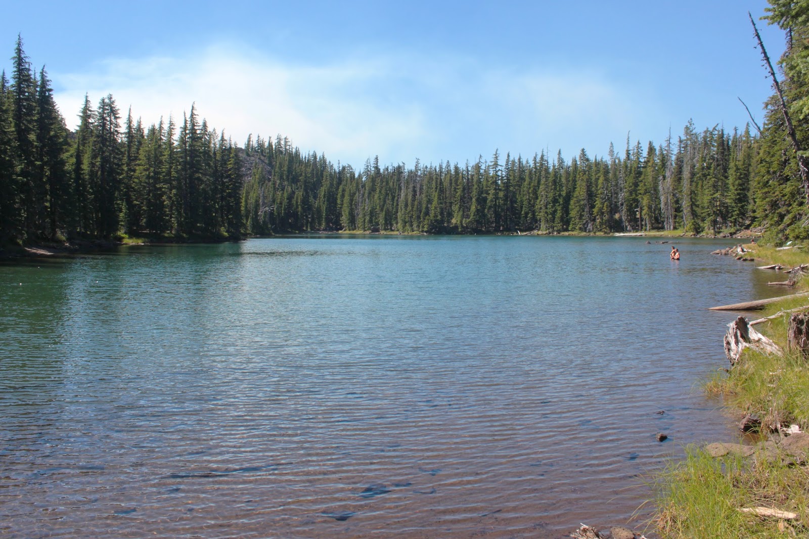
This little lake called us

Ray continued on a little bit further in search of a way to access the true summit without having to resort to technical climbing. While he was doing that I was snapping pictures of the scenery and noticed a small glacial lake directly below. Well that was an idea put into my head that would not quit and when Ray returned from his unsuccessful quest, we returned to Patterson Lake determined to visit the little pond.

Tough climb


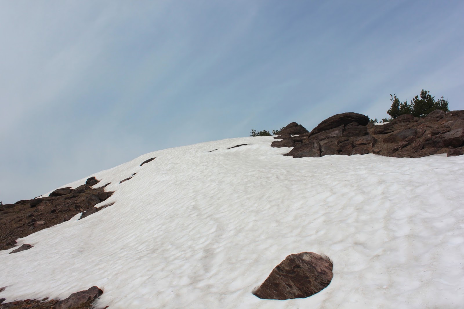
We lazed at camp for most of the day but in the afternoon, we worked our way off-trail to the bottom of a wall of loose boulders and rock directly below Warren Peak. Our little lake was hidden from view, but the basic idea was to go uphill until we hit the lake.  Easier said than done as rocks shifted constantly underfoot. At the top of the rock pile were snow drifts that were a little dangerous as on occasion our feet plunged through the thin snow without warning.

Sunset over Squaw Mountain
The lake was there and we got close enough to notice the iceberg floating in it like a sugar cube in a glacial teacup. On our return to camp, clouds formed overhead and the wind began to blow, the evening wind was becoming a trend. We enjoyed a superb sunset before calling it a day.


Day 3

Summit Trail view

Once again we found ourselves at the pass overlooking Patterson Lake but this time we continued south on the Summit Trail instead of engaging in quests for summits. The Summit Trail stays on top of the broad and treeless Warner crest and offers some incredible scenery as as reward for hiking in the heat.

Yet another picture of Surprise Valley


To the east, we enjoyed expansive views to the Alkali Lakes in Surprise Valley, the mountains on the east side of the valley being on the Nevada side of the California-Nevada border. To the north, we could make out in the haze the blocky silhouette of Oregon's Hart Mountain. To the west was Mount Shasta and if we squinted, we could pick out Lassen Peak in the hazy distance. Nearer and to the south was Eagle Peak, the high point of the South Warner Mountains.

Cow's clover


I'd be remiss if I did not talk about all the wildflowers growing in the ankle-high vegetation. We saw several species of wild onion, Cusick's monkeyflower, phacelia, kittentails, lupine, blue flax, and dense mats of buckwheat. Much photography ensued as we continued along the ridge crest.
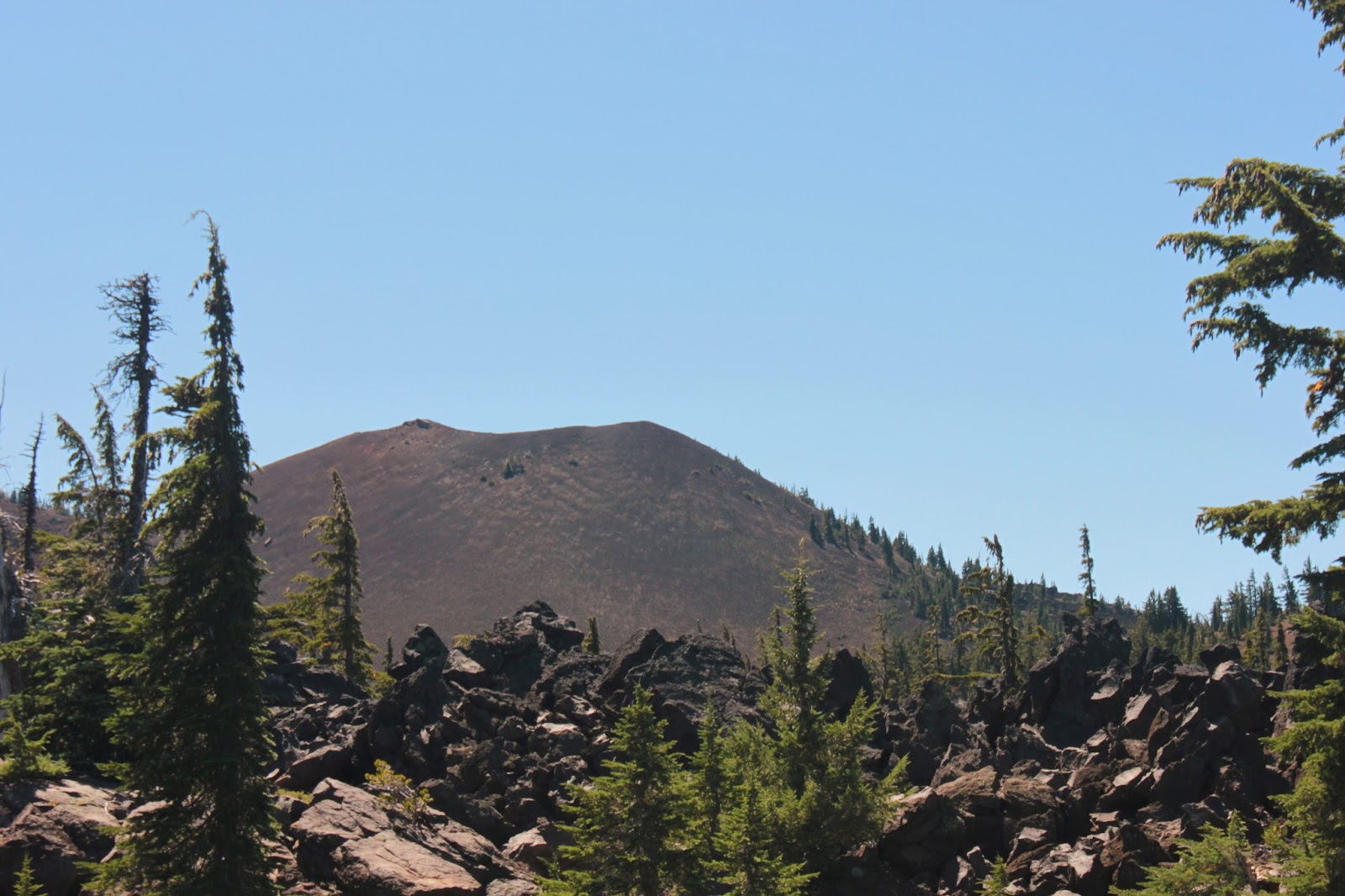
Peak 9053


Shortly after peering down into the rugged Owl Creek terrain below, we reached Peak 9053 which was promptly designated to be our lunch spot. So we climbed the small peak, still covered with snow drifts, and enjoyed a superb view down into the Pine Creek Basin where we could see a number of small lakes hiding in the basin's woods. 

Time to get off of Peak 9053


Clouds were coming in as we ate and we were aware there was a slight chance of thunder per the weather reports we had perused prior to our coming here. Being on top of a peak when there is a chance of lightning is not a smart thing to do, so we kept our lunch short before heading back.  


Rain was in our future
It warmed up considerably as we hiked back and it was a tedious slog hiking uphill from the Warner crest to the Patterson Lake pass. Predictably, clouds formed as the wind blew. The only difference was that the clouds covered up the sunset and it rained for most of the night.

Day 4

Trail junction
The next day dawned cloudless and clear and we packed up our gear and grabbed the Cottonwood Trail down to the Owl Creek Trail. The Owl Creek Trail paralells the Summit Trail but is located about 1,000 feet below the Summit Trail; The Cottonwood Trail is a connector trail linking the two trails.  

Meadow, typical of this area
The Cottonwood Trail dropped rapidly away from Patterson Lake as it switchbacked to and fro down an escarpment. Basically following Patterson Creek, the trail criss-crossed the creek several times and we enjoyed a series of lush hellebore meadows and small waterfalls.

How waterfalls start

At a marshy meadow with a huge waterfall, the trail turned to the north and leveled out as it peeled away from the creek, taking us through a forest that had been, and was still being, ravaged by pine beetles. Lots of dead trees waiting for a lightning strike to set things alight.


Cottonwood Creek headwaters

Rounding Peak 8298, we left trees behind and dropped into the sagebrushed canyon of Cottonwood Creek. The Warner crest loomed above and an impressive waterfall delivered Cottonwood Creek to the canyon floor.  As we approached the creek, the vegetation morphed from sagebrush to lush riverine growth.


Monument plant


Blooming in the sagebrush were the unique monument plants. The leaves of these  plants are arranged in a rosette resembling an agave or a yucaa but they are not succulents. They flower in tall towers of odd colored green/cream flowers. What makes these plants interesting is that they live from 20 to 80 years, flower once, and die. Because of the dire consequences of their monocarpic lifestyle, monument plants do not engage in premarital, extramarital, or plain old fashioned marital sex.  Family values aside, these plants were making their one and only procreative stand on the hillsides of Peak 8298.

Patterson Creek waterfall


We set up camp next to the creek and then did a short day hike south on the Owl Creek Trail.  Because the trail parallels the Warner Crest, the Owl Creek Trail spends its miles climbing in and out of one creek drainage to the next. The up-and-down experience on our day hike to Patterson Creek is typical of the Owl Creek Trail. It was a steep climb up to a level meadow atop an escarpment before dropping steeply down to Patterson Creek where were treated to lush meadows and a magnificent waterfall.

My view before the "fun" started


In the late afternoon, the clouds came in as usual and the wind began to blow, and blow, and blow.  Then the rain started and lightning flashed and thunder boomed.  I felt so secure with only the nylon tent fabric between myself and 30 kiloamperes of electrical current.  Yes, I am being sarcastic. The wind was so strong that it uprooted my tent with me in it so I got to enjoy the experience of staking down, clad in only my Power Rangers underwear, an unruly tent in wind and rain while lightning flashed and thunder boomed.

Day 5

Sunrise
After the previous night's turbulence, it stands to reason Day 5 would dawn crisp and clear. Since neither one of us got a good night's sleep, we had no problem starting early, we hit the trail pretty near 7 AM. Crossing Cottownwood Creek, the Owl Creek also started early, heading steeply uphill as it climbed up Squaw Peak.

Mid-morning view


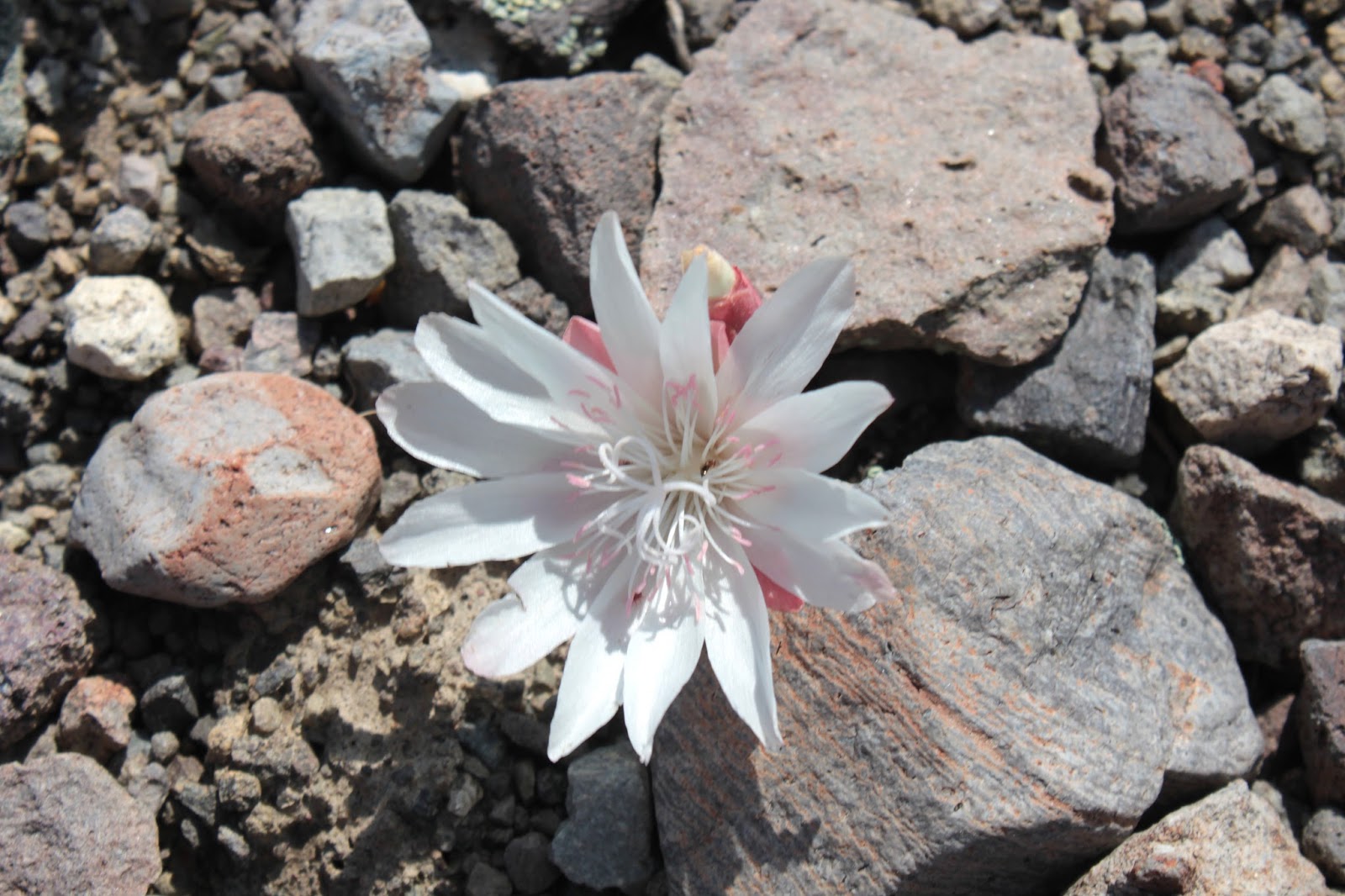
At least the faint trail switchbacked up Squaw Mountain as it gained altitude and the vegetation transitioned from the lush creekside growth to high desert sagebrush. Spotted in the low growth were desert-type flowers such as mariposa lilies and bitterroots. The views opened up as we gained elevation and we enjoyed a nice view down to Cottonwood Creek below.

Flowers gone wild


After a fairly rigorous climb, the trail rounded Squaw Mountain and rejoined with the Summit Trail.  There was much rejoicing because it would be all downhill from here on in.  The trail was flanked by rampant wildflowers blooming away in a floral rainbow.  It seems that the rains had inspired the lupines, buckwheat, wild onions, flaxes, and lilies to get busy blooming; much photography ensued.

I love my civilization
After a joyous reunion with my car, we stopped at the Pepperdine horse camp and field showered at a spigot.  Because there were campers nearby, I left all the important articles of clothing on; I didn't want to sully the new-trail smell with a gratuitous butt-imprint, figuratively speaking.

Odd-colored paintbrush

For more pictures of this magnificent hike,  please visit the Flickr albums:

Day 1
Day 2
Day 3
Day 4
Day 5

Bitterroot