Sunday, January 26, 2014

North Umpqua Trail (Dread and Terror section)


On January 1, I hiked at Mount Ashland on an ice covered Pacific Crest Trail. On January 2, just 7 minutes after opening time at REI, I was the proud owner of a brand new pair of crampons. On January 22, the Friends of the Umpqua scratched an upcoming hike on the North Umpqua Trail's Dread and Terror section due to icy roads and trails. On January 26, Ray and I hiked the Dread and Terror section. All of these events are related.

Care for a swim?
Ray had had his own ice issues last October when hiking up the hilariously named Opie Dildock Pass in the Three Sisters Wilderness. He too, became the proud owner of a pair of crampons shortly thereafter. Seems like icy trails have spurred rapid growth in the crampon manufacturing sector of the economy. After doing our part in helping jump start the nation's commerce via the conspicuous consumption of crampons, Ray and I decided we needed to try out our unused crampons and besides which, the club's hike cancellation sure sounded like a dare.

Streaker at the hot springs
It was a slippery drive to the Umpqua Hot Springs trailhead on an ice covered forest road and there were lots of cars and tents at the trailhead. Apparently neither rain, nor sleet, nor snow, nor icy roads will deter dozens of hot spring aficionados from sitting naked in smelly sulfur water bubbling with what I hope are natural sulfur bubbles. The hot springs denizens we encountered at the trailhead looked like they'd been living in the woods too long, sporting Sasquatch type hair and beards. And the men were no different! Sallying forth on the North Umpqua Trail instead of taking the trail to the hot springs, we were the odd ones out among the unclad hordes. Especially since we were fully clothed,  I might add.

Ray beholds the magical power of the crampon
The biting cold was in direct contrast to the balmy weather we'd been having for the last couple of months and the ice crunched under our feet as we walked. Both Ray and I were quite pleased with the crampons as we magically hiked on ice, as sure footed as an eight-legged goat.


A creek emerges from the earth


You'd be hard pressed to find a prettier mile of trail than the first mile of the Dread and Terror section. Springs gush on either side of the trail and the forest is amply mossed and ferned. You can almost imagine leprechauns and gnomes (besides Ray) leaping and cavorting in all the greenery. Creeks and waterfalls gush forth from the slopes, fully formed at their hydrologic inception.  Toss in some freezing temps and snow, and the hike becomes simply sublime.

Moss, entombed in ice
The trail undulated up and down from the river's edge to narrow catwalks on rocky cliffs and our inner mountain goats were happy with each cliff. Of course, the springs gushing over the trail created large icicles and ice patches and we walked past with nary a pratfall, thanks to the awesome magical power of the crampons. Life was good, although the further we walked, the more snow and ice on the ground we encountered.

We couldn't (safely) get past this ice patch
Our crampons were the hiking boot equivalent of chains on tires but they do have limits. We arrived at a thick patch of ice on a cliff and discovered our crampon-lites did not work on a clear ice slab several inches thick. We should have bought and brought a set of man-crampons, the kind with sharp ice-gripping teeth underneath. Because we were on a narrow path about 40 feet above the river, the consequences for slipping were fairly dire. The odds of slipping were pretty high too, so we turned around at the 2 mile mark, living to slip and fall some other day.

Gnome (besides Ray) homes
On the way back, we checked out a very nice riverside backpack campsite. A weak sun made an appearance and we sat down for lunch. Basaltic pillars formed a cliff across the North Umpqua and further up the hill, a steam cloud gave away the location of the hot springs bacchanalia. Some intrepid gnome or leprechaun (besides Ray) had balanced rocks nearby, creating odd little architectural structures worthy of a Hobbit movie scene. The whole vibe was awesomely magical, like crampons.

Columnar Falls
For more pictures of this hike, see the Flickr album.


Saturday, January 25, 2014

Horseshoe Bend

It's like an unwritten commandment in hiking:  Thou shalt not hiketh uphill to the car. Given that, there is probable cause for serving Edwin an indictment for breaking the aforementioned law, seeing as how we had to gain 1,840 feet over the last three miles just to get back to the car.  Edwin will be hearing from my attorney on this.

Tan oak leaf, working on the tan
The route, and I use the term loosely, was divined by reading an older map while wearing the happy glasses.  It followed a logging road dropping down the ridge way above the Rogue River and eventually would hook up with a trail that would finish off the descent to the river. Those hikers who are familiar with the Rogue River area are aware that the ridge culminates nearly 4,000 above the river and the topography is impossibly rugged.  So, naturally we (Edwin, his friend Richard, and myself, or ERR as we like to call ourselves) went hiking there!

Hiking on the logging road
Fortunately for us, the rickety logging road lost some elevation on the drive down, thereby sparing us some of that prodigious elevation gain on the return leg. The actual hike began at a locked gate well below the ridge crest. The forest here was absolutely gorgeous, consisting of a grove of stately firs with sunlight slanting through the branches. Periodic openings in the forest provided views of the very deep Rogue River Canyon with Mount Bolivar looming above it all,

Summer home and trespasser Edwin
The road dropped quickly through the forest before arriving at a very unexpected sight: another locked gate with signs stating "Private Property", "Keep Out", and "No Trespassing". After some debate and deliberation, we pretended we didn't see the signs or the gate and continued on down the road. 

Richard checks out a walnut orchard
After a short hike further downhill, the road arrived at a couple of summer cabins. Fortunately, this was not summer and it was readily apparent that the homes were not currently occupied so we tiptoed by as surreptitiously as possible considering we were totally exposed on a broad meadow/lawn in front of the homes. Deer were hanging about the homes so if anything is missing, I'm blaming the deer.

Trail down to the Rogue River
The good news was that just past the homes, there was a trail just inside the Rogue River - Siskiyou National Forest boundary. If anything, the trail lost elevation quicker than the road did and we dropped rapidly down the river canyon like snakes on a water slide. Any joy felt about walking downhill was tempered by the knowledge there'd be a whole lot of uphill hiking on the return. On the descent, the firs gave way to a forest of the largest madrone trees I've ever seen with tan oak and cedar mixed in. Poison oak, a Rogue River staple, also made an appearance and we made sure to look but not touch on the descent to the river.

Bridge crossing at a Meadow Creek fork
Despite this being an unofficial trail, there was evidence it had been maintained and brushed out.  A well constructed and sturdy bridge provided a safe crossing at Meadow Creek, "safe" meaning we got to keep our feet dry. After three miles of dropping through a lush Siskiyou forest with its odd little mix of conifer, cedar, oak, madone, and laurel the path spit us into what was obviously a man-made pasture. While the sun felt nice, the trail tread disappeared entirely, much to our consternation. While wandering aimlessly in the meadow, sharp-eyed Edwin espied the Rogue River Trail, passing below us about 20 yards away.

Our lunchtime view of Horseshoe Bend
We had arrived at Horseshoe Bend, although the campsites and gravel bar were a mile further east on the trail. It was as good a place as any for lunch, what with sunshine and a partial view of the bend and mountains above the trail. As much as we were putting off the big climb out, it was eventually time to go because the Rogue River was pretty much all in shadow as the sun got lower and lower in the sky.


Rickety barn at a homestead
So, it was up, up, up for the next 3-plus miles, past Meadow Creek, past the homesteads, past the two gates, past the beautiful forest as the shadows lengthened in the trees. It was pretty much sunset when we arrived at the car followed by the long drive to Mexican food, a warm shower, and lawyers.

Peek-a-boo!


For more pictures of this hike, please visit the Flickr album.

Monday, January 20, 2014

Samuel Boardman Park

About halfway through my hike on a small piece of the Oregon Coast Trail, the path spit me out onto a parking area just off of Highway 101. Next to a trail marker there, a small plaque honored Samuel Dicken, founder of the Oregon Coast Trail. In addition to honoring his contribution to the establishment of the trail, he was further honored by having this particular section named after him. Since I had reached this commemorative site after several miles of seemingly needless ups and downs, I agreed: This trail was indeed the Dicken's.

Incoming!
I'm not sure how Samuel Boardman became involved but there is a nice state park named after him. Basically the park is the 27 mile long strip of land between the ocean and the highway with the Oregon Coast Trail (hereafter referred to as the OCT) running the length of the park. Arguably, the park sports the most scenic stretch of coastline in Oregon. Last weekend, I partook of the ample coastal delights by hiking on Samuel's trail in Samuel's park.

Up, up, up....
Beginning at a pullout on the coast highway, the OCT entered the park by descending rapidly for about 50 yards after which the trail immediately ascended in equally rapid fashion. Up and down all day long would be the theme. Yes, I'm whining but in part that's my self-deprecating humor at work. But mostly, it's whining because they could have made the trail level in a lot of places but they didn't and a big phooey on trail engineers.

Naked alders
Much of the trail is spent in beautiful coastal woods that alternated between spruce trees with sunbeams sliding between branches, spotlighting ferns and salal on the forest floor; and bare white-trunked alder trees clawing at the blue sky draped above. Periodically, small breaks in the dense growth provided stunning views of the blue-green ocean with rock islands strewn randomly about like freckles on a face.

Miners Beach


Drawing in tourists and visitors are some prominent landmarks such as the aptly named Arch Rock, Thunder Rock, and Natural Bridges. Call me a tourist then, as I stopped often to take pictures of the attractions thereof. After Arch Rock, the OCT dropped precipitously down to idyllic Miners Beach with its photogenic collection of islands and stacks, each crowned with a clump of spruce trees that reminded me of my son's latest haircut.

Arch Rock
From there, the trail climbed relentlessly back up to the highway and then dropped back down to the Natural Bridges, consisting of several rock arches with the sea flushing and rushing through the narrow arches like an oceanic enema. Uncharacteristic of January at the Oregon coast, the temperature was in the 60's and I daresay I broke out in a mild sweat.

Ooh....aah!
On an uphill section, a pair of hikers were coming down the trail and I stepped aside to let them pass. Equally polite, they stepped aside to let me pass and darn it, I had to keep walking uphill. Lowering my head, I charged up the trail and I heard a confused "...is that Richard?" Turned out it was Glenn and Carol, my hiking friends from Medford, and we exchanged pleasantries in a nice and unexpected encounter. We both were well out of our normal hiking haunts and the improbability of our encounter kept me chuckling throughout the day, not that I need any help giggling mindlessly.

Thunder Rock
My original plan was to hike about 5 miles out and 5 miles back and just under the 4 mile mark, the trail dropped rapidly, switchbacking through a dark forest. A sheer cliff bordered the trail on the right where a large landslide had taken place and I was walking on a new trail that had been routed on top of the slide debris. Coming out of the forest, a bay full of roiling waves greeted me as the trail ended unceremoniously at the ocean's edge.

End of the trail
A left turn on the beach would take me round a small point and a beach walk on China Beach before the OCT would climb steeply away to the next adventure on the trail. But with the tide as high as it was, there was no going south today and the hike was cut shorter than intended.


Sunset started as I finished


The return trip was even better as the sun sank lower in the sky, providing ample reason to stop and take pictures as the ups and downs became downs and ups on the return leg. The last several climbs back up to the car were particularly taxing and I simultaneously cursed and praised all things Samuel as the afternoon eased into sunset. But mostly I'm grateful to the two Sams for providing a nice 8 mile hike on a sunny winter day, I couldn't have done it without them.

View through a trail window
For more pictures of this hike, please visit the Flickr album.


Saturday, January 18, 2014

Baker Beach


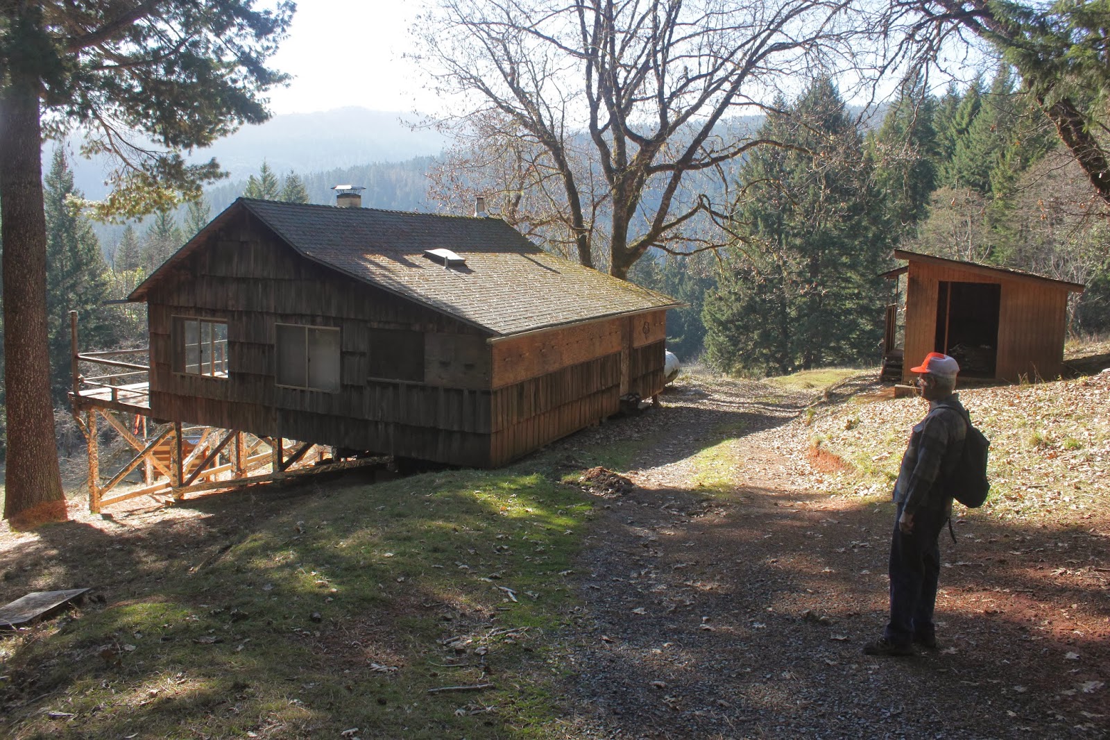
This hike had a couple of little ironies.  First, Lois got a speeding ticket in her haste to begin an activity that takes place at a leisurely 2 miles an hour. The other ironic moment occurred when I stepped in a sinkhole while wading through a marsh, making me the only hiker out of the 21 attendees that experienced a true Richard Hike experience.

What happens when I Google Earth late at night
The genesis for this hike came late one night when perusing Google Earth. Looking at the Alder Dunes area, a faint footpath led from dune to dune, seemingly going all the way to the Baker Beach area. So, a mid-week exploratory scouting trip was penciled in, starting at Dune Lake.

Alder Dunes view
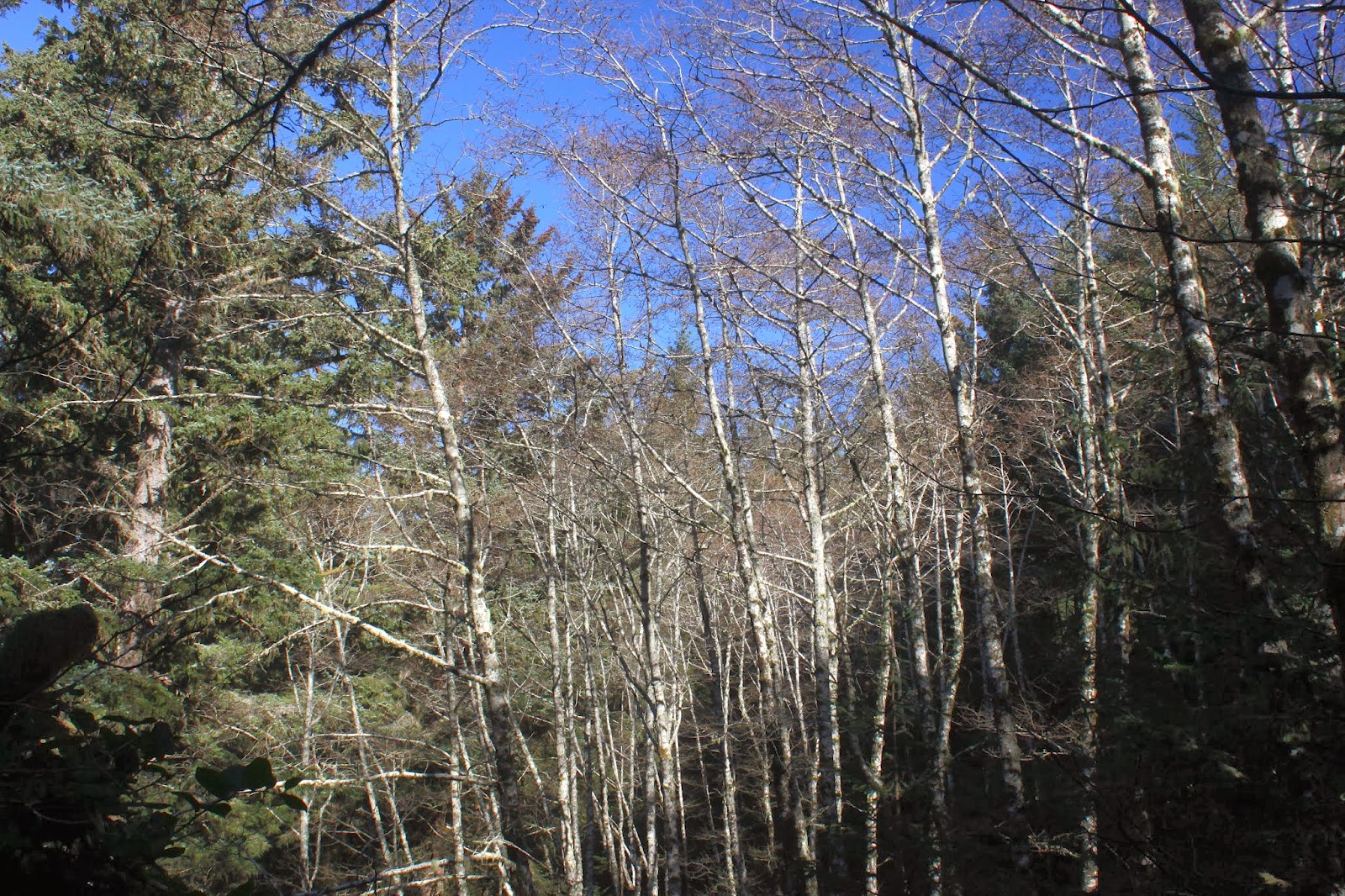
From little Dune Lake, the sandy footpath followed a series of small dunes collectively known as Alder Dunes. On the right side of the trail, the dunes sloped up to where presumably one could have views of lakes Alder, Mussel, and Nott.  Of course, that would involve gaining about 100 feet in steep and soft sand, it was more comfy to stay on the path.

Hiking on what amounts to a game trail


On the satellite photos, the trail passed through seven dunes but it seemed more like four from actual ground level. The trail was always visible but the problem is that the trail braided with other trails and more than once I mentally flipped a coin to decide whether to take the right or left fork. It was more confusing than the federal tax code. I don't think there really was a wrong way or a right way to get from Dune Lake to Baker Beach Campground, but there sure were a bunch of different ways to get there.

Odd little sand formation
Once at Baker Beach Campground, the GPS said I'd been wandering aimlessly in the forest and dunes for a mere 2.8 miles.  Clearly, more miles were required so I added several trail loops that visited Lilly Lake, Berry Creek, Baker Beach, and a massive sand dune that went on for miles; altogether it wound up being a 7.3 mile hike, all of it in soft sand.  My soft sand muscles were softer than the soft sand and this hike felt a lot longer and I was now ready to inflict the same amount of pain on my friends.

Nobody got lost and I like that
Last time I led a Friends of the Umpqua hike, only three friends showed up. Given that backstory, it was shocking to set out on the trail with 20 friends (and one dog) in tow, uttering a silent prayer to the hiking gods to help me arrive with 20 friends (and one dog) at the trailhead at the end of the hike. We cut down our chances of misplacing anybody by using the buddy system and stopping at all trail junctions.

Lake that is small and dry, just like me
In spite of those precautions, Edwin (who was at the front while I manned the rear) managed to lead us in a different direction from my scouting trip and we ended up at a small lake abutting the dunes. No worries, I had been on top of the dune looking down on the lake so we hiked uphill on a sandy path and resumed the proper route.

Reflection at Berry Creek


On the Lilly Lake route (where you really can't get a good look at the lake) we continued on to the banks of Berry Creek.  I walked down to the creek and instructed everyone to put on their wading shoes. Alternatively, I heard cursing, crying, and whining with the phrase "...it's a Richard Hike.." sprinkled liberally throughout. Great fun, and I let them know they'd been pranked and then I heard cursing, crying, and whining with the phrase "...it's a Richard Hike.." sprinkled liberally throughout.

Lunch time at Berry Creek
We ate lunch at Berry Creek, enjoying the sun while shivering in the cold ocean breeze. The canine portion of our group enjoyed swimming in the creek and retrieving large sticks. After lunch we closed the loop where no hikers took the offered option of heading back for a shorter hike.


Sandy cliff at Berry Creek
So, all 20 companions (plus one dog and one hike leader) went to the beach where several members took off shoes and went for a wade in the ocean while the rest of us shivered in the cold ocean breeze. One wave caught John but he seemed to enjoy being wet and cold, to judge from the grin on his face.


Let's hike through the marshes!
We made a short loop by hiking along the mouth of Berry Creek and then bushwhacking through the dunes and marshes to return to the trail. The marshy portion was short and feet got wet briefly.  So, while everybody continued on back to the campground, I backtracked to retrieve John and his wading crew as they had tarried when they put on their shoes after their ocean wade.

Hikers, walking past a hidden sinkhole
Not wanting to get my feet wet again, I took a loop around the edge of the marsh where it looked like it would be drier.  Looks can be so deceiving. I was shocked when my foot sunk into the grass, and sunk and sunk and sunk. I briefly wondered if I was going to wind up in China before I struck solid ground with the cold marsh water nearly up to my neck. Thrashing wildly, I grabbed on to some branches and hauled my now very wet carcass out of the diabolically disguised sinkhole I had stepped into.

Shadows in the late afternoon
It was a chilly walk through the forest after that and I took no more pictures as unfortunately, the camera had gone swimming with me. Concentrating on keeping a brisk pace to keep warm, the two miles back to Dune Lake seemed to go fairly quickly. I'm glad to report, no hikers (dog or human) were left behind, and we all had a great time, unintended swimming sessions and speeding tickets notwithstanding. On the way back, our car passed Lois who was plodding along exactly at the speed limit. It seems she has a newly found religion about obeying speed limits following her morning encounter with the police.  Oh, the irony!

Lichen
For more pictures of the two Baker Beach hikes, see the Flickr album.


Sunday, January 12, 2014

Cape Arago

This hike was all about the waves. And I'm not talking about the nice waves you find in a movie star's coif...no, these waves were tall and powerful, just like me. As Dollie and I crossed placid Big Creek at the start of the hike, a wave entered the creek, heading upstream like a watery sea creature migrating to its spawning grounds in the Sunset Bay campground; that's when we first realized this would be no routine visit to Cape Arago.

Watery sea creature
A winter storm had come to visit the Oregon coast last weekend and Saturday was the wilder day what with lightning, high winds, and a prodigious amount of rainfall.  By comparison, Sunday was milder with just an ordinary rainstorm with a high surf warning. Since I don't like getting electrocuted or having tree parts land on my head, and because a high surf warning is more like a high surf invitation in the O'Neill household: Sunday was the day to go hiking at Cape Arago. And speaking of watery sea creatures, Dollie came along.

Sunset Bay


As mentioned before, normally placid and tranquil Big Creek was having to contend with rude waves forcing their way upstream like a proctologist's probe, not that I know what that's like. Sunset Bay was a bowlful of seething sea with white water and angry waves boiling robustly like a pot of my abuelita's beans. Surfers were taking advantage of the wave action while onlookers gawked from the Sunset Bay parking lot.

A cliff gets a pummeling
Once atop the shoreline bluffs, the sonic booms of waves crashing into the rocks provided a noisy backdrop to the hike. Everywhere we looked, we could see giant explosions of white water bombs cresting higher than the cliffs we were standing on.  Marching inexorably to a noisy demise on the Oregon coast was wave after wave, most cresting 20 feet or higher.

A moron just has to get closer to the action


The real fun started at the ruins of the Shore Acres tennis courts. The waves were crashing into the cliffs with each exploding wave cresting about 20 feet higher than me and remember I was on the cliff which was already about 20 feet above the ocean. Some moron with a death wish clambered onto the rocks closer to the breaking point. Dumb, but on the plus side, he provided a nice human scale for my photographs.

Rain at Shore Acres
It was more of the same when we arrived at Shore Acres in a heavy drizzle. A small crowd braved the elements to ooh and aah at the ocean's display of might. Just past the whale observation building, Dollie turned back at a viewpoint of Simpson Beach with hardly any beach sand that was not covered with white water.


Simpson Reef
At the Simpson Reef overlook, the sea lions were barking indignant as their favorite beach on Shell Island was underwater. They made do by crowding onto all the nearby rocks, rudely pushing and shoving each other out of the way like the O'Neills at a family barbecue.

Road walk on the Pack Trail
For variety's sake, I crossed the Cape Arago Highway and grabbed the Pack Trail. There is a World War II bunker on the trail somewhere but I never saw the bunker, not sure how I missed a large concrete structure in the forest. However, it was a pleasant walk in the woods that satisfied my uphill quota before dropping back down to the cape.

Another beautiful day at the coast


I had the cape all to myself when I arrived, probably that had something do with the rain pouring out of the sky. The forecast had called for showers which implies an on-and-off wetting but it had morphed into non-stop rain while I was happily hiking through the forest.  I was 3.5 miles away from the car and the rain increased in intensity on the way back. I rapidly lost enthusiasm for hiking, totally commensurate with the amount of water my clothing retained.

I love walking in the rain (sarcasm!)
But hey, that's what dry clothes, a car heater, and hot chocolate is for and all were soon available upon arrival at the trailhead. Despite the less than optimum conditions, the wildness of the ocean made this hike worthy. Like I said, it was all about the waves and I was glad to wave bye-bye to the rain as we departed.

No swimming today!
For more pictures of this hike,please visit the Flickr album.